Ticker for January 9, 2017
MESONET TICKER ... MESONET TICKER ... MESONET TICKER ... MESONET TICKER ...
January 9, 2017 January 9, 2017 January 9, 2017 January 9, 2017
ICE-MAGEDDON 2017??
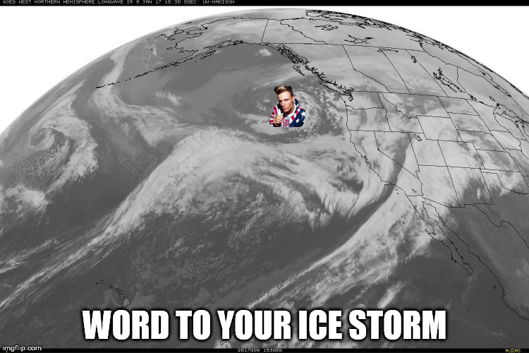
All right stop, Collaborate and listen,
Winter's back with a brand new invention.
Alright, so the worst kept secret in the world is the impending doom before
forecast for this weekend, with significant ice accumulations possible plunging
us back to the Stone Age (or at least 1950...we'll still have gas) for several
days. But surely such a pretty little swirl of clouds, graced by Vanilla Ice's
presence on the satellite picture, can't cause that much harm, can it? Well, the
bad news is, yes, it can. But the good news is, the storm is still well offshore
and many, many things can change between now and this weekend. Ice storms are very
fragile things, much like tornadoes, in that they need almost perfect ingredients
to actually come to fruition. And predicting those conditions 5 days out is
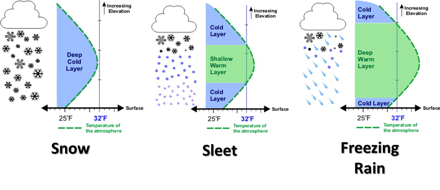
pretty darned difficult. The vertical profile of the atmosphere is perhaps the
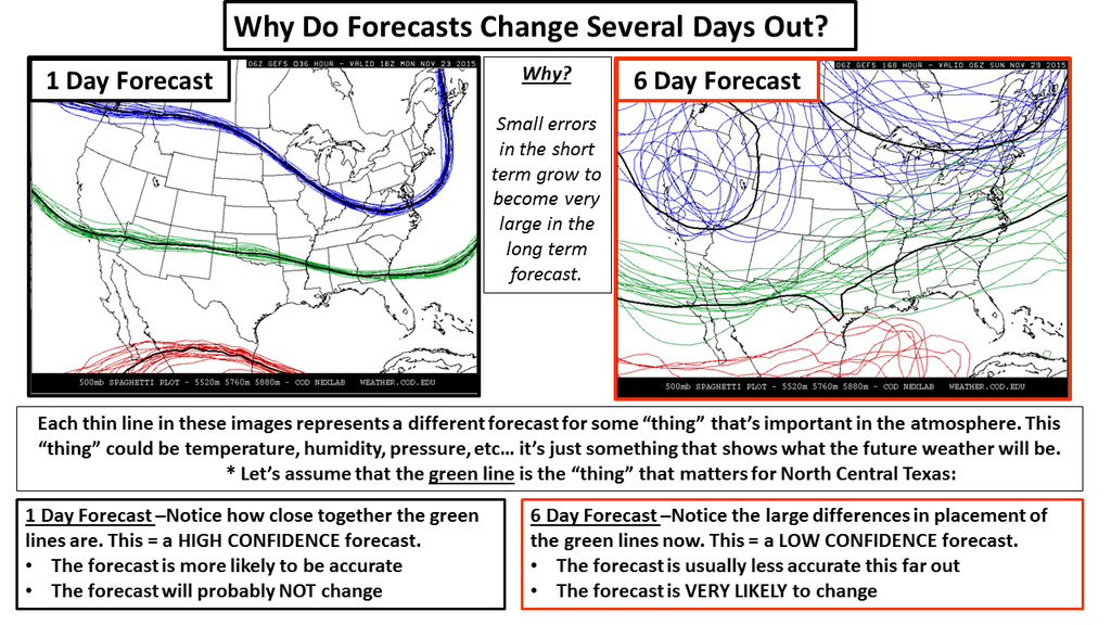
biggest key, as demonstrated by this graphic. And I'll include another graphic
explaining why the accuracy of those computer models improve as we get closer
to the event.
Now, more bad news. The latest and greatest forecast models we have now are
tending to coalesce even this far out into a rather gruesome scenario. I'll let
the NWS do my talking for a bit. From the Norman NWS office:
"...Dangerous Winter Storm Possible Friday into Sunday...
A slow moving storm system will affect the southern Plains Friday
into Sunday, bringing heavy amounts of precipitation to the
region. A wintry mix of primarily rain and freezing rain is
expected across the area. Some sleet and snow may also be
possible across northern and western parts of Oklahoma. Exact
precipitation types, amounts, and locations remain uncertain at
this time.
What we know at this time:
* Significant ice accumulations over 0.25 inches will be possible
for portions of Oklahoma and western north Texas.
* Snow and sleet accumulations could occur in western and
northern Oklahoma in addition to any ice accumulations.
* Flooding may result due to heavy rainfall across portions of
south central and southeastern Oklahoma.
* Impacts...Hazardous travel conditions will be likely. Power
outages may result from heavy ice accumulations.
Tired of reading? Well fine, I'm tired of writing. So here's a graphical look
at the same info from NWS Tulsa.
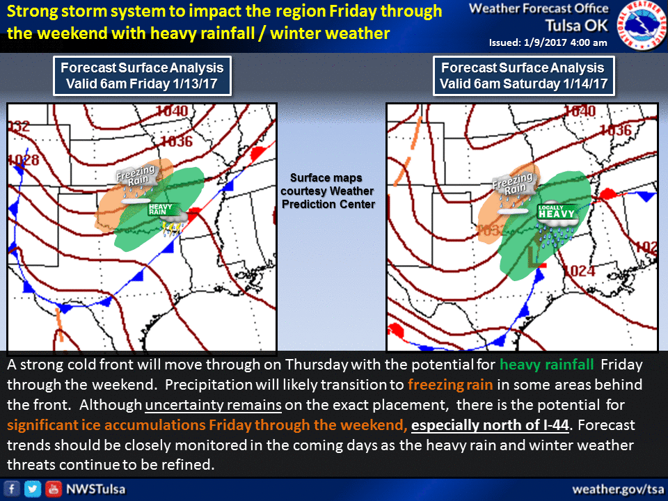
Still lots of uncertainty. Many, many factors will come into play. However,
almost a certainty, whether it comes in the form of sleet, freezing rain, snow,
or at best just a cold rain, there will be lots and lots of water vapor for this
system to work with. Silver lining? Drought relief!

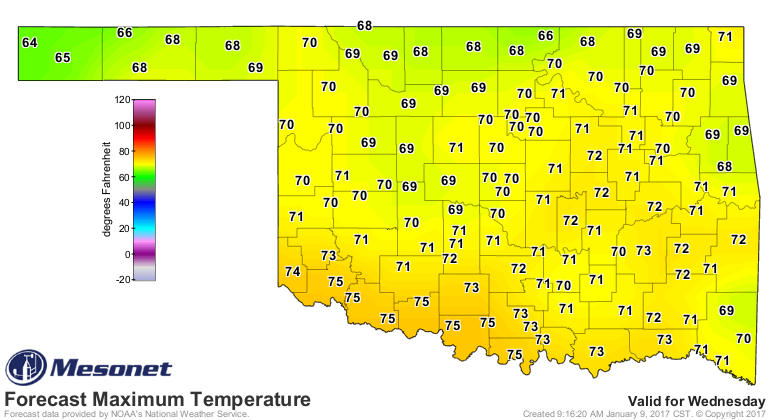
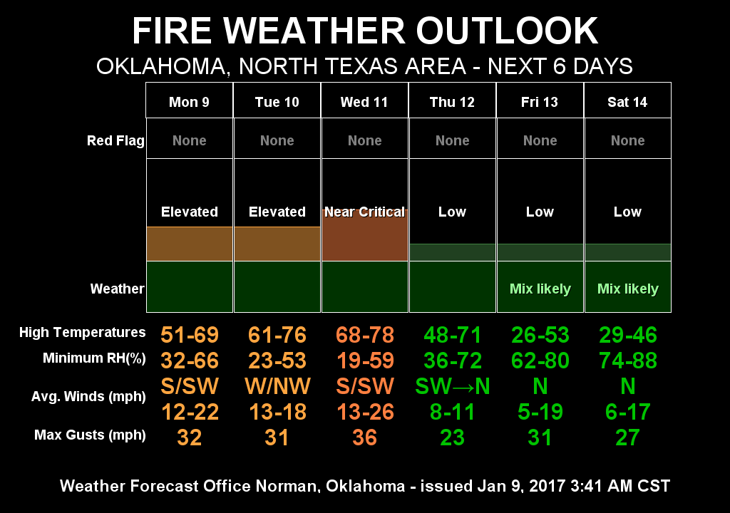
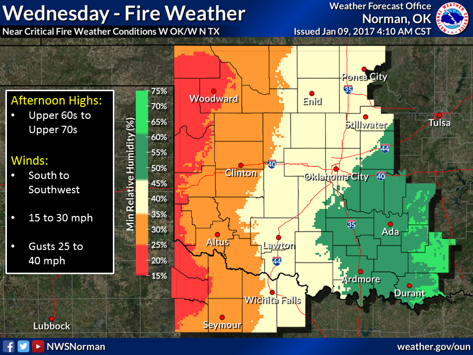
Until this weekend's event, expect a nice warmup and with that, another typical
winter hazard...wildfire danger. It will be elevated as we go into our warmest
day on Wednesday.
Now back to ICE-MAGEDDON 2017...what can you do to prepare? Well, I'll go back
to the Norman NWS for some tips:
* Stay up to date with the latest forecasts, check back frequently
for updates.
* If you are traveling this weekend, be prepared to change your
plans and make sure you have a safety kit in your car, such as a
blanket, water, a flashlight, and nonperishable food.
* Be prepared if you lose power, make sure you have flashlights,
extra batteries, food, and your cell phone charged.
Ice ice baby,
Too cold too cold!
Gary McManus
State Climatologist
Oklahoma Mesonet
Oklahoma Climatological Survey
(405) 325-2253
gmcmanus@mesonet.org
January 9 in Mesonet History
| Record | Value | Station | Year |
|---|---|---|---|
| Maximum Temperature | 81°F | ALTU | 2009 |
| Minimum Temperature | -4°F | JAYX | 2010 |
| Maximum Rainfall | 1.09 inches | BROK | 2013 |
Mesonet records begin in 1994.
Search by Date
If you're a bit off, don't worry, because just like horseshoes, “almost” counts on the Ticker website!