Ticker for November 28, 2016
MESONET TICKER ... MESONET TICKER ... MESONET TICKER ... MESONET TICKER ...
November 28, 2016 November 28, 2016 November 28, 2016 November 28, 2016
Ix-nay on the ow-snay
I REFUSE TO TALK ABOUT SNOW FOR THIS WEEKEND! I just do. If I start talking
about snow, then you'll start talking about snow, then we'll all start talking
about snow, then it will sink in that winter is here. Oh, it's still fall, but
once it snows, it's winter. So no more talk of snow.
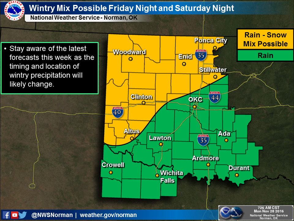
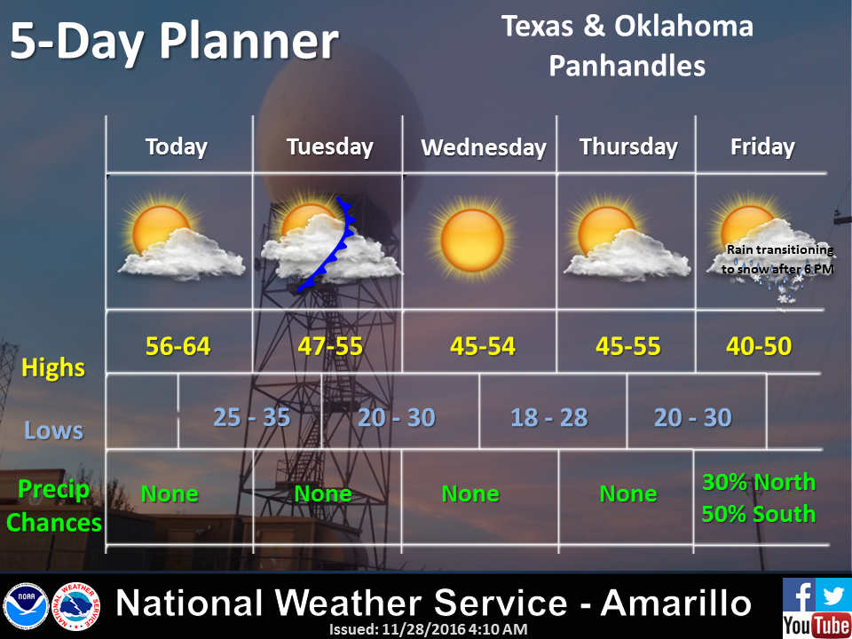
Oh by the way, there is a chance of snow for this upcoming weekend, but the
forecast models are all over the place on the placement on the placement of a
large upper-level low pressure system. And when you're talking snow (and any
mode of weather, really), that makes all the difference. Just check out the
Norman NWS forecast office's discussion early this morning and get lost in
the vernacular.
"Beyond Thursday, the forecast confidence is low for late Friday
into the weekend. The forecast continues to hinge on the eventual
evolution of a closed-low across the southwest. The 28/00Z ECMWF
is now a significant outlier, indicating a more progressive low
and a colder temperature profile. This solution would indicate
winter weather will be possible Saturday morning and even more so
late Saturday into Sunday as the low lifts northeastward--placing
parts of the area in the wrap around precipitation zone. However,
the (TICKER NOTE: insert lots of weird forecast model names here)
suggest the low will cut-off farther west and that the temperature
profile will be warmer, reducing the potential for winter weather."
Here's the key phrase from later on in the discussion:
"The bottom line is the forecast will continue to evolve with any
potential impacts too early to determine. Either way, expect a
cloudy/chilly weekend with at least some scattered showers possible."
Oof! That's sounds dangerously like winter. Now if you're talking below-freezing
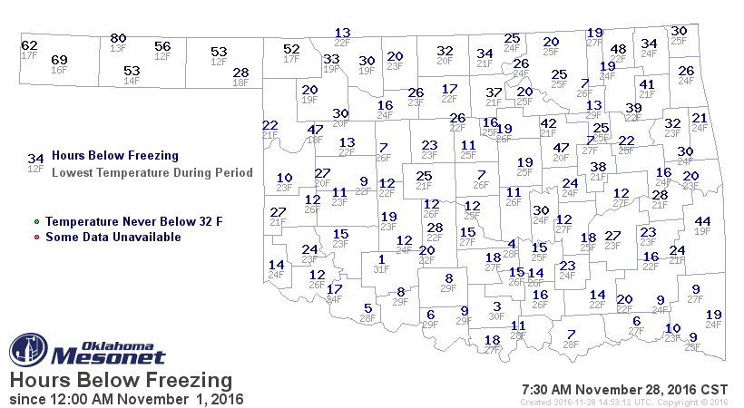
weather as winter, then it's been here awhile already. Here are the hours
at or below freezing for November thus far. If you'll check out the little
gray numbers below the blue "hours" number at each Mesonet site, you'll notice
that just about everywhere in the state has now had a hard freeze (28 degrees
or lower).
Other than that, we have an exiting storm system that brought decent rains to
mostly SE OK
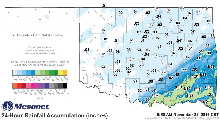
while the NW 2/3rds of the state are still hurting for moisture.
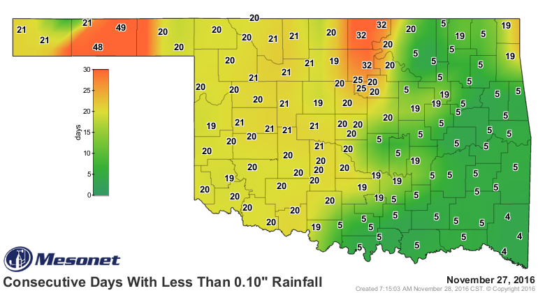
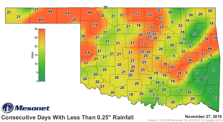
Which leads us to our next problem...an otherwise boring week for the most part
might be not-so-boring thanks to fire danger this afternoon.


Thank goodness we made it all the way through without talking about snow this
weekend!
Oops.
Gary McManus
State Climatologist
Oklahoma Mesonet
Oklahoma Climatological Survey
(405) 325-2253
gmcmanus@mesonet.org
November 28 in Mesonet History
| Record | Value | Station | Year |
|---|---|---|---|
| Maximum Temperature | 83°F | GOOD | 2014 |
| Minimum Temperature | 8°F | KENT | 2001 |
| Maximum Rainfall | 2.71″ | IDAB | 2016 |
Mesonet records begin in 1994.
Search by Date
If you're a bit off, don't worry, because just like horseshoes, “almost” counts on the Ticker website!