Ticker for November 1, 2016
MESONET TICKER ... MESONET TICKER ... MESONET TICKER ... MESONET TICKER ...
November 1, 2016 November 1, 2016 November 1, 2016 November 1, 2016
October Roasts As Fall Remains Absent
Autumn remained a reluctant visitor during October as the jet stream retreated
far to the north, leaving Oklahoma to bask in near summerlike heat. According to
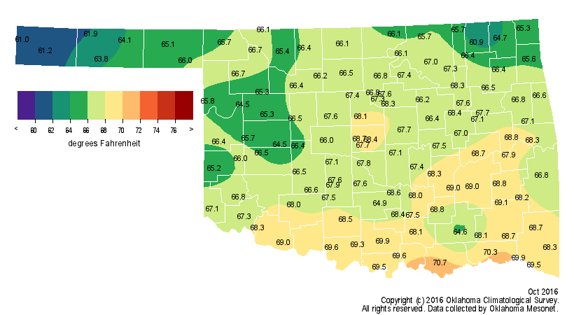
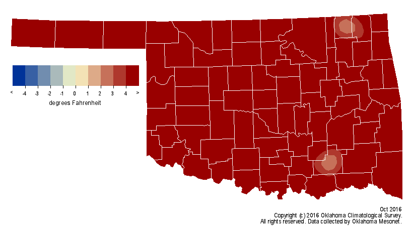
preliminary data from the Oklahoma Mesonet, the statewide average temperature
finished at 66.9 degrees, 6 degrees above normal, to rank as the fourth warmest
October since records began in 1895.
High temperatures reached into the 80s and 90s somewhere in the state on 30 of
October?s 31 days. Several stations climbed into triple-digits across the
northwest on the 16th and 17th. Slapout reached 102 degrees on the 16th and
Buffalo equaled that mark on the 17th ? the highest temperature ever recorded
in the state that late in the calendar year. Both readings topped the previous
record of 101 degrees at Healdton back on Oct. 17, 1972. The heat extended all
the way to Halloween where highs in the 80s and 90s provided pleasant trick-or-
treat weather that evening. Low temperatures did dip below freezing at times,
although those instances were uncommon. The month?s lowest temperature of 26
degrees was recorded by the Kenton Mesonet site on the sixth.

October?s heat continued to add to a very warm 2016 with the first 10 months of
the year ranked as the seventh warmest on record at 2.4 degrees above normal.
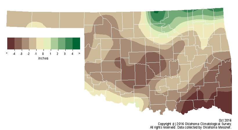
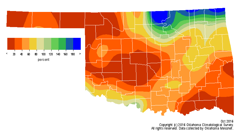
The state was largely devoid of significant precipitation during the month. The
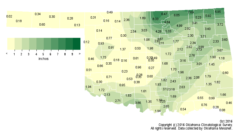
Mesonet?s statewide average of 1.85 inches was 1.69 inches below normal to rank
as the 37th driest October on record. The Panhandle suffered through its 14th
driest October with an average of a quarter-inch while the southeast averaged
0.96 inches, their 15th driest at 4 inches below normal. Only the northeast,
where heavy rains fell along the Kansas border from Osage to Ottawa counties,
managed a surplus with an average of 4.55 inches. That exceeds normal by nearly
an inch and ranks as the 33rd wettest October for that region. Blackwell led
the Mesonet with 8.33 inches. Approximately 350 miles to the west, the Kenton
Mesonet site barely had a sip of water with 0.02 inches. Of the 121 Mesonet
sites, 47 recorded less than an inch of rainfall during the month, and 73
recorded less than 2 inches.
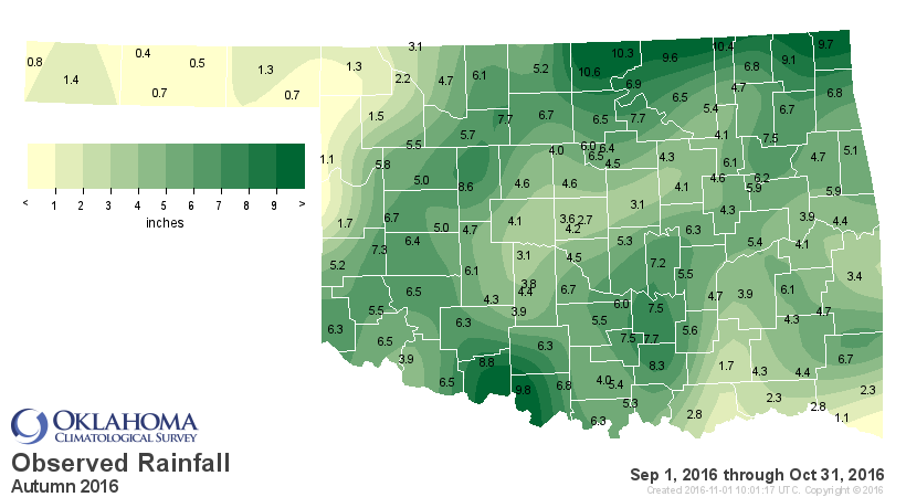
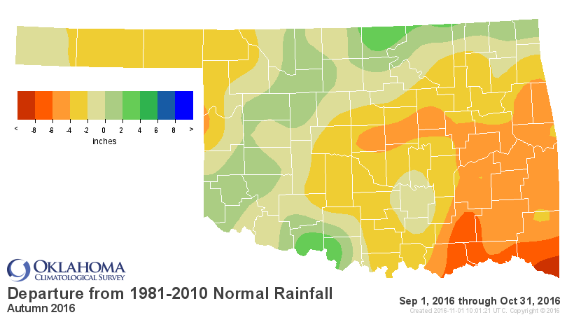
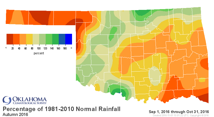
The first two months of climatological fall, September and October, ended as
the 44th driest across the state with a deficit of 1.84 inches. The Panhandle
and the southeast once again stood out in the statistics with a ranking of
12th driest for both during that period.
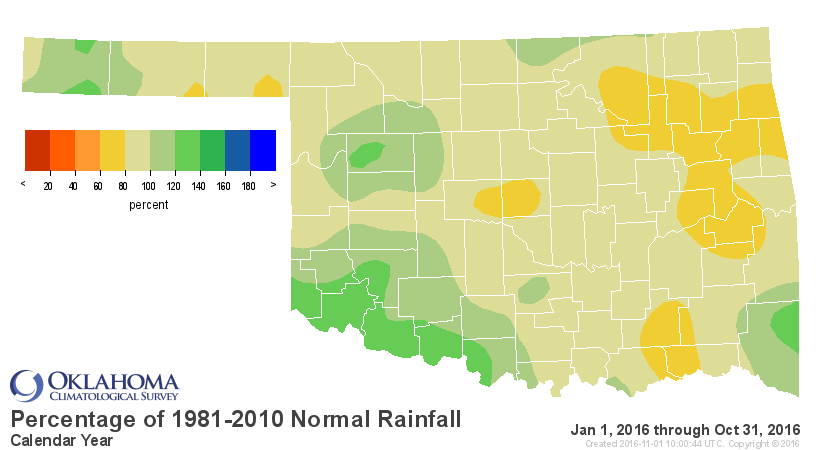
The January-October statistics look much tamer with the wet spring and early
summer included, but still ended with a deficit of nearly 3 inches, the 46th
driest such period on record. The year has been much drier across eastern
Oklahoma where the east central, northeast and southeast regions experienced
their 33rd, 45th and 37th driest January-October on record. The southwest saw
its 16th wettest, however, with a surplus of over 5 inches.


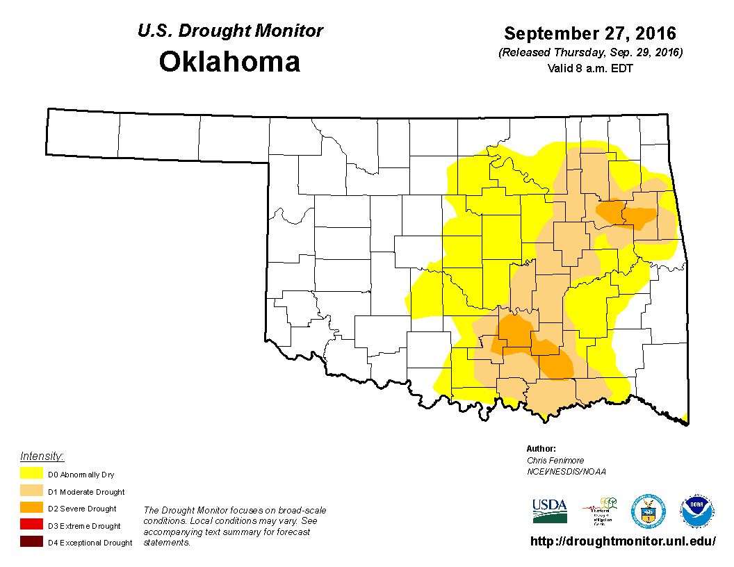
The lack of precipitation and excessive heat prompted drought?s return in the
northwest and intensification in the southeast. Drought was somewhat relieved
in the northeast thanks to areas of heavy rain, but dry conditions spread from
the far western Panhandle through northwestern Oklahoma. At the beginning of
the month, 19 percent of the state was considered in at least moderate drought
by the U.S. Drought Monitor, and 23 percent was considered to be abnormally
dry. By month?s end, those amounts had risen to 25 percent and 28 percent,
respectively.

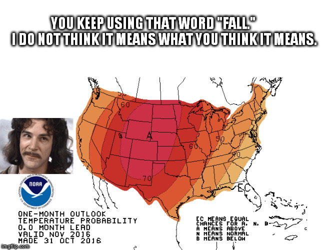
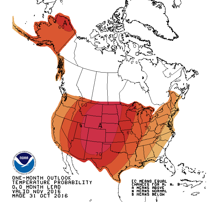
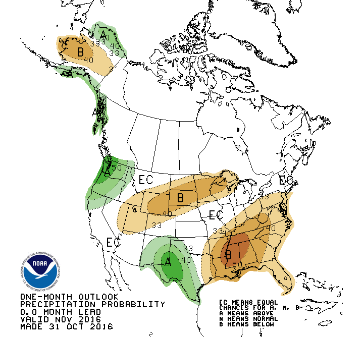
The November temperature outlook from the Climate Prediction Center (CPC) shows
greatly increased odds of above normal temperatures across all of Oklahoma,
but especially across the far northwest. The precipitation outlook is
indeterminate except for slightly increased odds of below normal precipitation
across far the far southeast and above normal precipitation in the far
southwest and western Panhandle.
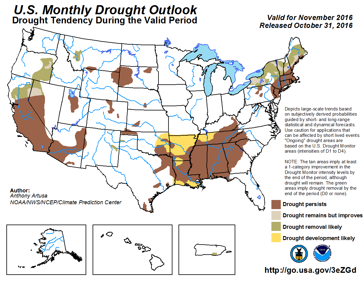
Given those prospects, CPC?s U.S. Monthly Drought Outlook for November
considers further drought development likely across the eastern one-third of
Oklahoma, and either persistence or intensification where drought already
exists.
Gary McManus
State Climatologist
Oklahoma Climatological Survey
Oklahoma Mesonet
(405) 325-2253
gmcmanus@mesonet.org
November 1 in Mesonet History
| Record | Value | Station | Year |
|---|---|---|---|
| Maximum Temperature | 90°F | ALTU | 2001 |
| Minimum Temperature | 16°F | VINI | 2023 |
| Maximum Rainfall | 3.65″ | NEWK | 1998 |
Mesonet records begin in 1994.
Search by Date
If you're a bit off, don't worry, because just like horseshoes, “almost” counts on the Ticker website!