Ticker for October 20, 2016
MESONET TICKER ... MESONET TICKER ... MESONET TICKER ... MESONET TICKER ...
October 20, 2016 October 20, 2016 October 20, 2016 October 20, 2016
HO HO oh no!
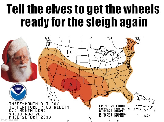
BUT NO! While the new outlooks from CPC this morning all show increased odds of
warmer and drier weather for both the November and November-January period, these
are outlooks, not forecasts of everyday weather. Take a look at the images and
then we'll talk.
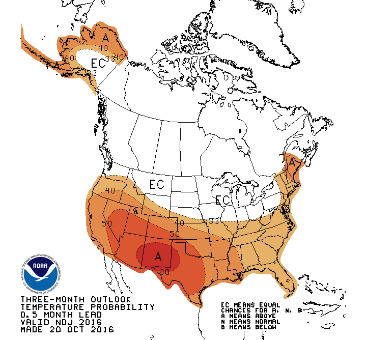
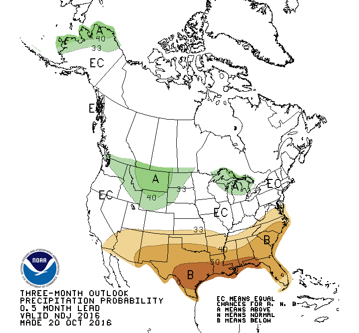
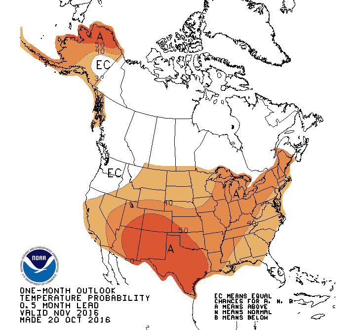
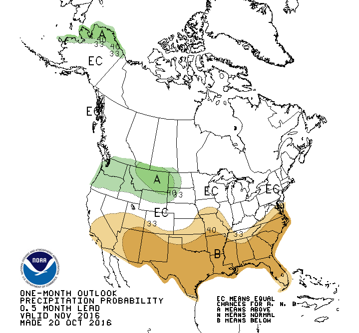
Pretty ugly, right? But remember, this signifies a tilting of the odds towards
this broader weather pattern through both those periods. Everyday weather is a
different story. You can have a 27-inch blizzard during a horrible drought (think
Feb. 2011 in NE OK where Spavinaw set the 24-hour state snowfall record). It's all
in the day-to-day weather. What these outlooks hint towards, however, is that at
the end of these periods when you look back, they might end up being warmer and
drier than normal. Wow, big whoop, right? Well, considering what's going on with
the drought situation in Oklahoma, it sort of is.
Take the last 30 days, for instance.
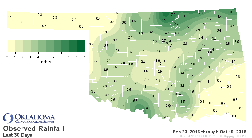
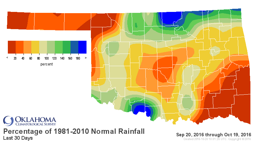
Ugh. That's ughly. And remember during this time we had 90s and 100s more
often than we should have, with periods of high winds. Drought enhancers. Black
gold. Texas tea. Whoops, momentary "Beverly Hillbillies" flashback! But check
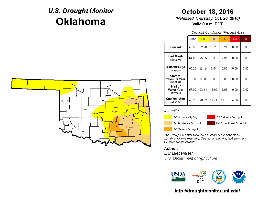
out the latest U.S. Drought monitor map for Oklahoma and you can see where
we're starting to get nervous again. And the national picture shows that the
whole region is starting to get nervous!

That's why when you combine those images with the outlooks, you get this type
of U.S. Drought Outlook for the Nov-Jan period.

So that sees drought persisting or intensifying where it already exists in
Oklahoma, but it also shows drought development to be likely in that area of
"abnormally dry (D0)" across the OK Panhandle and the far NW.
Now some of this is due to our on-again off-again La Nina, which is ON AGAIN.
In fact, CPC has reissued the La Nina watch that it cancelled just a couple of
months ago:
"A LA NINA WATCH HAS BEEN REISSUED, AND THE LATEST CPC/IRI CONSENSUS
ENSO FORECAST INDICATES PROBABILITIES FOR LA NINA NEAR 70% DURING
AUTUMN 2016, CONTINUING INTO THE WINTER OF 2016-2017, ALBEIT AT A
LOWER PROBABILITY AT THE CURRENT TIME. LA NINA REMAINS A CONSIDERATION
IN THE OUTLOOKS THROUGH THE WINTER."
It seems a bit iffy to think a weak La Nina will have that much of an impact,
but there are several other factors, such as long-range ensemble models, that
also point towards a warmer, drier cool season for our area. It's definitely
something to watch, as is the growing dry weather across the state. Now this
sort of thing helps
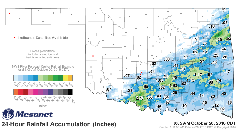
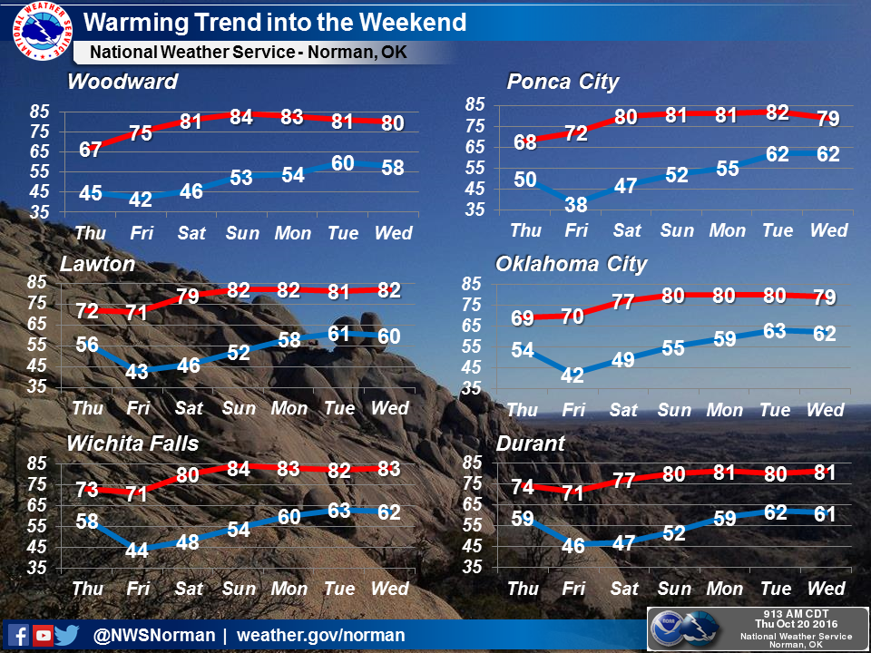
but not across the NW half of the state. And it is going to get warm again,
which won't help matters.
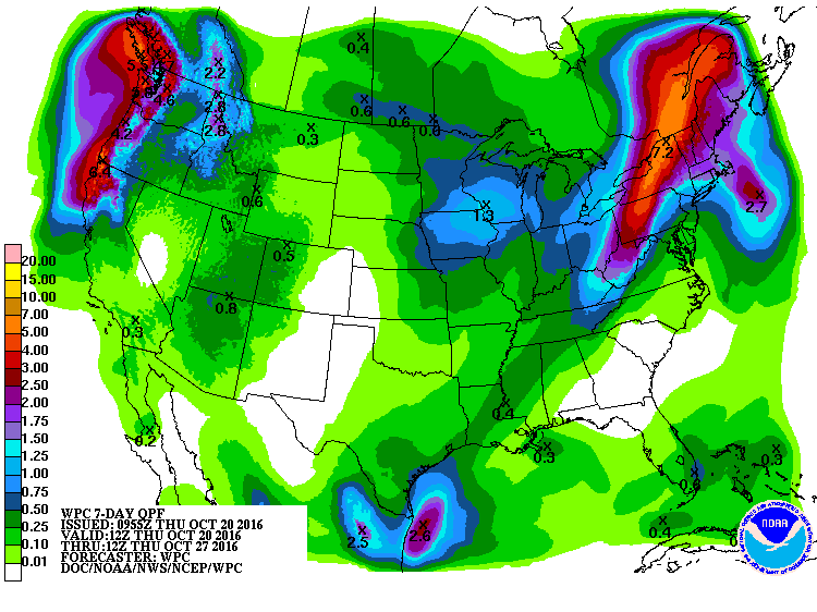
Nor will rainfall forecasts like this.
But at least we can calm Santa down. Our winter's fortune is not written in
stone just yet.
Gary McManus
State Climatologist
Oklahoma Mesonet
Oklahoma Climatological Survey
(405) 325-2253
gmcmanus@mesonet.org
October 20 in Mesonet History
| Record | Value | Station | Year |
|---|---|---|---|
| Maximum Temperature | 96°F | CAMA | 2003 |
| Minimum Temperature | 23°F | NOWA | 2011 |
| Maximum Rainfall | 3.10″ | LANE | 1996 |
Mesonet records begin in 1994.
Search by Date
If you're a bit off, don't worry, because just like horseshoes, “almost” counts on the Ticker website!