Ticker for October 24, 2016
MESONET TICKER ... MESONET TICKER ... MESONET TICKER ... MESONET TICKER ...
October 24, 2016 October 24, 2016 October 24, 2016 October 24, 2016
SPOILER ALERT!!
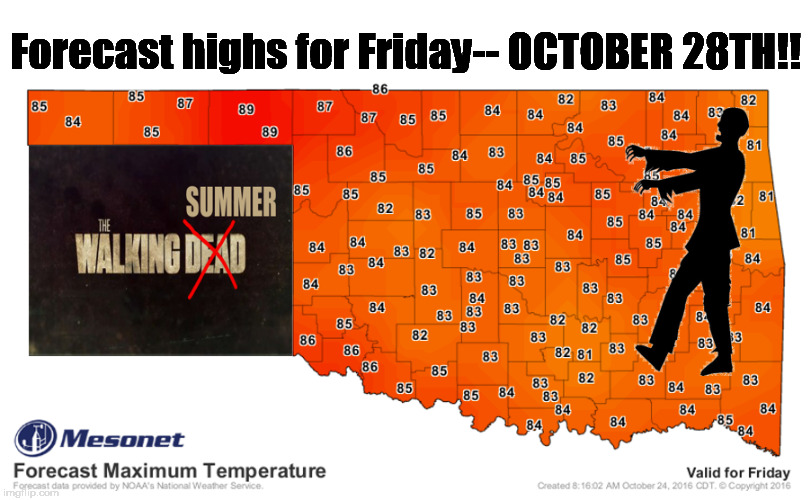
No, not spoilers about the weather. It will remain warm for another week, late
into October, wow isn't that strange, etc. and blah blah blah. I'm talking about
the show! I didn't get to watch last night so no spoilers or I'll order up a
DEF-BRAUMS Level 1 for Halloween.
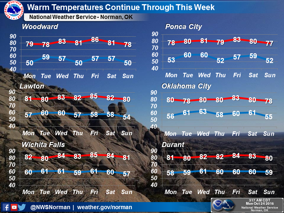
Okay, back to reality. The weather is scarily warm, right? I mean, we have had
a blast or two of true fall, including Saturday which saw widespread lows in the
30s. But that came directly after a week of 80s, 90s and even a few hundreds
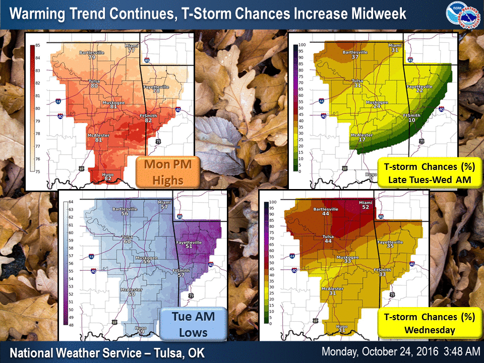
scattered about. And according to the forecasts, we're gonna be closer to
September than November, even as we head into November. Also a chance of rain
thrown in there Tuesday and Wednesday, but don't get too excited about that.
Amounts are expected to remain light.
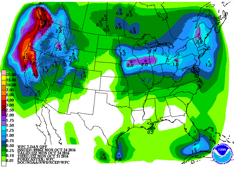
And that's unfortunate, because the extended period of warm weather only
compounds the growing dry conditions. The rainfall deficits have continued
to grow, becoming especially bad over the last 30 days.

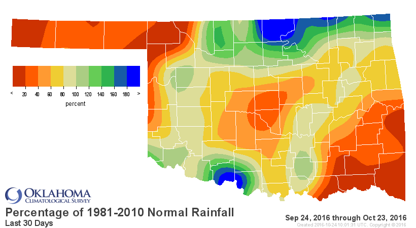
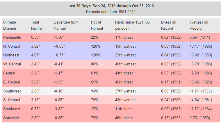
Drought continues to build, summer (okay, late summer) refuses to die, and I
still haven't watched the season premiere of "The Walking Dead." A cold front
and/or rain could cure two of those. The last is up to me (to avoid hearing
anybody talk about it).
I'll be in the bunker.
Gary McManus
State Climatologist
Oklahoma Mesonet
Oklahoma Climatological Survey
(405) 325-2253
gmcmanus@mesonet.org
October 24 in Mesonet History
| Record | Value | Station | Year |
|---|---|---|---|
| Maximum Temperature | 96°F | GRA2 | 2003 |
| Minimum Temperature | 20°F | BEAV | 2005 |
| Maximum Rainfall | 6.72 inches | MCAL | 2019 |
Mesonet records begin in 1994.
Search by Date
If you're a bit off, don't worry, because just like horseshoes, “almost” counts on the Ticker website!