Ticker for October 13, 2016
MESONET TICKER ... MESONET TICKER ... MESONET TICKER ... MESONET TICKER ...
October 13, 2016 October 13, 2016 October 13, 2016 October 13, 2016
Help is on the way!
Are you like me (LUCKY!) and tired of this already (don't get cocky, fare SE OK!)?

Does this make you cringe?
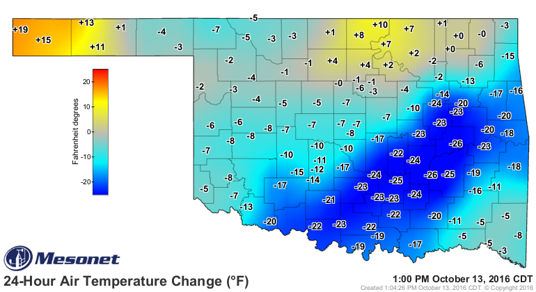
Well have no fear, help is on the way! We may suffer today, but starting tomorrow,
we'll be back in southerly flow and the temps will start to skyrocket. By this
weekend, we'll be summer dreamin'!
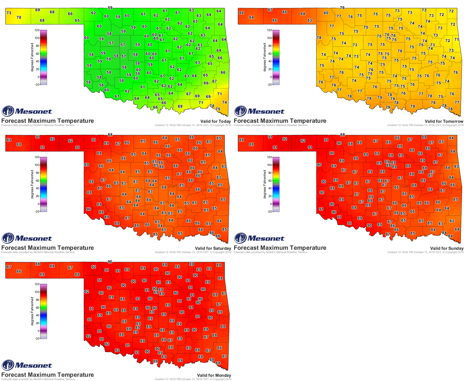
Okay okay, just calm down. I know I'm one of the few that likes to see this
weather continue. By early next week, there will be another front to cool us
down, then probably another one later next week. ARE YA HAPPY? I mean, we could
see 70s (70s!!!!) by next Wednesday, for crying out loud!
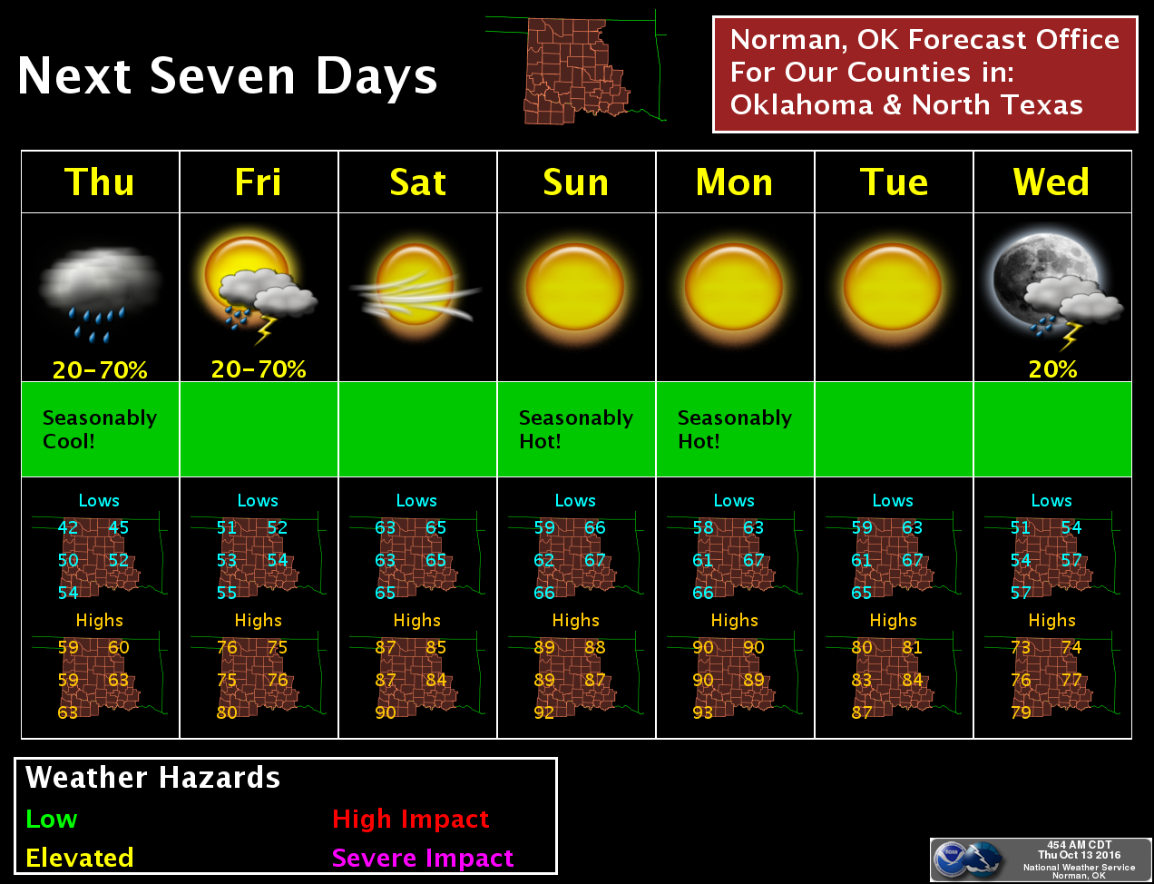
Until then, we'll be "frying" out loud.
Get it?
"FRYING" out loud!! LOL! Okay, still upset about the trip back to summer? Well
you can always make your chili tonight and enjoy it, then just crank down the
air conditioner for the next several days and eat the leftovers.
By the way, did you notice it was considerably cooler across west central
Oklahoma (and in the SE where the front hasn't made it through yet)? Well,
they're getting help by massive amounts of cloud cover and rain. Take a look
at the current radar and satellite maps and you can see the culprits.
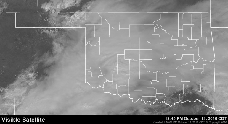
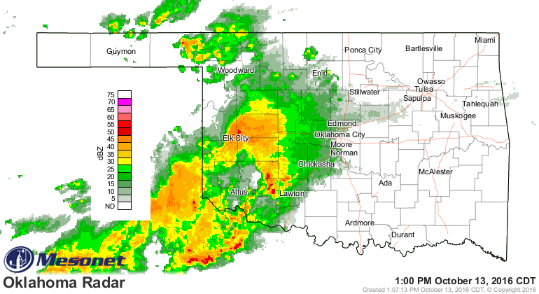
You can also see that the western Panhandle is a bit warmer as well, which
seems odd. But, the previous satellite pic showed the western Panhandle with
clear skies, so they're getting help from the sun. ANNNDDDD, the winds
have already switched to southerly out that way, so they're getting a bit of
warm air from the south.
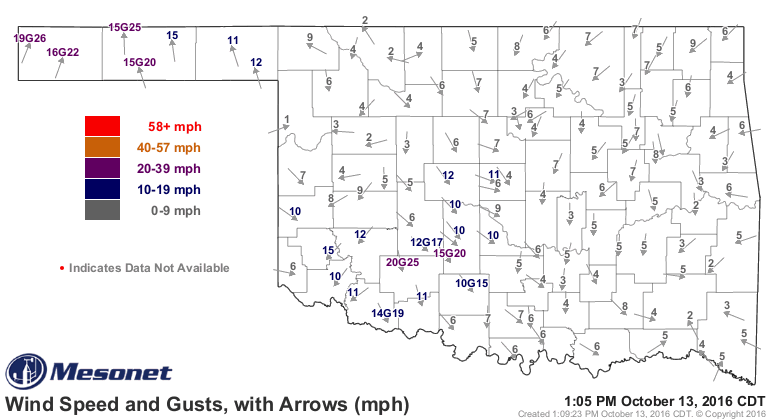
That's also why they'll be in the 80s tomorrow while the rest of the state
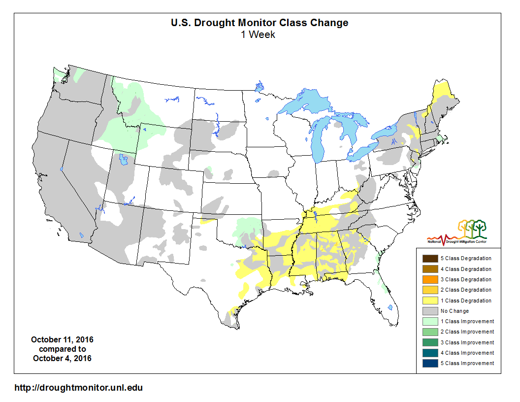
is in the 70s. Going back to that rain, though...we need that. The latest
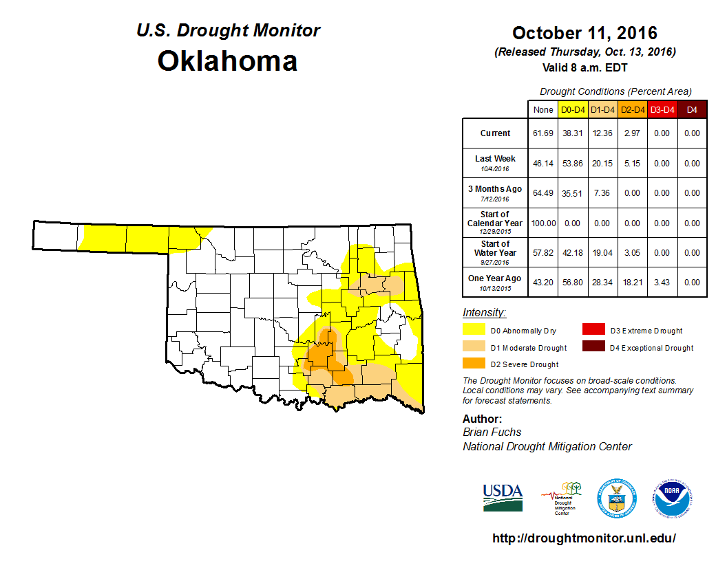
U.S. Drought Monitor report still shows some strengthening across far SE OK, but
also a bit of improvement north and west of there.
Alas, we still have over 12 percent of the state in drought, and 38 percent in
at least abnormally dry conditions. Not the best of maps, but it could be worse.
You gotta pick your chili spots. Doesn't look like we're going to see a large,
extended outbreak of cold air anytime soon.
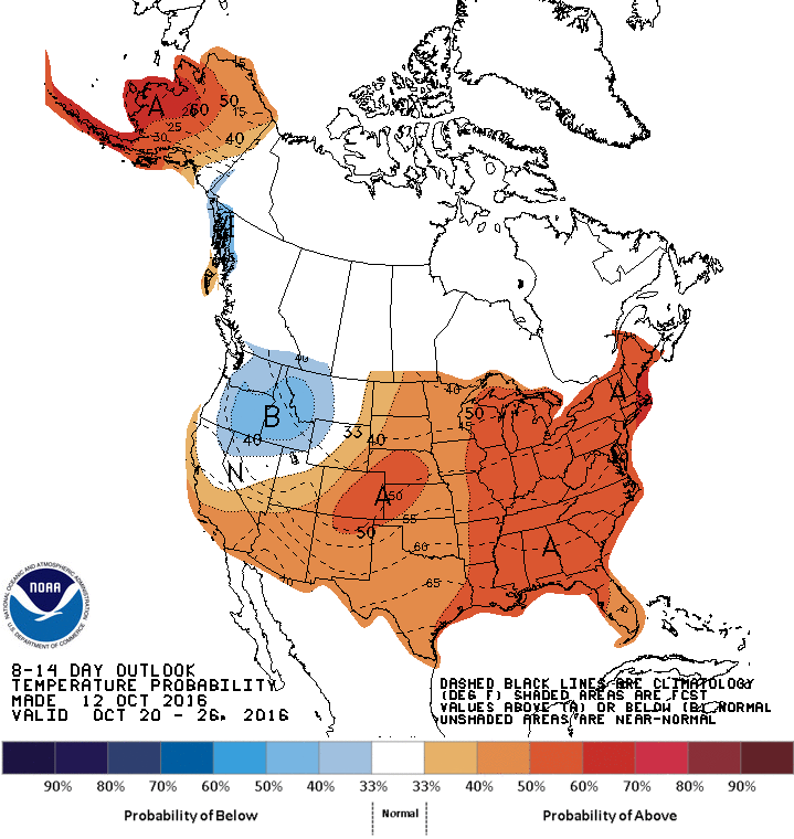
Hey, don't blame me! It's not my fault you're on the wrong side of the
temperature scale.
Gary McManus
State Climatologist
Oklahoma Mesonet
Oklahoma Climatological Survey
(405) 325-2253
gmcmanus@mesonet.org
October 13 in Mesonet History
| Record | Value | Station | Year |
|---|---|---|---|
| Maximum Temperature | 93°F | FREE | 2015 |
| Minimum Temperature | 24°F | KENT | 2019 |
| Maximum Rainfall | 4.60″ | OILT | 2012 |
Mesonet records begin in 1994.
Search by Date
If you're a bit off, don't worry, because just like horseshoes, “almost” counts on the Ticker website!