Ticker for October 6, 2016
MESONET TICKER ... MESONET TICKER ... MESONET TICKER ... MESONET TICKER ...
October 6, 2016 October 6, 2016 October 6, 2016 October 6, 2016
Hurricane Ponca
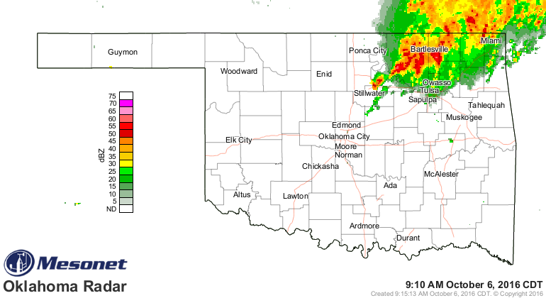
Sometime shortly after midnight last night it started raining up in the Kay
County (and the surrounding) area. And it's raining up that way still (although
Kay County is in the clear, finally).
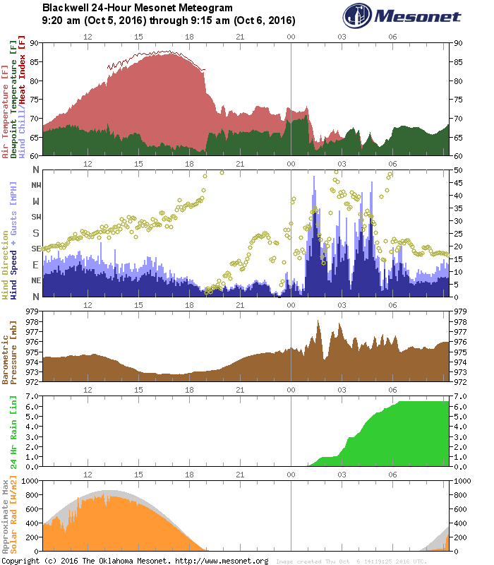
No, they didn't REALLY have a hurricane up in Ponca City, but they had their own
little version of it. As you can see from the Blackwell Mesonet meteogram, they
received about 6 inches of rain in a little over 5 hours, winds gusted to near
50 and higher off and on for a good 5 hours, and all heck broke loose. Okay, so
maybe not Hurricane Ponca...how about Tropical Depression Ponca?
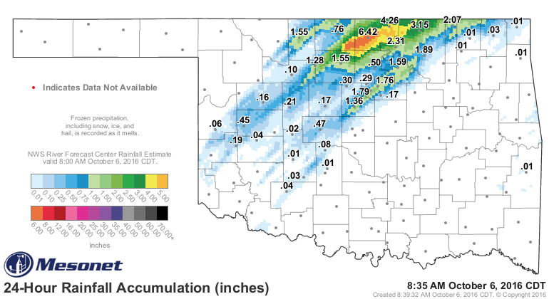
The rainfall totals were enormous in that area, nonetheless.
By the way, for a radar image of somebody REALLY getting pounded by a hurricane,
here ya go. Look towards Florida.
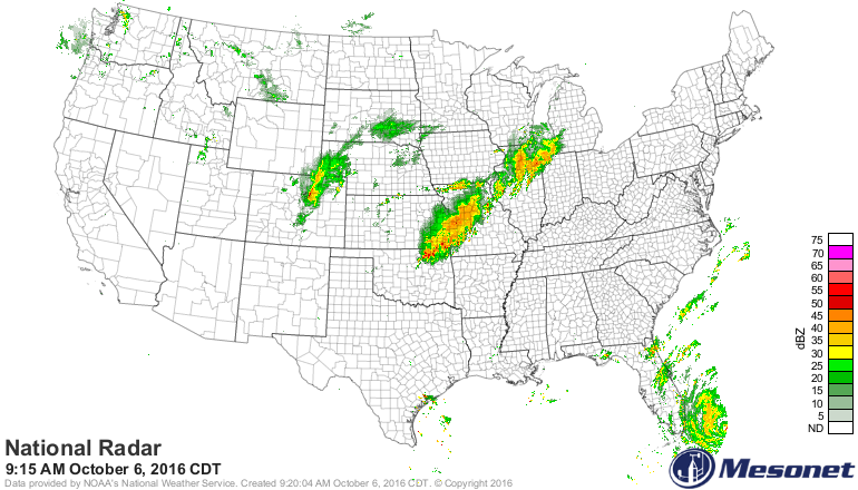
Unfortunately, that's the East Coast's problem for the foreseeable future. We
still have flash flooding, power outages and general mayhem going on up in
north central Oklahoma.
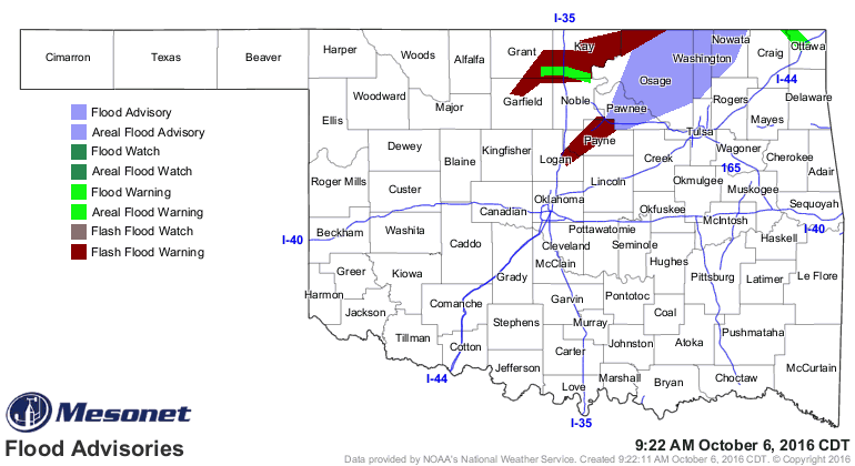
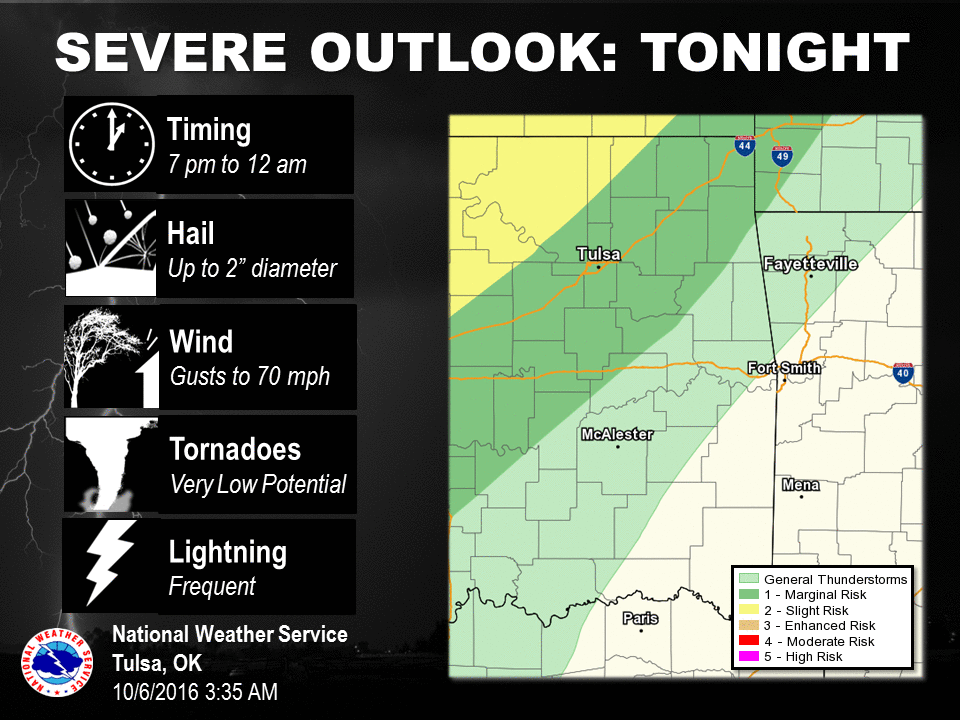
Things have the chance to get worse before they get better as well since that
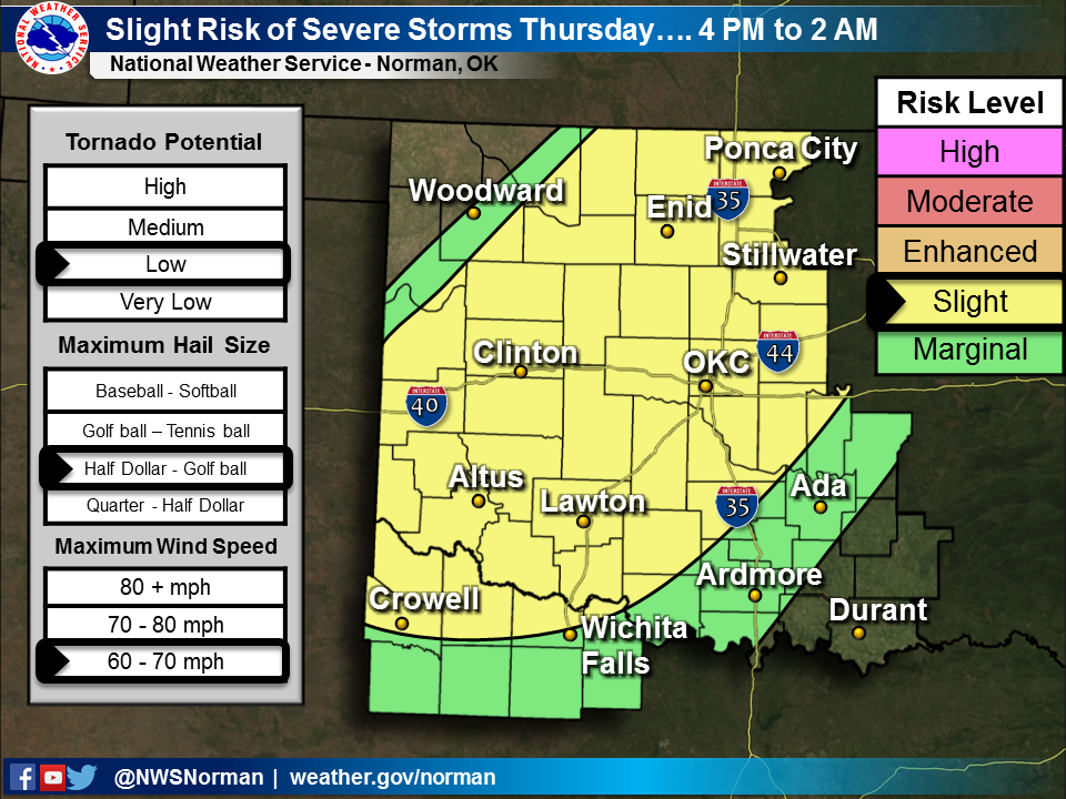
cold front is coming through tonight and expected to generate storms and severe
weather as it passes. Here are some graphics from the local NWS offices detailing
today's severe weather threat. As with the other day, the main threat will be
large hail and high winds, PLUS HEAVY RAINS (ugh). The tornado threat is low
but not zero. Again, that threat will be highest up across north central OK.

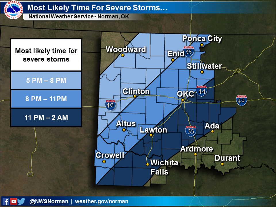
Some of that heavy rain being forecast
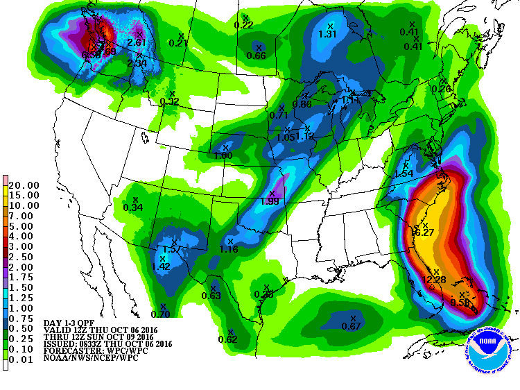
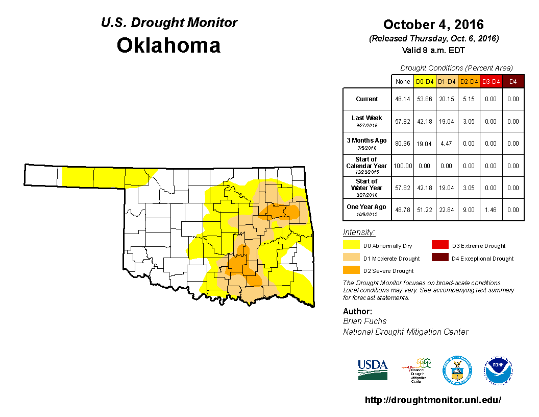
is greatly needed across parts of the state, especially the eastern third
where drought has become well established, and also the far NW, where drought
is trying to get a toehold.
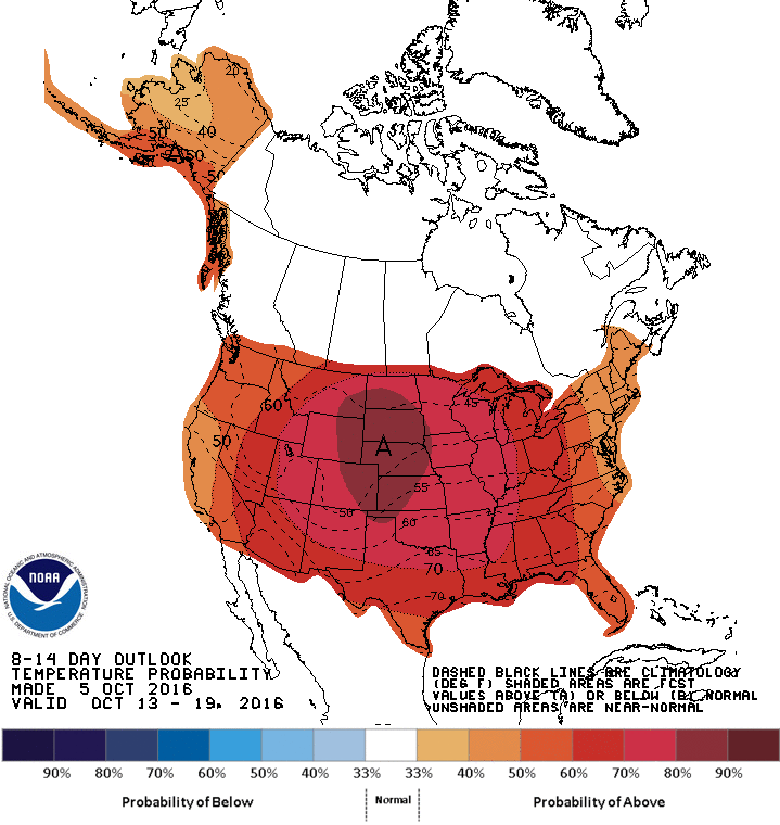
Remember, fall will be here for a bit, then...not so much.

Gary McManus
State Climatologist
Oklahoma Mesonet
Oklahoma Climatological Survey
(405) 325-2253
gmcmanus@mesonet.org
October 6 in Mesonet History
| Record | Value | Station | Year |
|---|---|---|---|
| Maximum Temperature | 95°F | FREE | 2016 |
| Minimum Temperature | 27°F | KENT | 2013 |
| Maximum Rainfall | 7.75 inches | JAYX | 2019 |
Mesonet records begin in 1994.
Search by Date
If you're a bit off, don't worry, because just like horseshoes, “almost” counts on the Ticker website!