Ticker for October 5, 2016
MESONET TICKER ... MESONET TICKER ... MESONET TICKER ... MESONET TICKER ...
October 5, 2016 October 5, 2016 October 5, 2016 October 5, 2016
A failure of fall
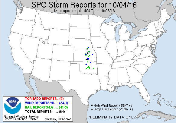
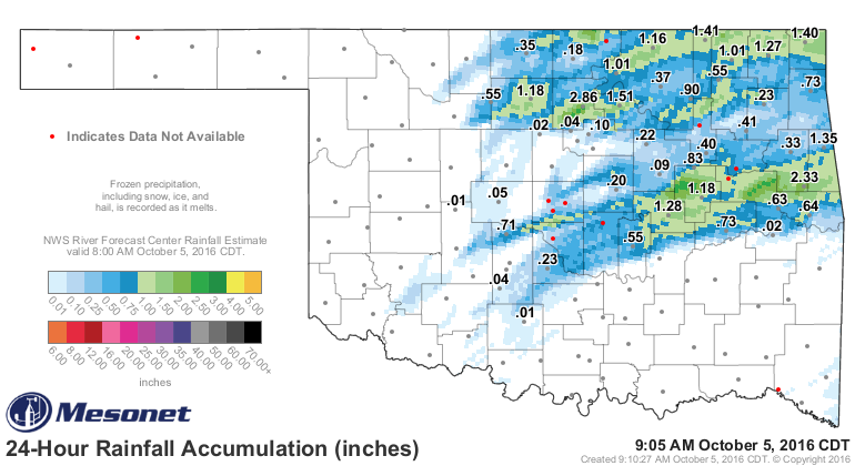
Well, did we all make it through last night? As expected, there were more storms
up north, just a few storms down south, lots of large hail and high winds, and
some funnels but no official tornadoes just yet. The SPC storm reports image and
the 24-hour Mesonet rainfall graphic tells the story of who got hit and where.
So all in all it was a fairly well forecast event with less than horrific results,
which is always a good thing. The probability of tornadoes from SPC fluctuated
from 5-10% throughout the day, and while I always end up getting bit in the hind
end when I proclaim there were no tornadoes (and somebody sends me video of a
tornado), it just proves once again that tornadoes themselves are exceedingly
rare events. Even when you have somewhat favorable conditions like yesterday. But,
some folks that needed rain certainly got some across the NE quarter of the state.
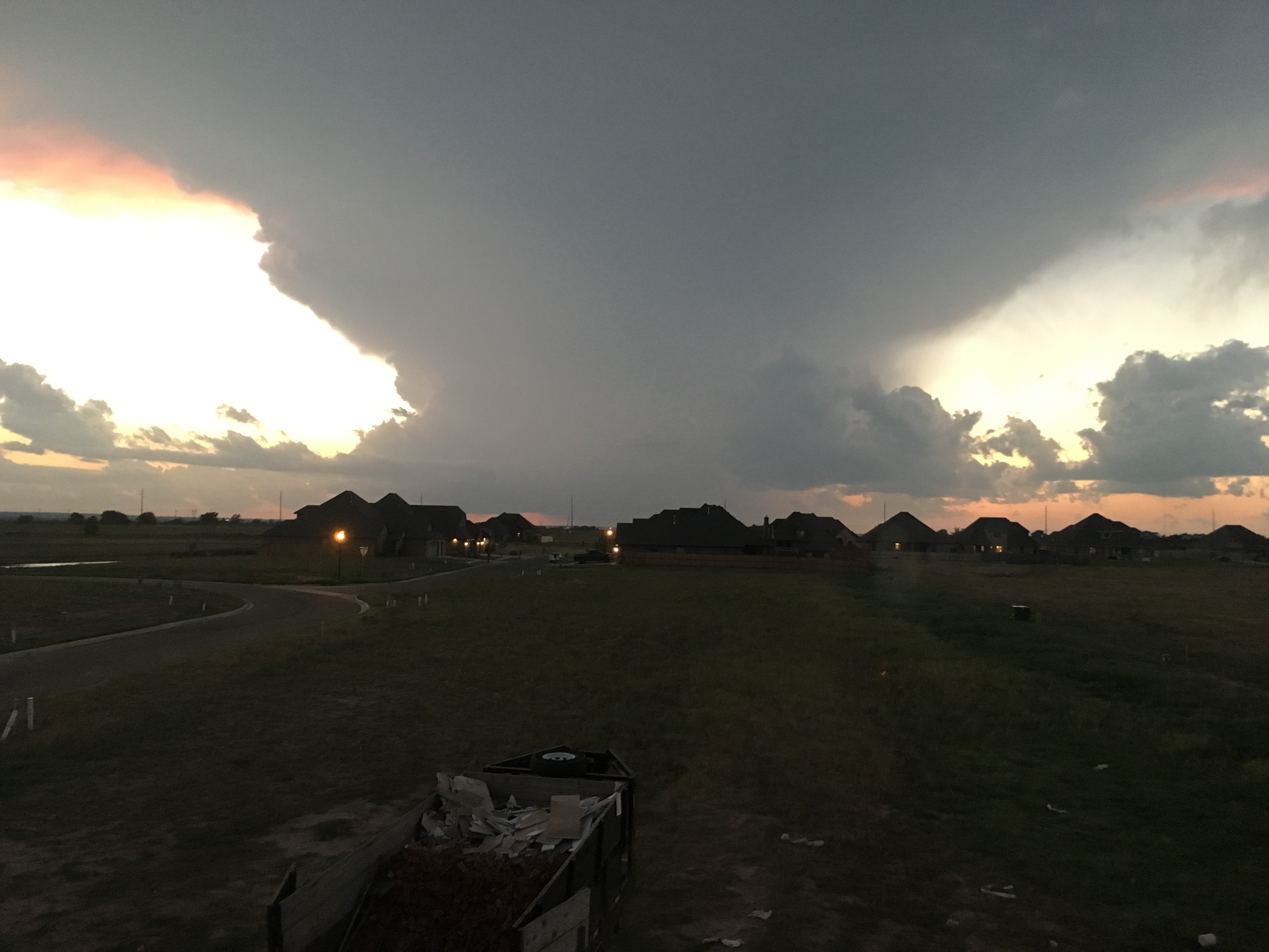
The view I had of the rotating supercell coming into west Moore last night was
fairly impressive. I wasn't scared. I mean, come on, a rotating supercell coming
into Moore? What could happen?
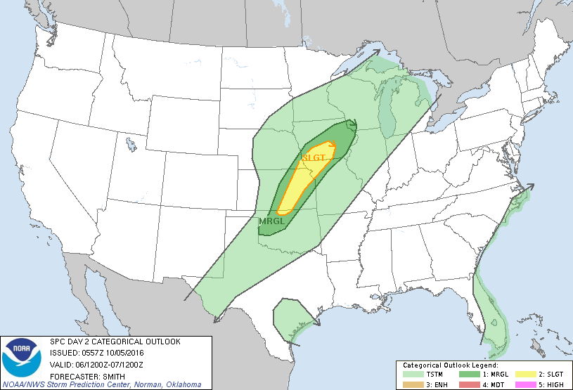
And to finish off the severe weather bit, yes we continue to have storm chances
today and tomorrow, and yes you will need to stay weather aware until this whole
thunderstorm craze passes by.
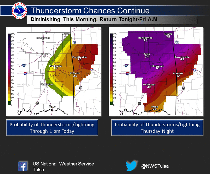
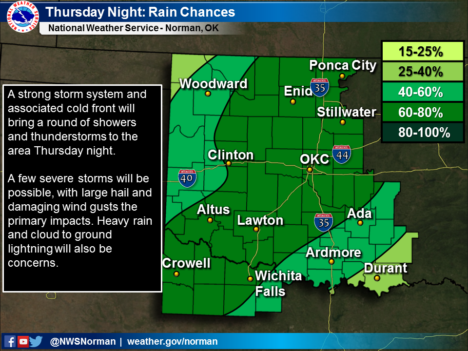

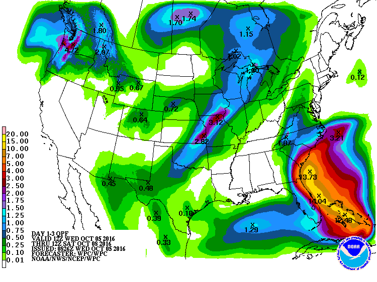
And with those storm chances comes more rain chances. Not bad, if this forecast
were to be realized.
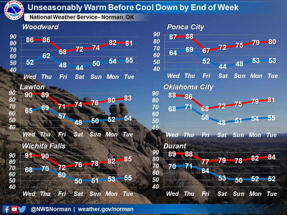
Okay, now on to the Ticker title. "A failure of fall"? What the heck does that
mean. There is a fairly significant front coming in, after all. I can see it
right-cheer (Okie for "right here") on this 7-day temperature graphic from NWS
Norman. Check out Friday's highs.
However, as this laughing feline says, oh, you thought fall was here to stay?
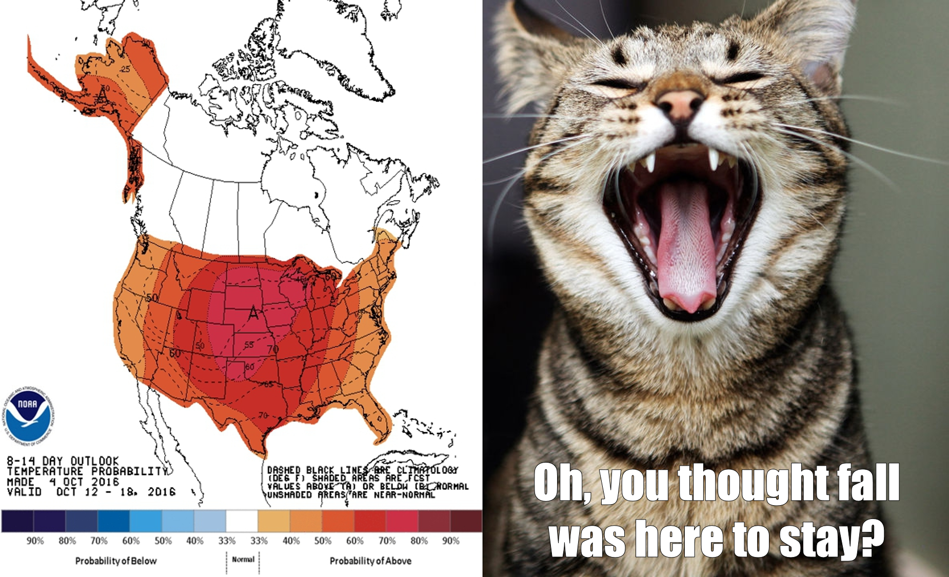
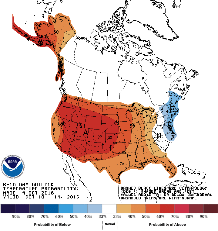
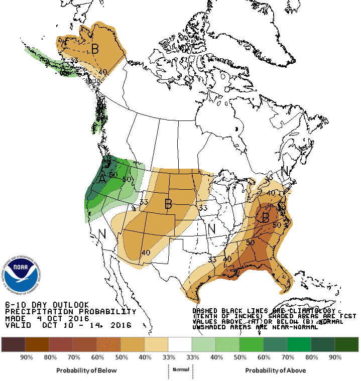
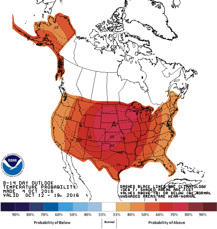
Yes, that's the CPC 8-14 day temperature outlook for Oct. 12-18 and it does
indeed show greatly increased odds of above normal temperatures for that time
frame. In fact, the 6-10 AND 8-14 day outlooks show both greatly increased odds
of above normal temps and below normal precip for much of next week.
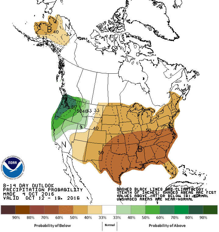
The good thing is that normals for that time of the year are in the lower half
of the 70s, so we're not talking highs of 95 degrees.
OR ARE WE?
Sorry, no bets on this one (but I think we haven't seen our last 90 in the state
yet).
Gary McManus
State Climatologist
Oklahoma Mesonet
Oklahoma Climatological Survey
(405) 325-2253
gmcmanus@mesonet.org
October 5 in Mesonet History
| Record | Value | Station | Year |
|---|---|---|---|
| Maximum Temperature | 96°F | HOOK | 2018 |
| Minimum Temperature | 31°F | KENT | 2016 |
| Maximum Rainfall | 5.92 inches | PRYO | 1998 |
Mesonet records begin in 1994.
Search by Date
If you're a bit off, don't worry, because just like horseshoes, “almost” counts on the Ticker website!