Ticker for October 4, 2016
MESONET TICKER ... MESONET TICKER ... MESONET TICKER ... MESONET TICKER ...
October 4, 2016 October 4, 2016 October 4, 2016 October 4, 2016
Tornado threat on the rise?
There have been 130 tornadoes in Oklahoma during October, and I'm betting that
number will be the same after today. In fact, the odds favor that number
remaining at 130. However, there is a chance of severe weather today across
Oklahoma, especially north central Oklahoma, and there will be a low
chance of twisters as well. The main threat will be large hail and damaging winds,
but the other usual suspects will be there as well, such as lightning and heavy
downpours.
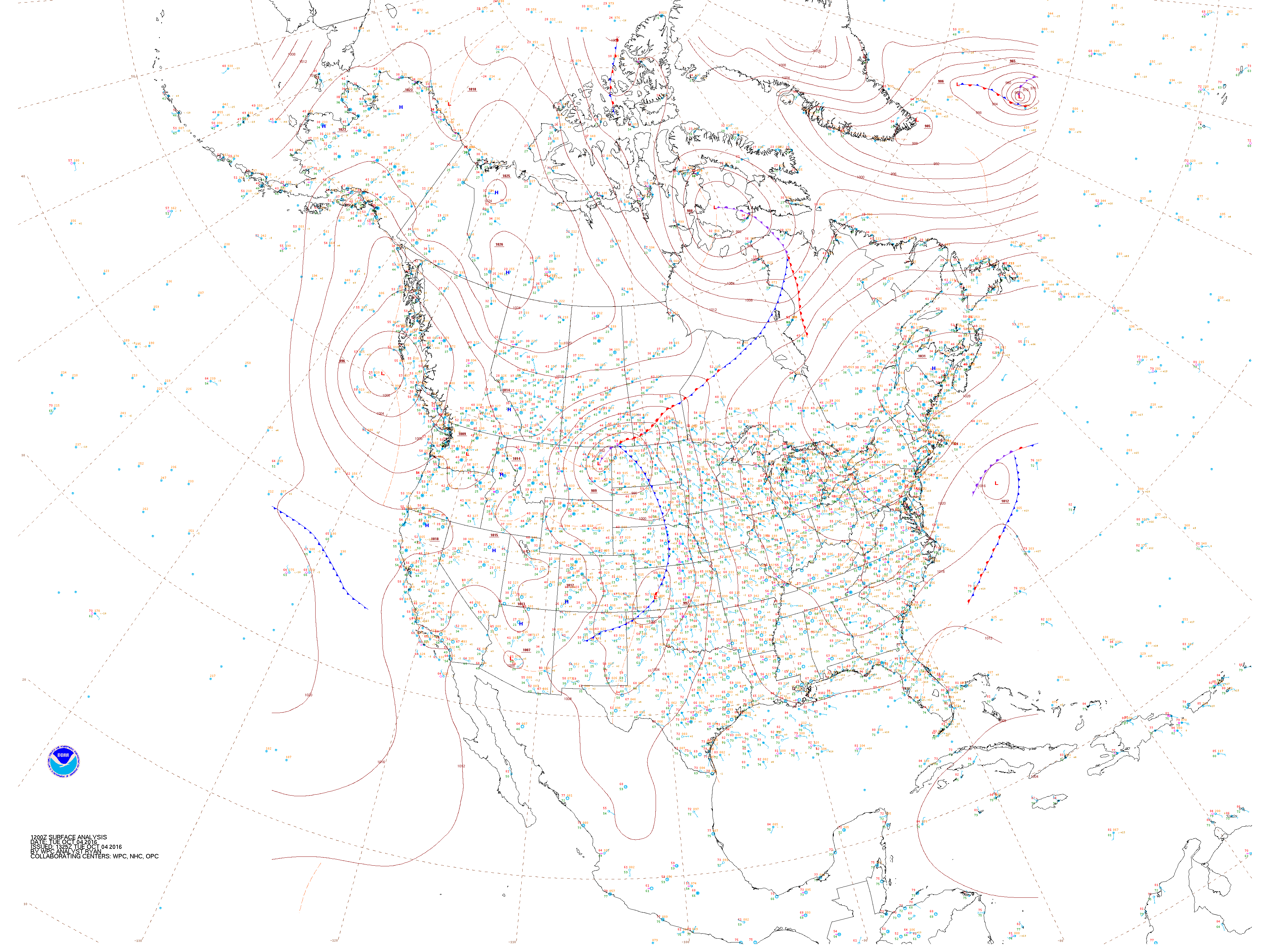
The culprit is the classic cold front/dry line scenario that we're
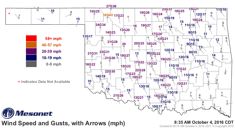
so familiar with here in Oklahoma. Moisture streaming northward on the low level
jet from the Gulf of Mexico...with surface winds on the Mesonet gusting from
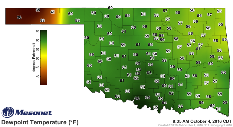
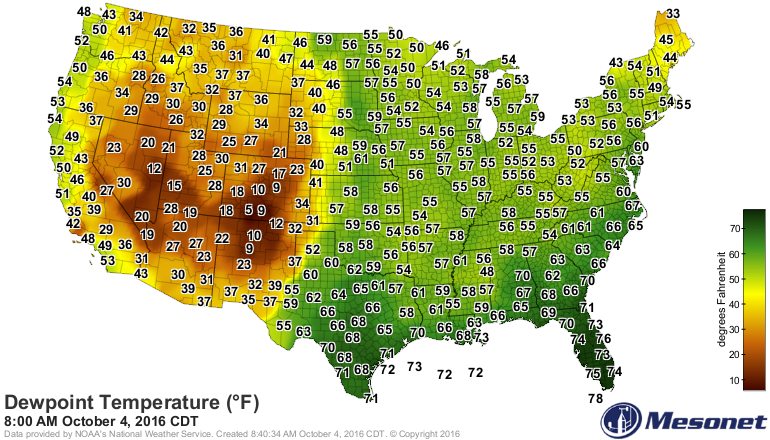
30-40 mph. Dewpoints -- available moisture for storm development -- are already
into the 60s across the western half of the state, and the dryline has already
established itself across the Panhandles northward. And there is even juicier
air to our south, possibly headed this way.
Let's get into the meat of the story, however, using NWS and SPC graphics. We
have an "enhanced" threat of severe weather across NC OK, with a slight/marginal
threat south into the much of the rest of the state.
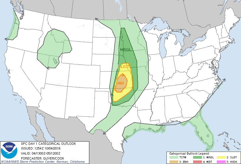
It's important to understand those different categories. In some ways, it's
not about the intensity of the storms in each area as much as it is about the
coverage of those storms (although intuitively you can assume the "enhanced" area
will have storms with a bit more gusto). But intense storms are also possible
down into the "slight" risk area, just not as numerous. And remember, this is
all AS FORECAST. Mother Nature doesn't always read the same computer models as
the forecasters.

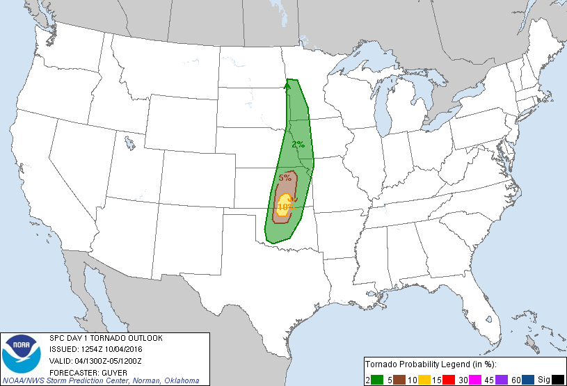
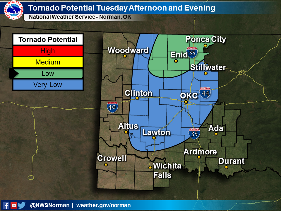
The tornado threat has increased just a bit from the last forecast early this
morning and now has a 10% probability area from far NC OK into S KS, with a
small area of 5% surrounding that. The 2% area extends farther south into
Oklahoma. The percentage is the probability of a tornado occurring with 25 miles
of a point within those areas.
From SPC:
"SUPERCELLS CAPABLE OF LARGE HAIL WILL INITIALLY BE POSSIBLE...AND AT
LEAST SOME TORNADO RISK SHOULD EXIST AS WELL PARTICULARLY ACROSS
SOUTH-CENTRAL KS/NORTH-CENTRAL OK TOWARD/JUST AFTER SUNSET."
The chances for severe winds and hail are the greater risks, again with higher
risks in north central OK.

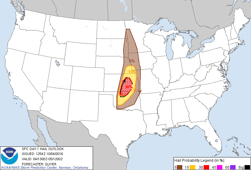
Concerning those areas to the south in the slight/marginal risk areas, as
noted by SPC, the severe risk is very conditional.
"TO THE SOUTH OF NORTH-CENTRAL OK...STORM COVERAGE IS MORE UNCERTAIN
WITH SOUTHWARD EXTENT ALONG THE DRYLINE ACROSS WEST-CENTRAl OK...
AS PREVIOUSLY MENTIONED...A LARGE
HAIL/TORNADO RISK APPEARS MOST PROBABLE ACROSS NORTH-CENTRAL OK NEAR
THE DRYLINE/FRONT INTERSECTION...BUT THESE THREATS CANNOT BE
DISCOUNTED FARTHER SOUTH ACROSS OK SHOULD STORMS INDEED FORM BY
EARLY EVENING."
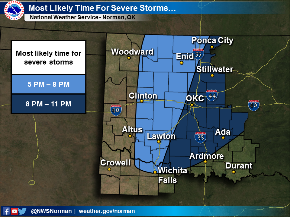
For a few more particulars, here are some helpful graphics from our local NWS
offices.

We've had 57 tornadoes this year, with the last one occurring on July 3 near
Stillwater, so today's threat three months later gives us a bit of pause since
it's been 3 months since our last bout with twisters. If this were May 30th,
we'd probably be "meh, stay weather aware, we've been through this before, it's
springtime in Oklahoma."
So my advice? Stay weather aware, we've been through this before, it's OKLAHOMA.
Just keep abreast of the weather from your local NWS and/or media sources and
be prepared. The exact timing and locations of the greatest severe threats will
become more apparent as the day goes on. Like the atmosphere, the situation
is fluid.
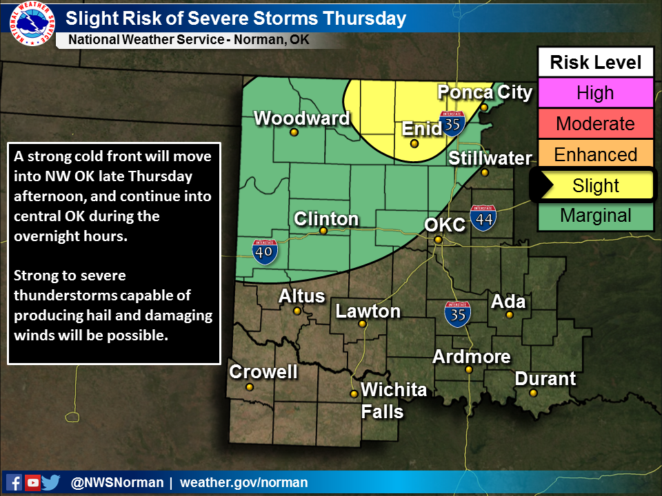
By the way, we may have to go through this again on Thursday, but right now the
storms don't look quite as potent. But that's a story for another day. Thursday,
to be exact.
Gary McManus
State Climatologist
Oklahoma Mesonet
Oklahoma Climatological Survey
(405) 325-2253
gmcmanus@mesonet.org
October 4 in Mesonet History
| Record | Value | Station | Year |
|---|---|---|---|
| Maximum Temperature | 99°F | WALT | 2000 |
| Minimum Temperature | 29°F | OILT | 2010 |
| Maximum Rainfall | 7.72″ | PAWN | 2017 |
Mesonet records begin in 1994.
Search by Date
If you're a bit off, don't worry, because just like horseshoes, “almost” counts on the Ticker website!