Ticker for September 29, 2016
MESONET TICKER ... MESONET TICKER ... MESONET TICKER ... MESONET TICKER ...
September 29, 2016 September 29, 2016 September 29, 2016 September 29, 2016
Okay, how is there still drought?

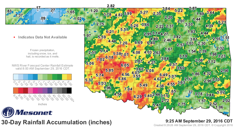
Yes, it HAS rained, and rained a lot, over the last couple of weeks...just not
across the eastern third of Oklahoma. The map looks all nice and green and red
and orange across most of the state but eastern Oklahoma has been left with a
big blob of droughty mess

And when you look at the actual percent of normal those amounts add up to over
that period, the picture becomes pretty clear.
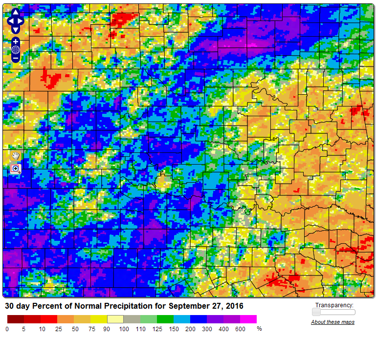
The Panhandle is starting to look pretty dry as well. Luckily we're headed into
fall and so the heat will not be as big of a factor enhancing drought impacts,
but it won't help that much unless it rains.
Now last night's front would have made a bigger difference if it had actually
rained as it passed, but we were so cleaned out of moisture by the last system
with little return from the Gulf that last night's cold front was about as boring
as they come. It did give us some chilly temps this morning
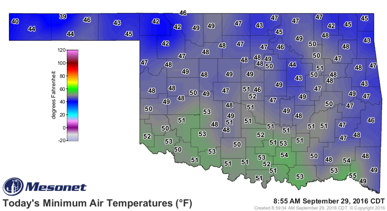
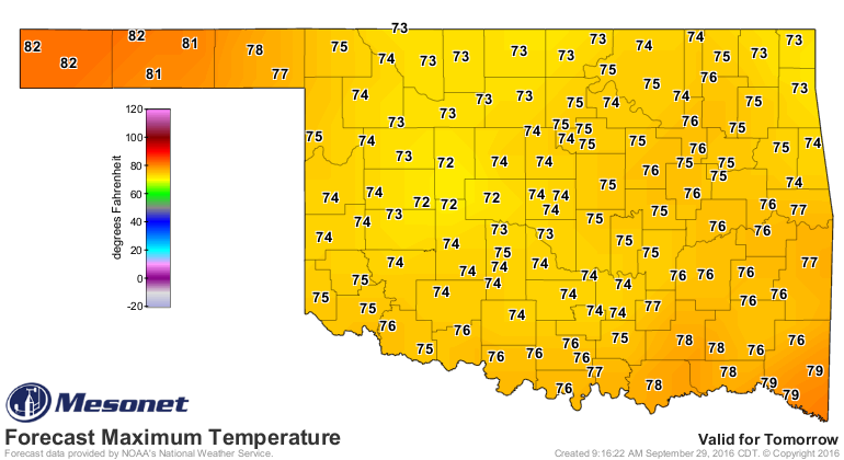
and it will give us a couple of relatively cool afternoons
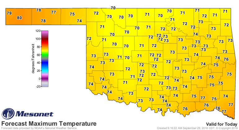
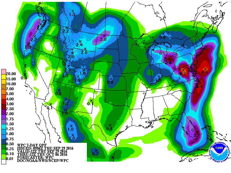
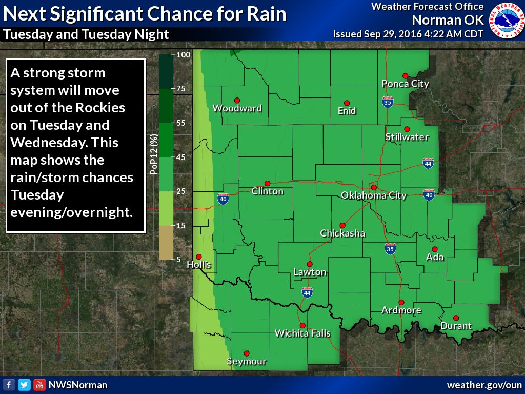
Never fear, the next chance of rain is just around the corner (if you call
Monday a "corner" which would make you a weirdo like me). It's just starting to
show up on the 7-day rainfall forecasts, and NWS Norman even has it in their
graphics...watch out for increasing chances of severe weather too!
More rain, more drought. No, how about more rain, LESS drought? Now THAT would
be amazing.
Gary McManus
State Climatologist
Oklahoma Mesonet
Oklahoma Climatological Survey
(405) 325-2253
gmcmanus@mesonet.org
September 29 in Mesonet History
| Record | Value | Station | Year |
|---|---|---|---|
| Maximum Temperature | 102°F | BURN | 2011 |
| Minimum Temperature | 31°F | KENT | 1999 |
| Maximum Rainfall | 4.93″ | STIG | 2012 |
Mesonet records begin in 1994.
Search by Date
If you're a bit off, don't worry, because just like horseshoes, “almost” counts on the Ticker website!