Ticker for September 14, 2016
MESONET TICKER ... MESONET TICKER ... MESONET TICKER ... MESONET TICKER ...
September 14, 2016 September 14, 2016 September 14, 2016 September 14, 2016


The Raineth Hath Begineth


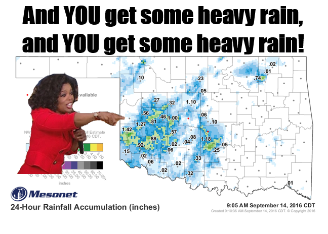
Mother Nature (i.e., Oprah) has deemed some locales deserving enough to receive
some very nice rains this morning, as viewed on the Mesonet's 24-hour rainfall
map from a bit ago. A stalled cold front (AGAIN??) helped to kick off these
showers and sometimes very loud storms last night into this morning. Some areas
have received from 1-2 inches of rain, and it's probably not over. Probably? Hey,
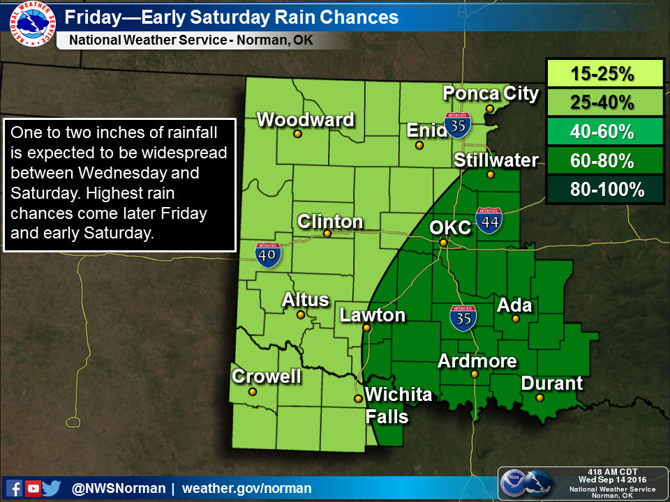
have to hedge our bets here, but the NWS does see pretty good rain chances
continue with that stalled front, another front approaching for this weekend,
and a series of upper-level disturbances. So as the saying goes, not everybody
is going to get really wet, but most should get somewhat wet (it's not really
famous, I just made it up).

This 5-day rainfall forecast looks like we'll get inundated, but most folks will
receive an inch or three while others will look fondly at their half-inch.


Friday into Saturday looks to be the focus now as a cold front comes through.


As for today, wherever the storms fire, there will be rain. How's that for a
scientific forecast!! I'll go one further...where it's storming now, it's
raining!


And you think my job is easy. HA!

Gary McManus
State Climatologist
Oklahoma Mesonet
Oklahoma Climatological Survey
(405) 325-2253
gmcmanus@mesonet.org
September 14 in Mesonet History
| Record | Value | Station | Year |
|---|---|---|---|
| Maximum Temperature | 103°F | MANG | 2000 |
| Minimum Temperature | 39°F | KENT | 2012 |
| Maximum Rainfall | 3.64″ | JAYX | 1998 |
Mesonet records begin in 1994.
Search by Date
If you're a bit off, don't worry, because just like horseshoes, “almost” counts on the Ticker website!