Ticker for September 15, 2016
MESONET TICKER ... MESONET TICKER ... MESONET TICKER ... MESONET TICKER ...
September 15, 2016 September 15, 2016 September 15, 2016 September 15, 2016
Drought keeps on ticking
Drought takes a licking, albeit with a dry tongue, but keeps on Tick(er)ing.
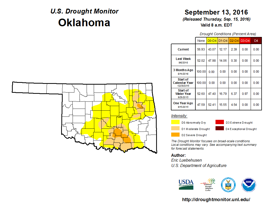
Okay, first off...gross! And secondly, Mother Nature could do us all a favor
(especially those of us that have to figure out where the drought is or is not
every Sunday-Tuesday of every week it hangs around) and knock the crud out of this
dry weather with a good rain over the next several days.
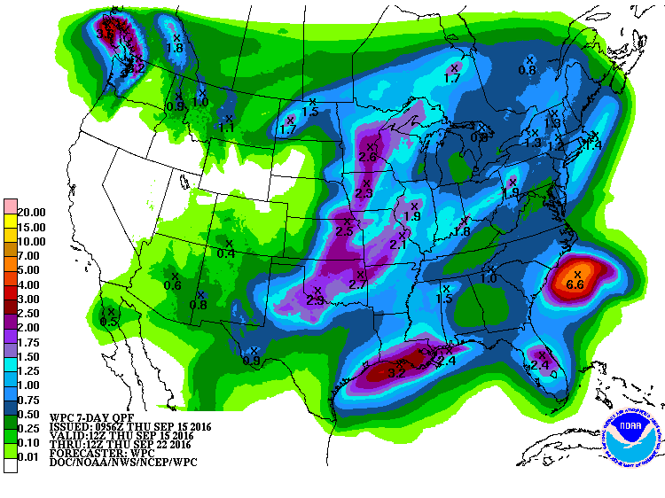
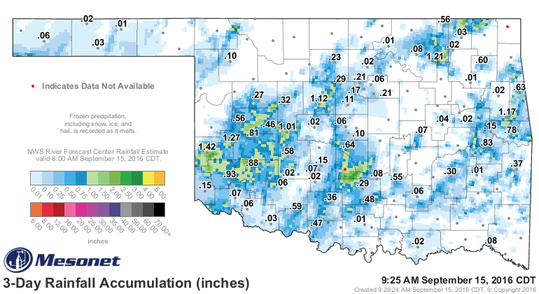
But like many of you, I'll believe it when I see it. The last system that came
through was a dud for most if you ask me...and you didn't but I'm writing this
and you're reading it so there you go.
However, there are actual storms out there right now in the Texas Panhandle,
and they appear to be headed this way.
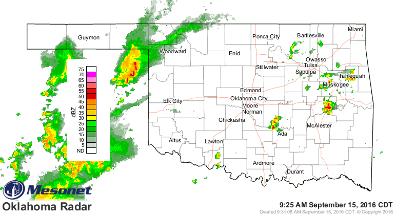
It will probably end up across the NW quarter like most of the recent action,
but hope is there. Friday looks to be the best chances for the rest of the
state as an upper-level system moves in and interacts with all this moist air
laying about.
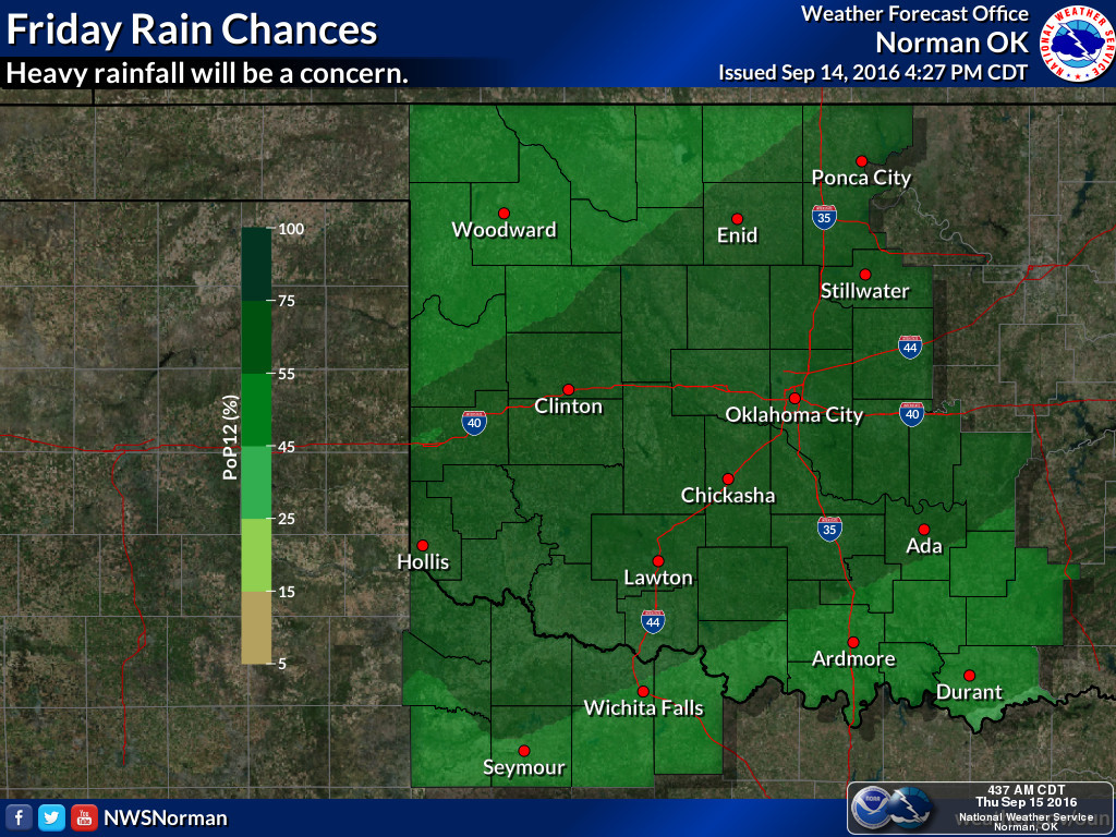
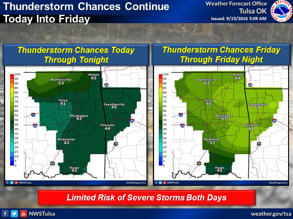
Then we should see additional rain chances off and on for the next week or so.
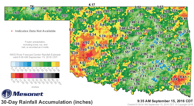
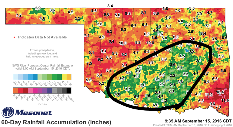
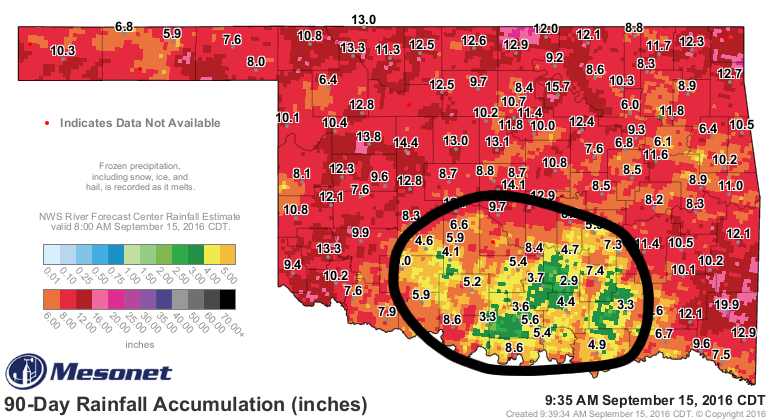
And we need the rain...just taking a gander, which is good for the goose, at
the colors on the Mesonet rainfall maps shows the problem areas that match up
pretty well with the Drought Monitor. Especially down across south central OK
where that severe (D2) drought is starting to take hold. The colors to watch for
are the greens, especially as we get out to 60-90 days. I broke out the Mesonet's
box of 24 crayons to help you out a bit.
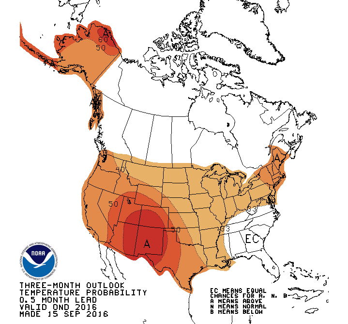
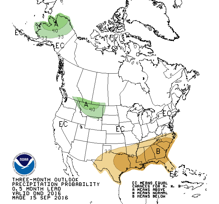
The October and October-December outlooks from the CPC came out today and for
the most part, they're not much help for Oklahoma. They do see increased odds
for above normal rainfall across northern Oklahoma, but equal odds of above-,
below- and near-normal temperatures across the state.
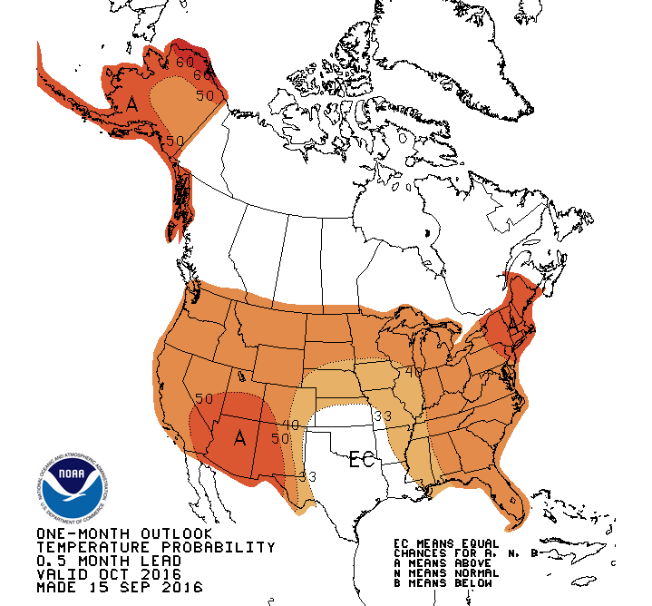

THAT DOESN'T MEAN NORMAL CONDITIONS ARE FAVORED, FOR CRYING OUT LOUD! IN THE
NAME OF ALL THAT IS HOLY, PLEASE DON'T LET ME SEE YOU SHOWING THAT MAP AND
SAYING THAT NORMAL TEMPS ARE FAVORED! ALL THREE ARE EQUALLY FAVORED, WHICH
ACTUALLY MEANS NONE OF THEM ARE FAVORED AT ALL!!
Okay, did that work? I hope so. Now the Oct-Dec outlooks actually do show
increased odds of above normal temps and at least for the southern half of the
state, below normal precip.
Okay, now we're going to head into dangerous territory...the winter outlook
(December 2016-February 2017). With La Nina looking more and more weak or
non-existent, I'd take this with a good dose of salt. But CPC shows increased
odds of above normal temps and for far southern Oklahoma, below normal precip.
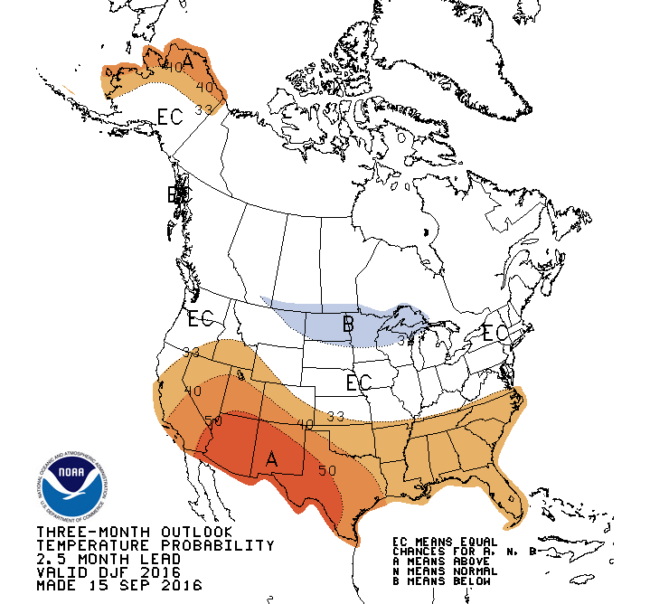
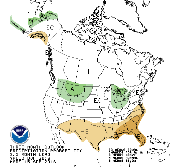
ONCE AGAIN THOSE WHITE EC AREAS DO NOT FAVOR "NORMAL" CONDITIONS! IF YOU SAY
THAT, I SWEAR I WILL COME FIND YOU AND READ PAST TICKERS TO YOU UNTIL YOUR
BRAIN SHUTS DOWN! It happened to me long ago just due to writing them. Imagine
having them read to you.
One final caution, even if the slightly increased odds of above normal temps
do occur, that does not indicate "no snow." Remember, this would be the average
over those three months and snowstorms and ice storms and things of that nature
occur with individual storms systems. You can have a 20-inch snow/blizzard and
end up with the driest and warmest winter on record.
Okay, enough for today. Time to go turn the brain back on.
Gary McManus
State Climatologist
Oklahoma Mesonet
Oklahoma Climatological Survey
(405) 325-2253
gmcmanus@mesonet.org
September 15 in Mesonet History
| Record | Value | Station | Year |
|---|---|---|---|
| Maximum Temperature | 103°F | FREE | 2010 |
| Minimum Temperature | 37°F | BOIS | 2012 |
| Maximum Rainfall | 5.53″ | SULP | 2001 |
Mesonet records begin in 1994.
Search by Date
If you're a bit off, don't worry, because just like horseshoes, “almost” counts on the Ticker website!