Ticker for September 8, 2016
MESONET TICKER ... MESONET TICKER ... MESONET TICKER ... MESONET TICKER ...
September 8, 2016 September 8, 2016 September 8, 2016 September 8, 2016
CPC cancels La Ni?a watch
Not much in the way of change in the U.S. Drought Monitor report released this
morning
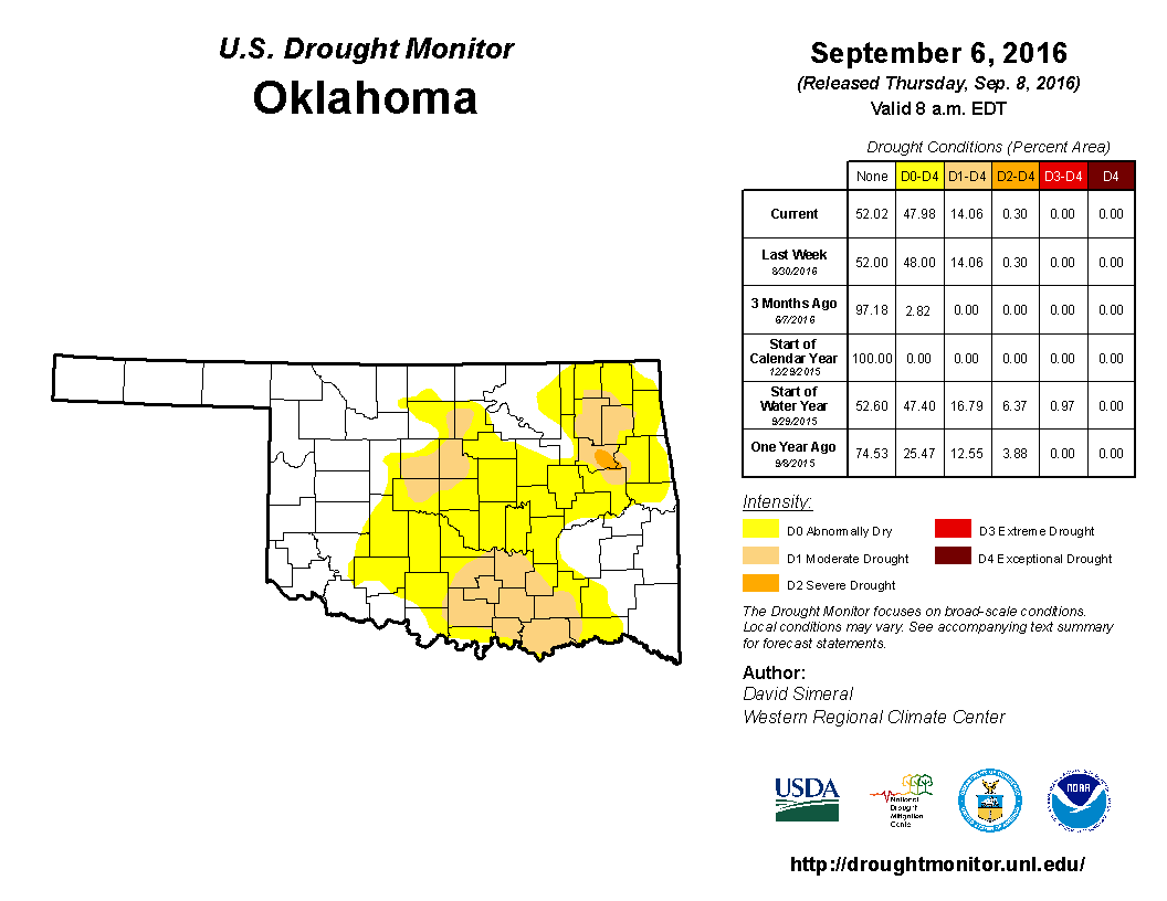
but then again there wasn't much in the way of rain since the last one
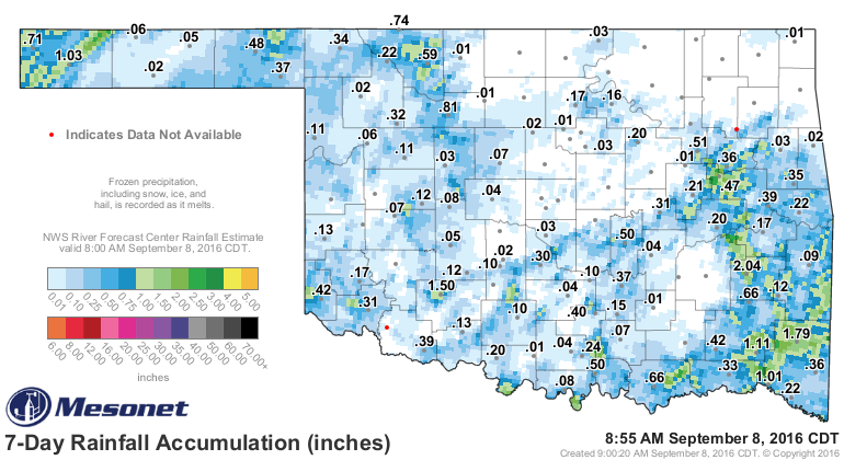
so the only way to go was intensification, and with some possible big rains coming
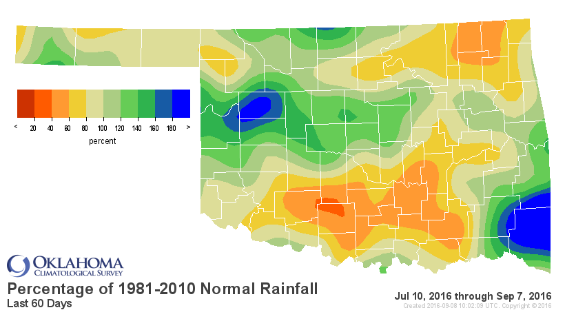
up, I decided to stand pat in case those rains actually materialize. Otherwise,
intensification is definitely in the works for parts of south central up through
central Oklahoma. Their deficits over the last 30-90 days are all screaming "DRY
DRY INTENSIFY!" The highest amounts look to be up across northern Oklahoma, but
that can of course change as the event unfolds.


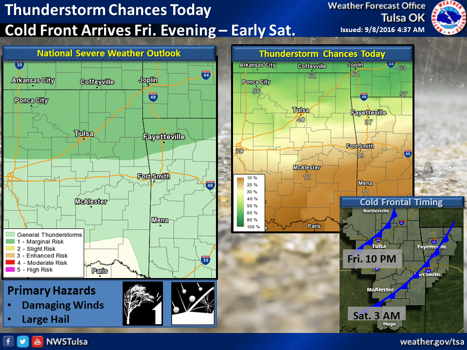
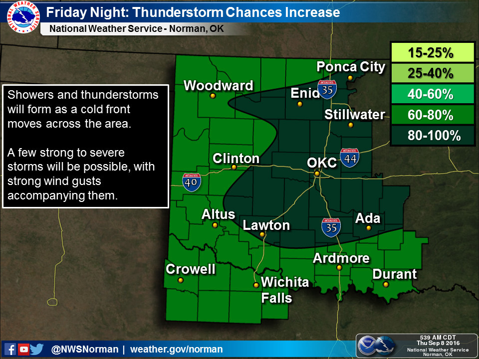
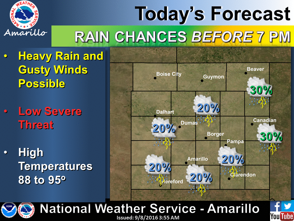
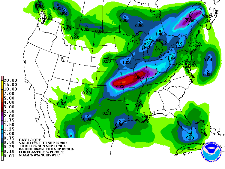
Now for the possibility of the big rains that we talked about yesterday thanks to
the remnants of Hurricane Newton, combined with a nice late-summer/early-fall
cold front, not too much has changed there. The chances begin today but look to
be greatest Friday into early Saturday as the cold front moves through.
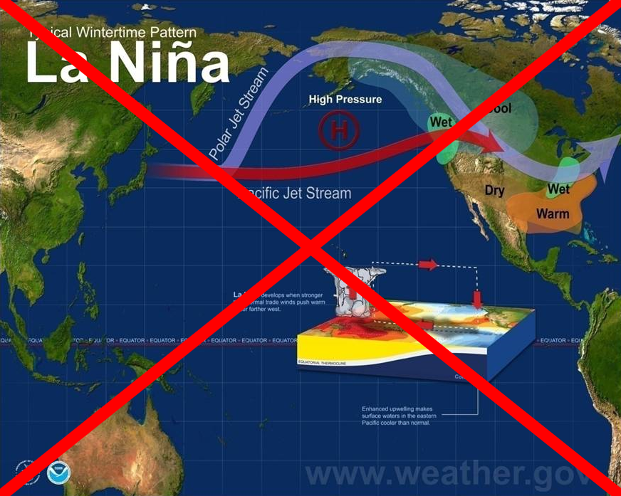
Perhaps the bigger news is the cancellation of the La Nina watch that CPC
had issued earlier this year. As you all probably know by now, La Nina conditions
in the equatorial pacific can negatively impact our weather in the Southern
Plains from late fall through early spring. It tends to give us higher odds of
above normal temperatures (which some may like) but also below normal
precipitation (which almost nobody benefits from). Here is the key paragraph
from this morning's "EL NI?O/SOUTHERN OSCILLATION (ENSO) DIAGNOSTIC DISCUSSION":
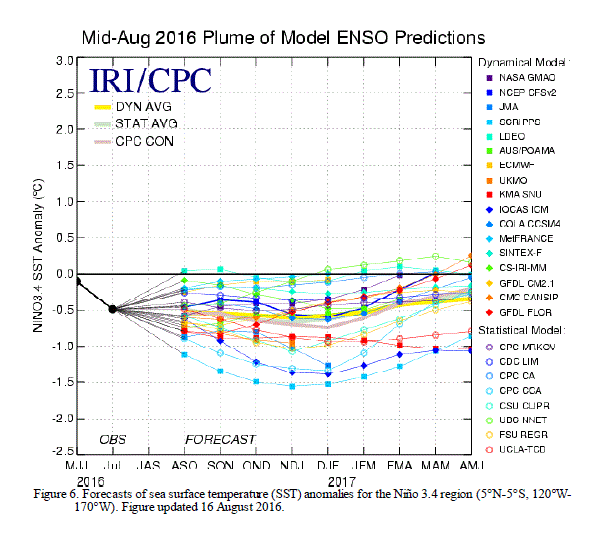
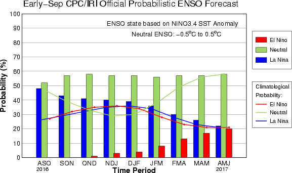
The multi-model averages favor borderline Neutral-La Ni?a conditions
(3-month average Ni?o-3.4 index less than or equal to -0.5?C) during
the Northern Hemisphere fall, continuing into winter (Fig. 6). However,
the more recently updated model runs from the North American Multi-Model
Ensemble (NMME) more strongly favor ENSO-Neutral (Fig. 7). The forecaster
consensus prefers this outcome, which is supported by the lack of
significant anomalies in several indicators over the past month (winds,
convection, subsurface temperatures). Overall, ENSO-Neutral conditions
are slightly favored (between 55-60%) during the upcoming Northern
Hemisphere fall and winter 2016-17.

Here are a couple of important reminders from Victor Murphy of the NWS Southern
Region Headquarters in Ft. Worth:
1) There is still a 40-45% chance of La Nina. However, this does not meet
the threshold for CPC to continue the La Nina Watch. There is a 55% to 60%
chance of ENSO neutral conditions. Certainly still a healthy chance for
La Nina, but less than the CPC threshold to keep the La Nina Watch intact.
There is a near zero chance of El Nino.
2) In general, the watch is being ended due to the fact that subsurface
temperatures are warming. Easterly trade winds are near average, and the
combined ocean and atmosphere system continues to reflect ENSO neutral.
HIP-HIP-HOORAY? Who knows. Perhaps the climate regime which will not be
influenced by La Nina this fall through winter will be replaced by something
worse. But given the 5-year drought we endured from late 2010 through spring
2015 that was initiated by a strong La Nina, I think we consider this a win
for now.
Gary McManus
State Climatologist
Oklahoma Mesonet
Oklahoma Climatological Survey
(405) 325-2253
gmcmanus@mesonet.org
September 8 in Mesonet History
| Record | Value | Station | Year |
|---|---|---|---|
| Maximum Temperature | 111°F | GRA2 | 2023 |
| Minimum Temperature | 34°F | KENT | 2020 |
| Maximum Rainfall | 5.37″ | WILB | 2001 |
Mesonet records begin in 1994.
Search by Date
If you're a bit off, don't worry, because just like horseshoes, “almost” counts on the Ticker website!