Ticker for August 25, 2016
MESONET TICKER ... MESONET TICKER ... MESONET TICKER ... MESONET TICKER ...
August 25, 2016 August 25, 2016 August 25, 2016 August 25, 2016
Drought spreads across Oklahoma
While it cooled off from "WOW IT'S HOT" to "Ugh, it's hot" levels over the last
week or two, that previous summer regime coupled with a lack of rainfall has led
to drying, drought development and finally drought intensification across parts of
Oklahoma. The new U.S. Drought Monitor map released this morning, using input from
drought indices, rainfall statistics (deficits, mostly) and advice from county-
level officials, has rendered a picture of desiccation from the northeast down
though south central Oklahoma, with a new area of droughty conditions developing
across central and north central Oklahoma.
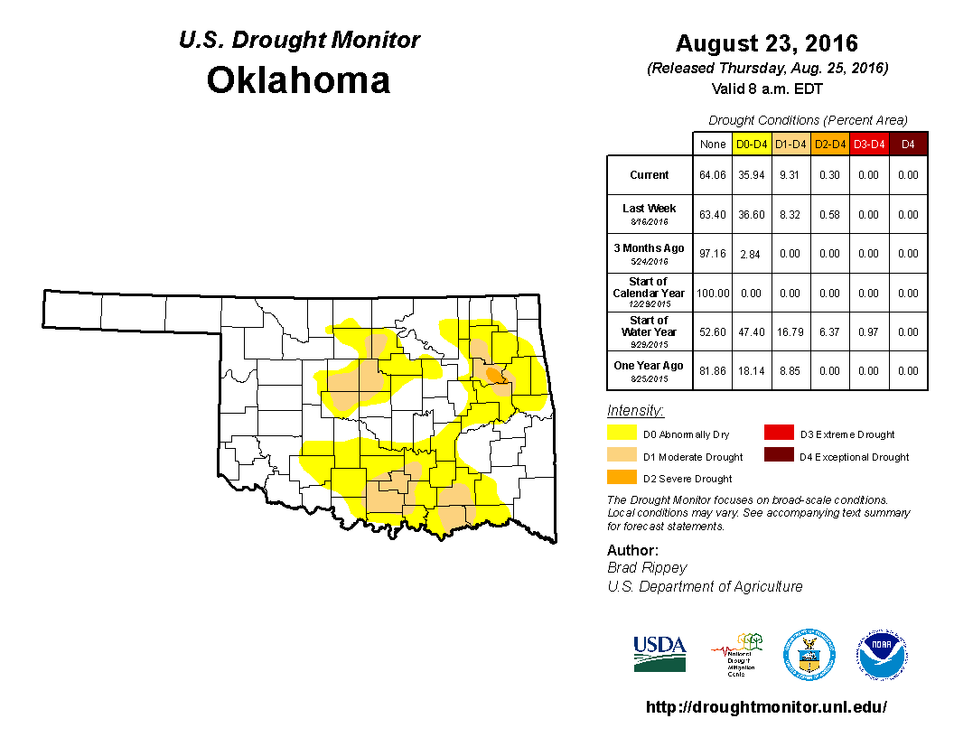
Furthermore, so on and so forth, 36% of the state is now in at least "abnormally
dry" conditions, up from 3% three months ago. The amount of D1-D2 increased just
a tad from 8% to 9%.
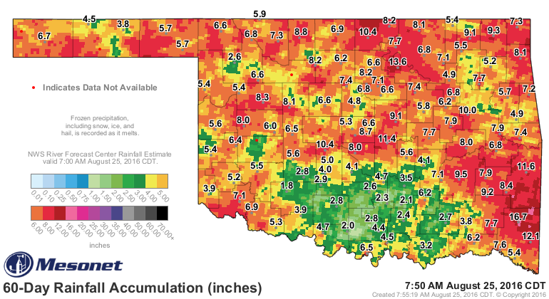
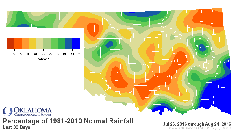
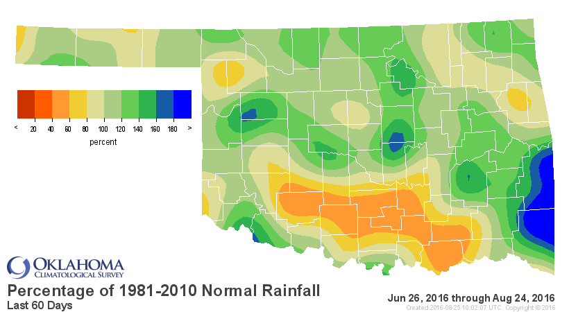
This dryness has been building since late April in some cases despite sporadic
periods of relief, and the trouble areas, especially across south central Oklahoma
show up in a sickly green and yellow on the 60-day Mesonet rainfall map. These
trouble areas show up a bit better on the Mesonet's percent of normal maps from
30 and 60 days.
Now all of this is "sorta" where we should be as summer wanes, with vegetation
a little brown, pond and reservoir levels down a few feet here and there,
soil moisture a bit sparse:
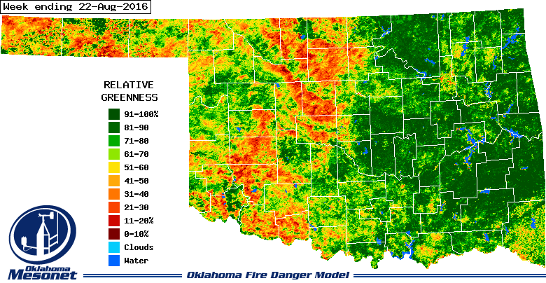
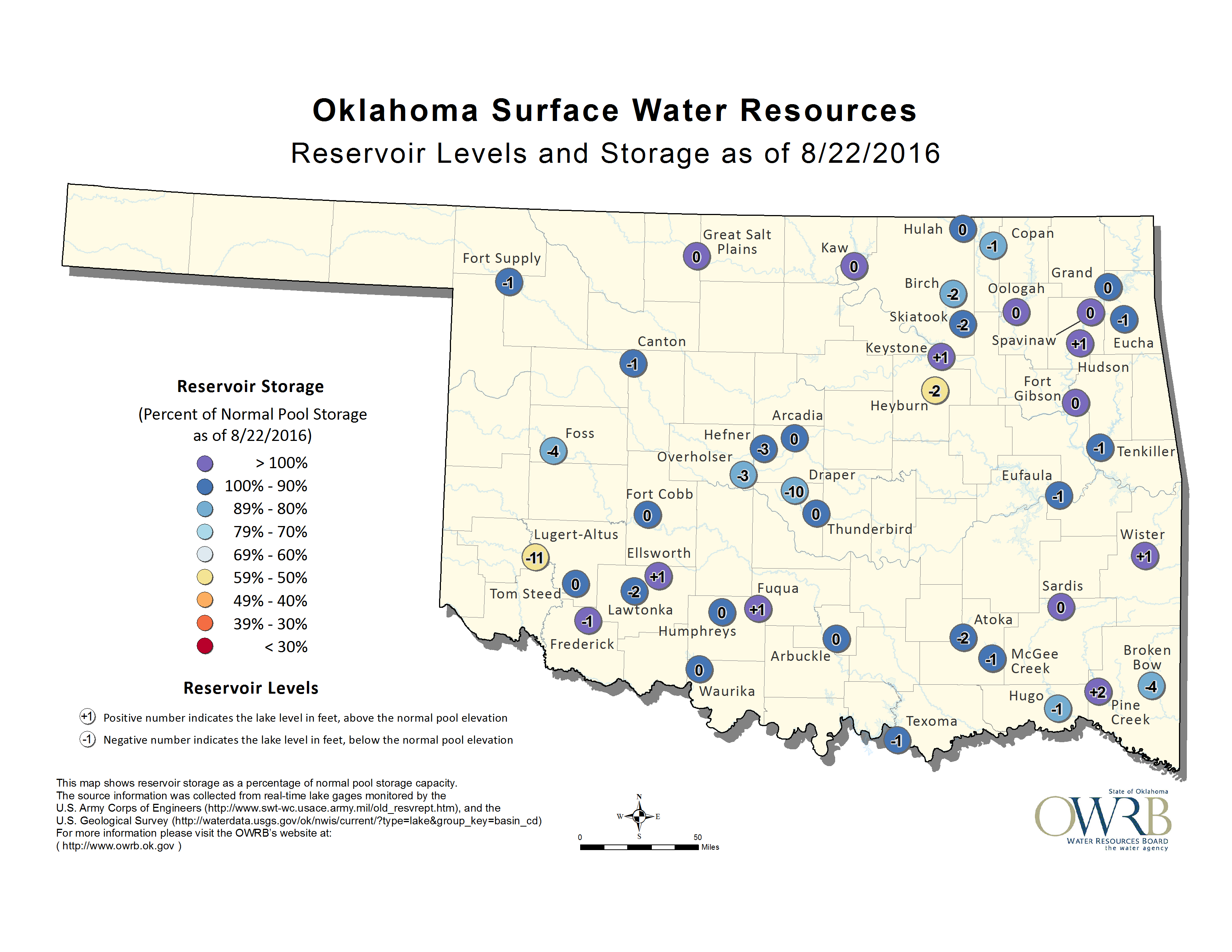
http://www.mesonet.org/index.php/weather/category/soil_moisture
Unfortunately, the places needing the rain the most just don't seem to be
getting it, and with our erstwhile front stalled across NW Oklahoma, those lucky
folks will continue to get the bulk of the rain (and unfortunately most of the
severe weather threat) over the next several days, at least until that front
can shift to the southeast.
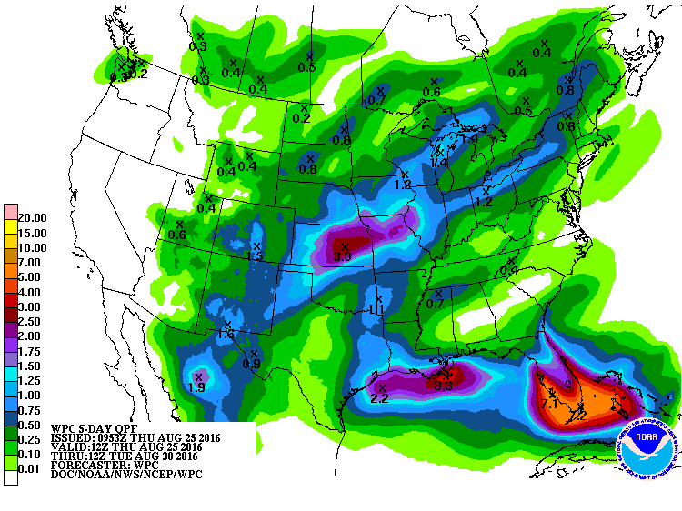
After this week, back out of the frying pan and into the fire?
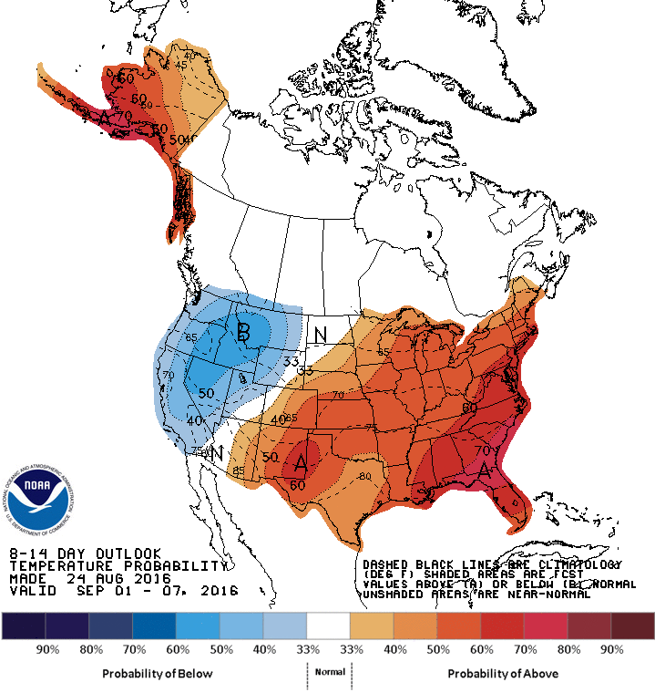
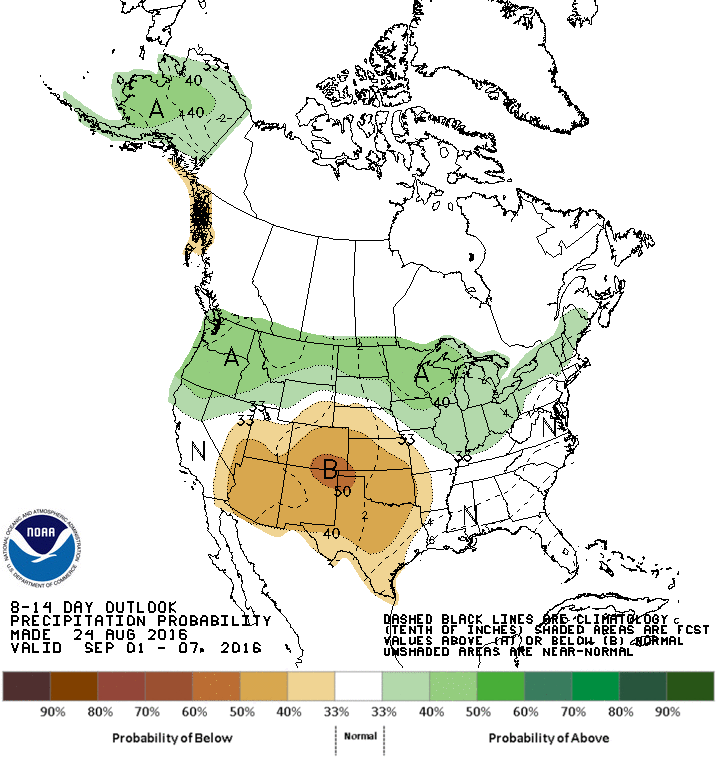
Ugh or UGH? Quite a choice, eh?
Gary McManus
State Climatologist
Oklahoma Mesonet
Oklahoma Climatological Survey
(405) 325-2253
gmcmanus@mesonet.org
August 25 in Mesonet History
| Record | Value | Station | Year |
|---|---|---|---|
| Maximum Temperature | 109°F | FREE | 2024 |
| Minimum Temperature | 46°F | BEAV | 2010 |
| Maximum Rainfall | 4.69″ | MEDI | 2017 |
Mesonet records begin in 1994.
Search by Date
If you're a bit off, don't worry, because just like horseshoes, “almost” counts on the Ticker website!