Ticker for August 29, 2016
MESONET TICKER ... MESONET TICKER ... MESONET TICKER ... MESONET TICKER ...
August 29, 2016 August 29, 2016 August 29, 2016 August 29, 2016
These pretzels are making me thirsty!
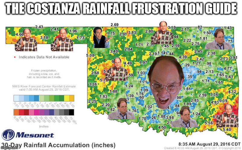
You can say a lot of things about this August...
Okay, you done? Can I write again? Okay, you can say a lot of things about his
August...blazing hot, very wet or dry depending on where you were at, refreshingly
mild for awhile there. And who better to determine the proper attitude about such
a neurotic month than Mr. Neurotic himself, George Costanza. Now some may wonder
why we have two angry looking Georges and only one happy George.
Because Costanza, that's why.
Now here's the crazy 30-day rainfall map that encompasses all of August thus far
without George being in the way.
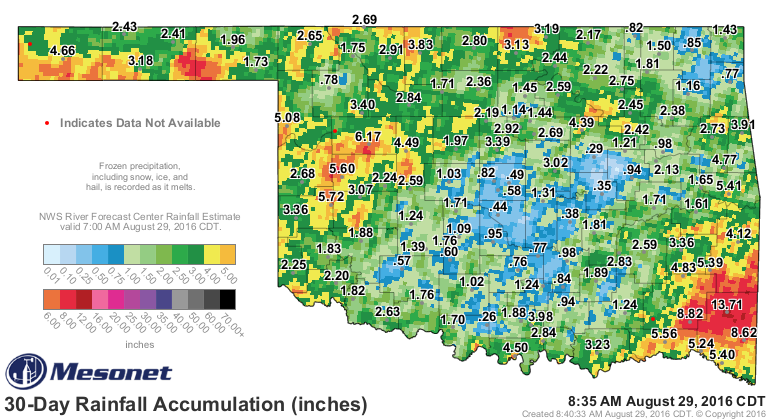
Everybody has gotten SOME rainfall over the month, with huge totals down across
the far SE, completely squelching that flash drought situation that cropped up
this summer. To the north and west of there, however, as well as up in the NE,
you can see some holes in the plan. Especially across central down through south
central Oklahoma, where it becomes even more evident on the 60-day rainfall map.
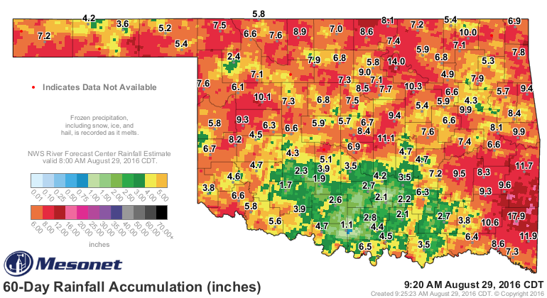
And remember, this was through parts of August that saw high temperatures
consistently in the 100s for the first couple of weeks before a about a week
of pre-fall, then right back to summer after that. So lots of evaporation and
a beat down of vegetation.
What can we expect now? Well, more of what we've seen over the last few days.
We will see seasonable to below-seasonable temps, lots of humidity, and areas of
showers and storms popping up as various weak storm systems and frontal
boundaries mess with us.
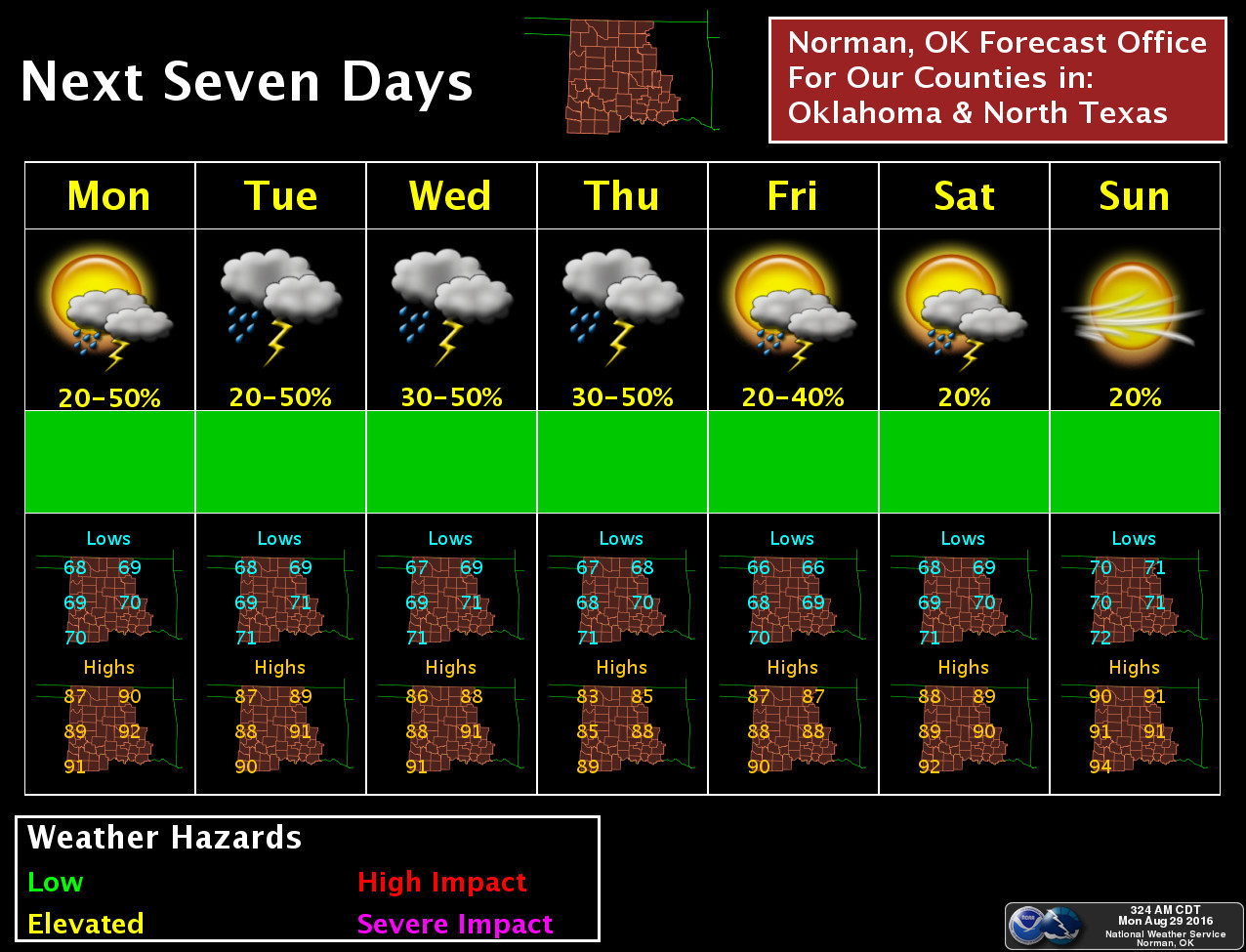

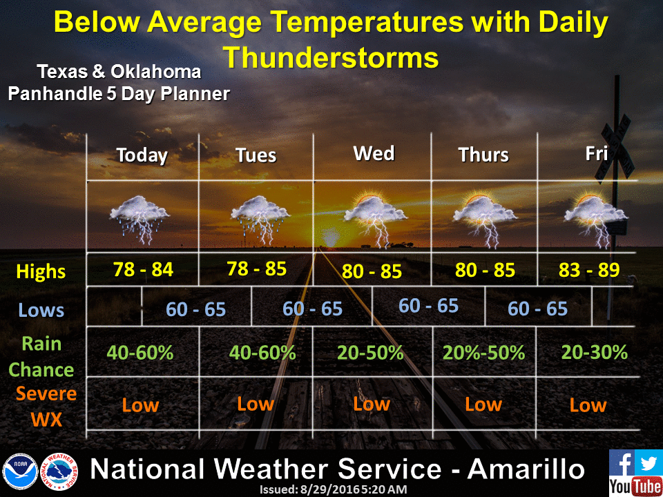
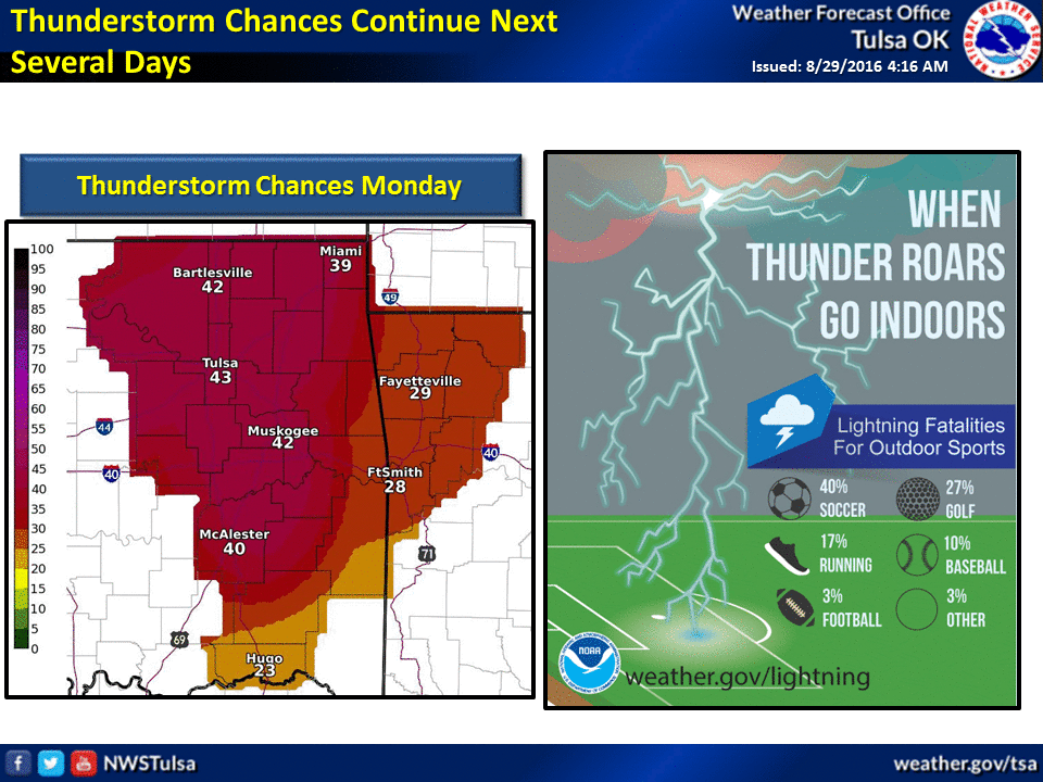
Not bad for a late August, but parts of the state REALLY need a good rain. NW
Oklahoma looks to be the big winner this week, however.

Oh, why does Buffalo get a Seinfeld?
Because Buffalo, that's why.
Gary McManus
State Climatologist
Oklahoma Mesonet
Oklahoma Climatological Survey
(405) 325-2253
gmcmanus@mesonet.org
August 29 in Mesonet History
| Record | Value | Station | Year |
|---|---|---|---|
| Maximum Temperature | 109°F | WAUR | 2011 |
| Minimum Temperature | 48°F | EVAX | 2017 |
| Maximum Rainfall | 5.06 inches | VINI | 2003 |
Mesonet records begin in 1994.
Search by Date
If you're a bit off, don't worry, because just like horseshoes, “almost” counts on the Ticker website!