Ticker for August 23, 2016
MESONET TICKER ... MESONET TICKER ... MESONET TICKER ... MESONET TICKER ...
August 23, 2016 August 23, 2016 August 23, 2016 August 23, 2016
Severe weather on the rise?
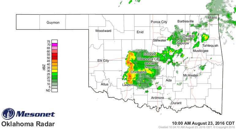
But we'll take some rain, right? There is a smallish complex of showers and storms
moving quickly through the I44 corridor right now, not amounting to much.
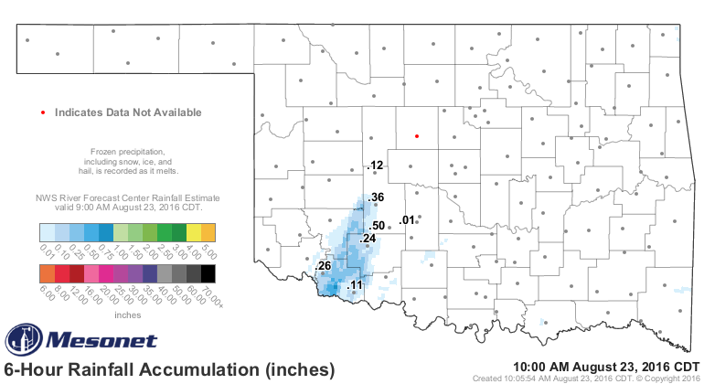
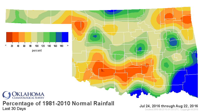
Rainfall amounts are underwhelming, but they ain't nothing. Some folks could see
a half-inch to over an inch if they're lucky.
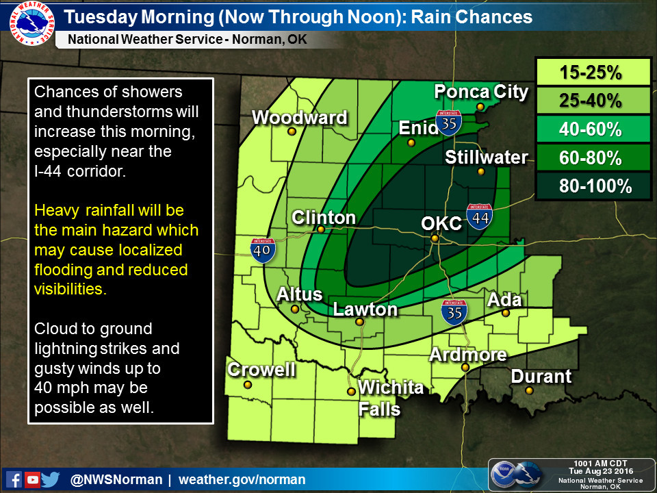
And this is reflected in the rain chances today with that I44 corridor being the
main focus through noon.
The real action, including the possibility of severe weather across the NW third
of the state, comes with a cold front later tonight and tomorrow that's expected
to stall out somewhere between Idabel and Kenton (hey, I like to leave my options
open). So the focus for that severe weather and rain will probably be somewhere
in the NW, but that could change depending on how much push the front gets. The
Amarillo NWS office gives a good explanation with their graphics.
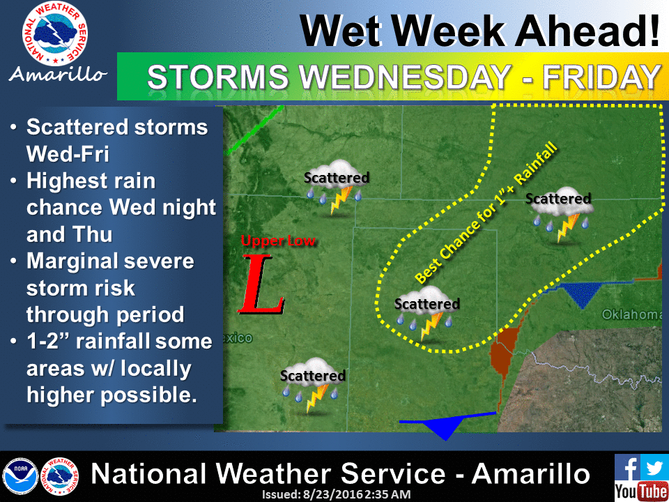
"A cold front will move through the region Wednesday Night before
stalling just south of the area. This combined with a slow moving
upper level storm system in New Mexico will lead to potential for
scattered storms from Wednesday through Friday. Highest rain chances
will occur with the initial frontal passage Wednesday night and
Thursday when storms may become numerous for a period of time.
Strong storms are possible and there is a marginal risk for severe
storms Wednesday & Thursday. Some areas may also experience heavy
rainfall with 1-2" rainfall totals and locally higher amounts possible."
The Norman and Tulsa offices have additional info available.
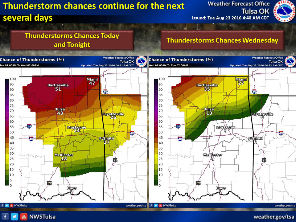

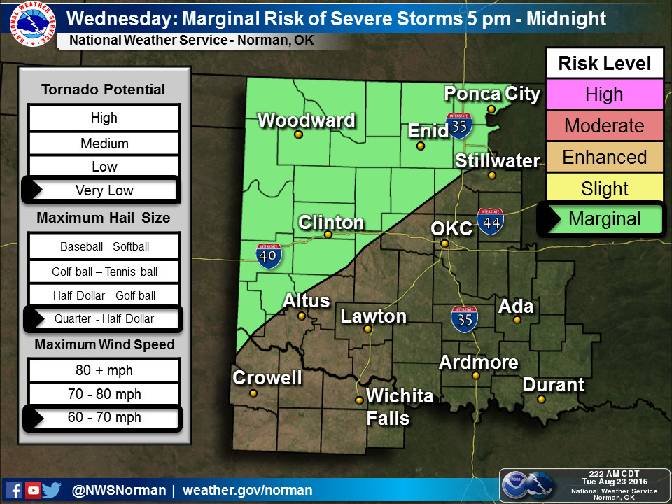
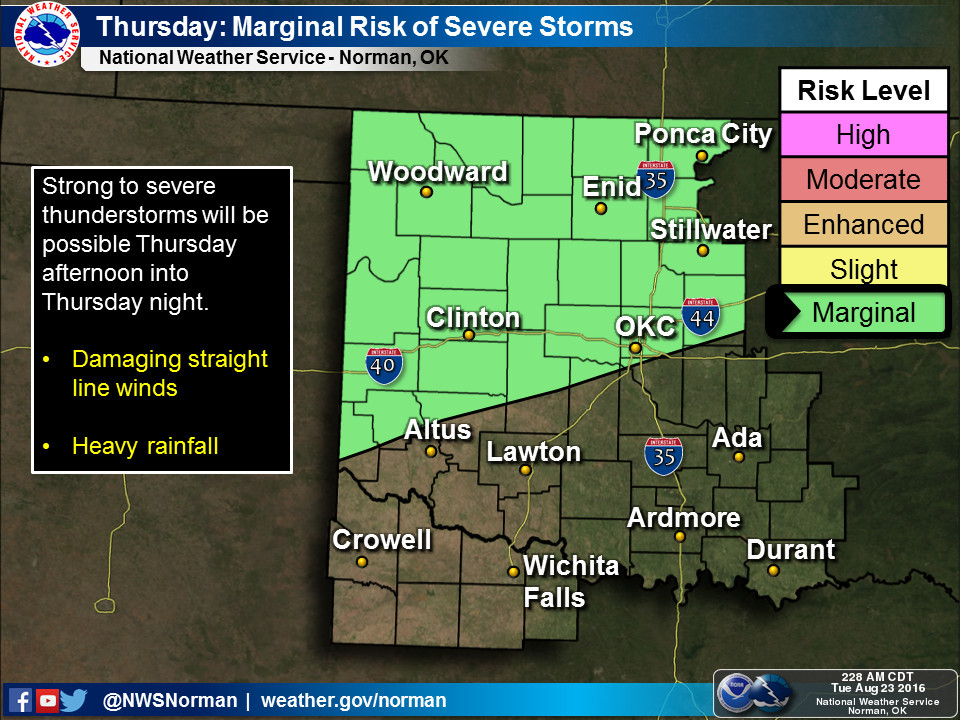
This isn't a classic severe weather setup we're talking about here...some severe
winds and damaging hail possible. However, it is Oklahoma and if there is
severe weather, you should be weather aware and ready for just about anything.
I see a dearth of 80s coming up, with seasonable low 90s more likely as well
as lots of humidity at times...like RIGHT NOW.

Dewpoints up to the mid-70s are pretty stout anytime of the year, and that's
what is fueling this chance of storms with today's storm system and then the
front that is approaching. Lots of moisture to work with, so heavy downpours
will probably occur at times. Either pray you're under one if you're dry, or
not if you've had enough rain lately. However, I'm betting the former is probably
true for most of you.
Gary McManus
State Climatologist
Oklahoma Mesonet
Oklahoma Climatological Survey
(405) 325-2253
gmcmanus@mesonet.org
August 23 in Mesonet History
| Record | Value | Station | Year |
|---|---|---|---|
| Maximum Temperature | 113°F | ALTU | 2024 |
| Minimum Temperature | 52°F | NOWA | 2009 |
| Maximum Rainfall | 5.40 inches | BEAV | 2019 |
Mesonet records begin in 1994.
Search by Date
If you're a bit off, don't worry, because just like horseshoes, “almost” counts on the Ticker website!