Ticker for August 22, 2016
MESONET TICKER ... MESONET TICKER ... MESONET TICKER ... MESONET TICKER ...
August 22, 2016 August 22, 2016 August 22, 2016 August 22, 2016
Egg on our forecast
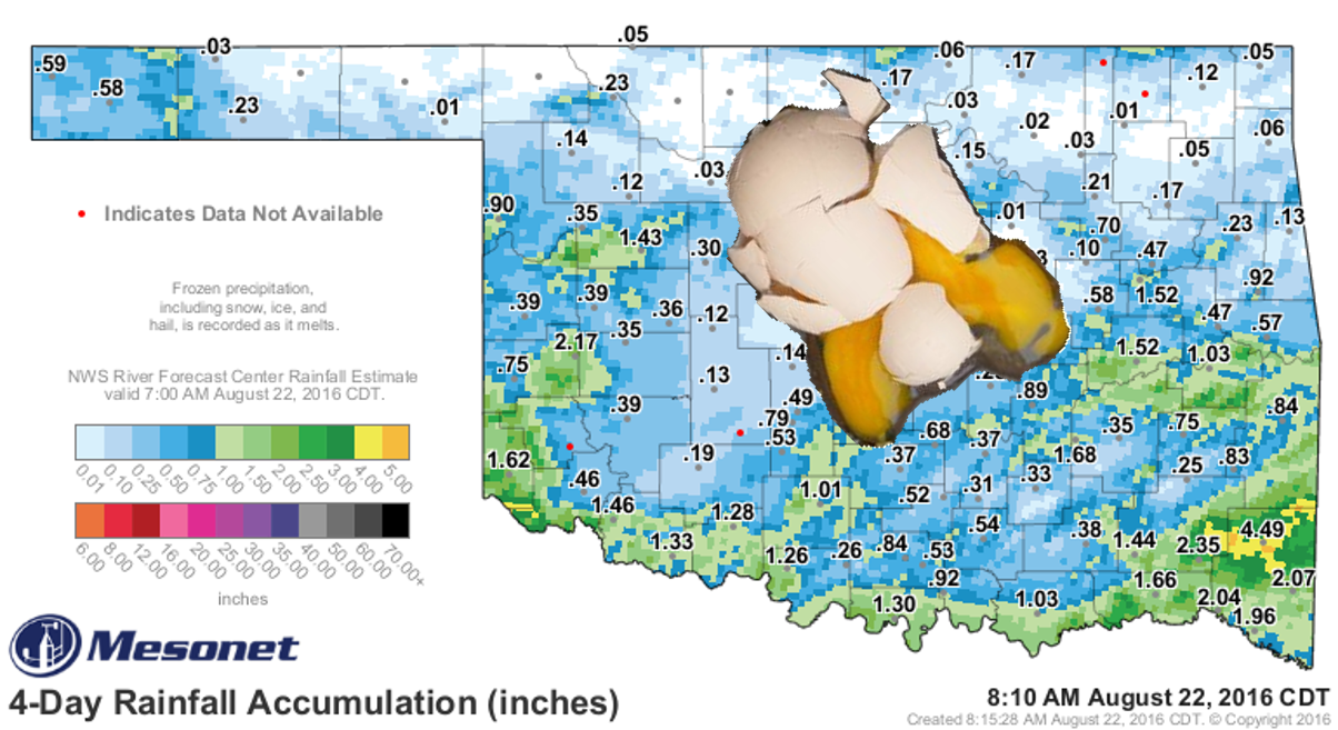
Okay, so this didn't eggsactly (HA! YOU SEE WHAT I DID THERE! EGGCELLENT!) work
out as we had hoped.
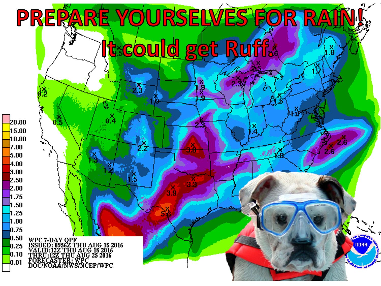
And neither did this.
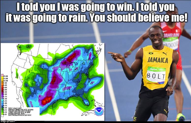
But hey, those WERE 7-day rain forecasts, so in the 4-5 days since those were
posted, we did get rain, just not everywhere (as in "most of the state"). Here's
the rainfall map, without the splattered egg.
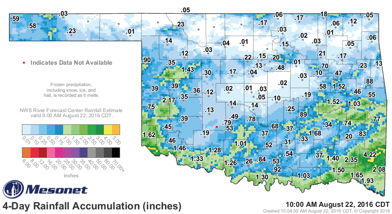
Really good rains fell down along the Red River and up into the periphery of
both the eastern and western borders...other than that, localized rains here and
there and a whole lot of light blues to whites. However, our chances aren't over
yet! Another upper-level storm should come through tonight that will up those
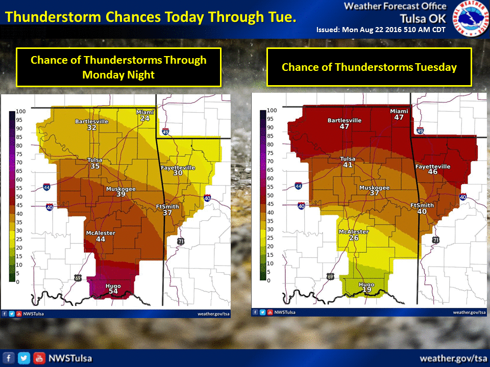
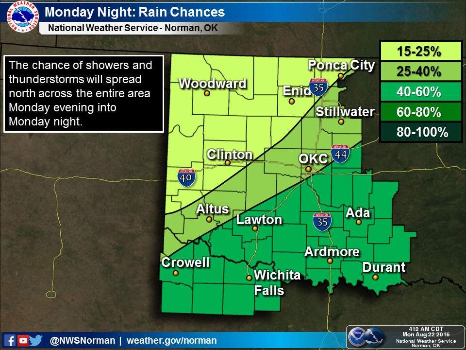
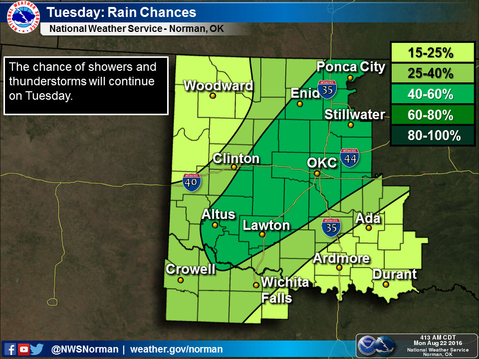
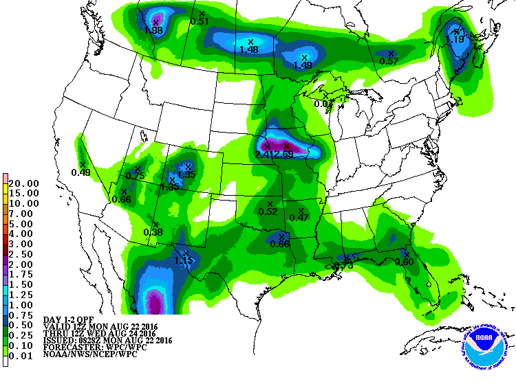
odds for rain once again. Here are the forecast amounts for tonight and tomorrow,
and then a few graphics from the NWS offices helped to explain where and when.
And THEN we will have another chance as we see an additional cool front sometime
around Wednesday or so, as evidenced by the NWS Amarillo and Norman long-range
planners.
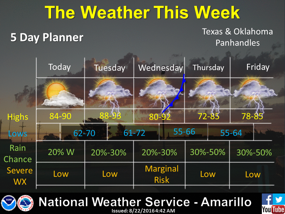
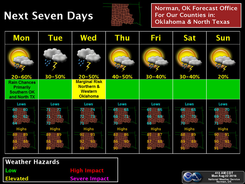
So we're not necessarily done with the rain just yet, although I can't get Usain
Bolt or that weird dog with the goggles to give us any guarantees again. But hey,
ain't these temperatures a peach?
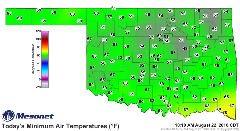

Gary McManus
State Climatologist
Oklahoma Mesonet
Oklahoma Climatological Survey
(405) 325-2253
gmcmanus@mesonet.org
August 22 in Mesonet History
| Record | Value | Station | Year |
|---|---|---|---|
| Maximum Temperature | 108°F | GRA2 | 2023 |
| Minimum Temperature | 48°F | BRIS | 2016 |
| Maximum Rainfall | 4.25 inches | MRSH | 2005 |
Mesonet records begin in 1994.
Search by Date
If you're a bit off, don't worry, because just like horseshoes, “almost” counts on the Ticker website!