Ticker for August 18, 2016
MESONET TICKER ... MESONET TICKER ... MESONET TICKER ... MESONET TICKER ...
August 18, 2016 August 18, 2016 August 18, 2016 August 18, 2016
Ch-ch-ch-ch-changes
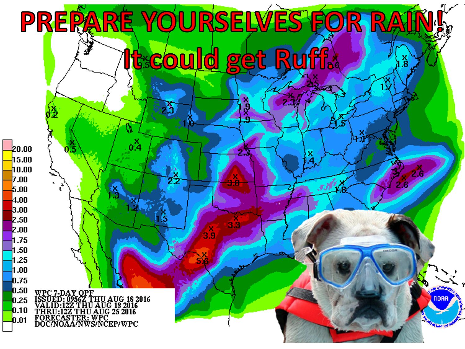
Turn and face the...NO! No more music lyrics for awhile (for the record, I could
have gone with Tupac OR Bowie). Heavy rain will be possible BUT NOT GUARANTEED
(remember last weekend?) with a strong front that will pass through the state
this weekend. We're still seeing warm-to-hot weather in the state, depending on
how much rain and/or clouds you had, like yesterday.
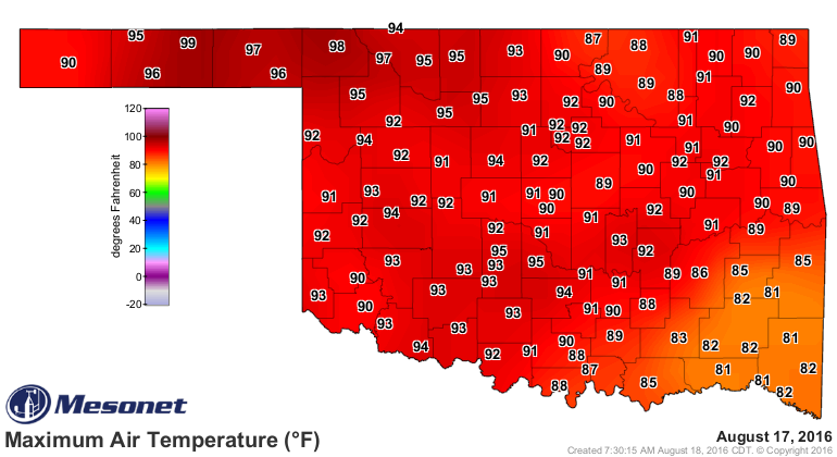
Heck, it darned near reached triple-digits in the Panhandle, with 80s in the SE
as they had a spot of rain.

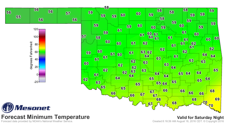
But we did see the Panhandle temps fall into the 50s overnight. Now we may not
need to break out the winter gear as Doggie Dolittle did on that graphic, and it
has dropped into the 50s over the last several days in the dry air of the
Panhandle, but we should be closer to lows in the 50s in a couple of days over
more of the state than 70s in a couple of days.
Here are the forecast lows for Sunday, for instance.
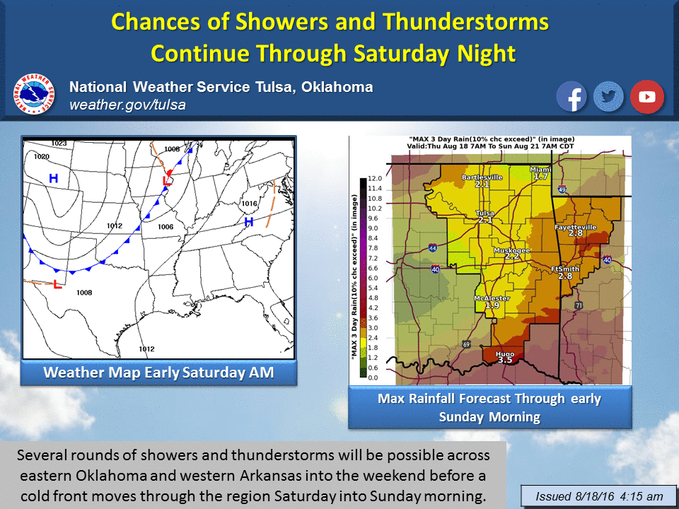
The NWS forecast in Tulsa has a graphic summarizing what's going to happen
over the next few days as we see an approaching front for the weekend and
multiple shots of rain through that period.
And we do need the rain as more and more of the state starts to get a bit
crispy. We've seen the 39th driest July 19-Aug. 17 on record since at least
1921 over the last 30 days, with that dropping to as low as the 16th driest for
southwest Oklahoma.
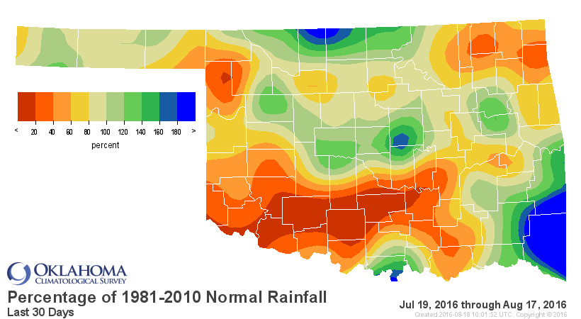
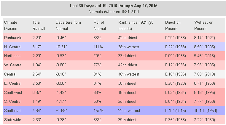
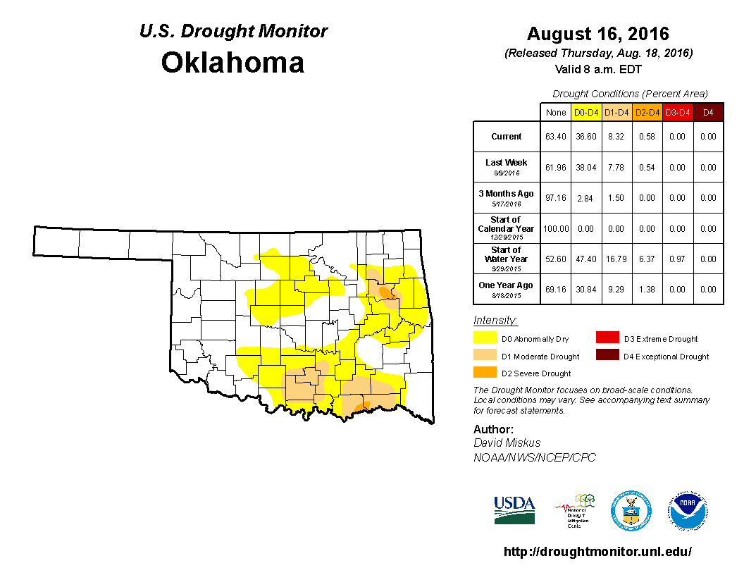
That has led to more drought intensification across parts of Oklahoma.
The possibility for rain and storms will extend into next week, but that front
and associated storms probably represents our best chance for a bit of drought
relief. And the cooler weather won't hurt either. Less evaporation, less misery,
etc.
Gary McManus
State Climatologist
Oklahoma Mesonet
Oklahoma Climatological Survey
(405) 325-2253
gmcmanus@mesonet.org
August 18 in Mesonet History
| Record | Value | Station | Year |
|---|---|---|---|
| Maximum Temperature | 112°F | GRA2 | 2023 |
| Minimum Temperature | 53°F | EVAX | 2016 |
| Maximum Rainfall | 9.00 inches | FTCB | 2007 |
Mesonet records begin in 1994.
Search by Date
If you're a bit off, don't worry, because just like horseshoes, “almost” counts on the Ticker website!