Ticker for August 1, 2016
MESONET TICKER ... MESONET TICKER ... MESONET TICKER ... MESONET TICKER ...
August 1, 2016 August 1, 2016 August 1, 2016 August 1, 2016
Summer Sizzles During July
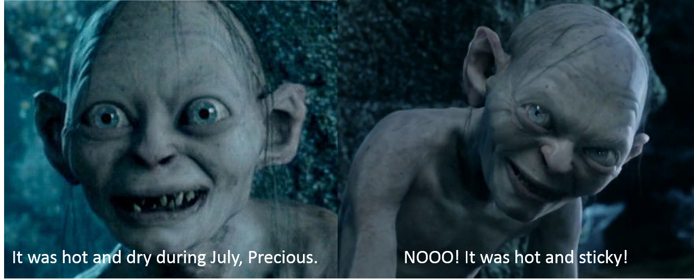
Depending on where you were, July was either hot and rainy, or it was hot and
dry. Key word there, "or." Ha! You thought I was going to say "hot," didn't ya?
Well, not much is going to change this week..."or"...I mean "hot" will remain
the common denominator, which very little chance of "rainy."
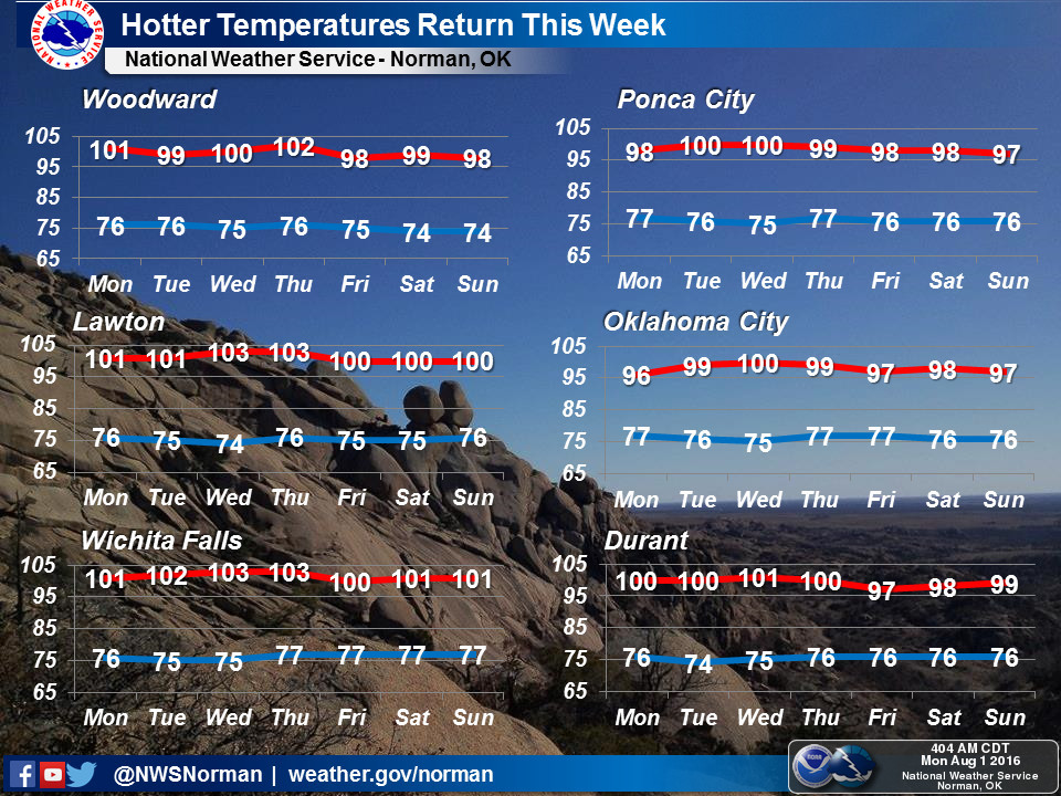
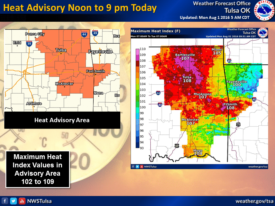
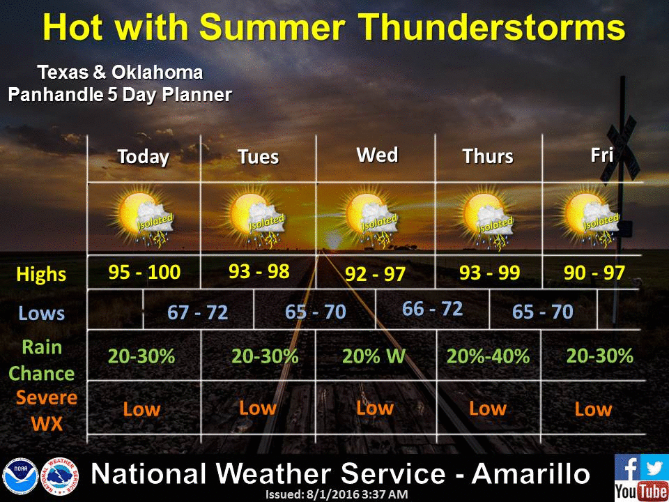
Now grab your cup of ice and whatever beverage you prefer to partake and take a
look back at July and a look forward to August.
--------------------------------------------------------------------------------
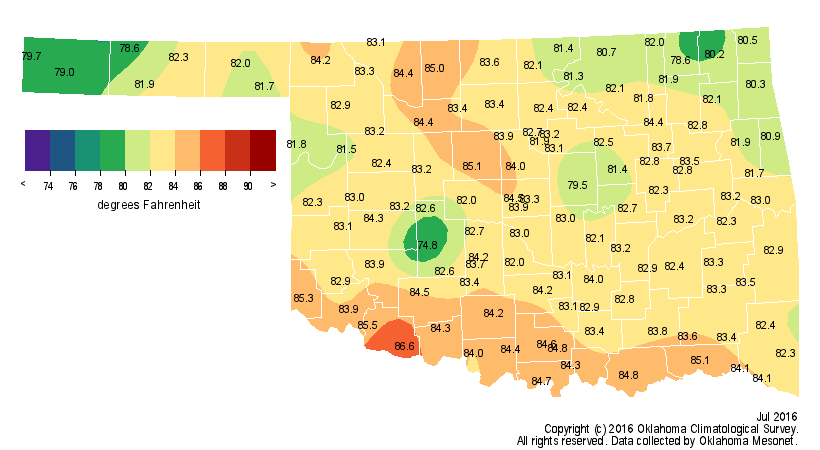
The state?s sizzling summer continued unabated through July, at least for most
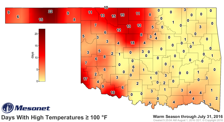
Oklahomans. The Oklahoma Mesonet recorded at least one triple-digit temperature
in the state on 25 of the month?s 31 days. Goodwell and Hooker led all Mesonet
sites with highs of 108 degrees on the 11th. Those temperature extremes were
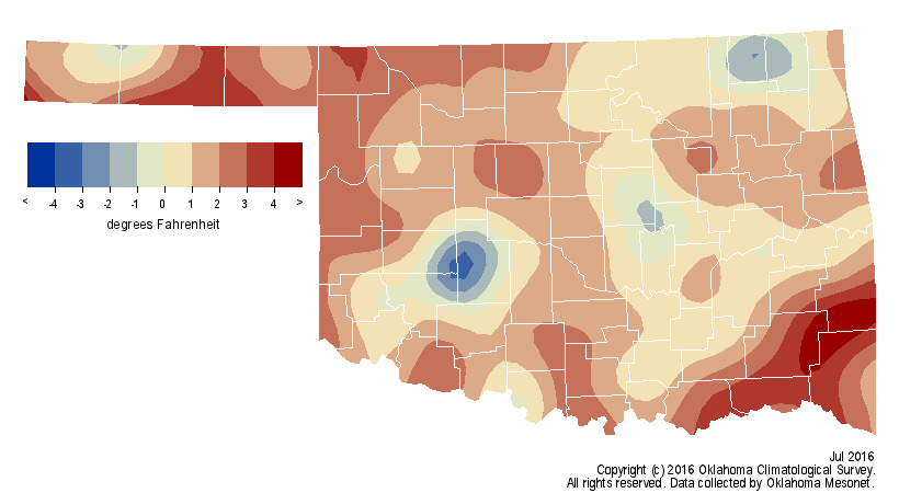
reflected in the statewide average for the month. According to preliminary data
from the Oklahoma Mesonet, the statewide average temperature was 82.8 degrees, 1.3
degrees above normal to rank as the 43rd warmest July since records began in 1895.
That does not paint the complete picture of the miserably hot weather, however.
Those temperatures combined with the stifling humidity to boost heat index
values well into the dangerous category throughout the month. The Mesonet?s 121
stations recorded 984 instances of daily maximum heat indexes of at least 105
degrees, and 89 times at or above 110 degrees. Kingfisher took the top spot in
that category at 116 degrees. The climatological summer season, which runs
from June 1 through August 31, stands 2 degrees above normal to rank as the
24th warmest June-July on record. Hooker topped the seasonal triple-digit count
with 22 days at or above 100 degrees.
The January-July statewide average of 61.5 degrees was 2 degrees above normal
as well, the ninth warmest such period on record.
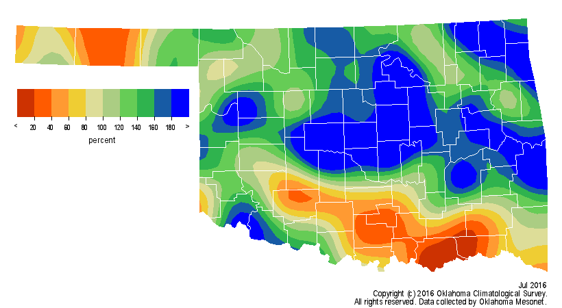
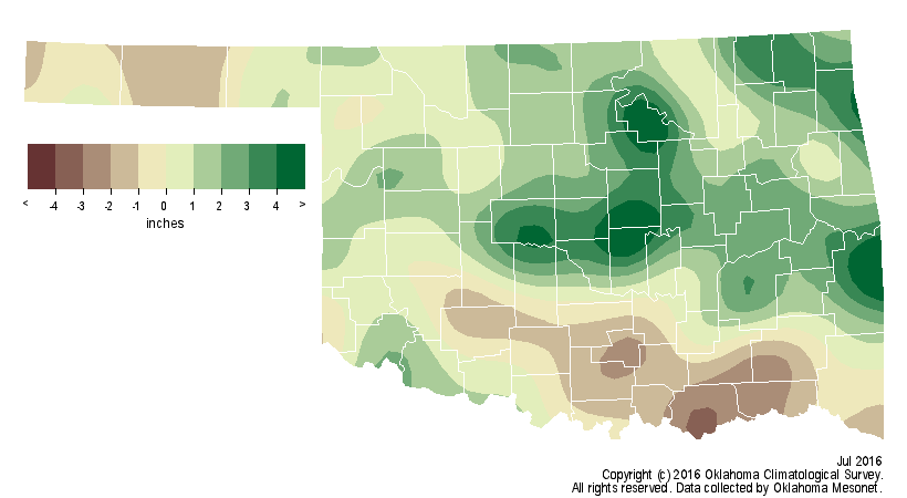
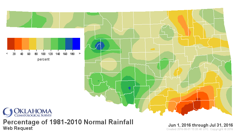
Intermittent episodes of very heavy rainfall kept much of the northern half of
the state well above normal while far southern Oklahoma was not quite as
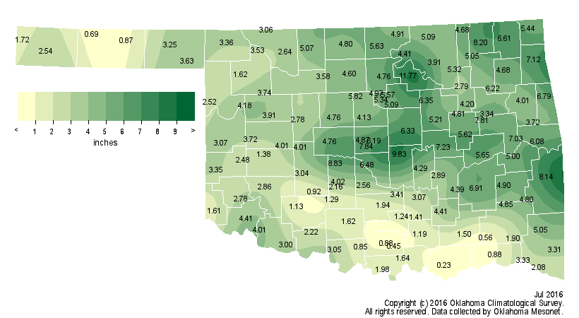
fortunate. Thirty-four Mesonet sites recorded at least 5 inches of rain during
July with Pawnee leading the state at 11.77 inches. Most of central though east
central Oklahoma had generous totals of 6-9 inches. That was not the case for
southeastern Oklahoma, however. Several stations in that region failed to
register an inch of rain for the month with Durant recording the lowest total
at 0.23 inches. The statewide average of 3.84 inches was nearly an inch above
normal to rank as the 32nd wettest July on record.
Thanks to a dry June, the first two months of summer remained on the dry side
at nearly a half-inch below normal, although west central and southwestern
Oklahoma had a soggier start with their 37th- and 28th-wettest June-July
periods, respectively.
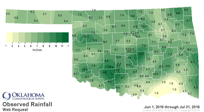
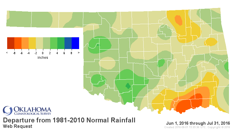
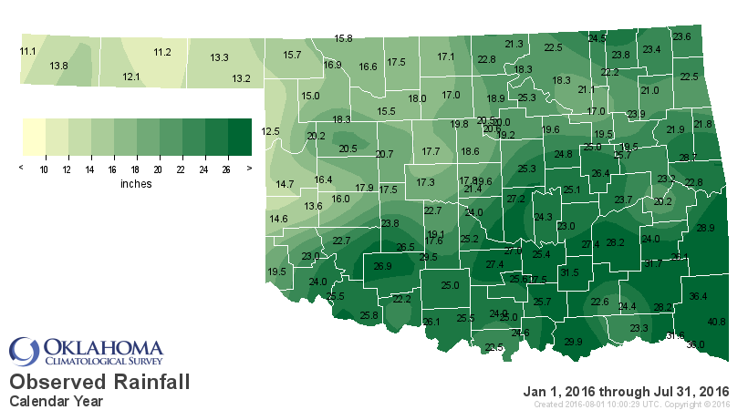
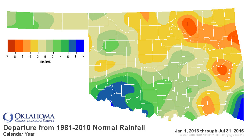
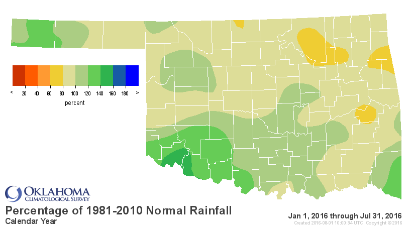
The first seven months of the year combined for a statewide average of 20.97
inches, about an inch below normal.
The heavy rains from central through northeastern Oklahoma put a halt to the
spread of flash drought in those regions, counteracting dry weather that began
back in late April. Unfortunately, the aforementioned lack of rain across
southern Oklahoma led to flash drought erupting in that region by month?s end.
The July 5 U.S. Drought Monitor report had four percent of the state in
moderate drought and an additional 15 percent in ?abnormally dry? conditions ?
a drought precursor.
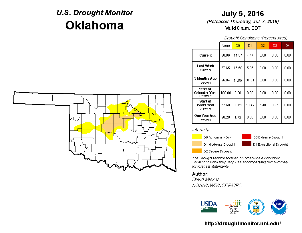
The final Drought Monitor of the month had over nine percent of the state in
moderate drought, mostly across southeastern Oklahoma, and 29 percent was
considered abnormally dry. A small section of Bryan and Choctaw counties had
intensified to severe drought.

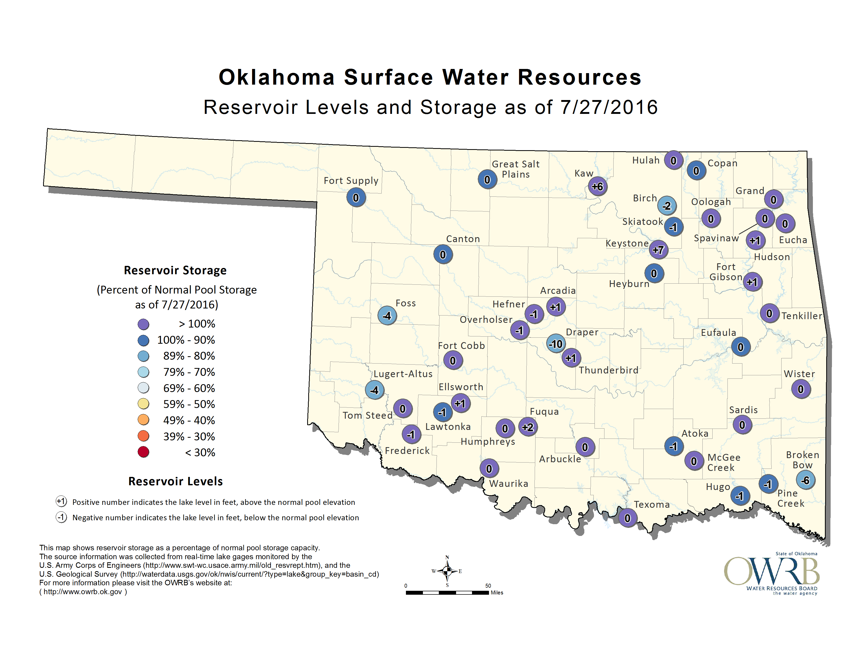
The Drought Monitor?s intensity scale slides from moderate-severe-extreme-
exceptional, with exceptional being the worst classification. Several state
lakes had begun to show signs of drought stress according to the Oklahoma Water
Resources Board. Broken Bow Lake in McCurtain County fell 6 feet below normal
as of July 27 and Lake Stanley Draper in central Oklahoma was 10 feet down at
that time. Lugert-Altus, Foss, Atoka and Skiatook were some of the other major
reservoirs that had dipped below normal.
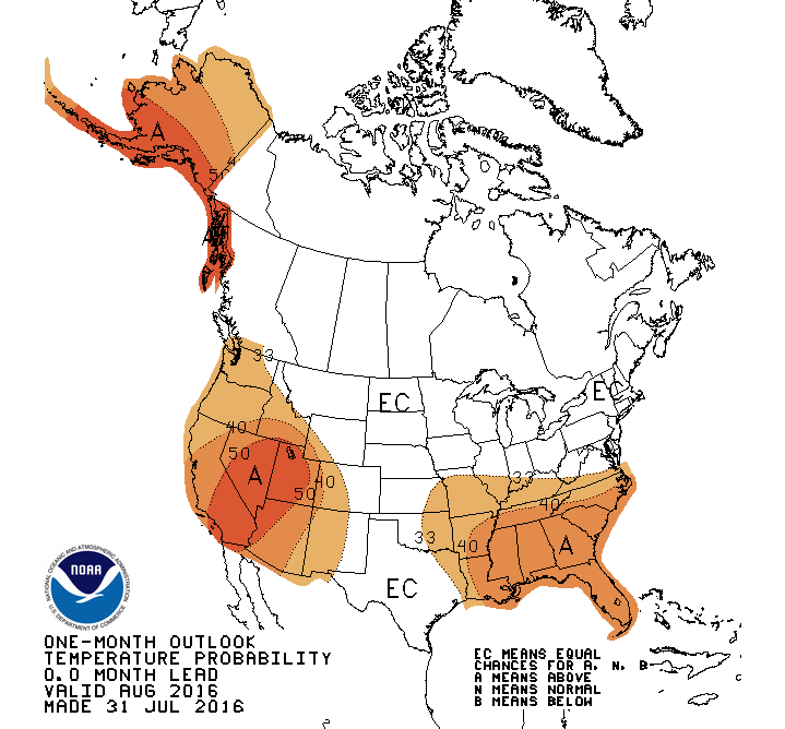
The Climate Prediction Center?s (CPC) August outlooks called for increased odds
of above normal temperature across the eastern half of the state and below
normal precipitation across the far southeast.

The seasonal outlooks see increased odds for above normal temperatures across
the entire United States through early fall and the southern half through
winter and next spring. Below normal precipitation over the country?s southern
tier, including Oklahoma, is indicated from late this fall through next spring.
http://www.cpc.ncep.noaa.gov/products/predictions/long_range/
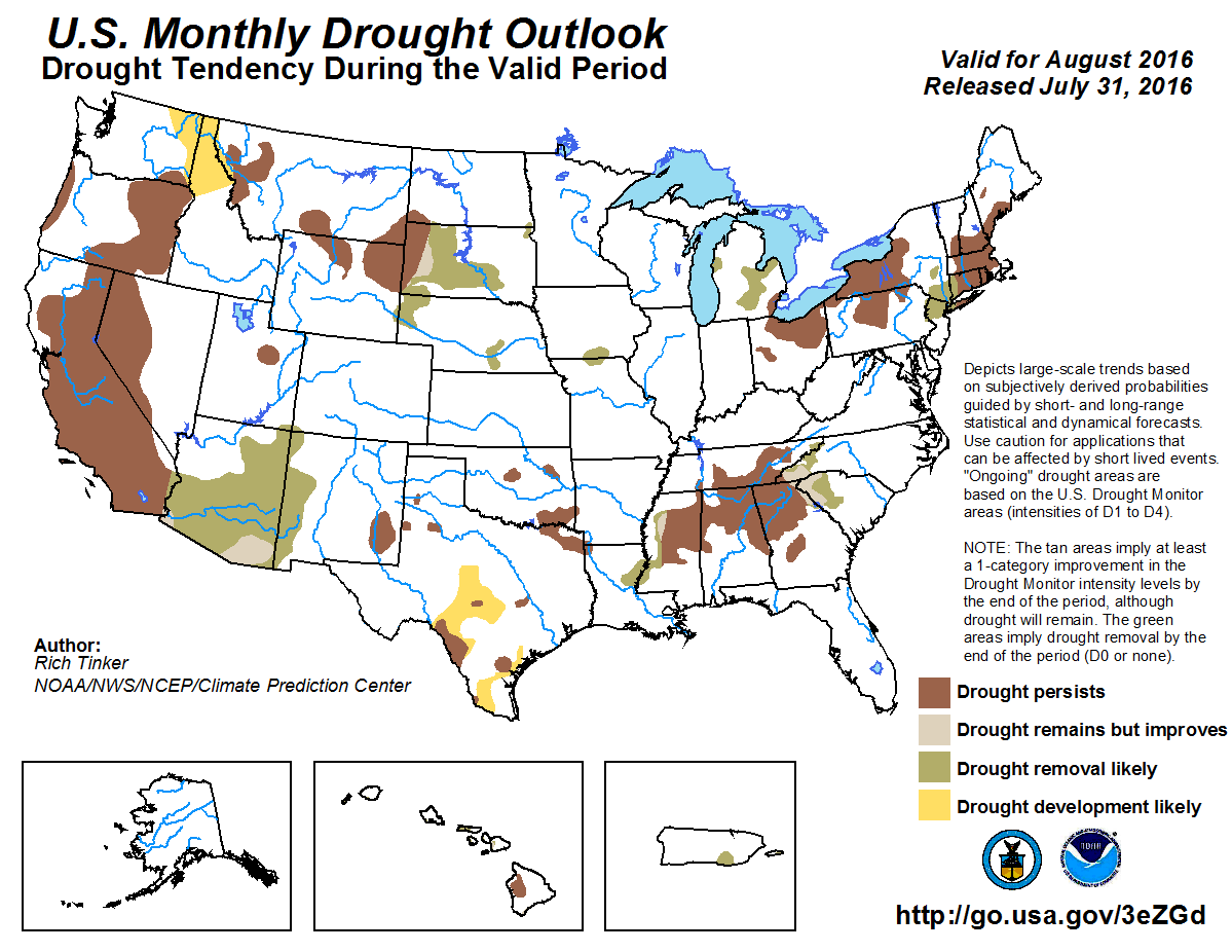
CPC?s Monthly Drought Outlook expects drought to persist across Oklahoma
through August, although no new drought was projected to develop.
Gary McManus
State Climatologist
Oklahoma Mesonet
Oklahoma Climatological Survey
(405) 325-2253
gmcmanus@mesonet.org
August 1 in Mesonet History
| Record | Value | Station | Year |
|---|---|---|---|
| Maximum Temperature | 115°F | KIN2 | 2012 |
| Minimum Temperature | 53°F | KENT | 2018 |
| Maximum Rainfall | 5.04 inches | NOWA | 1995 |
Mesonet records begin in 1994.
Search by Date
If you're a bit off, don't worry, because just like horseshoes, “almost” counts on the Ticker website!