Ticker for July 28, 2016
MESONET TICKER ... MESONET TICKER ... MESONET TICKER ... MESONET TICKER ...
July 28, 2016 July 28, 2016 July 28, 2016 July 28, 2016
Invader from the North
Yes, I like that movie so much I'm doubling down on this meme. And why not, pray
tell? Just like back in the spring, we have another "classic" severe weather
setup tonight, this time summer style. And that consists of storms forming in the
High Plains of CO, NE and KS and plummeting south towards Oklahoma, bringing with
it severe winds, hail and heavy rain. Here's the take from the Storm Prediction
Center.


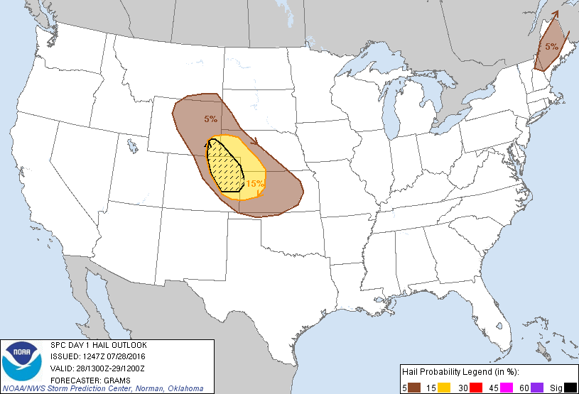
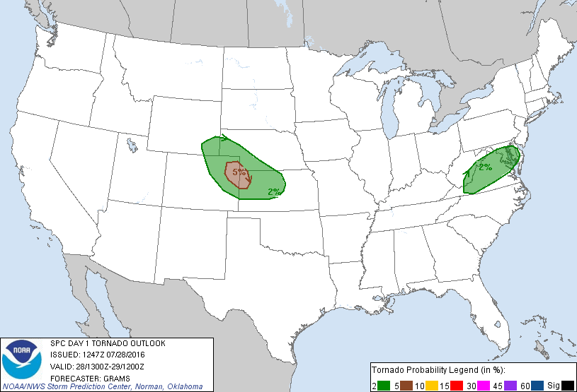
You can see there the greatest danger is again in the High Plains as those storms
form initially into supercells before morphing into a more organized blob of
ill intentions, plunging to the south towards Oklahoma. At that point, a large-
scale severe wind event will be the biggest concern for mostly western Oklahoma
(but it is EARLY in the day and that focus could change as we go through the
day).
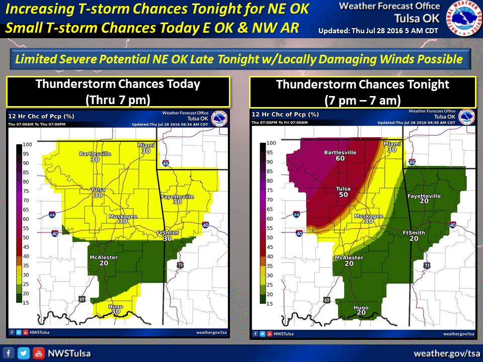
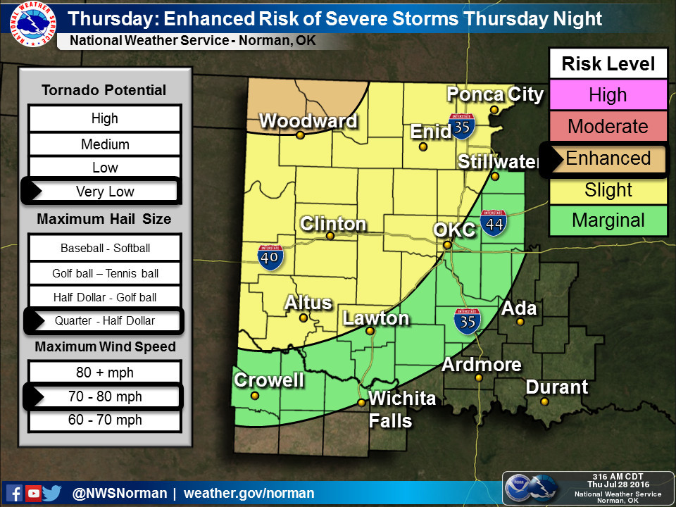
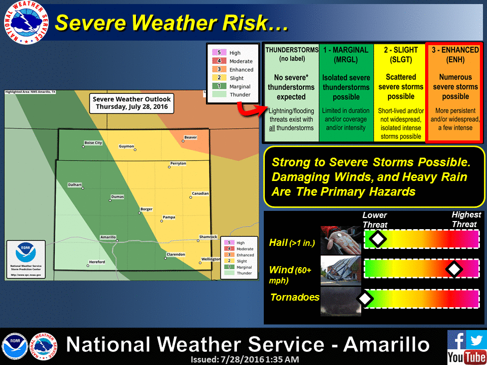
Here are the takes by the local NWS offices.

And here are the expected rainfall totals from the action tonight.
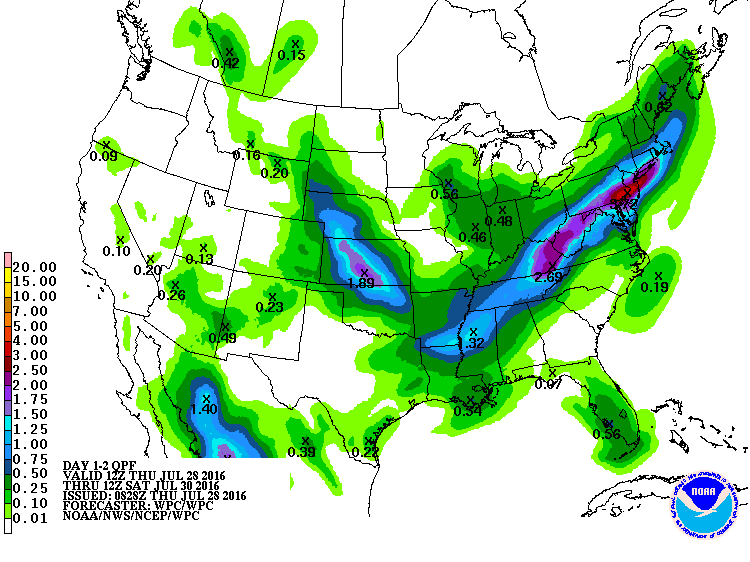
Unfortunately (but fortunately for the western half of Oklahoma), those totals
don't appear to be highest where they're needed the most, and that's southeastern
Oklahoma. Sure, we've had some really good rains over the last 10 days or so,
including that big blob in central Oklahoma due to that prolonged lightning
storm, or as I like to call it, the "Continuous Barrage of Luminous Molten
Fingers of Death" storm complex.
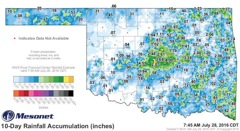
But the lack of rainfall in the southeast combined with the intense heat over
the last couple of weeks has finally taken its toll, especially over the last
30 days.
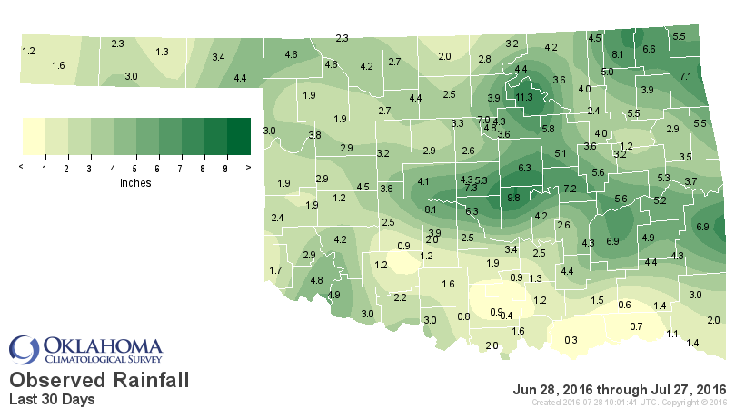
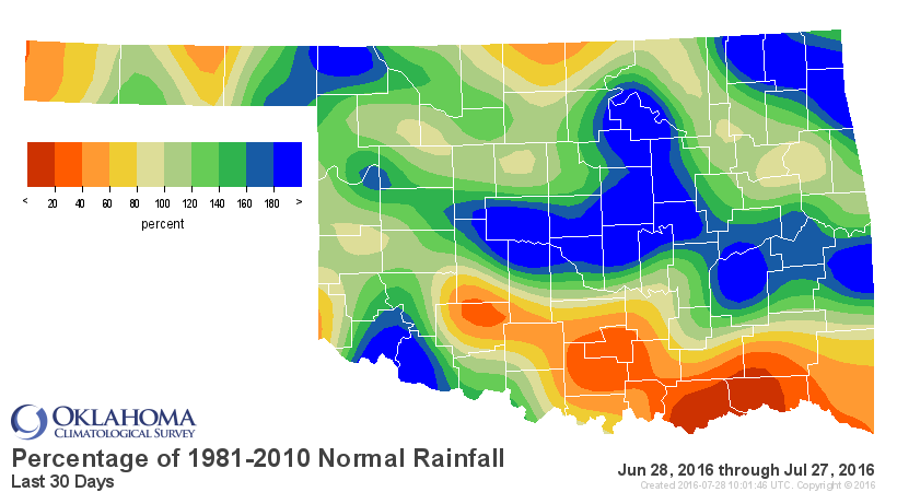
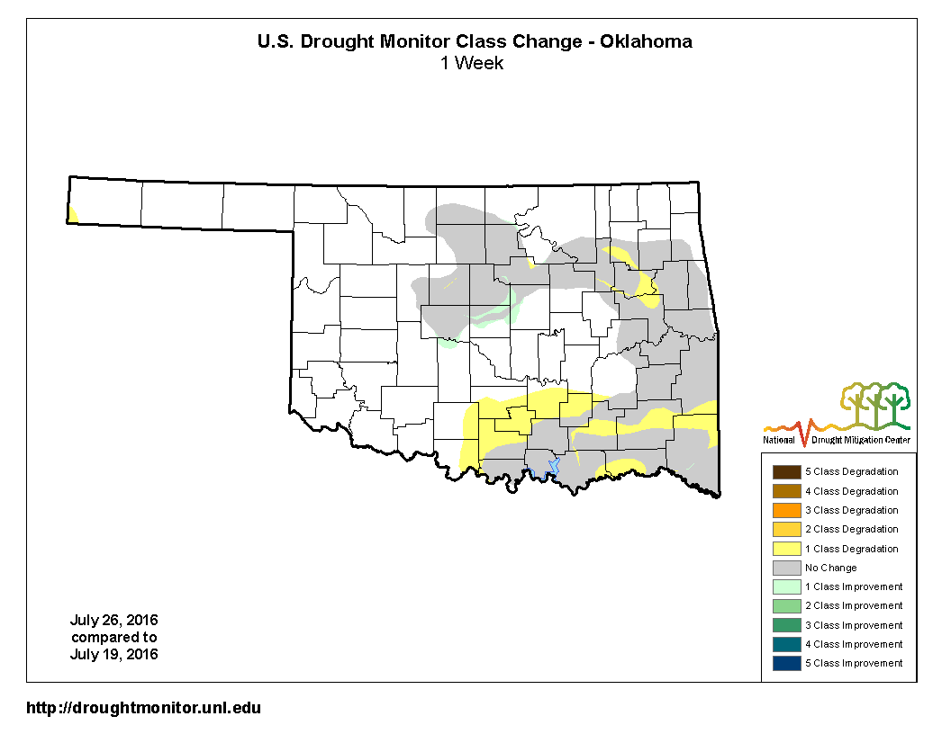
And while that big blob of rain did make some headway against the drought in
central Oklahoma, the drought has only intensified across SE OK (as shown in
this one-week Drought Monitor change map).
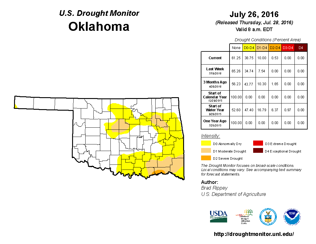
Finally, we leave you with this snapshot of the drought from Tuesday at 7am.
Not much has happened since then that would have changed this map by its
release this morning. That, we can only hope, occurs tonight. Those storms have
a long way to go, however.
Gary McManus
State Climatologist
Oklahoma Mesonet
Oklahoma Climatological Survey
(405) 325-2253
gmcmanus@mesonet.org
July 28 in Mesonet History
| Record | Value | Station | Year |
|---|---|---|---|
| Maximum Temperature | 109°F | GRA2 | 2008 |
| Minimum Temperature | 47°F | MANG | 2005 |
| Maximum Rainfall | 3.50″ | ALV2 | 2002 |
Mesonet records begin in 1994.
Search by Date
If you're a bit off, don't worry, because just like horseshoes, “almost” counts on the Ticker website!