Ticker for July 25, 2016
MESONET TICKER ... MESONET TICKER ... MESONET TICKER ... MESONET TICKER ...
July 25, 2016 July 25, 2016 July 25, 2016 July 25, 2016
Relief at last, but WILL it last?

NEVER look a gift cold (well, cool at least) front in the mouth during summer,
especially late July or early August. Our string of unbearably hot weather has
come to a close. Well, "unbearably" isn't quite accurate since we did bear it, but
even bears wanted to be bare during this almost-unbearably hot weather. Yesterday
was quite the capper with heat indices again well into the 110s across eastern
Oklahoma and actual air temperatures well into the triple digits.
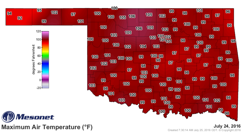
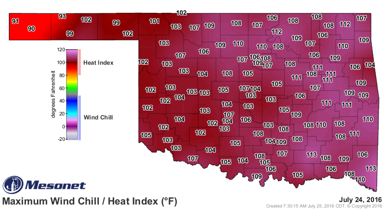
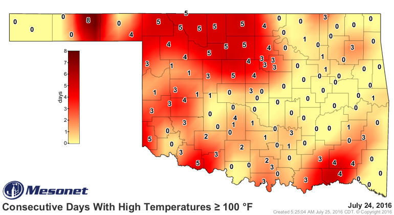
And that ends a string of up to eight consecutive days where Hooker hit 100 degrees
with others as high as five days, and that also brings Hooker up to 21 days thus
far for the warm season with Kingfisher right behind at 18.

And here entereth the cool front into the state, a consequence of the heat dome
shifting to the west and allowing more northwesterly in the atmosphere. That
will allow a front and minor disturbances to swing over the top of that ridge
and give us rain chances and A BIT (we're not talking fall here) cooler weather
for awhile.
First, check out this weather analysis from the Weather Prediction Center. Kind
of tough to read, but you can see the cold front (which might just be a
glorified outflow boundary from convection across KS, but whatever it is, we'll
take it!) intersecting Oklahoma. Then you can see the glorious maps with
chances of rain for the state over the next week.
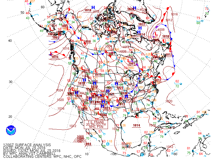
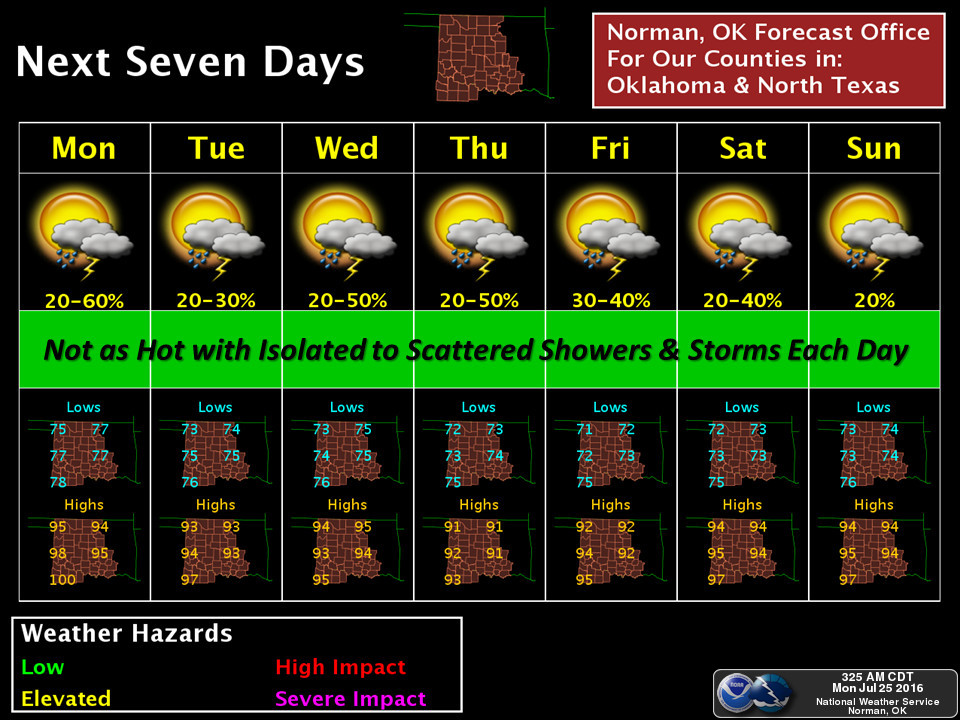
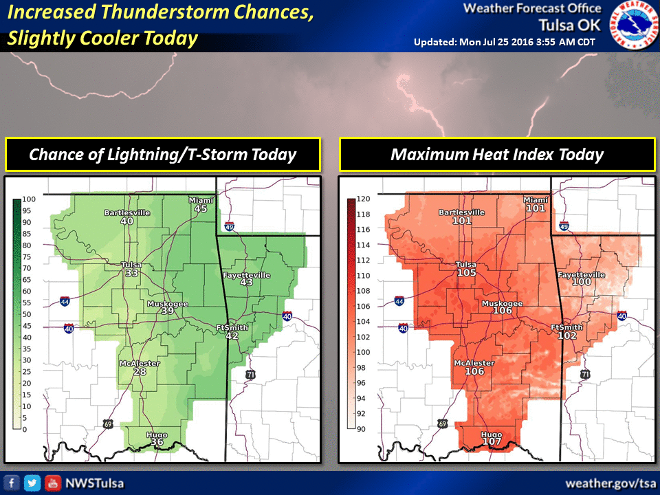
While WPC does show some decent rainfall amounts over the next seven days
across the state, keep in mind where that front stalls or how far south it makes
it will be key on both rainfall amounts and locations. And that goes for future
activity as well.

Okay Mother Nature, you've given Kansas theirs.

Now it's Oklahoma's turn. Let's dance.
Gary McManus
State Climatologist
Oklahoma Mesonet
Oklahoma Climatological Survey
(405) 325-2253
gmcmanus@mesonet.org
July 25 in Mesonet History
| Record | Value | Station | Year |
|---|---|---|---|
| Maximum Temperature | 110°F | GRA2 | 2011 |
| Minimum Temperature | 55°F | BOIS | 2004 |
| Maximum Rainfall | 3.16″ | SHAW | 2016 |
Mesonet records begin in 1994.
Search by Date
If you're a bit off, don't worry, because just like horseshoes, “almost” counts on the Ticker website!