Ticker for July 21, 2016
MESONET TICKER ... MESONET TICKER ... MESONET TICKER ... MESONET TICKER ...
July 21, 2016 July 21, 2016 July 21, 2016 July 21, 2016
Zoinks!

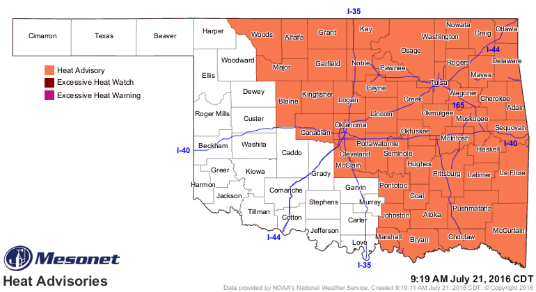
No Scooby Snacks to the rescue, we're still caught in heat dome hell, I'm afraid.
BUT (and that's a big "but"...WATCH IT!!), there is light, or less light, at the
end of the tunnel. And I'm not talking about the inevitable transition to Fall,
either. I'm talking falling high temps, possibly all the way down to the low-mid
90s! WHOO-HOO!!
Here's NWS Norman's temperature outlook for the next 7 days, somewhat
representative of the state as a whole.
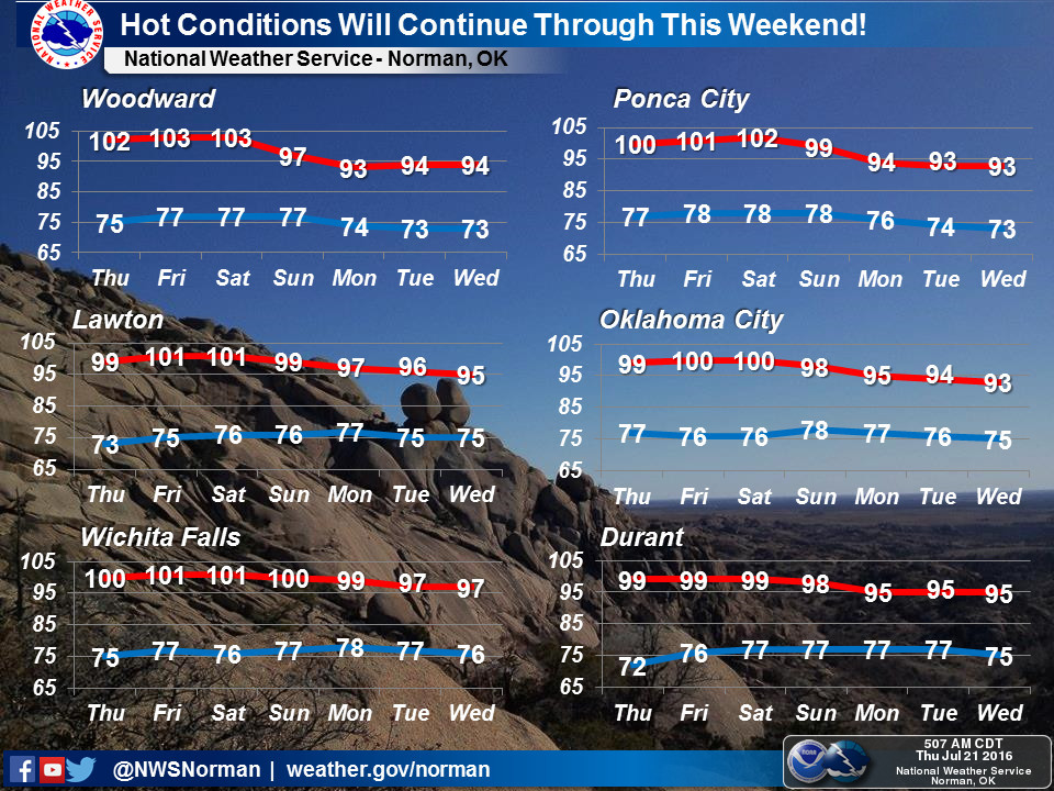
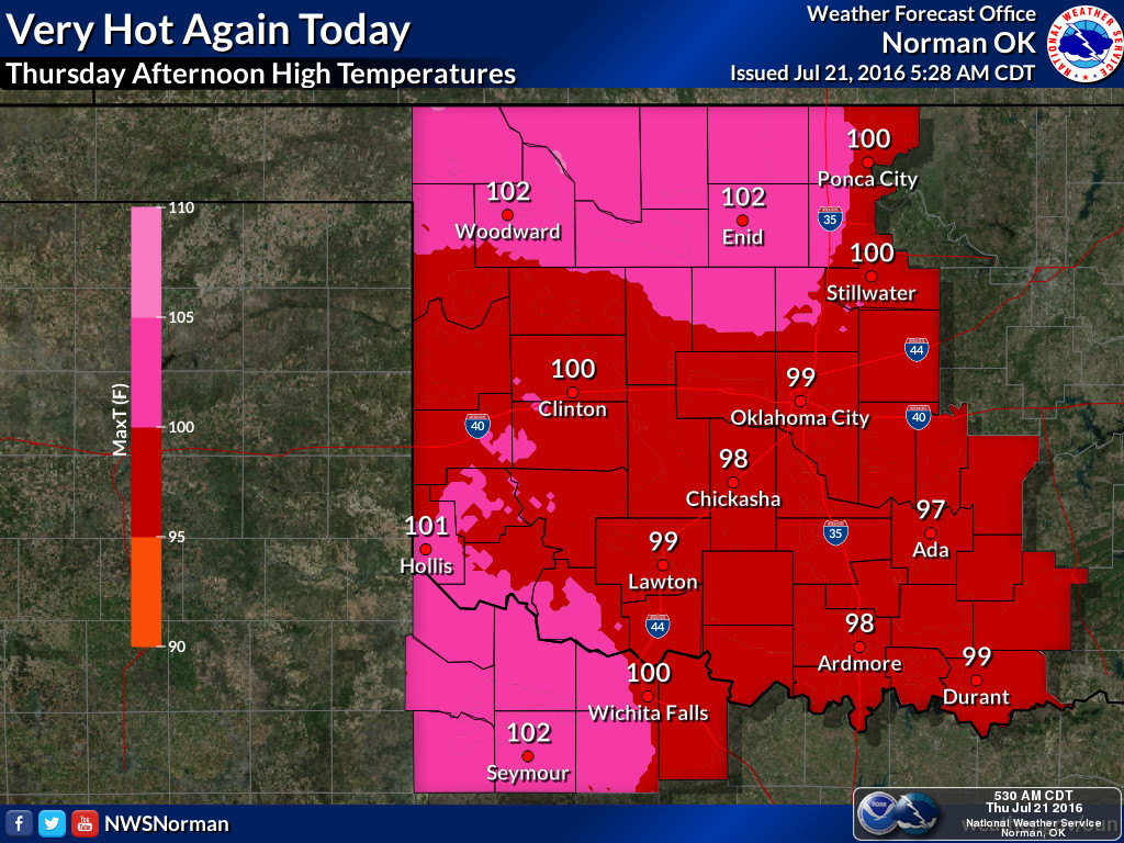
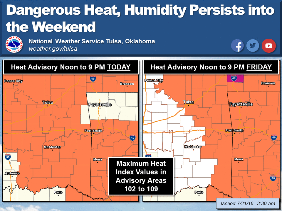
Unfortunately, before that heat dome shifts to the west and gives later into
the weekend and provides us with a cool front and rain chances, we're going to
have to bake awhile longer.

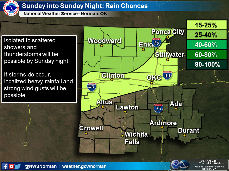
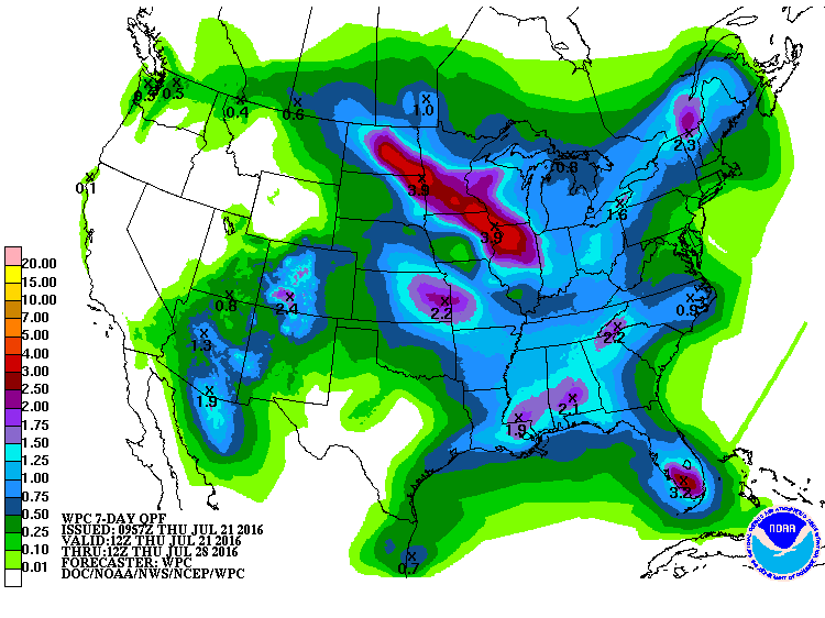
Now these rain chances aren't humongous, nor does it look like tons of rain,
at least at this time, but it's a change for the better.
The heat and lack of rainfall are only enhancing the current flash drought across
parts of Oklahoma, which began across northern Oklahoma but has now reared its
ugly head down south. The new U.S. Drought Monitor report does indeed show
moderate drought getting a toehold down in far southeastern Oklahoma, and drought's
precursor, abnormally dry conditions, spreading out even farther.
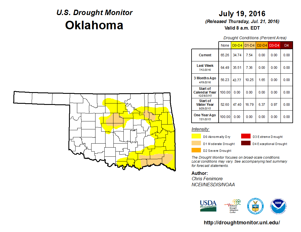
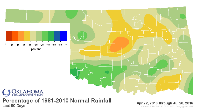
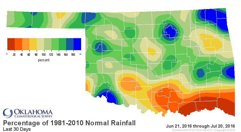
So despite recent rains, the drought is still holding on across northern Oklahoma
due to longer-term deficits (e.g., the 90-day rainfall maps)

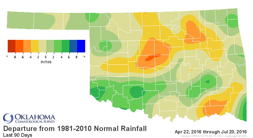
while the drought across southern Oklahoma is more flash-y (e.g., the 30-day
rainfall maps)


If you're looking for an early fall...it could happen. But, if the newest CPC
outlooks for both August and the August-October periods are to be believed,
we have greater odds of continuing in a warmer-than-normal pattern.
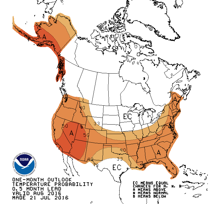
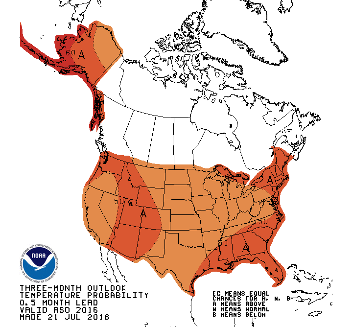
The precip outlooks are largely indeterminate, so I won't bother with those. Now
I have seen the outlooks for winter thrown about already, alluding to the chances
for snow. And while they do resemble the classic La Nina pattern of increased
odds for above normal temps and below normal precip across the southern tier of
the U.S., including Oklahoma, that's not an indication of less snow (other than
the possibility of drier than normal conditions).
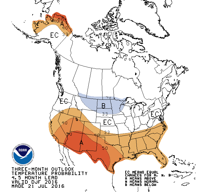
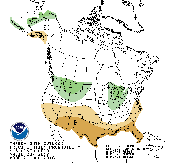
Again, these are climate outlook, and reflect the chances for the overall,
generalized pattern for the U.S. I'll remind you gentle readers that Oklahoma
saw its records for both coldest temp (-31 degrees at the Nowata Mesonet site)
AND its 24-hour snowfall record (27 inches at Spavinaw) in Feb. 2011, smack dab
in the middle of a strong La Nina and the beginning year of arguably the worst
drought Oklahoma has seen since the 1950s.
And yes, that was a very long sentence...but so is Oklahoma's summer. Just keep
in mind once again that a flash drought now combined with drier than normal
conditions due to La Nina in the fall would not be a good thing. I didn't WANT
to mention that, but I felt I had to thanks to you meddling kids!
Gary McManus
State Climatologist
Oklahoma Mesonet
Oklahoma Climatological Survey
(405) 325-2253
gmcmanus@mesonet.org
July 21 in Mesonet History
| Record | Value | Station | Year |
|---|---|---|---|
| Maximum Temperature | 111°F | GRA2 | 2018 |
| Minimum Temperature | 54°F | EVAX | 2021 |
| Maximum Rainfall | 5.92″ | SALL | 2022 |
Mesonet records begin in 1994.
Search by Date
If you're a bit off, don't worry, because just like horseshoes, “almost” counts on the Ticker website!