Ticker for July 18, 2016
MESONET TICKER ... MESONET TICKER ... MESONET TICKER ... MESONET TICKER ...
July 18, 2016 July 18, 2016 July 18, 2016 July 18, 2016
Keep your pants on

Actually, you should probably be wearing shorts since summer is hitting us full
force right now, thanks to "HEAT DOME APOKIKLYPSE 2016" (exclamation points
gone, but understood). Yes, it's hot. Yes, it's going to stay hot for awhile. No,
this is not really that unusual. Yes, this is a very annoying way to write. Yes,
I'm annoying. No, I'm not going to stop.
Okay, I'll stop. Here's the weather news about the next week or tow, HOT off the
presses. DID YOU GET THAT ONE? "HOT" off the presses? HAHA! Might as well laugh
or you'll just cry.
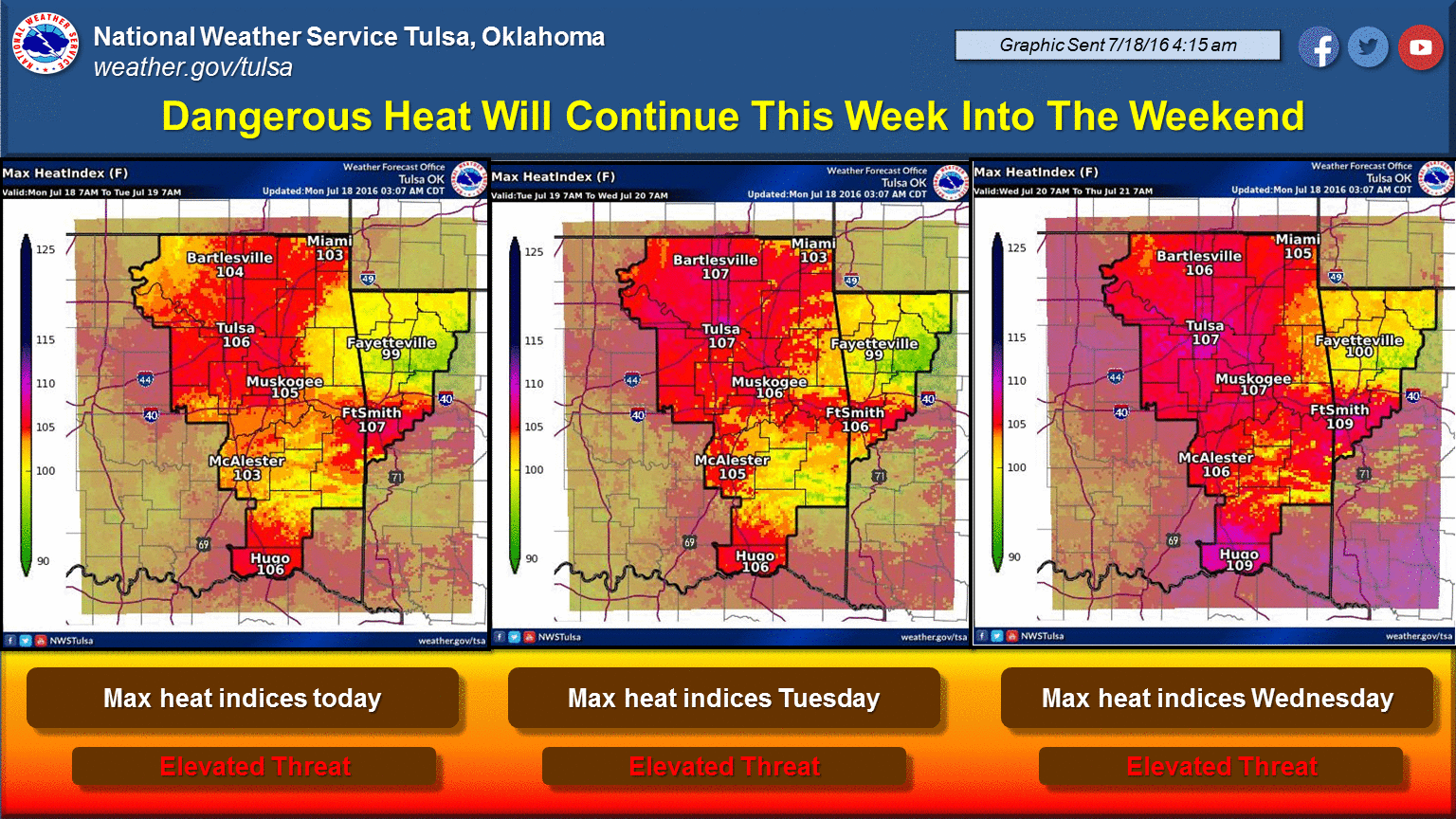
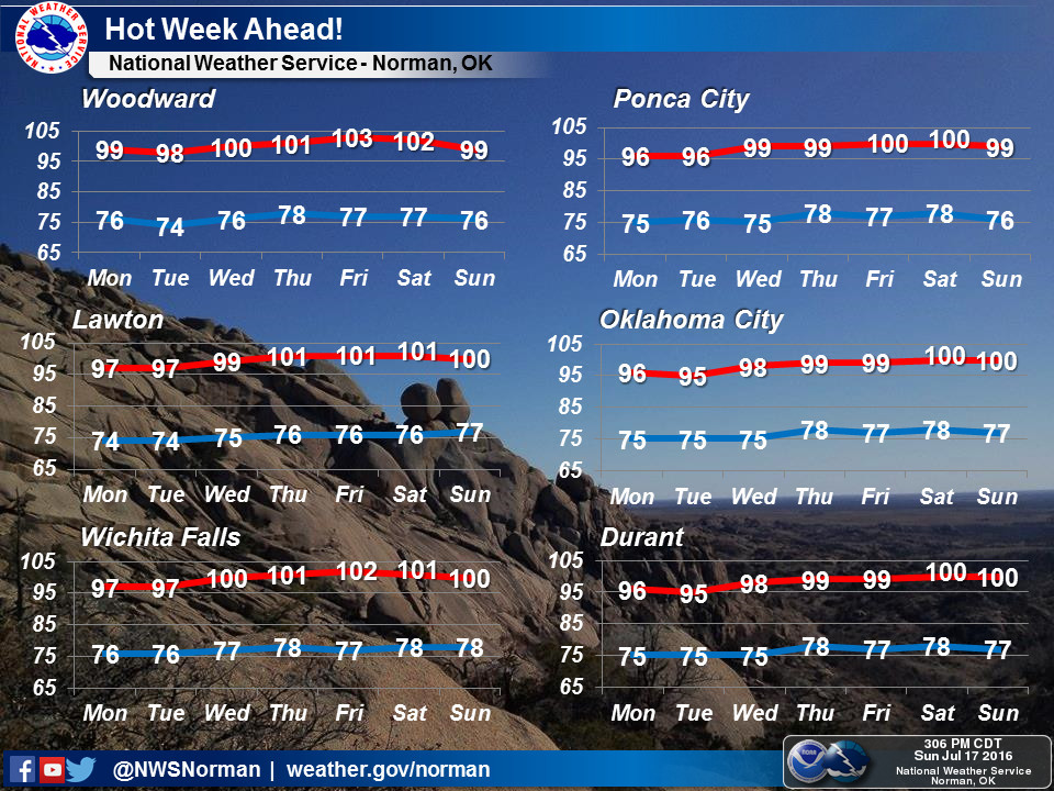
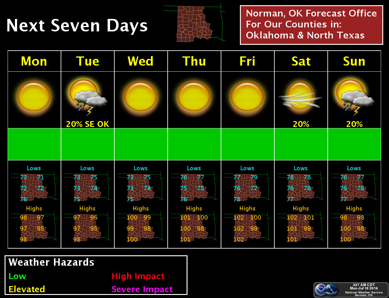
It does look like this type of heat, with minor temperature variations up and down,
will continue for a bit as we get through July into August. At least that's what
the long-term models are showing, and those will only get you so far before they
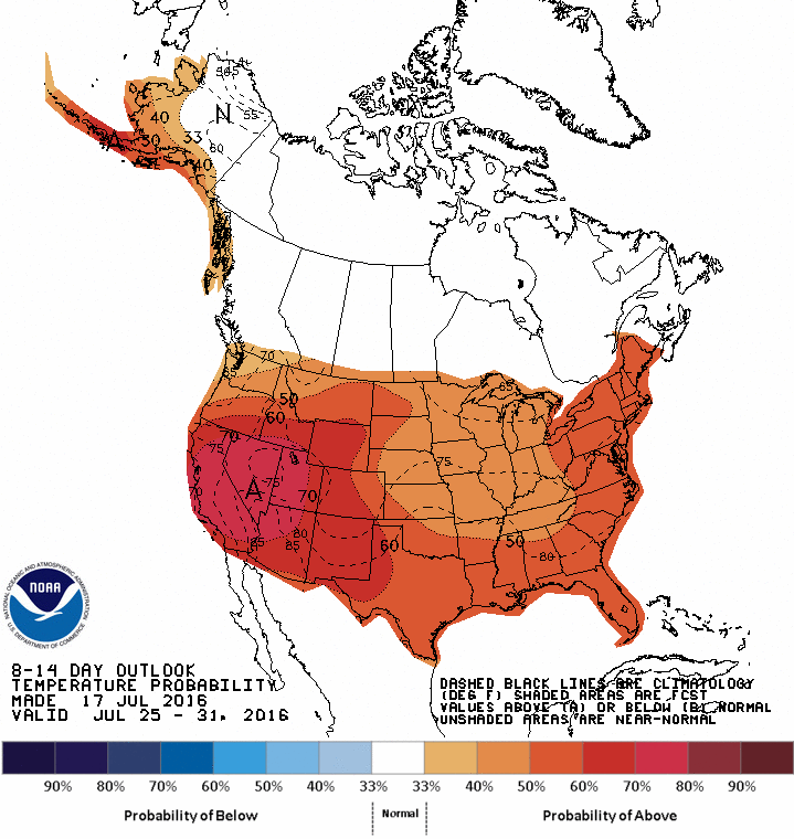
get a bit iffy. Here's the temperature outlook from CPC yesterday for the July
25-31 time frame. Notice the Southern Plains is still in the increased odds
for above normal temperatures region, although the highest of those odds shifts
a bit to the west.
But just as before this summer, as that upper-level ridge wobbles around with
the jet stream shoved far to the north, its center will determine who gets
the thermostat set on 105 vs. the fringes that might get 95, along with periodic
chances of rain. And like I said earlier, this is summer in Oklahoma. The long-
term average statewide temperature graph (maximum temperatures) shows pretty
clearly that we're entering the "normal" hottest part of the year, peaking in
early August before we take that blessed plunge into fall.

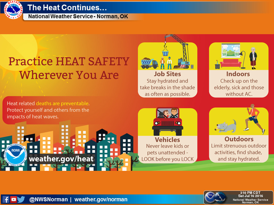
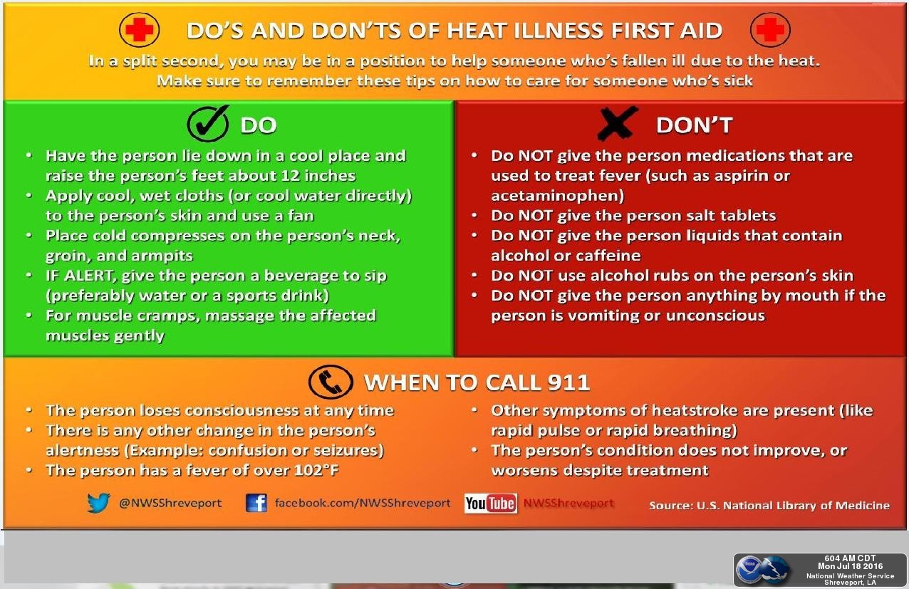
So what can you do? Well, stay out of the sun, check on those most vulnerable
to heat stress, stay hydrated, etc. For some gentle reminders, here are some
heat safety rules from some of our local NWS offices.
We did have some nice rains that should have tamped down on some of those
developing flash drought impacts, but I'm afraid what fell will soon be going
back up into the atmosphere, making for a very sticky situation for awhile.
This is a chance for those dry conditions to return and spread again, however.
Bear with us, better weather's ahead.
Any month now.
Gary McManus
State Climatologist
Oklahoma Mesonet
Oklahoma Climatological Survey
(405) 325-2253
gmcmanus@mesonet.org
July 18 in Mesonet History
| Record | Value | Station | Year |
|---|---|---|---|
| Maximum Temperature | 110°F | BURN | 2022 |
| Minimum Temperature | 51°F | JAYX | 2009 |
| Maximum Rainfall | 3.17″ | CHAN | 1997 |
Mesonet records begin in 1994.
Search by Date
If you're a bit off, don't worry, because just like horseshoes, “almost” counts on the Ticker website!