Ticker for July 14, 2016
MESONET TICKER ... MESONET TICKER ... MESONET TICKER ... MESONET TICKER ...
July 14, 2016 July 14, 2016 July 14, 2016 July 14, 2016
DROUGHTBUSTERS!

If there's something dry
In your neighborhood (or state, or climatological region)
Who you gonna call?
A stalled cold front and a few outflow boundaries, the chance for severe weather
and the possibility of heavy rain!!
Man, if I produced that song's rewrite I'd make a million dollars! But I won't
since the Ghostbusters folks would probably sue me. Okay, maybe not. But with
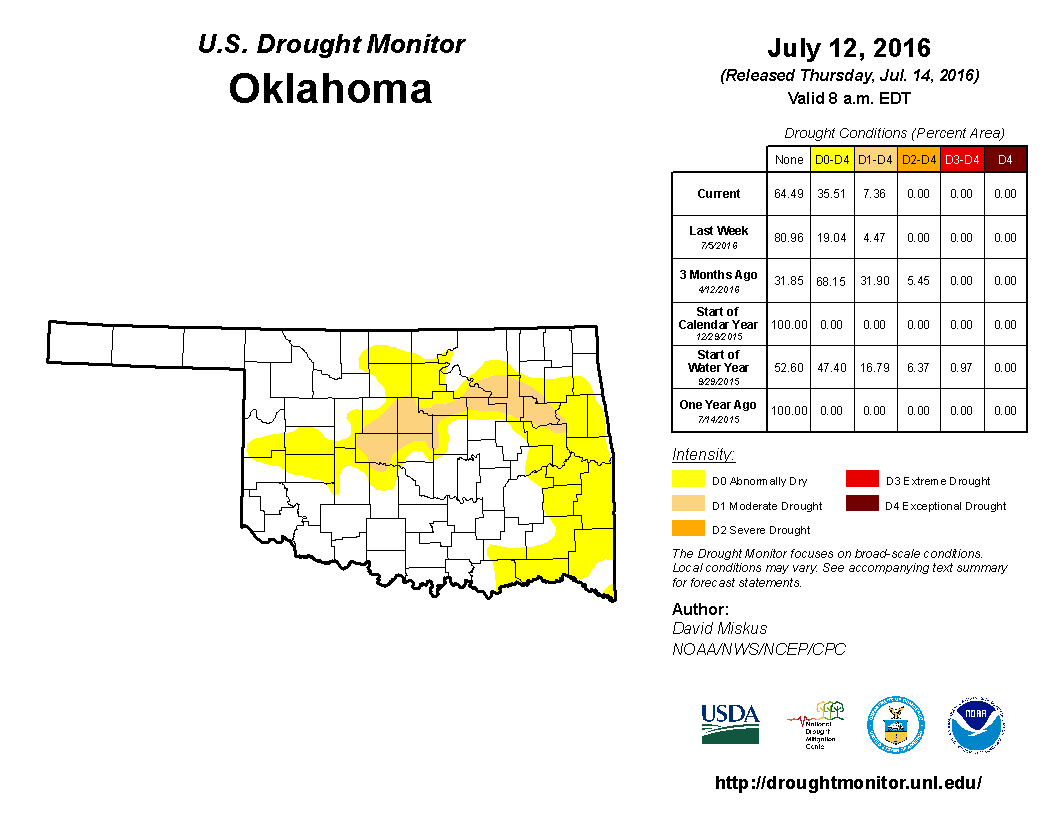
drought STILL hanging around and even spreading, as evidenced by the new Drought
Monitor map this morning
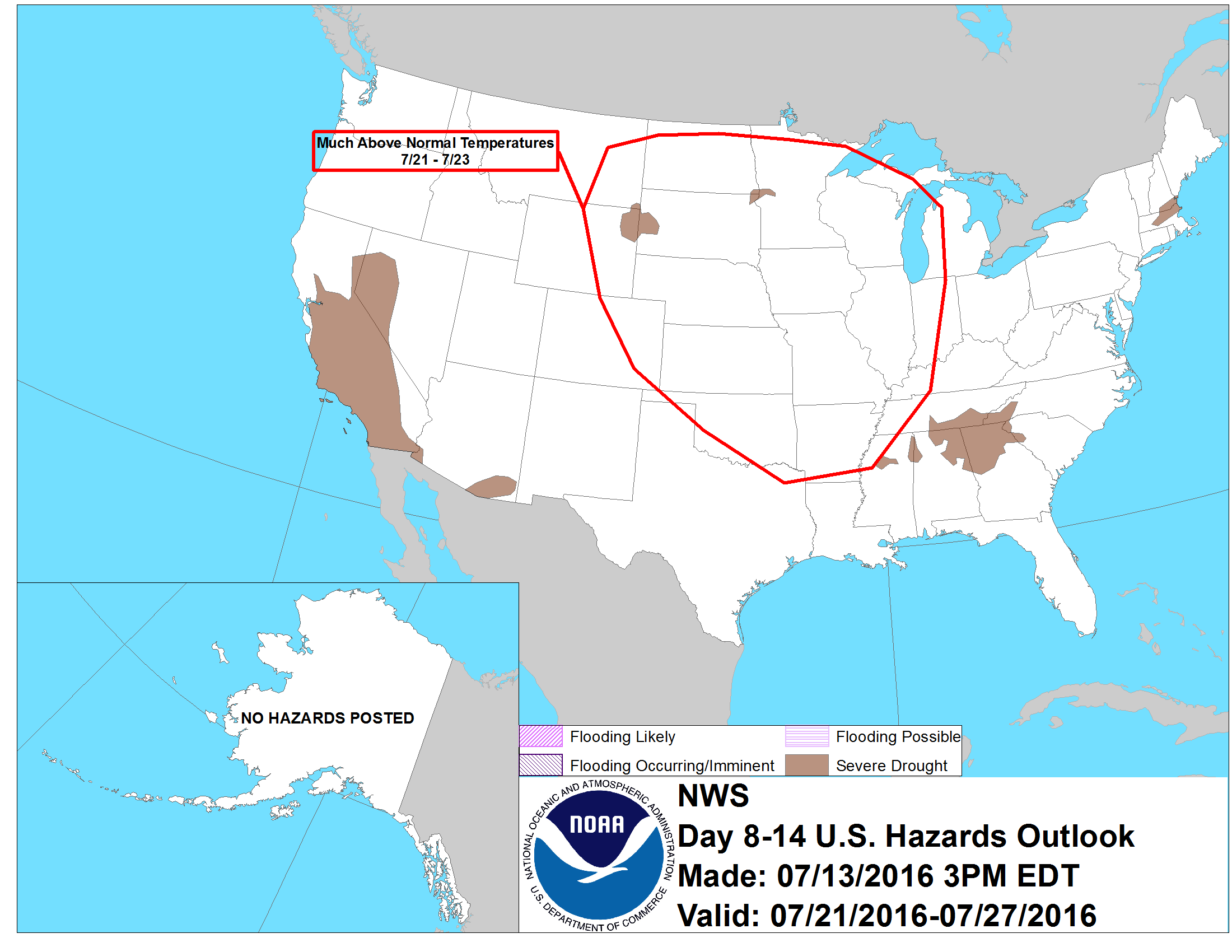
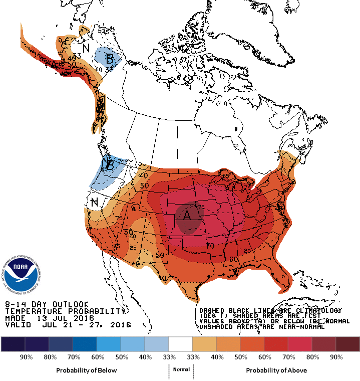
and with the dreaded DEATH RIDGE HEAT DOME APOKYKLYPSE (trademarked!) coming
next week
we really need this front to come through in a sorta big way. Enough to tamp down
the drought's spread, maybe even knock it out, but not give us any significant
flooding. I'm sure it will happen that way...Mother Nature usually doesn't throw
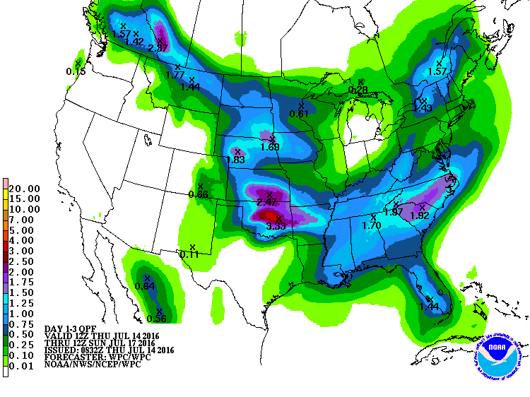
us any curveballs (sarcasm intended). Here's that 3-day rainfall forecast map
again but a bit bigger. Central OK could used a good 2-3 inches of rain right
about now, or tonight, or tomorrow.
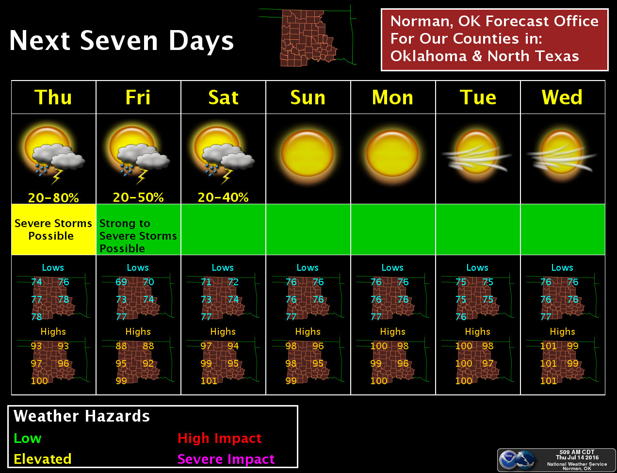
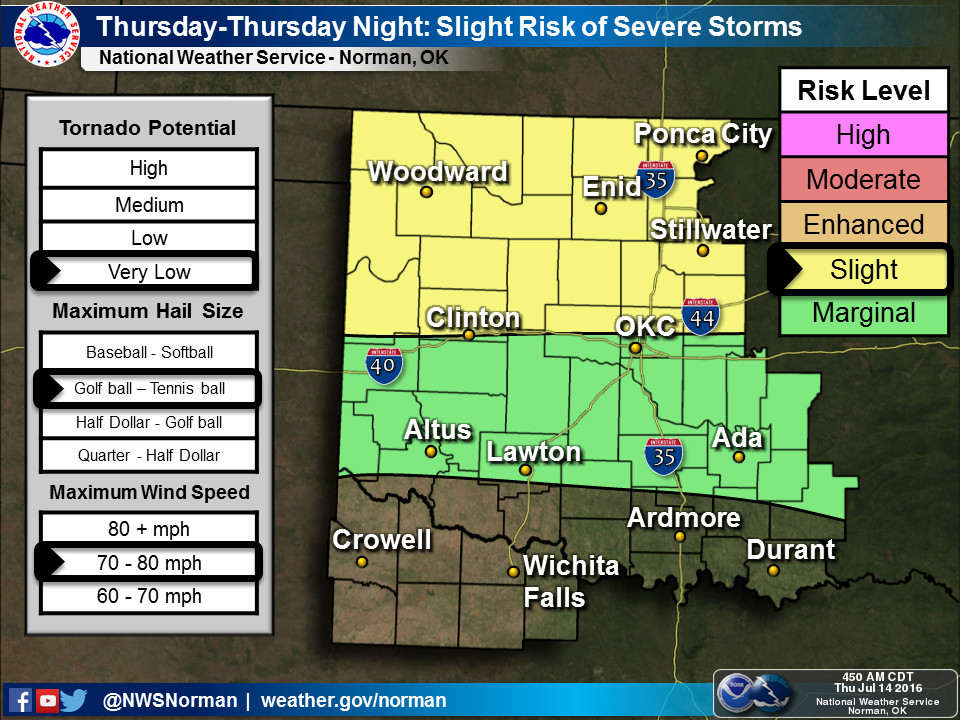
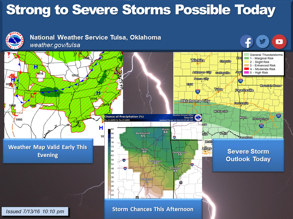
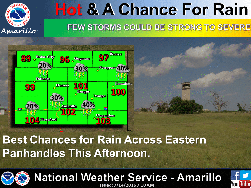
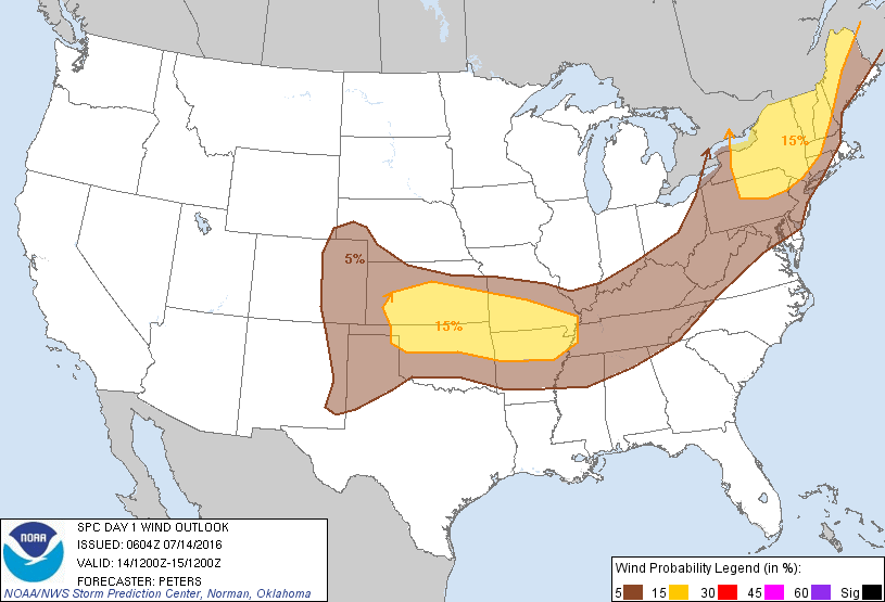
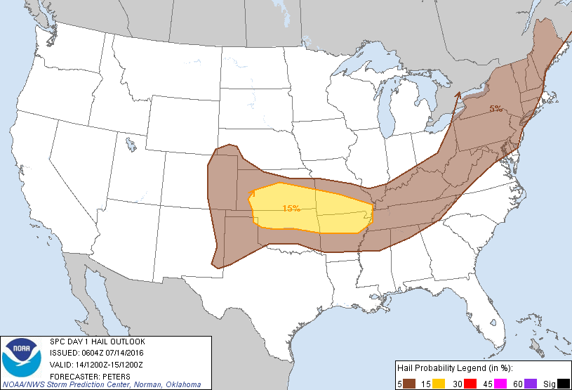
And with the stalled front and outflow boundaries will come the chance of
severe weather, especially across northern Oklahoma.
What we're talking about here is Old Testament, real wrath of God type stuff.
Fire and brimstone coming down from the skies! Rivers and seas boiling! Forty
years of darkness! Earthquakes, volcanoes...the dead rising from the grave!
Human sacrifice, dogs and cats living together... mass hysteria!
Mother pus bucket, really?!? No, not really. There will be the chance of some
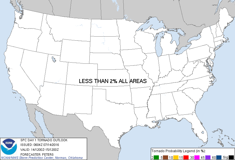
hail, wind and flooding. Tornado threat is so low it's not worth mentioning,
but it's Oklahoma so I will anyway. Very low chance of tornadoes.
But with a continued chance of rain and that front having moved a bit further
through the state, Friday looks good.
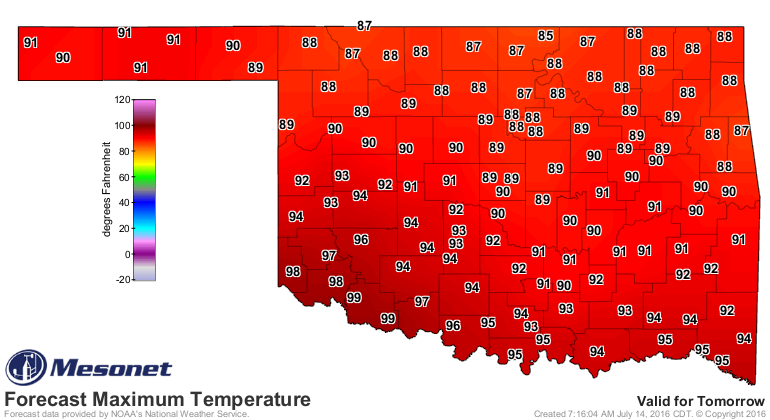
Next week and beyond...not so much. Where do these temperatures go?
Up.
Gary McManus
State Climatologist
Oklahoma Mesonet
Oklahoma Climatological Survey
(405) 325-2253
gmcmanus@mesonet.org
July 14 in Mesonet History
| Record | Value | Station | Year |
|---|---|---|---|
| Maximum Temperature | 113°F | HOLL | 2020 |
| Minimum Temperature | 54°F | EVAX | 2019 |
| Maximum Rainfall | 5.94″ | ANT2 | 2025 |
Mesonet records begin in 1994.
Search by Date
If you're a bit off, don't worry, because just like horseshoes, “almost” counts on the Ticker website!