Ticker for July 13, 2016
MESONET TICKER ... MESONET TICKER ... MESONET TICKER ... MESONET TICKER ...
July 13, 2016      July 13, 2016      July 13, 2016      July 13, 2016


The Curious Case of Kingfisher County


As you may have seen on the Mesonet's Facebook page yesterday (give us a like!)

https://www.facebook.com/mesonet/

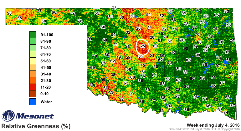
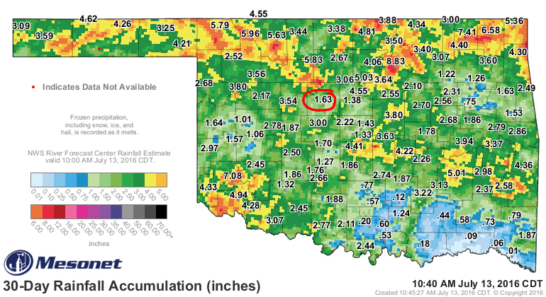
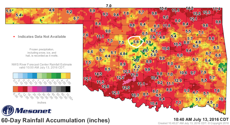
summer has been acting the fool in Kingfisher County. Thanks mainly to all those
bare fields following wheat harvest (as seen in the latest Relative Greenness
map from the Mesonet's OK-FIRE program with Kingfisher's value circled in white)


and relatively dry conditions over the past 30-60 days.


So what you have going on here is a lack of soil moisture and vegetative cover
that allows more of the suns rays to absorbed by the ground instead of going
towards other things (like evaporating that soil moisture, a cooling process). And
just like the bare ground absorbs heat, it also emits it. So that ground then
becomes like a giant hotplate that emits that heat all day and then late
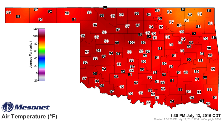
into the night. That's why Kingfisher's low temps have been hovering in the
upper 70s and even the low 80s. Check out last night's lows, for example.


Now while I'm picking on Kingfisher, if you take a look back at all those maps,
you can really see that much of NW and NC Oklahoma is in the same boat, albeit
a boat marooned on a flat, dry surface being baked by the sun.

Oh by the way, guess who was the first to hit 100 today?

WRONG! Kingfisher.


Gary McManus
State Climatologist
Oklahoma Mesonet
Oklahoma Climatological Survey
(405) 325-2253
gmcmanus@mesonet.org
July 13 in Mesonet History
| Record | Value | Station | Year |
|---|---|---|---|
| Maximum Temperature | 109°F | LAHO | 2003 |
| Minimum Temperature | 52°F | BOIS | 2008 |
| Maximum Rainfall | 4.29 inches | CLAY | 2025 |
Mesonet records begin in 1994.
Search by Date
If you're a bit off, don't worry, because just like horseshoes, “almost” counts on the Ticker website!