Ticker for June 29, 2016
MESONET TICKER ... MESONET TICKER ... MESONET TICKER ... MESONET TICKER ...
June 29, 2016 June 29, 2016 June 29, 2016 June 29, 2016
WHOOSH!
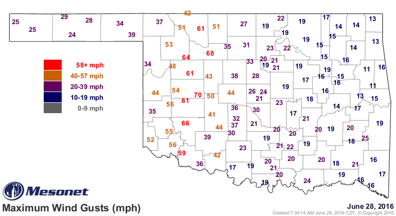
Well that was certainly uncalled for. Yesterday's storm complex that roared out
of Kansas and plunged through western Oklahoma left a lot of damage in its wake,
with winds of 70 mph or higher reported and toppled trees, fireworks stands and
the like. The max wind gust map from the Mesonet yesterday does a pretty good
job of showing you the path of the storm front, which was about 100 miles wide
it appears.
But this animation of the radar, winds and associated warnings does an even better
job.
http://cig.ocs.ou.edu/~gmcmanus/public/June_28_2016_Storms.mov
And here you can see a table of those wind gusts from the Mesonet, with 20 reports
of severe winds (58 mph or greater constitutes a severe wind gust according to
NWS guidelines).

However, believe it or not, wind gusts do actually occur between Mesonet sites,
although usually estimated instead of observed. A 71 mph gust was reported from
the Burns Flat ASOS site and a trained spotter estimated 70 mph winds causing
roof damage in Carnegie. The wind storm blew all the way through the Red River,
with a 64 mph wind gust reported from Altus Air Force Base and a 69 mph gust
by another observing station in Altus.
That complex of storms and the gust front that pushed out in front of it was
certainly more intense than the second line which is currently pushing through
western OK. The highest gusts I can find from that second complex would be
46 mph from Hooker. Piece of cake.
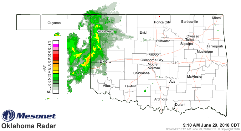
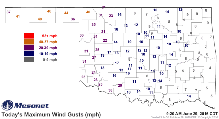
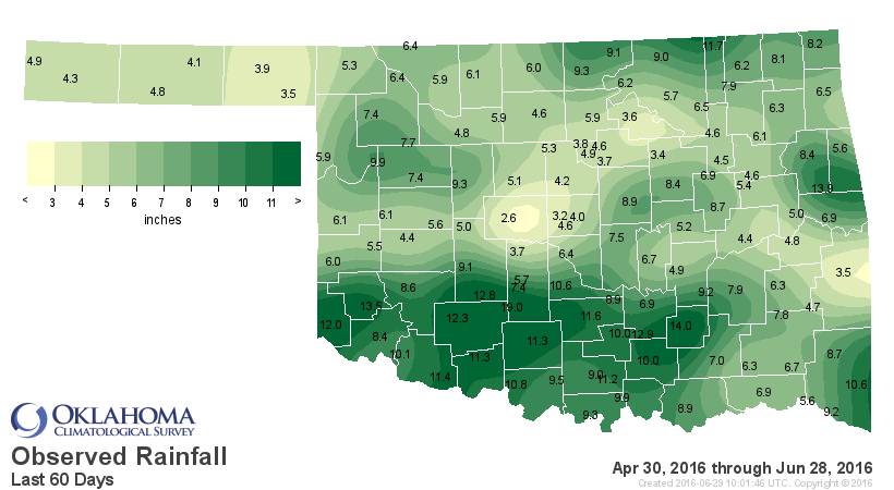
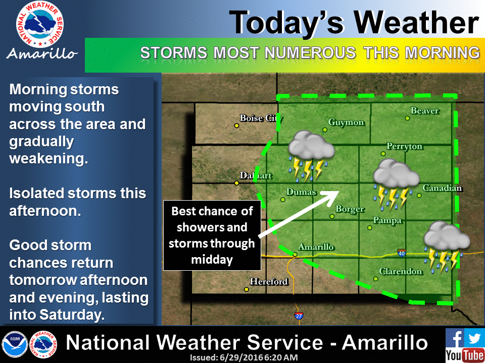
Together, they have given western OK a good dose of moisture. Not as widespread
as I thought it would be, still isolated amounts have risen into the 2-inch range
in some areas. The Mesonet site at Watonga led the way with 2.07 inches thus far.
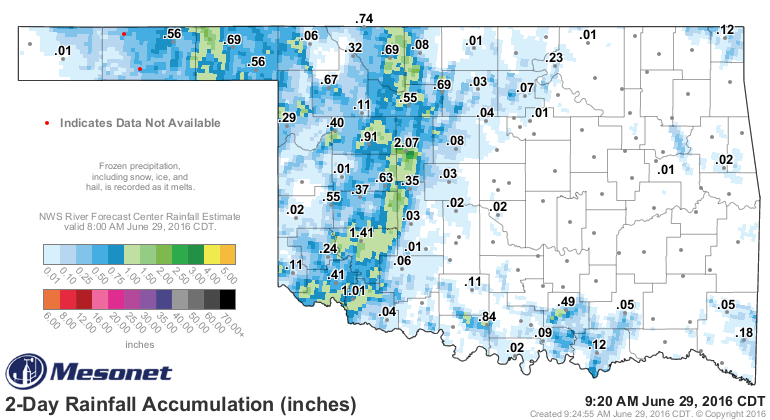
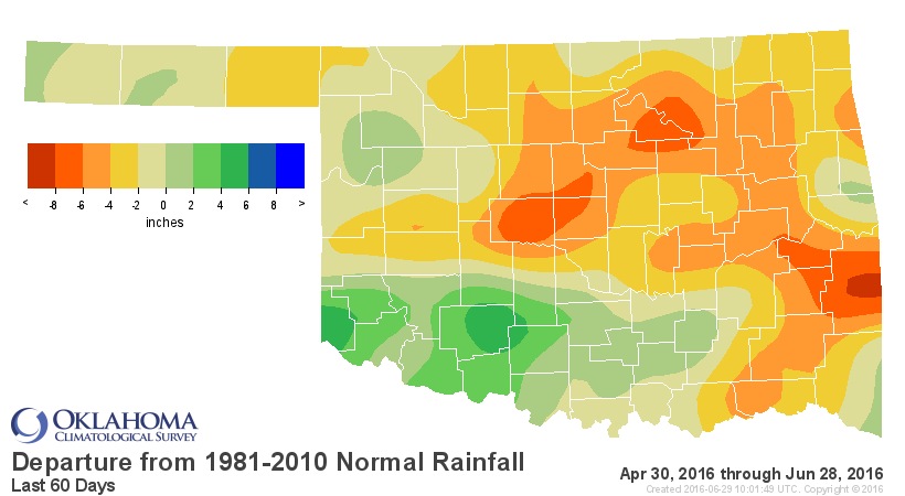
Unfortunately, the rains continue to miss those areas that are seeing flash
drought start to erupt from Canadian County through the NE and down to the SE.
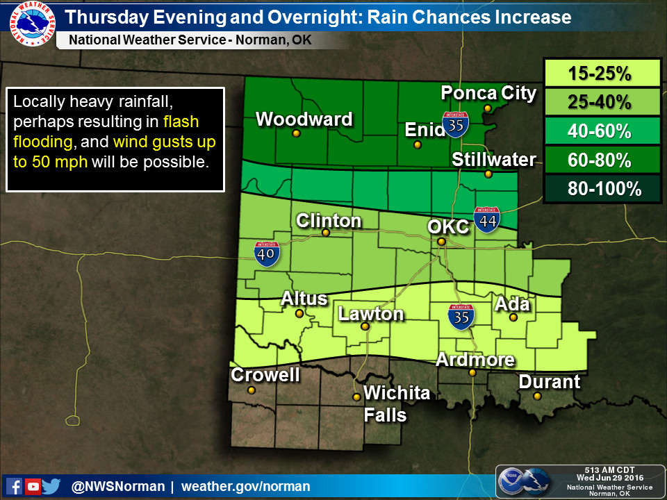
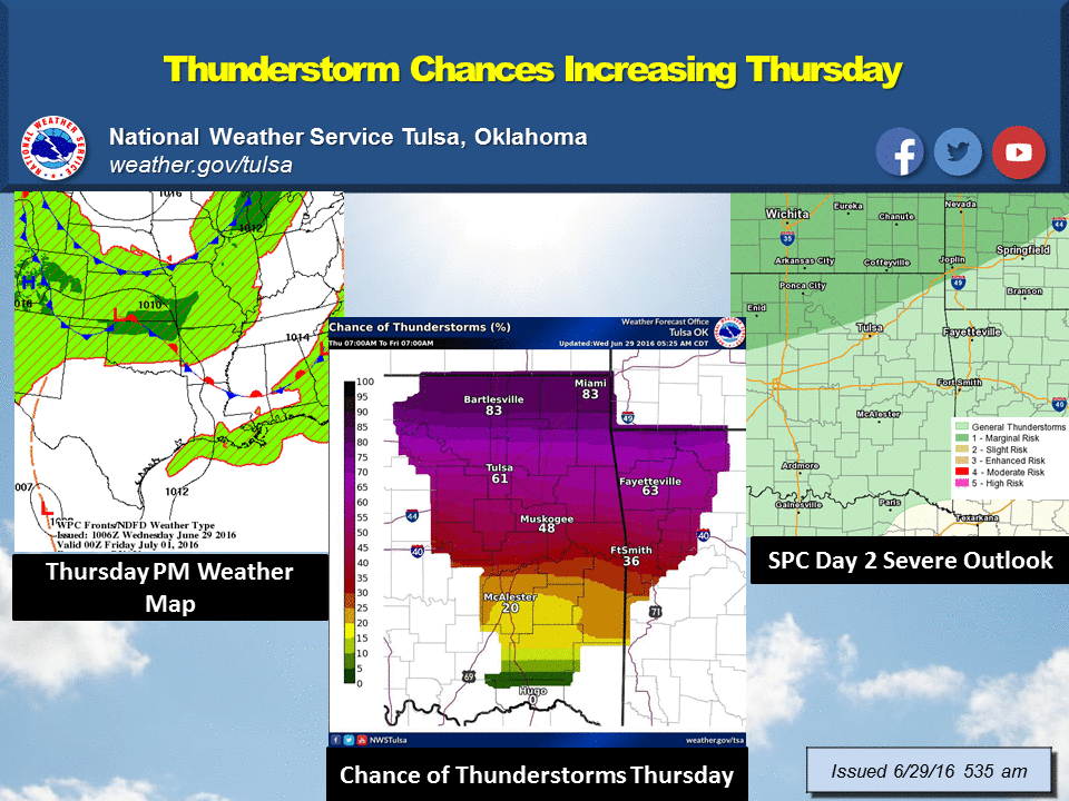
Never fear (well, fear if you get another storm complex like last night...other
than that, never fear), more rain is possible over the next several days.
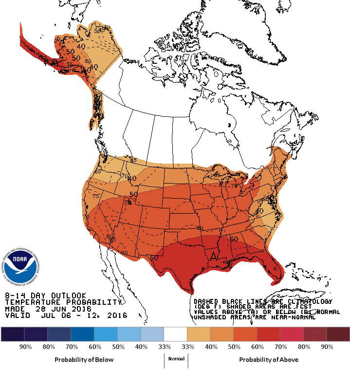
Enjoy it whilst you can because the heat dome that plagued us for the previous
couple of weeks will be moving back east over the Southern Plains again after
a brief sojourn to the west.
Gary McManus
State Climatologist
Oklahoma Mesonet
Oklahoma Climatological Survey
(405) 325-2253
gmcmanus@mesonet.org
June 29 in Mesonet History
| Record | Value | Station | Year |
|---|---|---|---|
| Maximum Temperature | 111°F | HOOK | 1998 |
| Minimum Temperature | 47°F | GOOD | 2007 |
| Maximum Rainfall | 4.34 inches | CLAR | 1995 |
Mesonet records begin in 1994.
Search by Date
If you're a bit off, don't worry, because just like horseshoes, “almost” counts on the Ticker website!