Ticker for June 27, 2016
MESONET TICKER ... MESONET TICKER ... MESONET TICKER ... MESONET TICKER ...
June 27, 2016 June 27, 2016 June 27, 2016 June 27, 2016
Flash drought?
So what happens when the numbskull...I mean State Climatologist goes on TV, radio
and in the newspapers all Chicken Little about flash drought? Well, it rains,
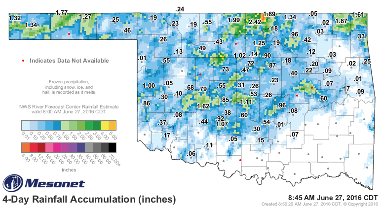
obviously. And if you look back over the weekend and just prior to that, it's
rained a lot in some places. The heaviest rain fell in clumps and clusters. In
Kay County, between Blackwell and Newkirk, radar estimates place the totals up
above 5 inches.
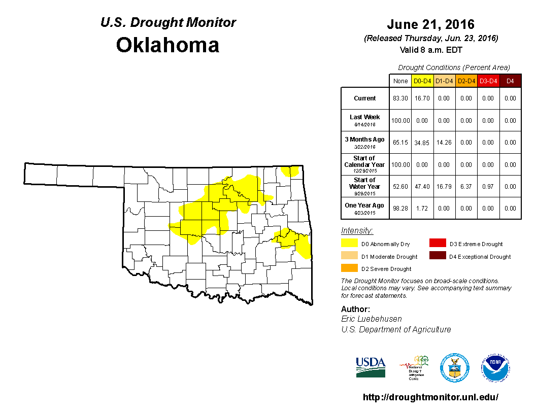
If you look at the area just placed back into D0 "Abnormally Dry" conditions, on
its way back into D1 "moderate drought" designations in the coming week (if not
this week), most of it received at least some rainfall.
But how much of a change did it make? Tough to say at this point, although we
know that where it did rain an inch or two in those localized areas, conditions
had to improve somewhat. However, the 60-day departure from normal map (well,
60+ day, since I will have them both start on April 24) went from this

to this
Remember that those departure from normal maps are based off of the Mesonet
gauge data only, so those splotches of green and orange and yellow and red
you might see on the radar estimated overlays aren't necessarily counted. But
there's the rub...if they aren't widespread enough to hit a gauge, are they
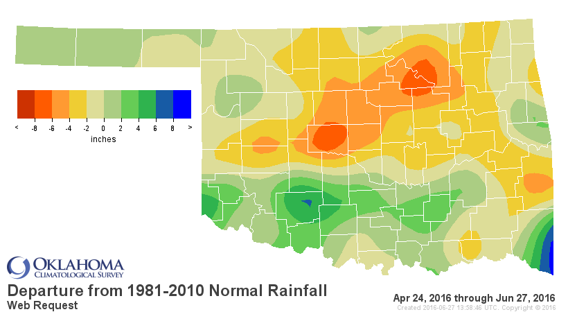
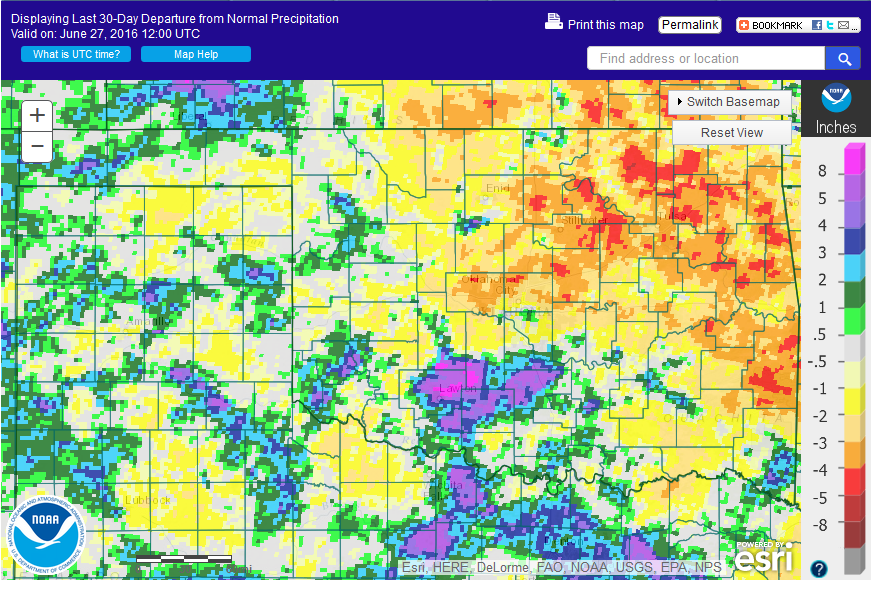
widespread enough to curtail drought? If you look at a radar/gauge estimated
departure from normal rainfall map over the last 60 days, courtesy of the
NWS, you STILL see significant deficits of 4-8 inches over a large
part of northern OK. And the 30-day map is no picnic either.

So maybe that flash drought ain't going away just yet, but here's the deal. We
knew that heat dome was going to shift to the west and allow us to adopt a more
favorable flow pattern for rainfall chances, so the recent rains were possibly
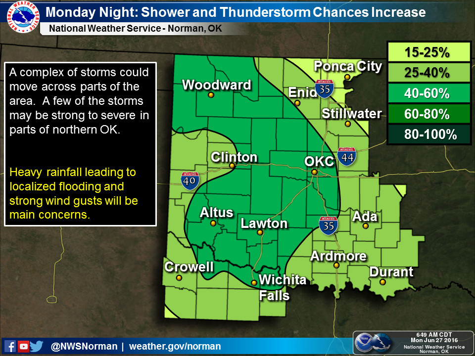
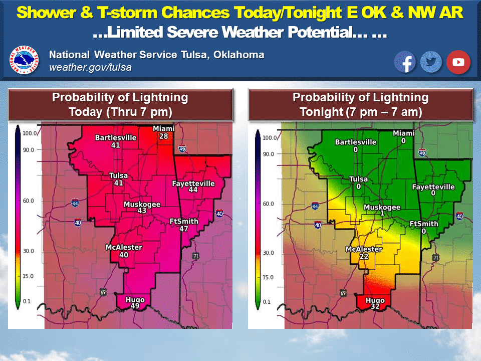
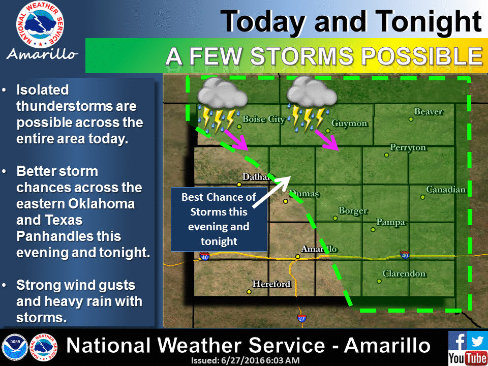
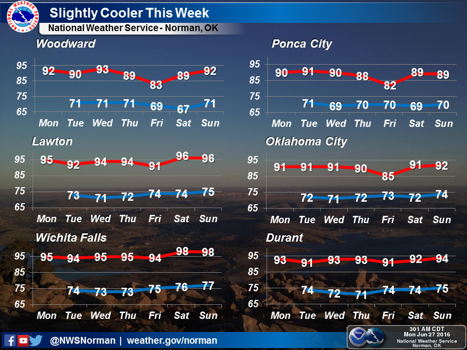
just a beginning. Here are some graphics from our local NWS partners showing us
those upcoming rain chances that MIGHT just nip this developing drought in the
bud.
The real show appears later in the week, however, as the upper-level high shifts
farther to the west and puts us in a more NW flow pattern with increased
rain chances yet again and a nice cooldown in time for the weekend.
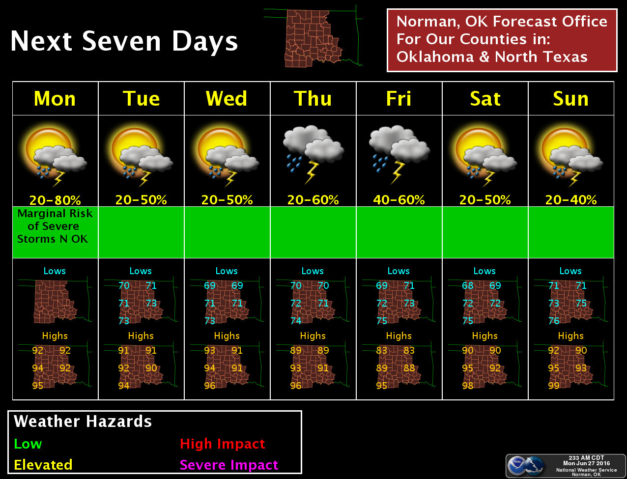

There's a chance severe weather might rear it's ugly head later this week, but
the NWS forecasters say flash flooding is more of a concern.
And now that I've spent so many paragraphs talking about rain, prepare for sunny
skies and highs in the hundreds instead. The jinx is on!
Gary McManus
State Climatologist
Oklahoma Mesonet
Oklahoma Climatological Survey
(405) 325-2253
gmcmanus@mesonet.org
June 27 in Mesonet History
| Record | Value | Station | Year |
|---|---|---|---|
| Maximum Temperature | 112°F | BUFF | 2012 |
| Minimum Temperature | 50°F | COOK | 2003 |
| Maximum Rainfall | 4.21 inches | KING | 2007 |
Mesonet records begin in 1994.
Search by Date
If you're a bit off, don't worry, because just like horseshoes, “almost” counts on the Ticker website!