Ticker for June 9, 2016
MESONET TICKER ... MESONET TICKER ... MESONET TICKER ... MESONET TICKER ...
June 9, 2016 June 9, 2016 June 9, 2016 June 9, 2016
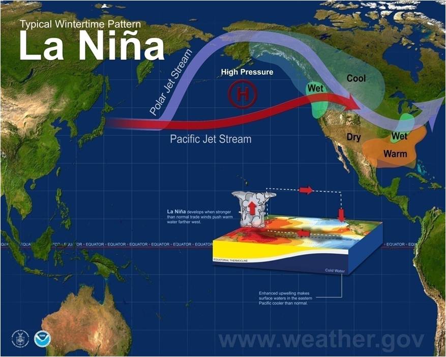
La Nina Watch continues

Yep, that's about as exciting as it gets for us climate folks...drought, El Nino,
La Nina and even the scintillating "ENSO neutral conditions!" No, this information
won't save your life in the next 15-30 minutes, but much like Clark Griswold's BB
Gun might eventually cause a nasty infection, the continued threat of La Nina
MIGHT have an impact on the state sometime later in the fall. That's why the
Climate Prediction Center continues with its La Nina Watch.
A La Nina watch is issued when La Nina conditions are favorable WITHIN THE NEXT
SIX MONTHS (play ominous music here). This follows the death of the "super" El
Nino that plagued the world over the last year or so. Quoting the CPC ENSO (El
Nino/Southern Oscillation -- a term that encompasses all three phases of the
irregularly periodical variation in winds and sea surface temperatures over the
tropical eastern Pacific Ocean) Diagnostic Discussion released this morning:
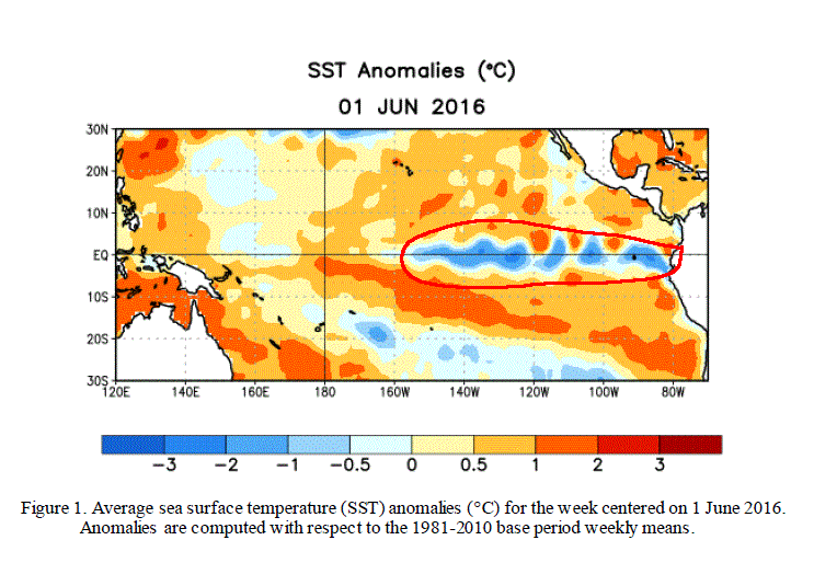
"El Ni?o dissipated and ENSO-neutral conditions returned during over the
past month, as indicated by the expansion of near-to-below average
surface temperatures (SST) across the eastern equatorial Pacific Ocean."
You can see this in figure one with the help of my electronic scribbling (hey,
I DO have the 64 color box of crayons...WITH built in sharpener):
Furthermore, from the CPC Diagnostic Discussion concerning the development of
La Nina:
"Many models favor La Ni?a (3-month average Ni?o-3.4 index less than
or equal to -0.5?C) by the Northern Hemisphere fall."

Now some of those models show La Nina forming by summer, others later into the
fall. Perhaps the most important info from the forecasters deals with the
strength of the possible La Nina:
"At this time, the forecasters are leaning toward a weak or borderline
moderate La Ni?a if an event were to form. Overall, ENSO-neutral
conditions are present and La Ni?a is favored to develop during the
Northern Hemisphere summer 2016, with about a 75% chance of La Ni?a
during the fall and winter 2016-17."
Weak to borderline moderate would be good news, although the impacts we see on
average across the Southern Plains (drier and warmer weather during the cool
season from fall through mid-spring or so) are generally more significant the
further south you go. Nevertheless, we do feel La Nina's impacts more often than
not when one does develop...not always, but it does tilt the odds.
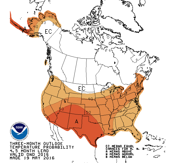
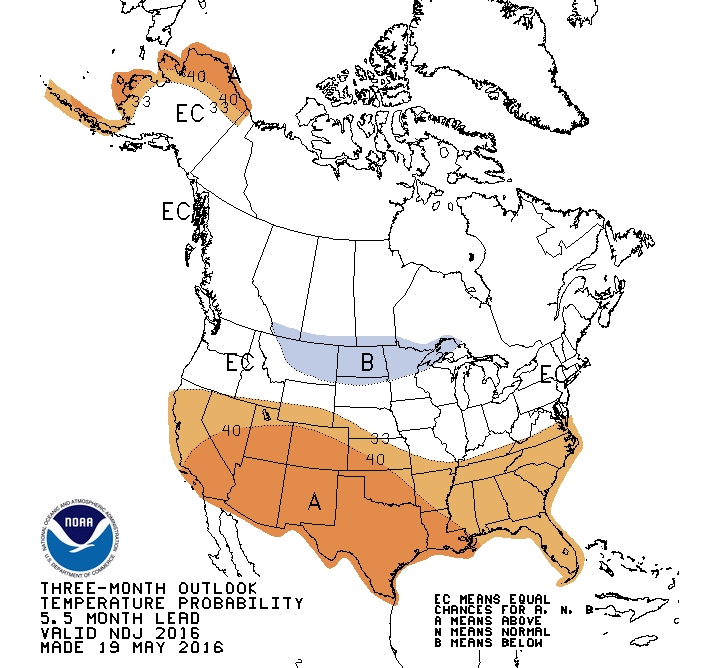
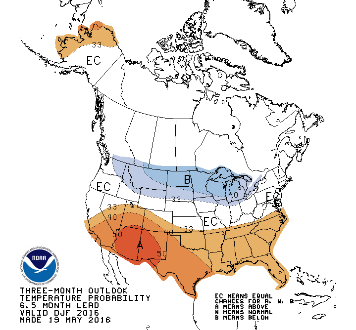
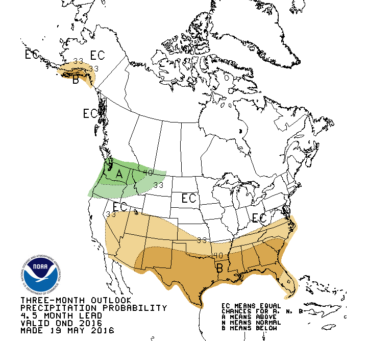
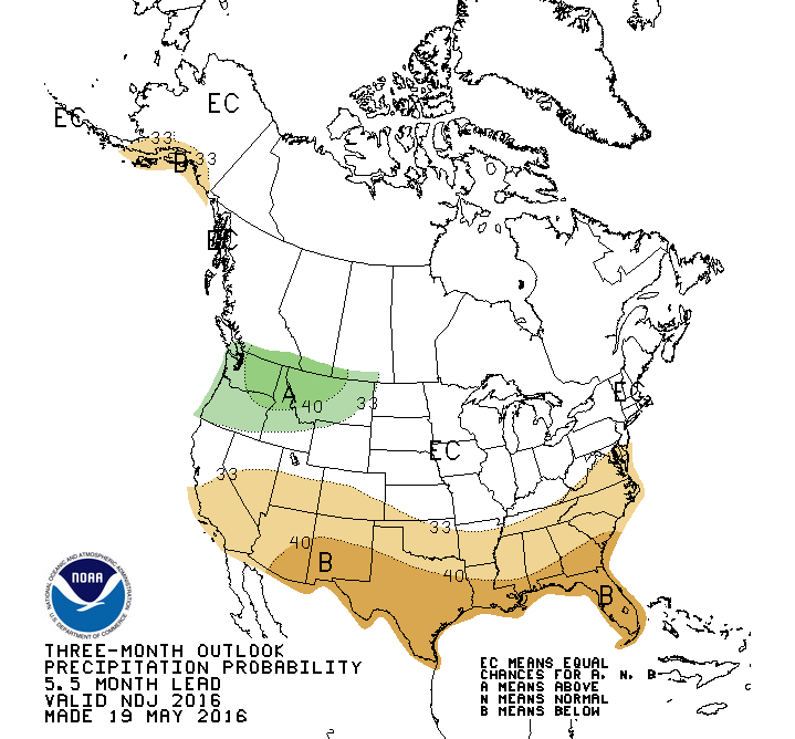
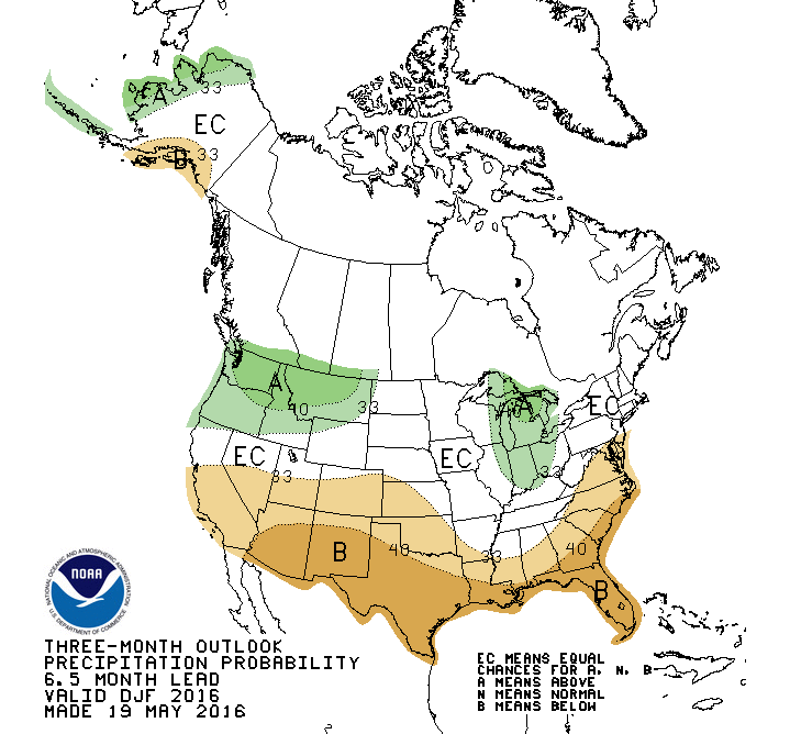
And the CPC temperature and precip outlooks are already starting to indicate
increased odds of those above normal temps and below normal moisture amounts
for the coming fall through winter.
The worry, of course, is that we'll see our typical Oklahoma summer which means
a nice drying out of the vegetation and soils, perhaps some evaporative draw-down
of our reservoirs. To add to that worry, the last two summers that followed
strong El Ninos in similar oceanic conditions, 1982-83 and 1997-98 (so the
summers of 1983 and 1998), not pleasant. The 1983 summer was fairly normal in
temps and very dry while the summer of 1998 was just plain nasty hot and dry.
Here is a composite of those two summers' temperature and precip anomalies.

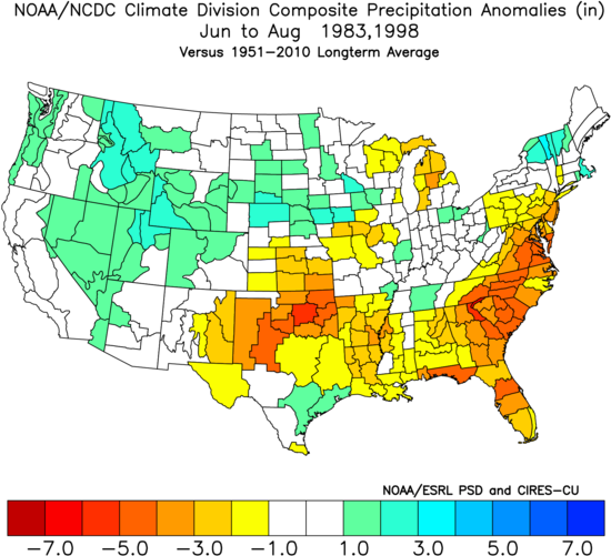
That's only a sample size of two, so definitely not a strong correlation
implied, but if a summer like that occurs (and June is off to a bad start) and
then we go right into a La Nina-induced drought during the cool season, the
impacts will start to add up.
That's similar to what occurred with the beginning of the 2010-15
Southern Plains drought with a flash drought in the summer of 2010, a brief
recovery in the early fall, then the start of the worst drought Oklahoma has
seen in the last 50 years in October thanks to a strong La Nina. The point being,
if we can keep this event a bit weaker, those types of worries are lessened.
And without getting into the hairy (I HEARD THAT!) details, some of the other
oceanic factors that worked in unison with that 2010-12 La Nina to worsen its
impacts are not there (cold phase of the Pacific Decadal Oscillation {PDO}, warm
phase of the Atlantic Multi-decadal Oscillation {AMO}), so that's another plus
in our favor. We can go over the PDO and AMO stuff in another Ticker, but I
don't want to acronym you to death this morning.
However, the La Nina watch was issued for a reason, and despite it's forecast
strength being somewhat lesser and other factors seemingly playing in our favor,
we still have to be cognizant of its disruptive presence to agriculture and
water resources in Oklahoma.
So be alert! In 6 months or so, it might be time to act.
Turn around if you want, you have 6 months. Stay climate aware if you can
remember that far ahead. Only YOU can prevent forest...wait, that's something
else.
Gary McManus
State Climatologist
Oklahoma Mesonet
Oklahoma Climatological Survey
(405) 325-2253
gmcmanus@mesonet.org
June 9 in Mesonet History
| Record | Value | Station | Year |
|---|---|---|---|
| Maximum Temperature | 104°F | ALTU | 2011 |
| Minimum Temperature | 43°F | EVAX | 2020 |
| Maximum Rainfall | 5.12 inches | BOWL | 2008 |
Mesonet records begin in 1994.
Search by Date
If you're a bit off, don't worry, because just like horseshoes, “almost” counts on the Ticker website!