Ticker for May 26, 2016
MESONET TICKER ... MESONET TICKER ... MESONET TICKER ... MESONET TICKER ...
May 26, 2016 May 26, 2016 May 26, 2016 May 26, 2016
Summertime summertime sum sum summertime
I REFUSE TO TALK ABOUT SEVERE WEATHER TODAY! I'm tired of it.
Hey, you wonder why we're having so much severe weather?
DOH! Oh well, let's run with it. We have a storm system to our west and tons of
moisture and heat in place for that storm system to tap into. Nothing shows
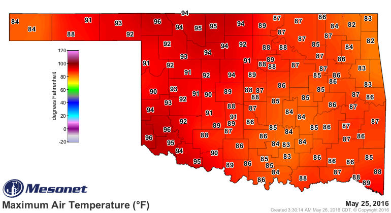
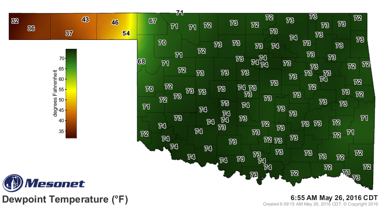
that better than the Mesonet's air temps, heat index and dewpoint maps. Check
out yesterday's.
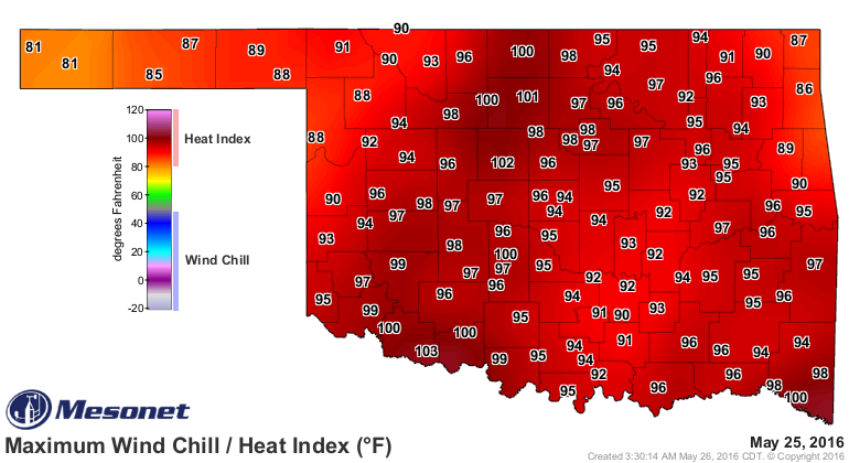
100s in the heat index already? ARE YOU SERIOUS? Now everybody knows I'm a warm
weather admirer, very much so, but hailing (no hail, please) from the dry environs
of the Panhandle, I hate the moisture. I also hate trees, non-red dirt and large
bodies of water, but that's a story for my therapist. There's so much moisture
that our lows can't even manage to get down into the 60s at night, as evidenced
by the low temperature map this morning.
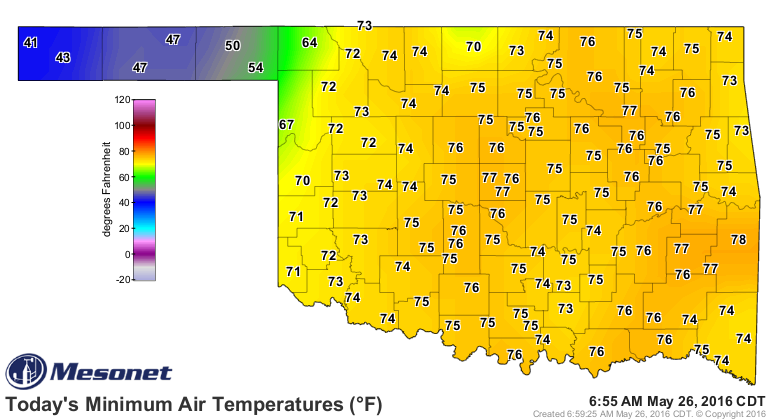
Notice the 40s and 50s out in the dry air of the Panhandle, behind the dryline?
Otherwise, those 70s are in July territory. You can even see the Urban Heat
Island effect on those stations around OKC and Tulsa as those gigantic areas
of concrete exude heat throughout the night (reminder: talk to therapist about
gigantic areas of concrete).
But that dryline is the problem, as are other boundaries of air hanging around
(e.g., outflow boundaries, a warm front, etc.), since they become foci for
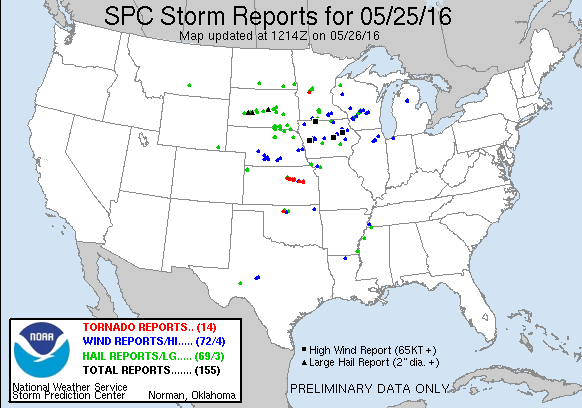
storms to form upon. That was the case last night as a very large storm went up
just to the NW of Enid and quickly started rotating, dropping several tornadoes
that made for an intense couple of hours for those residents.
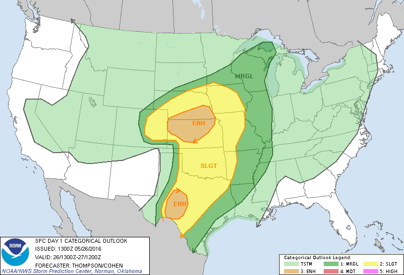
Okay, as far as that severe weather goes, same for today...there will be a
chance of storms today, some will probably become severe, and there could be
a tornado or two here or there. But in truth, we're a bit lucky the main
"energy" of this system remains to our north where Nebraska and Kansas are
expected to take it on the chin once again.

There is still lots of uncertainty, however, as noted by the Storm Prediction
Center forecasters (I'll translate where needed) last night:
"NARROWING DOWN TIMING AND SPECIFIC LOCALES OF GREATEST RISK
REMAIN DIFFICULT (at this time)...WITH AN ARRAY OF THE LATEST
MODELS EXHIBIT(ing) DIVERSE/DISPARATE SOLUTIONS
REGARDING CONVECTIVE TIMING/INITIATION/PROGRESSION. THOUGH THE
ENVIRONMENT APPEARS SUPPORTIVE OF RISK FOR VERY LARGE
HAIL...DAMAGING WINDS...AND A FEW TORNADOES...DETAILS PRECLUDE ANY
FURTHER SPECIFICATION ATTM."
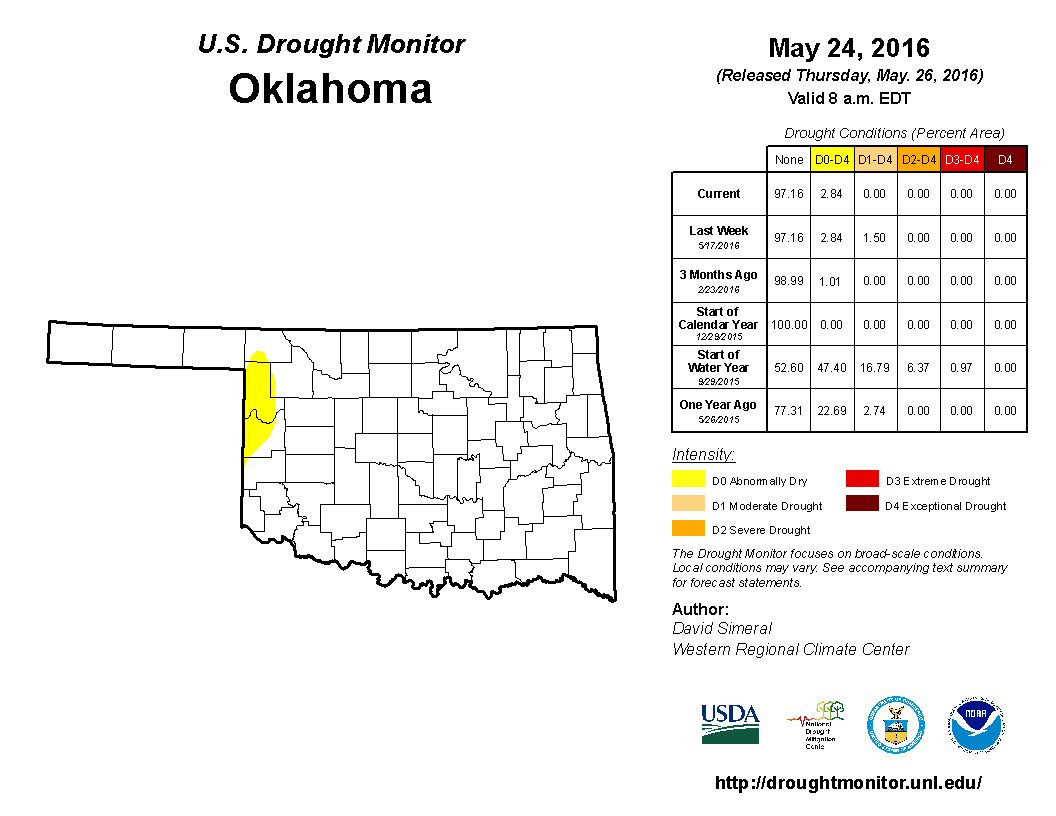
One thing we have seen from this whole episode is rain, and that has finally
wiped out the last vestiges of drought from withing the state's borders. All
we are left with is a bit of D0 (abnormally dry) conditions in far western OK.
D0, as you know, is not a drought designation but signals areas going into our
coming out of drought. The latter holds in this case.
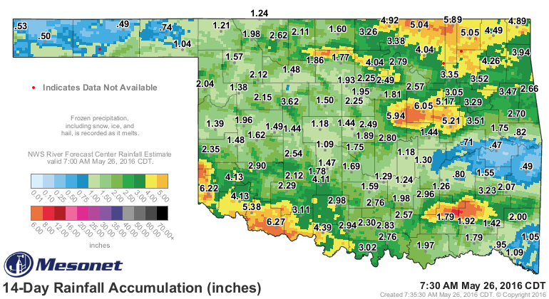
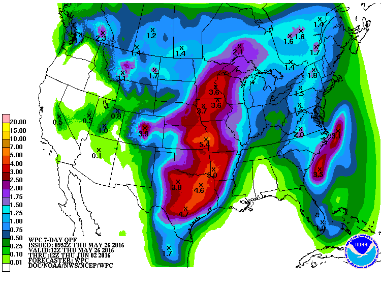
And more rain is on the way, although these totals are very tenuous and should
just be considered "potential" since we're talking convective rains here. In
other words, these rainfall totals are very dependent upon where and how many
storms form.
As for that severe weather I'm not going to talk about, well, tomorrow could
severe too. As well as next week (pick a day, any day).
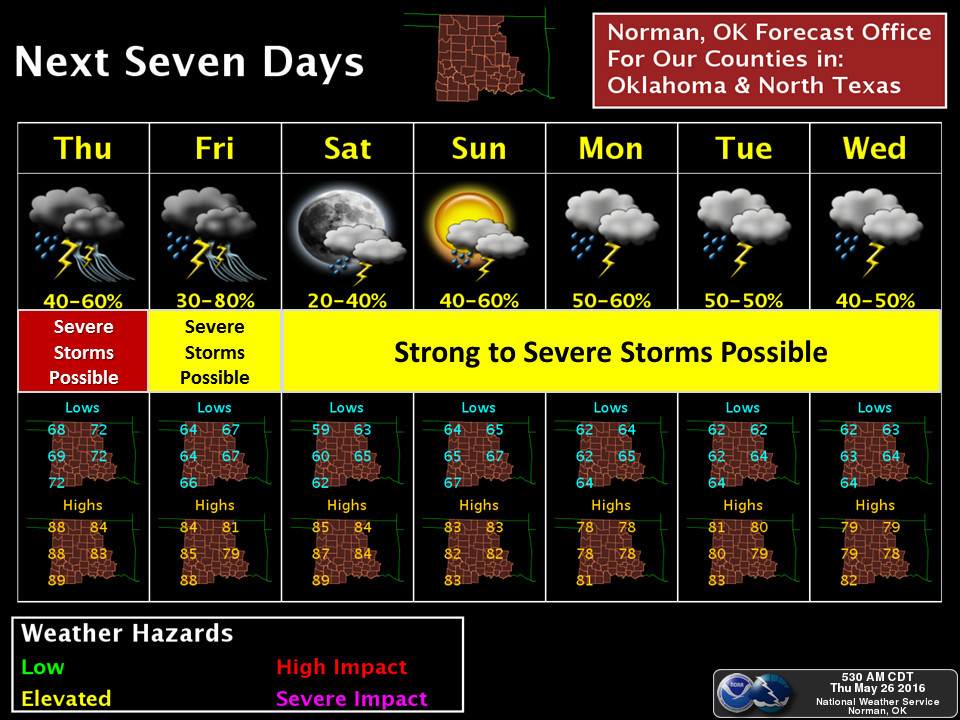
Take a look at those temperatures, though. Our brush with summer will be short
lived. Dangit.
Gary McManus
State Climatologist
Oklahoma Mesonet
Oklahoma Climatological Survey
(405) 325-2253
gmcmanus@mesonet.org
May 26 in Mesonet History
| Record | Value | Station | Year |
|---|---|---|---|
| Maximum Temperature | 101°F | HOOK | 2006 |
| Minimum Temperature | 37°F | KENT | 2011 |
| Maximum Rainfall | 5.26 inches | HINT | 2000 |
Mesonet records begin in 1994.
Search by Date
If you're a bit off, don't worry, because just like horseshoes, “almost” counts on the Ticker website!