Ticker for May 5, 2016
MESONET TICKER ... MESONET TICKER ... MESONET TICKER ... MESONET TICKER ...
May 5, 2016 May 5, 2016 May 5, 2016 May 5, 2016
Sink-o de Drought-o
It took awhile since last week we were in ARMAGEDDON-TORNADO-POCALYPSE 2016 mode
when it came time to send in recommendations to the U.S. Drought Monitor, but
we finally have some movement on Oklahoma's rendition. Check out this nice looking
map...full of lovely white colors with just a few unsightly blemishes across north
and western OK.

That seems to follow along pretty will with our rainfall patterns over the last
30 days out to 4 months or so.
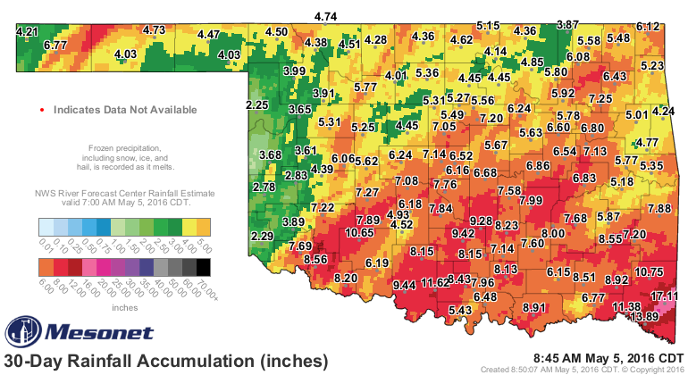
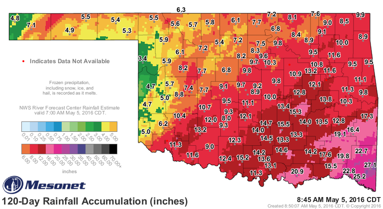
Now everybody has gotten SOME rainfall over those periods, but obviously the
southeastern half of the state has gotten more of the moisture. But we're starting
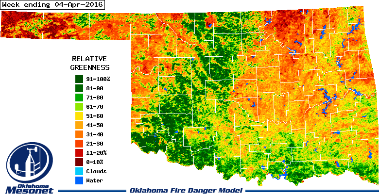
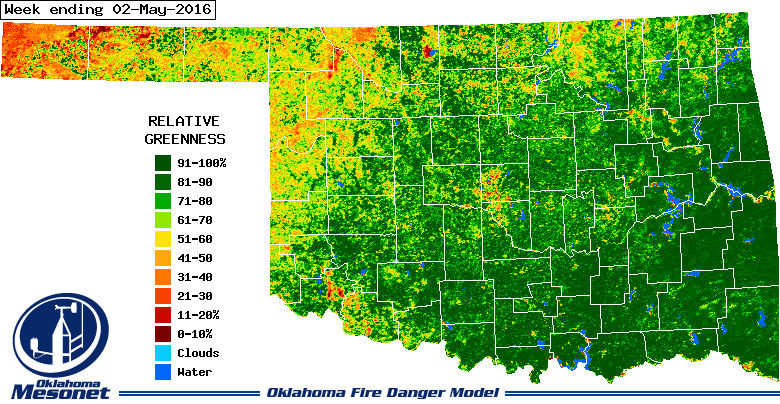
to do well with all those short-term drought impacts starting to fade, such as
the extended wildfire season. The rain has really made short work of the dry/dead/
dormant vegetation in the last month.
Long-term deficits are hard to define and pinpoint, but low farm ponds and
sparsely vegetated pastures are just a few that we've heard of from parts of
NW OK. In those areas, a close watch is going to be needed since those long-term
background impacts (and sometimes foreground) will make it easier to slip
back into drought.
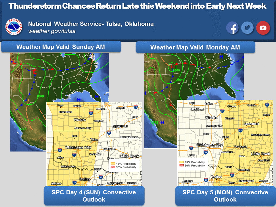
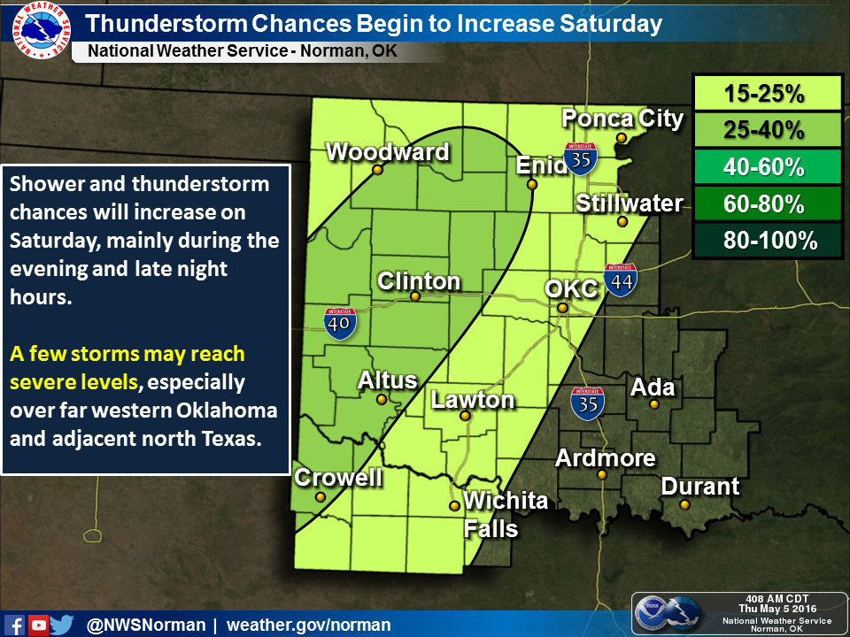
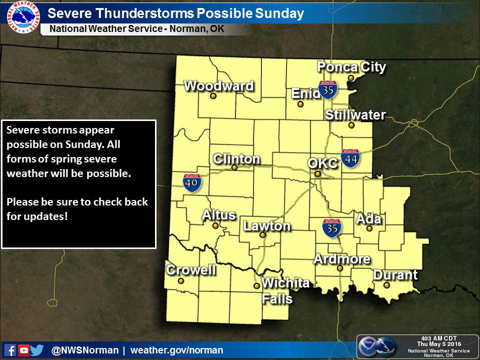
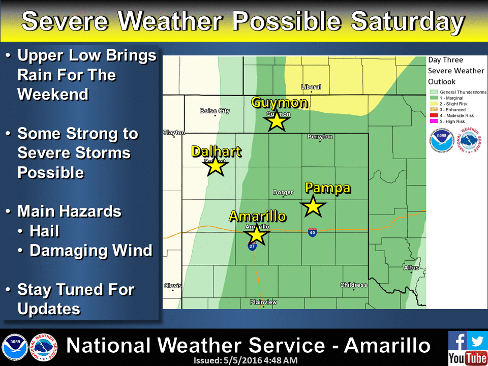
Now we turn our attention back to later this weekend for our next chance of rain
and unfortunately, severe weather. We'll rely upon our NWS friends to describe
that a bit better. Sunday and Monday look to be days we need to be weather aware.
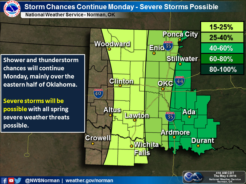
Not exactly up to the standards of April's rainfall totals, but as expected,
the eastern half of the state looks to receive more of the moisture.
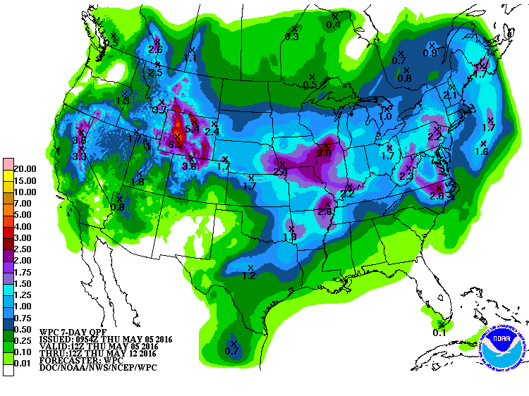
Just a weeeeee bit more rain and we can wipe some more colors off that map.
Weeeeee is debatable, but that's Mother Nature's job.
Gary McManus
State Climatologist
Oklahoma Mesonet
Oklahoma Climatological Survey
(405) 325-2253
gmcmanus@mesonet.org
May 5 in Mesonet History
| Record | Value | Station | Year |
|---|---|---|---|
| Maximum Temperature | 106°F | ALTU | 2012 |
| Minimum Temperature | 29°F | KENT | 2013 |
| Maximum Rainfall | 4.13 inches | WEB3 | 2022 |
Mesonet records begin in 1994.
Search by Date
If you're a bit off, don't worry, because just like horseshoes, “almost” counts on the Ticker website!