Ticker for May 2, 2016
MESONET TICKER ... MESONET TICKER ... MESONET TICKER ... MESONET TICKER ...
May 2, 2016 May 2, 2016 May 2, 2016 May 2, 2016
April Sees Active Weather Ignite
It's ye olde monthly summary press release time, turned into Ticker fodder. Enjoy.
Or don't. I suggest the former but expect the latter.
***
Fears of the strengthening drought and associated wildfire danger, so prevalent
through the first three months of the year, lasted about a week into April before
Mother Nature unleashed spring on Oklahoma. Flooding, gigantic hail, severe winds
and a final week filled with the threat of tornadoes were all in the offing during
the month. The drought was quenched in most parts of the state by repeated storm
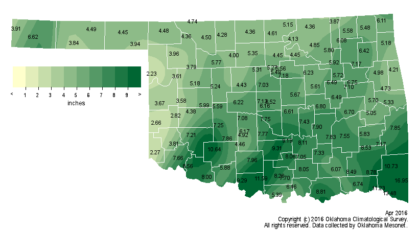
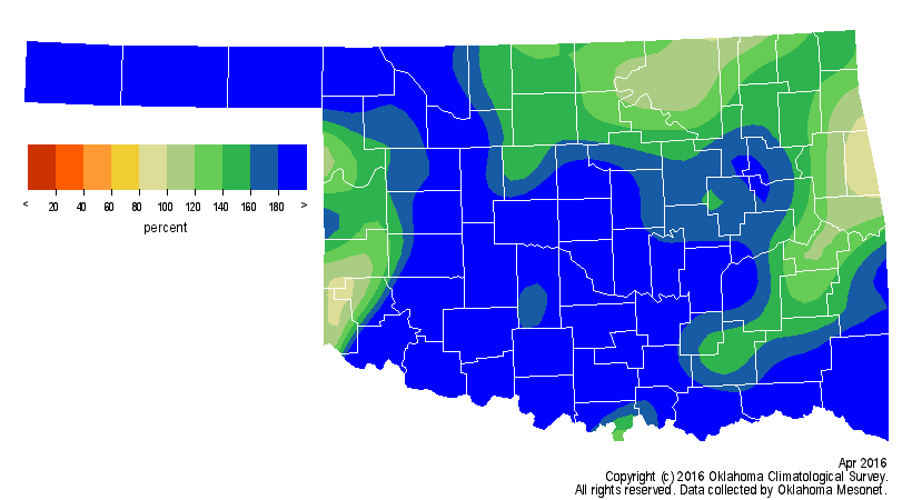
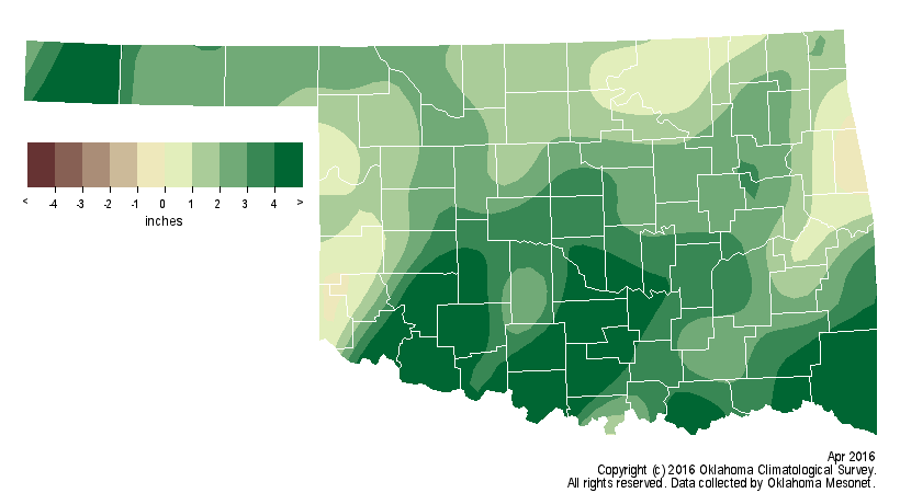
systems. According to preliminary data from the Oklahoma Mesonet, the robust
moisture propelled April to rank as the seventh wettest on record, dating back to
1895. The statewide average of 6.11 inches was nearly 3 inches above normal.
Regional ranks ranged from the third wettest April for southwestern Oklahoma to
the 27th wettest in east central parts of the state. Broken Bow led the
Mesonet?s totals with 16.95 inches while Arnett had a more modest 2.23 inches.
A few pockets in far western and east central Oklahoma had below normal rainfall
and remained a concern for droughty conditions due to deficits that date to the
beginning of the year.
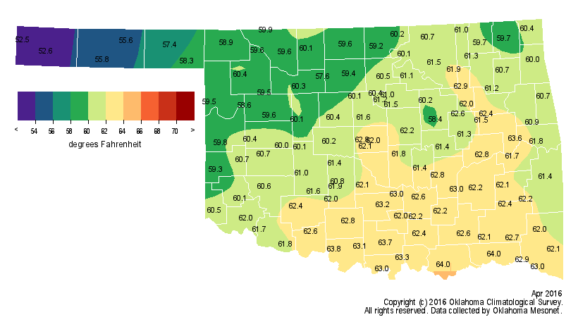
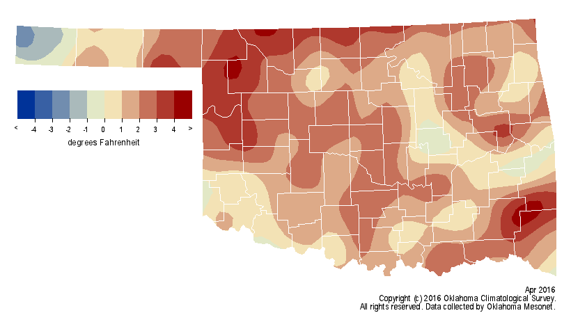
The month was also the 39th warmest April on record at 1.5 degrees above normal.
Altus recorded a statewide high of 92 degrees on the 25th. Boise City recorded
the last freeze of the month with 32 degrees on the 18th.
Despite the gaudy statistics, the real star of the month was the extreme and
sometimes violent weather. Wildfires during that dry first week dominated the
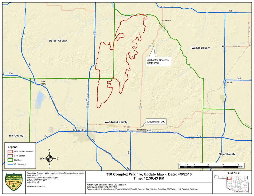
headlines, and none more so than the ?350 Complex Fire? in northwest Oklahoma.
The fire began on April 5 and burned uncontrolled for days despite the efforts
of fire crews, some from as far away as Tennessee. Emergency management
personnel estimated damages at $2.3 million from the fire as it scorched nearly
90 square miles in Woodward and Harper counties.
The weather became much more exciting following that point with a cavalcade of
powerful storm systems. Torrential rains fell from the 10th through the 20th,
particularly across southern Oklahoma and the western Panhandle. Cimarron County
saw severe flooding from 3-6 inches in some areas, nearly a third of their
normal annual total.
Two confirmed weak tornadoes touched down near Eva in Texas County on April 15,
damaging a couple of farmhouses and out buildings. A few days of nice weather
followed from the 21st through the 25th before severe weather erupted again on
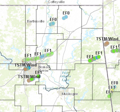
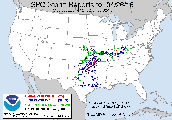
the heels of two consecutive storm systems. The first on the 26th dropped at
least eight confirmed tornadoes from across the state according to local
National Weather Service (NWS) offices, although all were considered weak
tornadoes rated at EF-0 or EF-1 intensity. Nevertheless, the twisters and
associated straight-line winds were quite damaging to power infrastructure,
trees, residences and businesses. Flash flood warnings were issued for some of
the storms, and hail to the size of golf balls was reported.
Finally, the month closed out with another storm system on the 29th. Tornadic
supercells were once again on the agenda, forming in southwestern Oklahoma
before marching to the east and northeast. At least three confirmed tornadoes
touched down according to NWS survey teams, but that preliminary number could
go higher as more investigations are conducted.
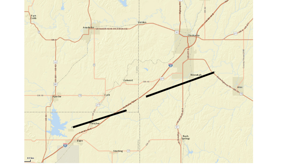
As with the twisters previously in the week, the confirmed tornadoes were all
of the weak variety, but still damaging. Large hail was widespread with this
round of storms. Ice to the size of grapefruits fell in Comanche County, with
several other reports of baseball size hail or larger scattered around the
state. More flooding occurred, especially across southeastern Oklahoma. The
Mesonet site at Broken Bow recorded 8.73 inches of rain on the 29th, and
several other southeastern Mesonet sites saw more than 4 inches.
The May temperature outlook from the NWS? Climate Prediction Center sees
increased odds of below normal temperatures for the western two-thirds of the
state, with the highest odds across the western one-half.

The precipitation outlook is bullish on above normal precipitation across all
of Oklahoma, but especially the southwestern two-thirds.

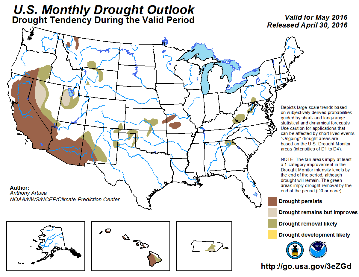
CPC?s May drought outlook indicates Oklahoma?s already diminishing drought is
expected to be eradicated by the end of the month.
Gary McManus
State Climatologist
Oklahoma Mesonet
Oklahoma Climatological Survey
(405) 325-2253
gmcmanus@mesonet.org
May 2 in Mesonet History
| Record | Value | Station | Year |
|---|---|---|---|
| Maximum Temperature | 105°F | ALTU | 2020 |
| Minimum Temperature | 24°F | BOIS | 2013 |
| Maximum Rainfall | 4.04 inches | HASK | 2022 |
Mesonet records begin in 1994.
Search by Date
If you're a bit off, don't worry, because just like horseshoes, “almost” counts on the Ticker website!