Ticker for April 29, 2016
MESONET TICKER ... MESONET TICKER ... MESONET TICKER ... MESONET TICKER ...
April 29, 2016 April 29, 2016 April 29, 2016 April 29, 2016
Here we go again!
Once more unto the breach, dear friends! There will be a *CHANCE* of significant
severe weather today across most of Oklahoma, but especially southern OK where
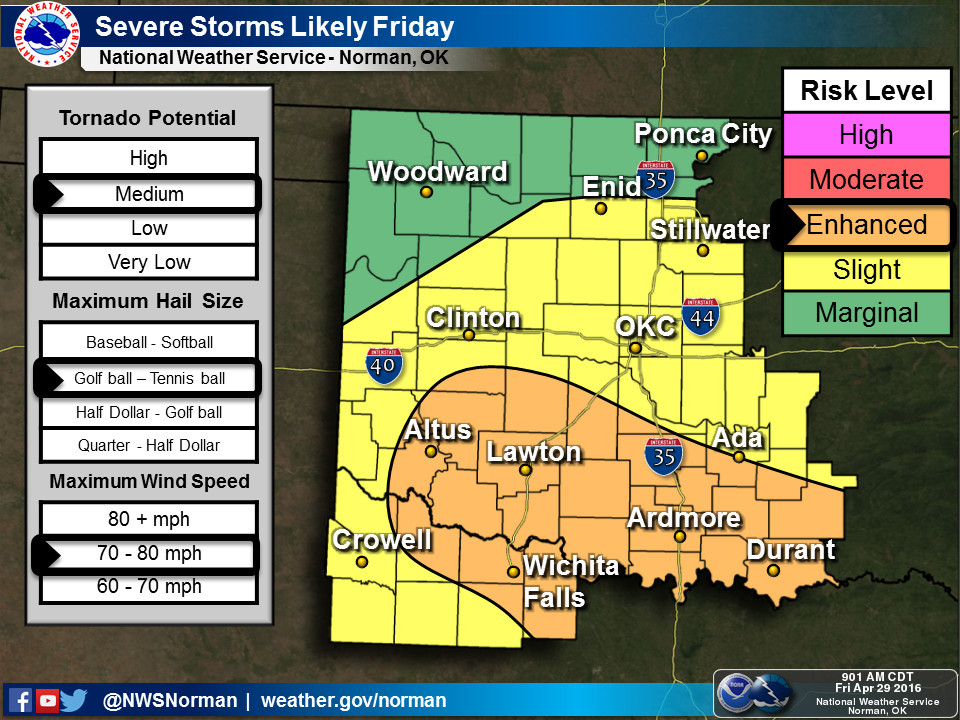
the SPC has an "enhanced" chance of categorical risk today.

Now once again this severe weather risk is conditional...depending on whether
a warm front can make it up this far north, whether convection and showers
ongoing now "mess up" the environmental variables for later today when the risk
is possibly greater, and the track of the surface low and associated boundaries
as the storm system moves across. Quoting SPC (their yelling, not mine):
"FARTHER N ACROSS THE RED RIVER VALLEY AND ARKLATEX REGION INTO
OK...NWD ADVANCE OF THE WARM FRONT REMAINS UNCERTAIN...LIKELY
HINDERED AT LEAST THROUGH THE MORNING BY ONGOING
CONVECTION/CLOUDINESS/OUTFLOW. WITH THAT SAID...SEVERAL CAM RUNS
DEPICT ONGOING CONVECTION OVER THE ERN OK/WRN AR AREA EVENTUALLY
DEPARTING EWD...POSSIBLY ALLOWING THE WARM FRONT TO SHIFT INTO SRN
OK -- ALONG WITH AT LEAST SOME HEATING/DESTABILIZATION. GIVEN
FAVORABLE LOW-LEVEL SHEAR (near) THE LOW/WARM FRONT...RISK FOR
TORNADOES WOULD APPEAR MAXIMIZED. THUS...WILL ADJUST WRN PORTIONS
OF THE ENH RISK AREA SWD -- TO WHERE THE WARM FRONT IS CURRENTLY
EXPECTED TO RESIDE.
WITH TIME...STORMS SHOULD SPREAD ACROSS SRN OK AND NRN/CENTRAL TX
AND INTO THE ARKLATEX AND TX COASTAL PLAIN THROUGH THE AFTERNOON AND
EVENING...WITH LARGE HAIL AND DAMAGING WINDS ACCOMPANYING THE
STRONGER STORMS IN ADDITION TO SOME TORNADO RISK."
Now don't let that verbiage scare you. That's meteorologist-ese for "if all
the variables come together perfectly, things could get nasty, sorta-nasty, or
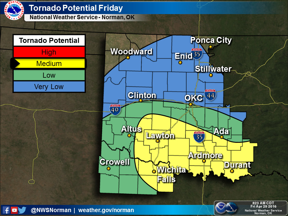
just unpleasant." When you see the different severe mode probabilities, you'll
notice that the tornado threat is much lower than Tuesday, and while the hail
threat is as well, that's what's really driving this enhanced risk area.
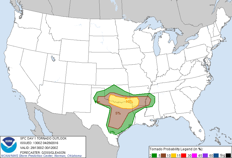
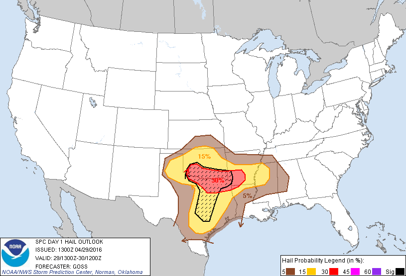
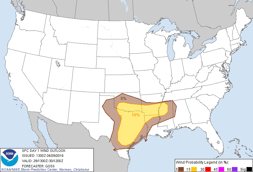
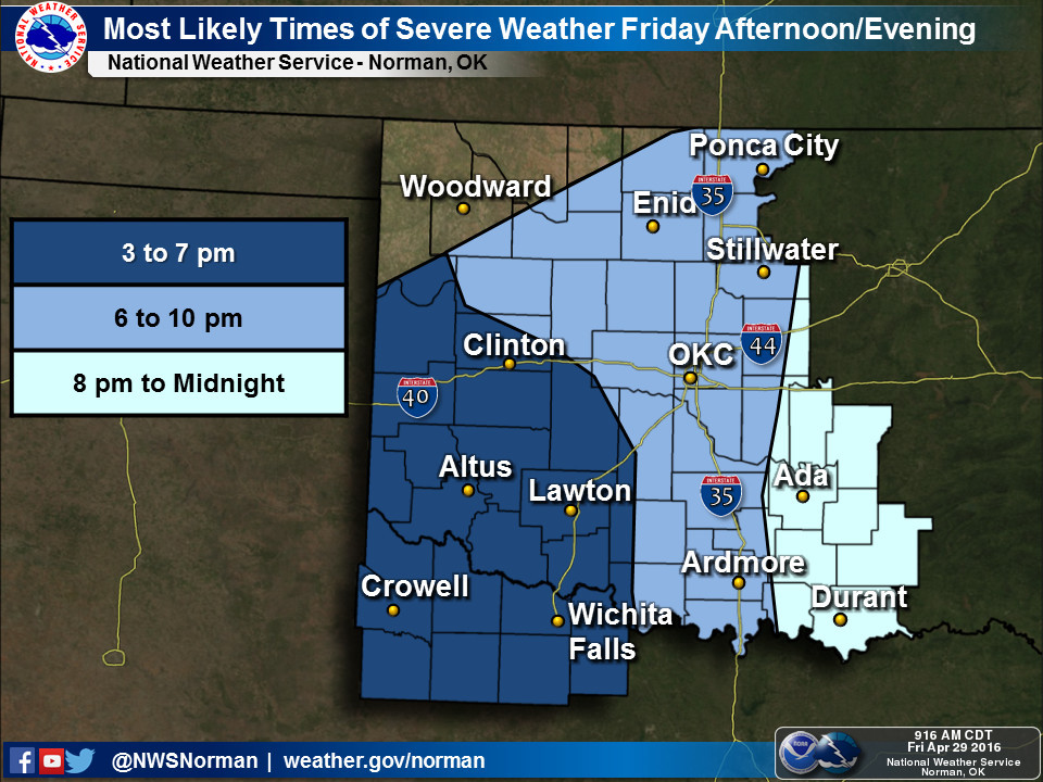
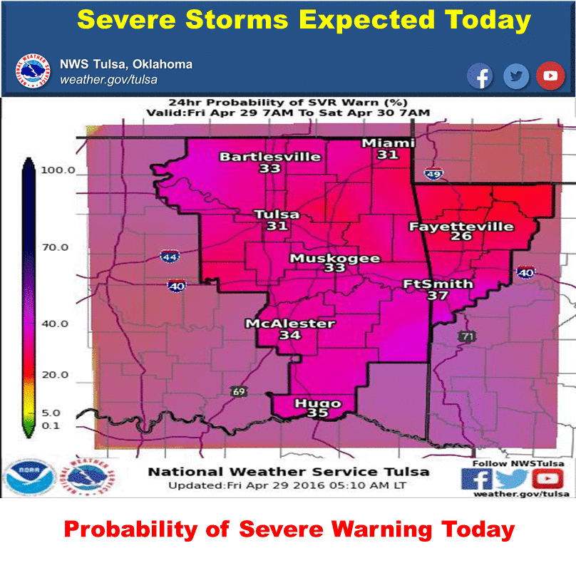
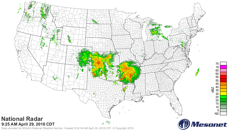
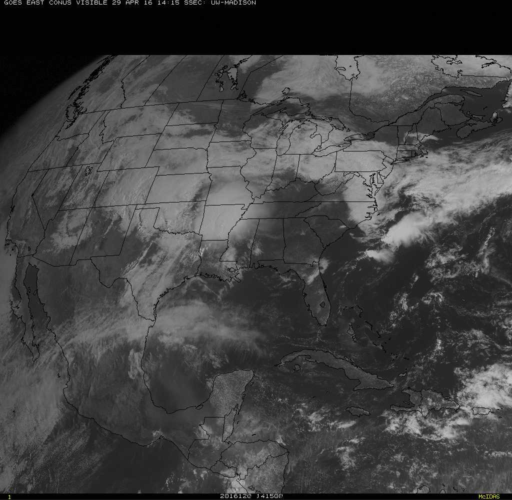
Here are some graphics from our friends at the local NWS offices to help us
out.
Notice that convection is ongoing across the western half of the state right now
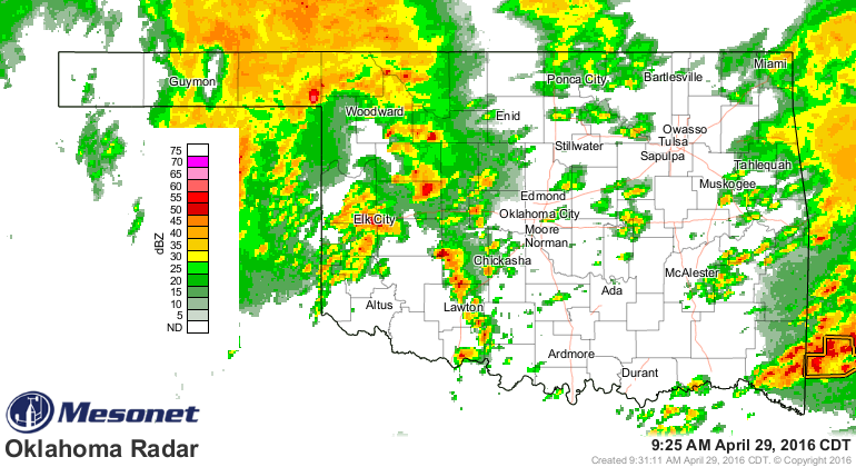
but not much down across N Texas, which is where we would get benefit in the
disruption of our severe chances later this afternoon.
And there is some indication of clearing of the skies in NW Texas.
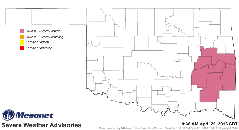
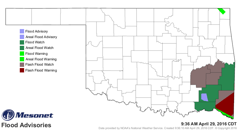
Now none of this precludes some severe weather in the storms going on now across
both western and far SE OK. In fact, there is a severe thunderstorm watch right
now for the SE, and also lots of flash flood warnings as well as a watch.
So the key points? Stay weather aware and keep checking in with your favorite
severe weather source on an hourly basis because that's how quickly this can
evolve, all thanks to our erstwhile warm front that's just across the border in
Texas right now.
Springtime in Oklahoma. Fun fun fun.
Gary McManus
State Climatologist
Oklahoma Mesonet
Oklahoma Climatological Survey
(405) 325-2253
gmcmanus@mesonet.org
April 29 in Mesonet History
| Record | Value | Station | Year |
|---|---|---|---|
| Maximum Temperature | 100°F | ALTU | 2022 |
| Minimum Temperature | 31°F | KENT | 2017 |
| Maximum Rainfall | 12.42 inches | BURN | 2009 |
Mesonet records begin in 1994.
Search by Date
If you're a bit off, don't worry, because just like horseshoes, “almost” counts on the Ticker website!