Ticker for March 23, 2016
MESONET TICKER ... MESONET TICKER ... MESONET TICKER ... MESONET TICKER ...
March 23, 2016 March 23, 2016 March 23, 2016 March 23, 2016
It's deja vu all over again!
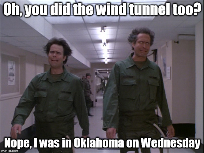
Okay, now Mother Nature is just messing with us. This Wednesday is nearly the
exact same setup we saw for Wednesday, November 9 of last year...so much so I
don't even need to change the meme!
And I quote the Ticker for that day:
"Here we go again. Another week, another strong storm system approaching
from the west bringing us a grab-bag of weather wonders. Once again
we'll have a dryline/cold front type situation setting up for...Wednesday,
a chance of rain (again, east over west probably), a chance of high
wildfire danger, and a chance for severe weather."
So let's go through the checklist.
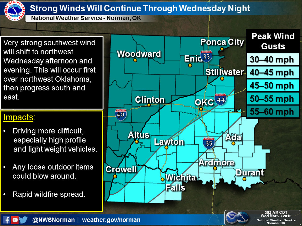
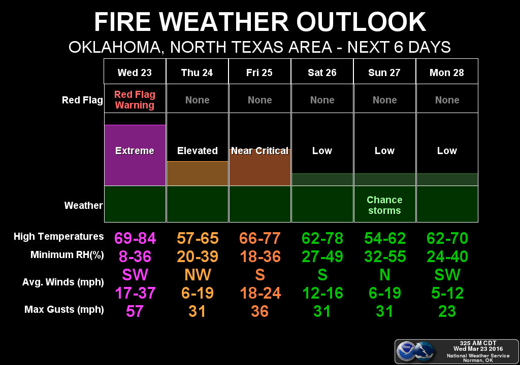
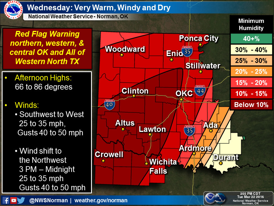
1) Storm system approaching from the west with dryline/cold front type situation.
Check. The dryline is already mixing out through far NW OK and will continue to
make an eastward push later today into central and even eastern Oklahoma. The
cold front follows soon thereafter with strong SW winds switching over to
strong NW winds. The lower dewpoints signifies the dry air and the progression
of the dryline.

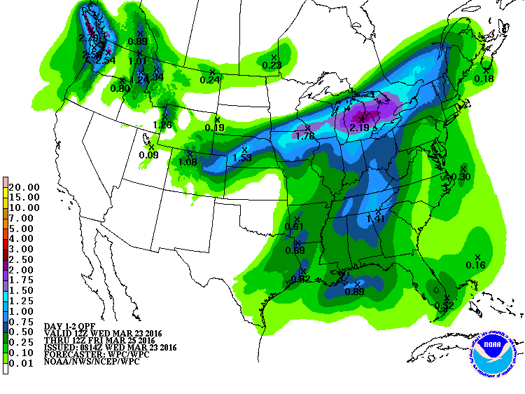
2) A chance of rain (again, east over west probably).
Check, although this one is kind of iffy. We're going to need the moisture to
return fast enough to fire off some storms in eastern Oklahoma as the dryline
pushes through. But hey, the east over west part looks spot on! For the western
4/5ths of the state...you're rain gauge will more likely be filled with dust
rather than water.
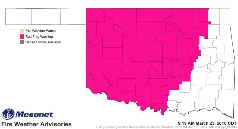
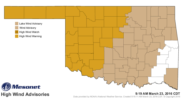
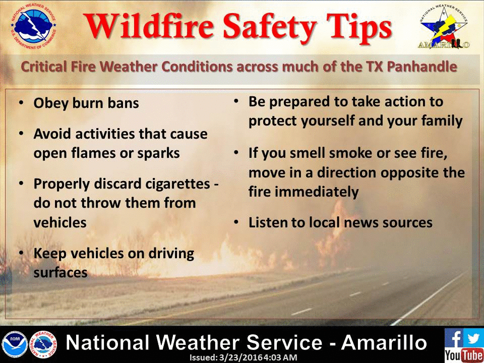
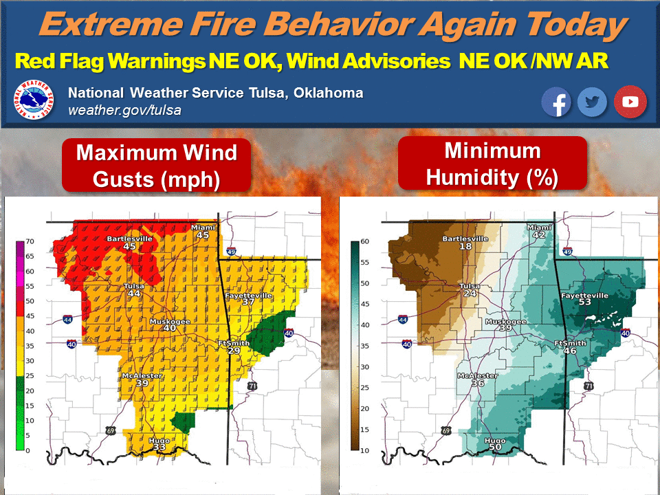
3) A chance of high wildfire danger.
Duh. We could have written that part for more than half of the days since
January! Most of the state is a powder keg waiting to go off and warrants a
Red Flag Fire warning, meaning DO NOT BURN ANYTHING OUT DOORS! And no flinging
your cigarette butts out of your cars, be careful about pulling off the road
into higher vegetation lest your catalytic converters spark a blaze, and be
careful of welding and other sparky activities. And don't drive into smoke!
Turn around, don't wreck (or burn).
We're going to see winds gusting to over 60 mph in the west through the night
with a wind shift as the front comes through. Between the dryline and the front
we'll see those relative humidity values crash and with the high temps and winds,
any fires that start are almost guaranteed to get out of control. Fire crews are
going to have to be especially careful as the wind shift with the front could
put them on the wrong side of an advancing fire.
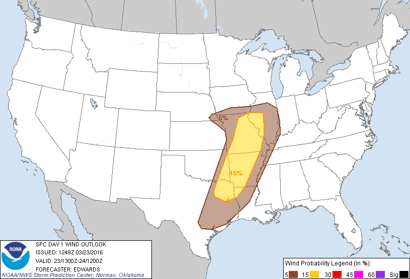
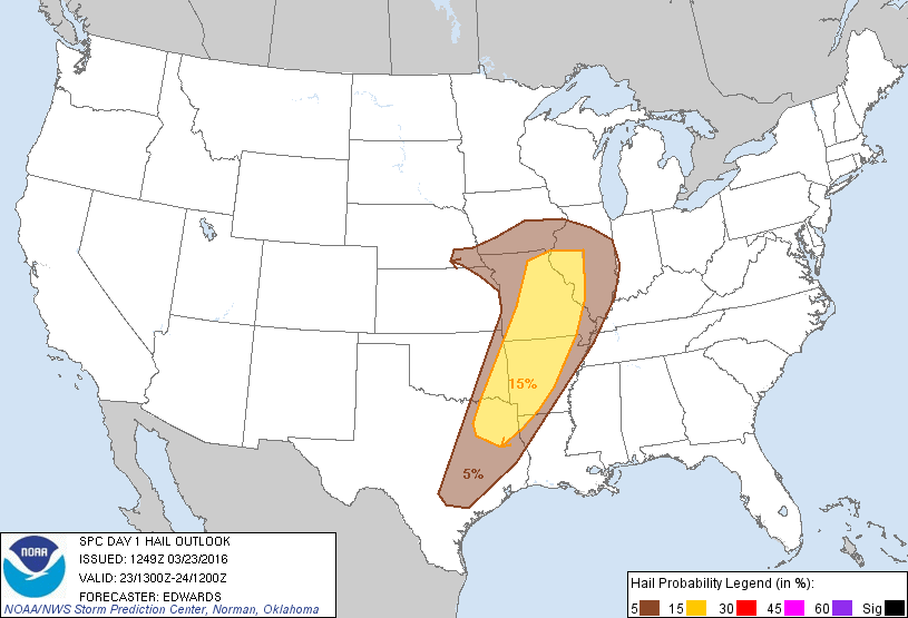
4) A chance of severe weather.
Check, but again, kind of a stretch. We will just have to see if enough moisture
can make it back into the state to interact with that dryline across far E OK
to kick off some storms. A bit of rain, but also severe t-storm winds and large
hail will be possible. Keep in mind that the winds across western Oklahoma will
be gusting to above severe limits (57 mph) at times, so damage due to wind is
possible outside of any thunderstorm area.
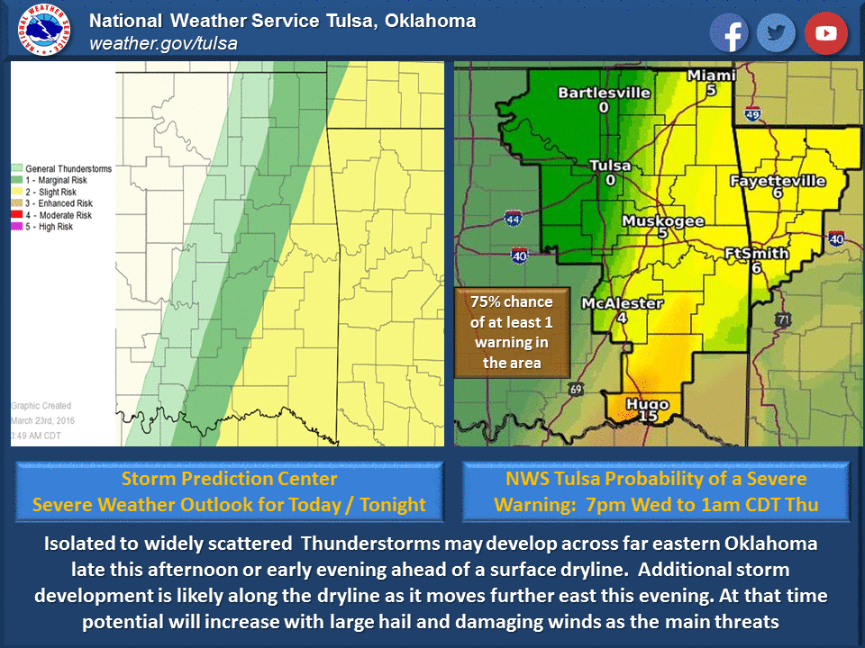
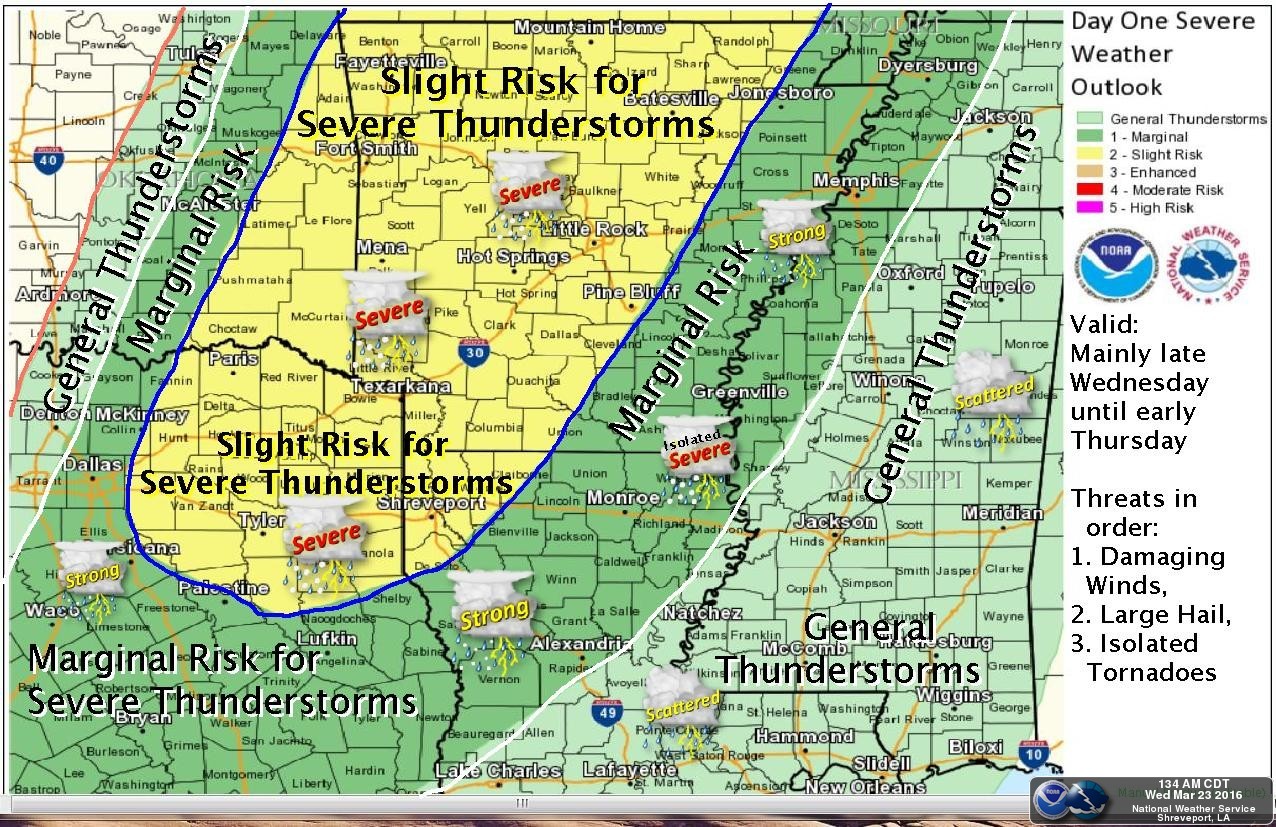
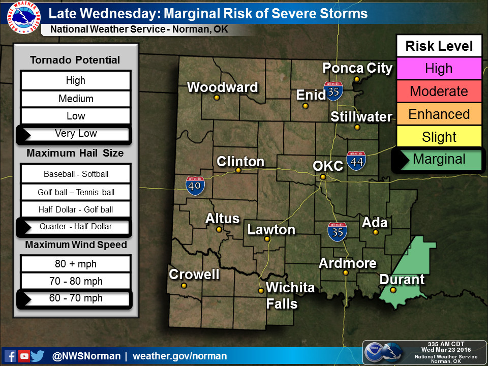
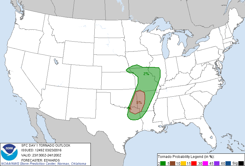
The tornado threat is low, but not zero.
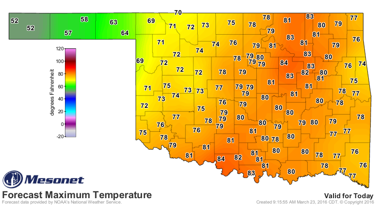
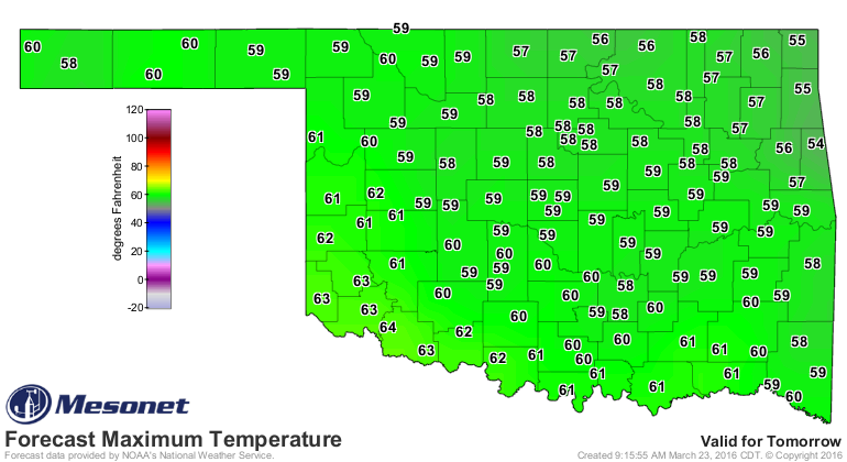
Back to a colder reality tomorrow. I would say enjoy today's 70s and 80s, but
with the winds, just forget it.
Gary McManus
State Climatologist
Oklahoma Mesonet
Oklahoma Climatological Survey
(405) 325-2253
gmcmanus@mesonet.org
March 23 in Mesonet History
| Record | Value | Station | Year |
|---|---|---|---|
| Maximum Temperature | 95°F | BEAV | 2018 |
| Minimum Temperature | 17°F | BOIS | 2013 |
| Maximum Rainfall | 3.91 inches | INOL | 2023 |
Mesonet records begin in 1994.
Search by Date
If you're a bit off, don't worry, because just like horseshoes, “almost” counts on the Ticker website!