Ticker for March 24, 2016
MESONET TICKER ... MESONET TICKER ... MESONET TICKER ... MESONET TICKER ...
March 24, 2016 March 24, 2016 March 24, 2016 March 24, 2016
Well that about covers the fires
Ahhh, large, uncontrollable wildfires. They're the gift that keeps on giving, ain't
they?
SHEESH! Yes, if you were unfortunate to be within a few hundred miles of about a
120-degree arc from that humongous fire yesterday up in NW OK/SW KS, you probably
got a full dose of smoke. And the unfortunate folks close to it got a whole lot
of fear and anxiety to go with. We posted a lot of these pics on our Facebook and
Twitter accounts yesterday, but here are a few interesting views of that massive
fire yesterday (and we don't mean to discount the other fires blazing throughout
the state, but this one was a monster that captures the attention).
Here you can see a close up view from the MODIS satellite where you can see the
burn path and the fire itself. Aaaaaand, if you look even closer, you can see
an even cooler (or hotter?) feature, pyrocumulus clouds going up from the smoke.
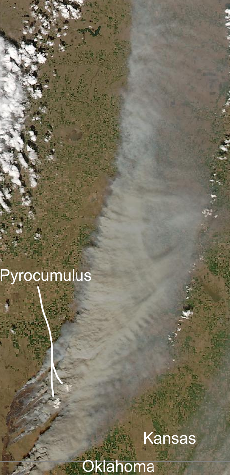
What are pyrocumulus clouds? Pretty simple, really. All that heat causes parcels of
air to rise, taking smoke/ash/water vapor with it. That water vapor can then
condense on the smoke and ash particulates and form a cumulus cloud. In extreme
cases, thunderstorms can even form if enough water vapor and particulates to
condensate upon are present. Very cool indeed!
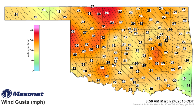
Now here you can see how the winds, gusting to over 60 mph in some cases

carried that smoke all the way up to Nebraska.
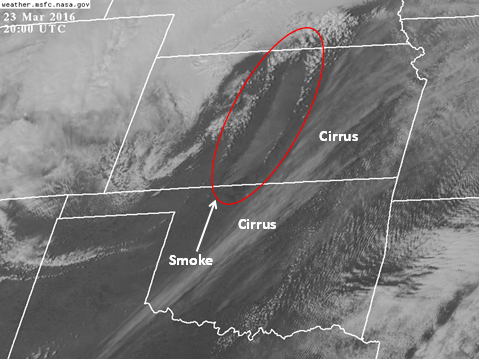
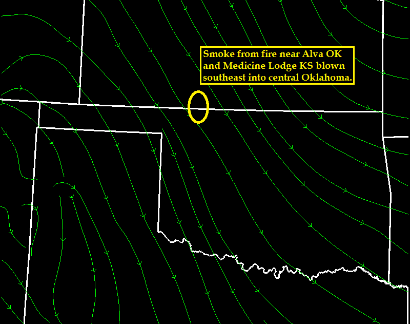
And now that the winds, still gusting to over 30 mph, are from the northwest,
central Oklahoma is now getting the smoke from that still somewhat active fire.
And THAT is why central OK residents are smelling smoke this morning. I've added
an annotated version from the Norman NWS to help in the explanation.
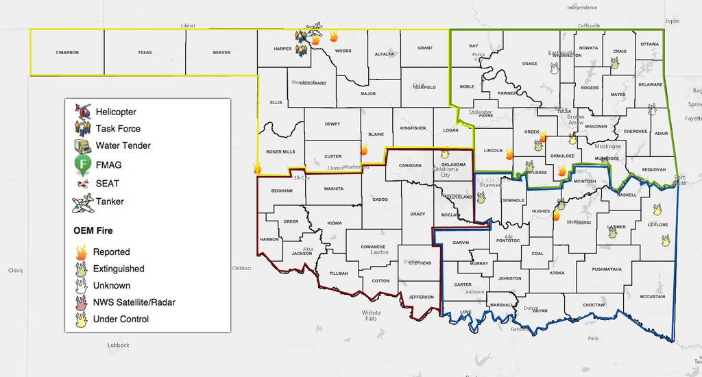
As I said, that wasn't the only fire, just the biggie for the day. Here's a look
from OEM at where other big fires occurred,and some of the resources tasked to
fight them.
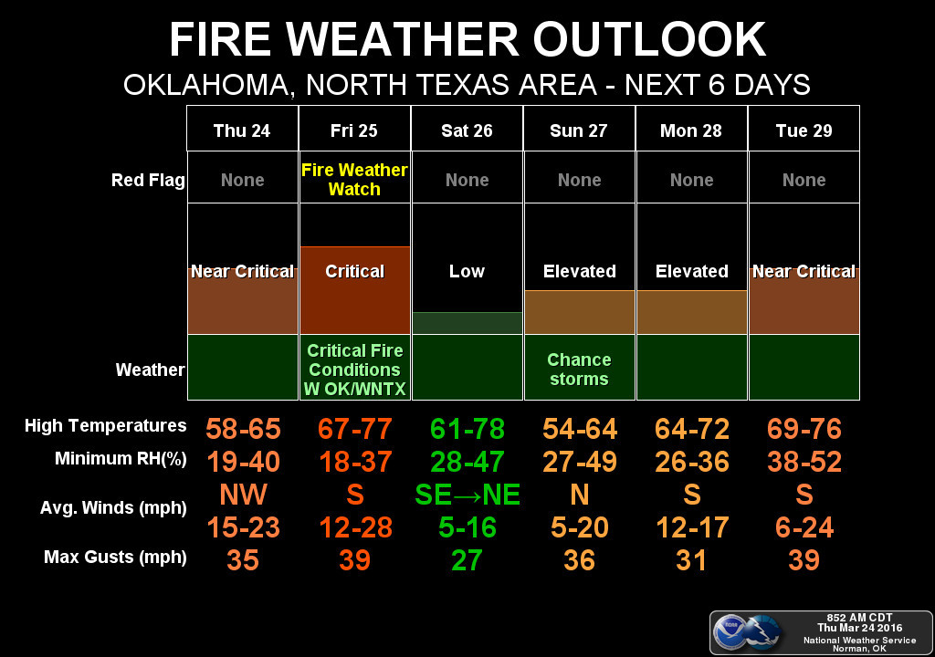
Ugh, to tell you the truth, I'm kind of fired out. Trouble is the fire danger
ain't over. Not by a long shot. Keep tuned to your favorite "FIRE! FIRE!" source
for more information throughout the next week or so.
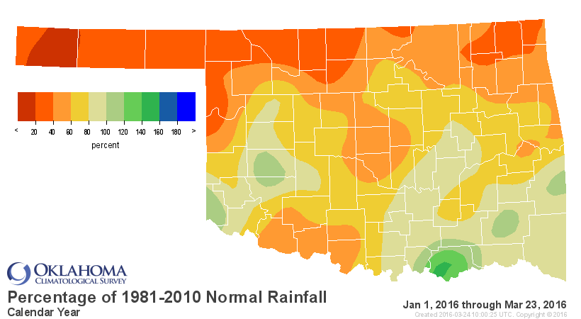
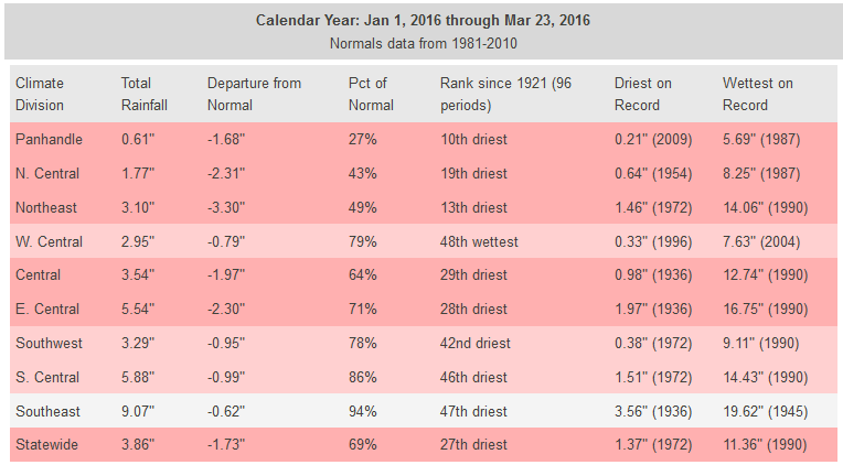
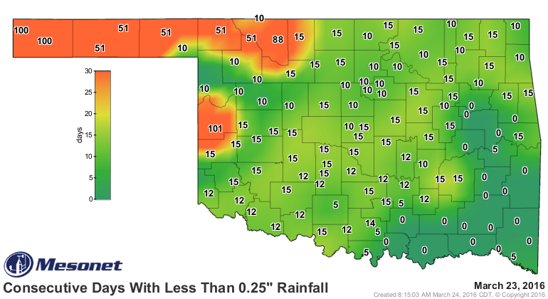
The spring green up can't get here fast enough. Speaking of that, with the
moisture deficits continuing across the NW quarter of the state, and the
seemingly non-stop cavalcade of high fire danger days, drought is on the
increase across that portion of the state. Today's new drought monitor shows
a large increase in D1 (moderate) drought across NW OK.
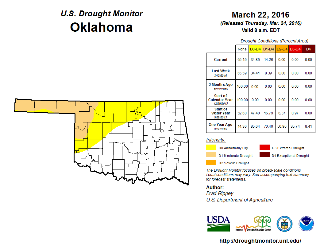
We now see 14% of the state in that D1 drought, all up in the NW, and 35% of
the state in at least D0 (abnormally dry) conditions. We continue with the
growing deficits and days without significant rain in that area of the state.

There is moisture in the forecast with several chances of rain over the next
week or so.
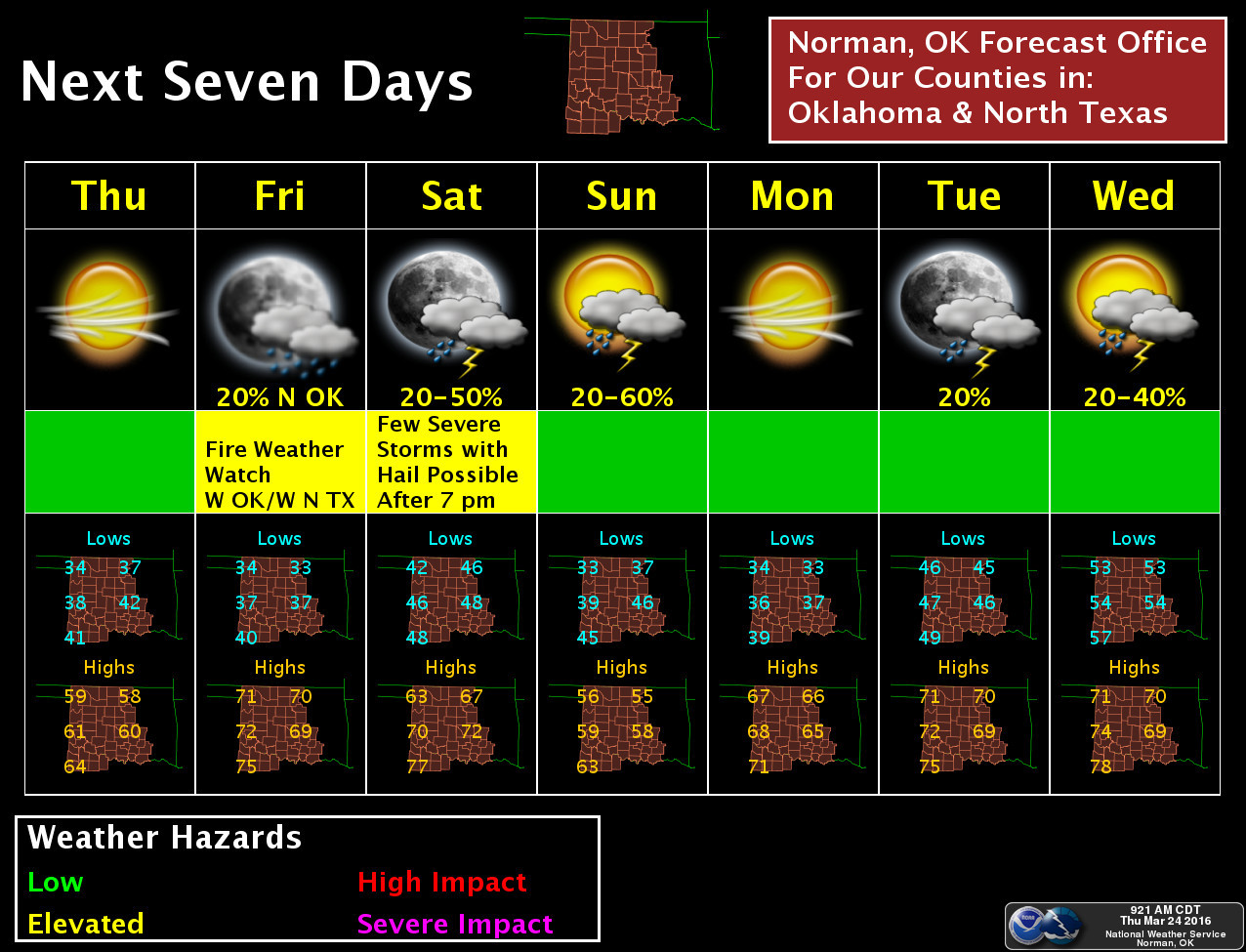

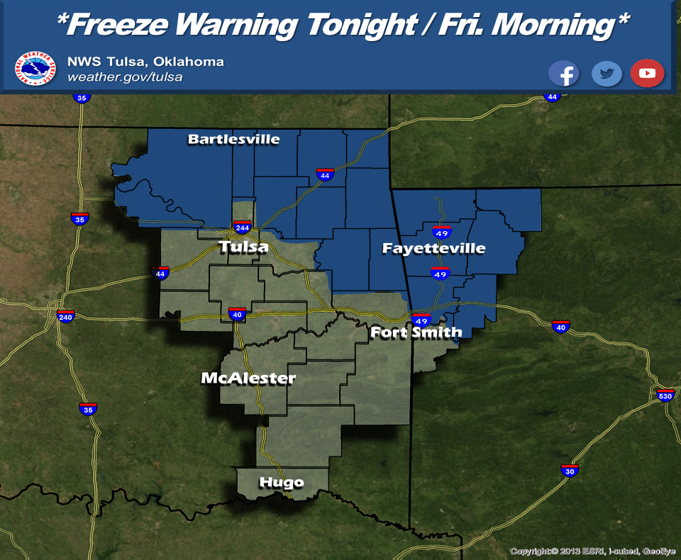
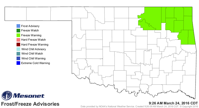
But we're also going to see a chance of another freeze, including tonight across
the NE part of the state where a freeze warning is in place.
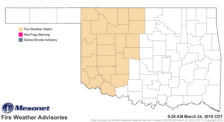
Last word...there is a fire watch for western Oklahoma on Friday. Don't burn
outdoors, for crying out loud. It ain't worth it.
Gary McManus
State Climatologist
Oklahoma Mesonet
Oklahoma Climatological Survey
(405) 325-2253
gmcmanus@mesonet.org
March 24 in Mesonet History
| Record | Value | Station | Year |
|---|---|---|---|
| Maximum Temperature | 88°F | ALTU | 2003 |
| Minimum Temperature | 12°F | KENT | 2013 |
| Maximum Rainfall | 5.00 inches | CLAY | 2023 |
Mesonet records begin in 1994.
Search by Date
If you're a bit off, don't worry, because just like horseshoes, “almost” counts on the Ticker website!