Ticker for March 22, 2016
MESONET TICKER ... MESONET TICKER ... MESONET TICKER ... MESONET TICKER ...
March 22, 2016 March 22, 2016 March 22, 2016 March 22, 2016
Earth, Wind and Fire...without the earth part
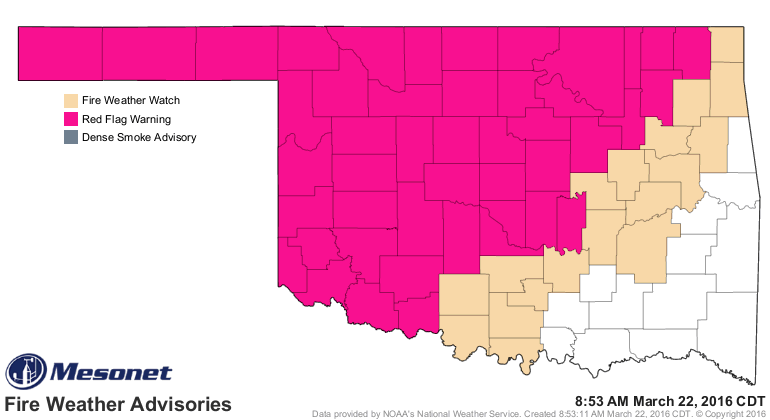
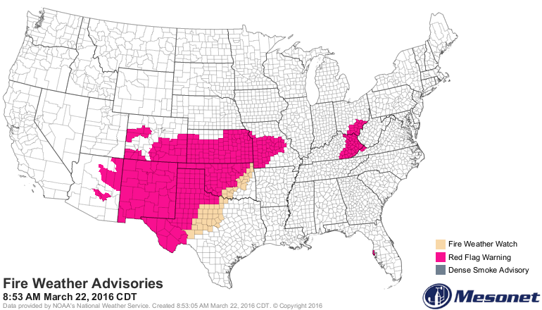
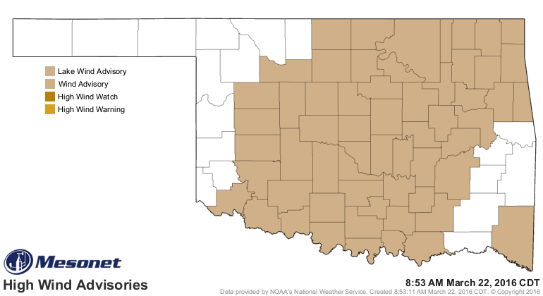
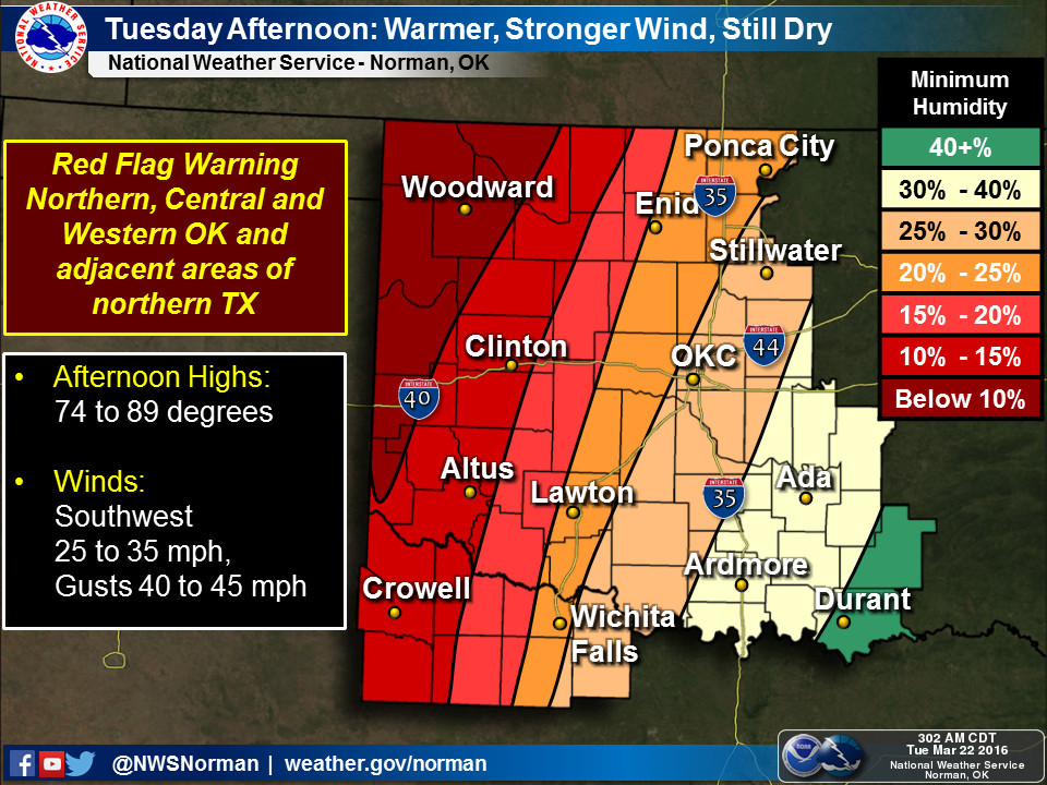
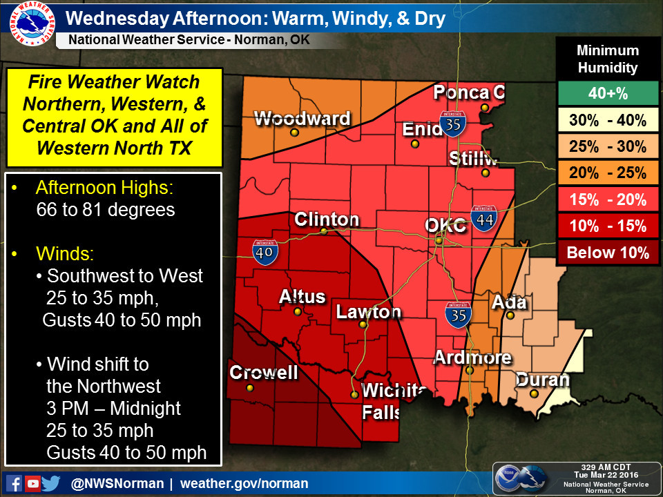
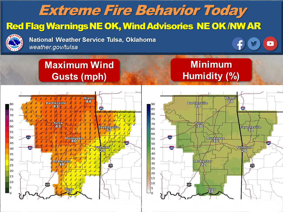
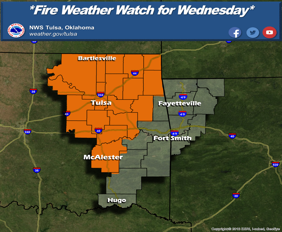
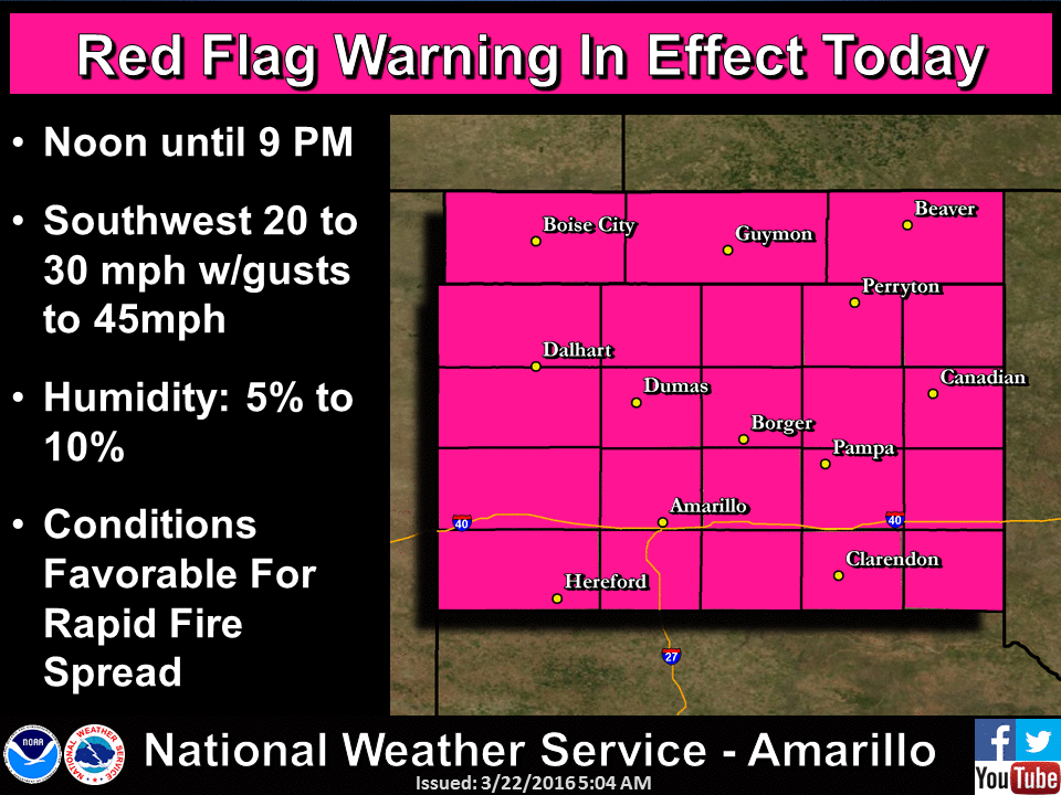
The next two days will be critical fire days with Red Flag Warnings for much of
the NW half of the state and a fire weather watch extending farther to the SE.
It's gonna be a windy, dry and warm ride until that cool front slides through
on Wednesday and drops the fire danger down to more manageable levels. Here are
the maps indicating what sorts of advisories the NWS has out now, not only for
Oklahoma but for the entire region.

A Red Flag Warning is described thusly by the NWS:
"A RED FLAG WARNING MEANS THAT CRITICAL FIRE WEATHER CONDITIONS
ARE EITHER OCCURRING NOW...OR WILL SHORTLY. A COMBINATION OF
STRONG WINDS...LOW RELATIVE HUMIDITY...AND WARM TEMPERATURES CAN
CONTRIBUTE TO EXTREME FIRE BEHAVIOR."
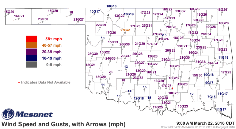
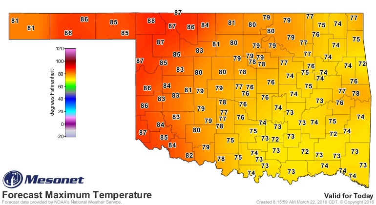
And here are some NWS graphics describing the situation:
To top it off, here is the situation described by the Oklahoma Forestry Services
this morning:
"Initial attack efforts will likely prove to be very challenging
today with potential for extreme rates of fire spread and erratic
fire behavior within the warned area. Typical grass fuels may exhibit
a rate of spread near 400 ft./min. Fire weather and fuel conditions
may pose even greater threat tomorrow as a cold front is expected to
move across Oklahoma with limited precipitation chances isolated to
southeast Oklahoma. As such, a Fire Weather Watch is in effect for a
large area of Oklahoma tomorrow. Slightly cooler temperatures will be
present, but still above critical criteria. Humidity will once again
be very low concentrating in southwest Oklahoma and up into north-
central counties. Winds will again be problematic encouraging rapid
rates of fire spread and producing shifting spread direction as the
cold front approaches. Southwest winds 20-35 mph with gusts of 40 mph
should be anticipated with some gusts near 55 mph expected as winds
shift to the northwest by evening."
And here's how Dr. JD Carlson of the Mesonet's OK-FIRE program
(http://okfire.mesonet.org/) is describing today and tomorrow:
"Fire danger will continue to be high Tuesday and become extreme
in portions of Oklahoma on Wednesday as a dryline pushes through
I35 in the early afternoon and progresses into eastern Oklahoma.
Fire danger will be extreme in the "dry wedge" between the dryline
and approaching cold front. Shifting winds on Wednesday from
southerly to the east of the dryline to SW to W behind the dryline
and then NW behind the cold front will make for changing fire
behavior and direction. 1-h fuel moisture values of 4-5% with
sustained winds of 25-30 mph with higher gusts can be expected
in this dry wedge..."
Winds are already howling and the RH will drop like a rock as the day heats
up into the 70s and 80s.
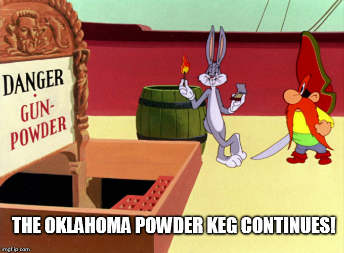
Easter looks to be good...little fire danger at least. No charred Easter Bunny
(or Bugs Bunny, we hope).
Gary McManus
State Climatologist
Oklahoma Mesonet
Oklahoma Climatological Survey
(405) 325-2253
gmcmanus@mesonet.org
March 22 in Mesonet History
| Record | Value | Station | Year |
|---|---|---|---|
| Maximum Temperature | 92°F | WALT | 2011 |
| Minimum Temperature | 12°F | MEDF | 2002 |
| Maximum Rainfall | 3.70 inches | PUTN | 2007 |
Mesonet records begin in 1994.
Search by Date
If you're a bit off, don't worry, because just like horseshoes, “almost” counts on the Ticker website!