Ticker for March 21, 2016
MESONET TICKER ... MESONET TICKER ... MESONET TICKER ... MESONET TICKER ...
March 21, 2016 March 21, 2016 March 21, 2016 March 21, 2016
A shock to the system
Now the Ticker didn't SAYYYYY that winter was over (note to self...disable Ticker
search function!), but we certain thought it. Who could blame us after one of the
warmest winters on record (4th warmest, to be exact-ish), and continued forays
into the 70s and 80s over the last month. But winter did rear its ugly head over
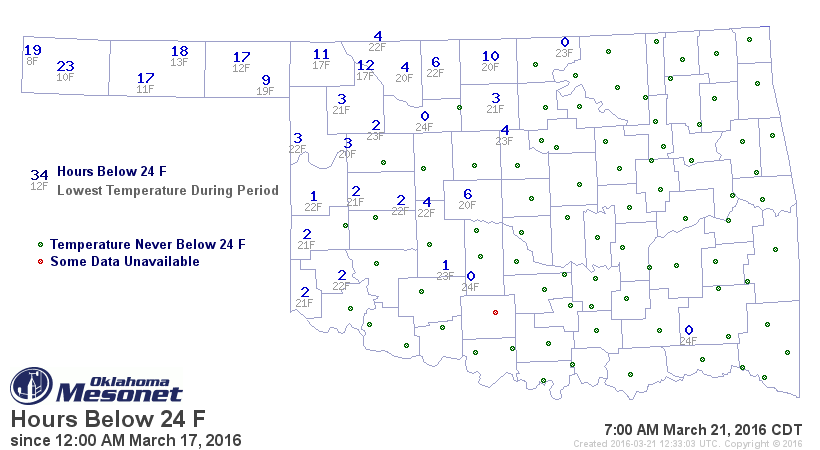
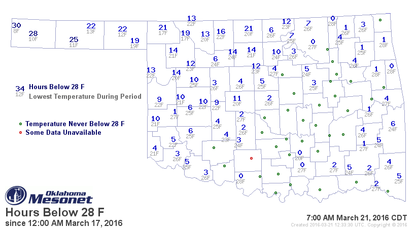
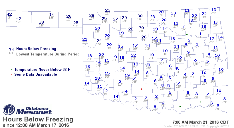
spring break, just as feared, and Oklahoma's tender wheat crop might have taken a
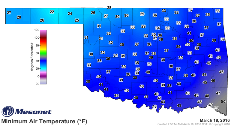
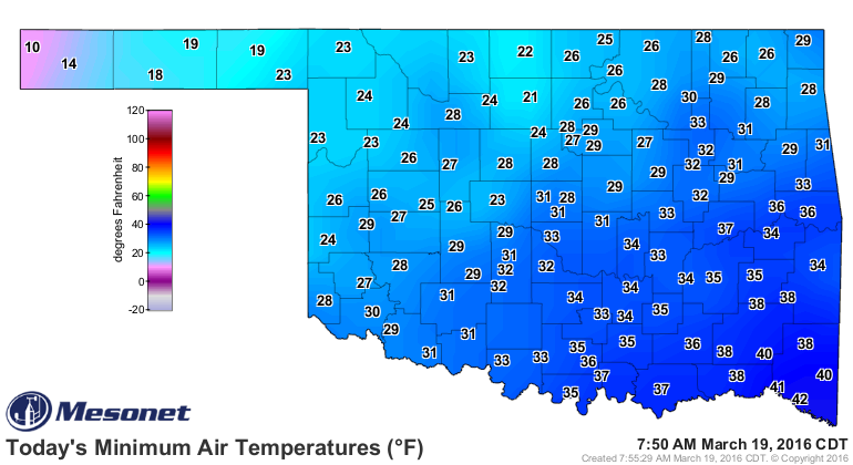
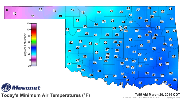
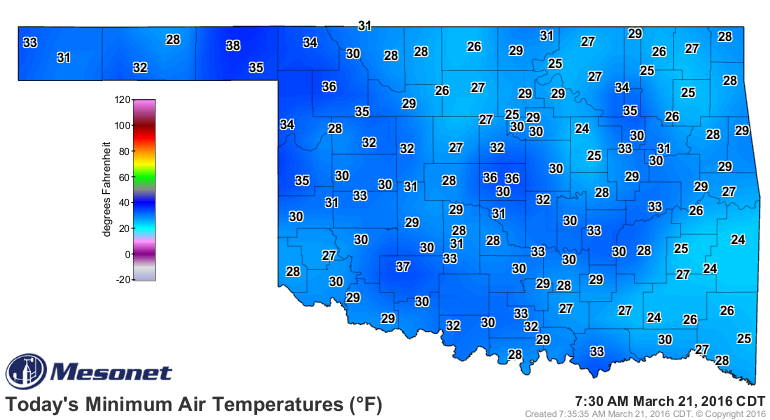
beating in the process. Check out these hours below freezing (and colder) maps
from the Mesonet to see just how low it got, and for how long.
And here are the actual low temperature maps from the last 3 days:
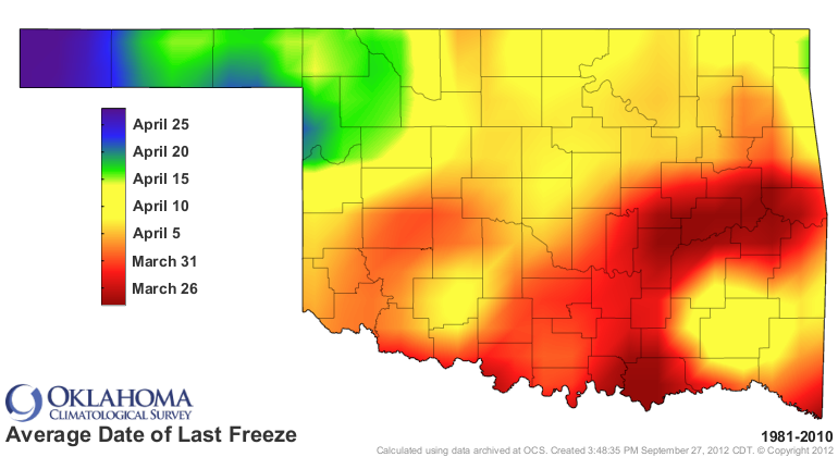
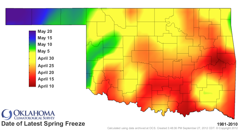
Let me say it for you..."UGH!" It's not like it should be such a shock,
considering we still have a week to several weeks to go before our average
last freeze date, depending on location, and even longer until our latest
freeze.
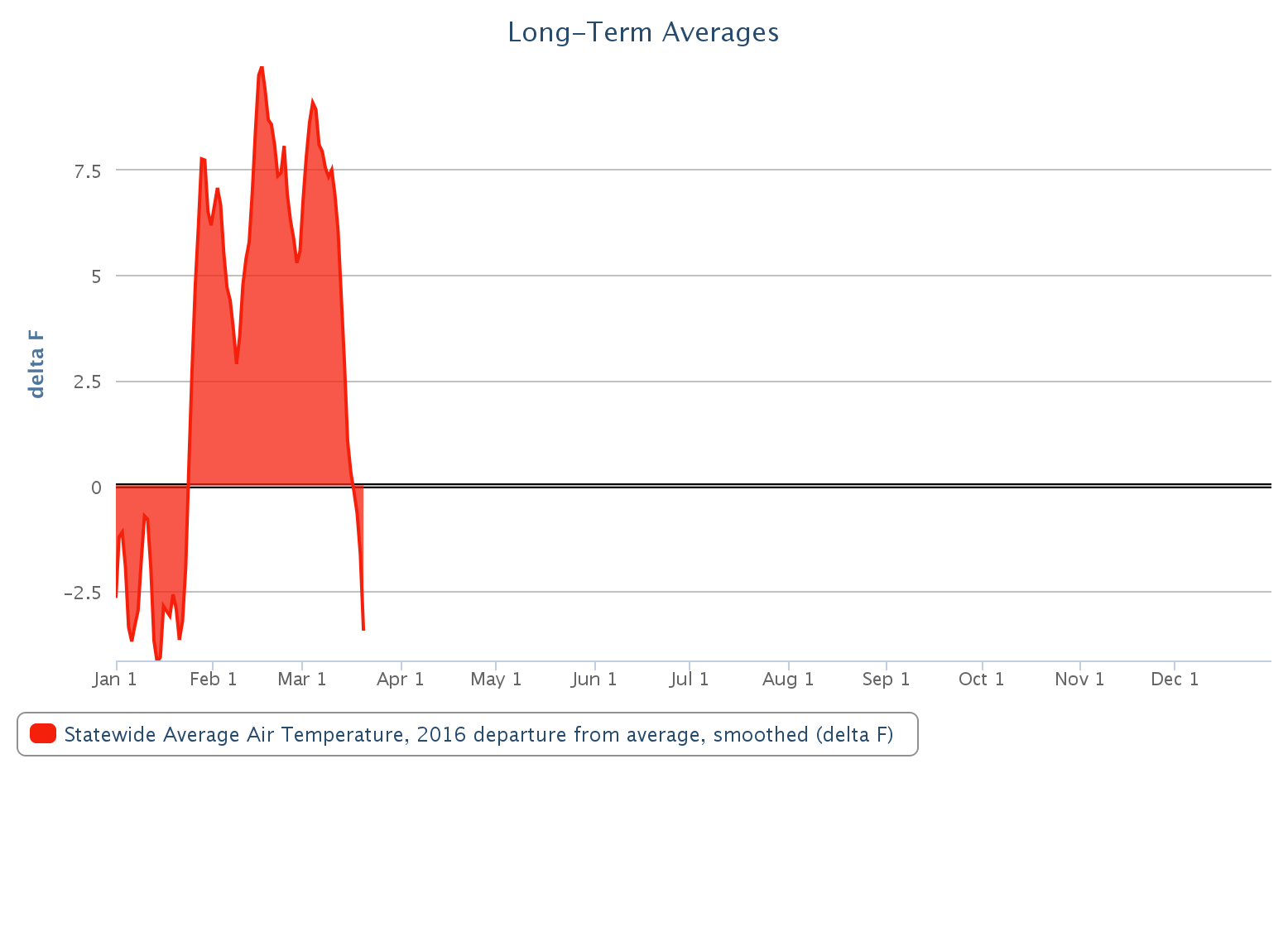
Again, the problem comes from how warm it has been. Statewide since about the
middle of January, it has consistently been from 5-8 degrees above normal as
shown in this Mesonet departure from average temperature map.
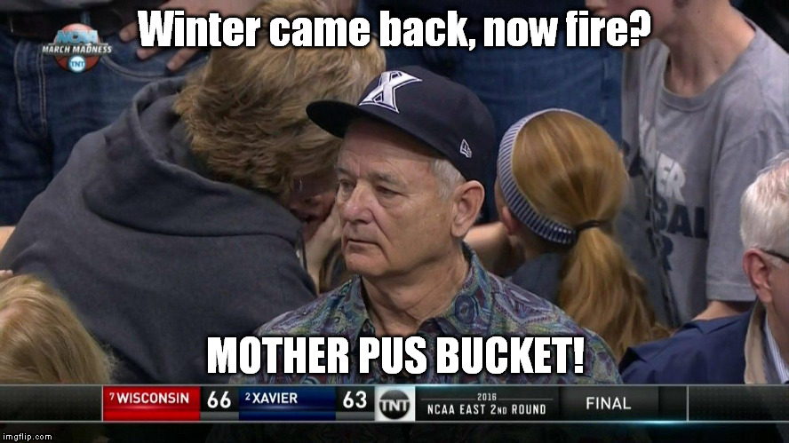
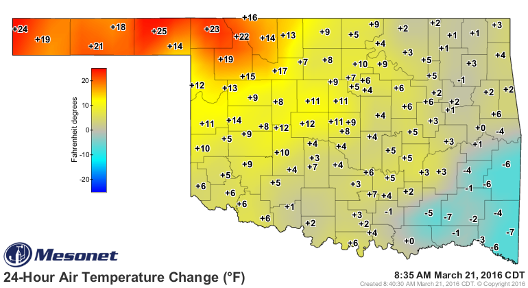
Okay, enough cold talk, let's move on to another displeasurable (I may have
made up a word there) subject...FIRE! As that cold air pulls off to the
northeast and the southerly winds kick in (just look at the difference it makes
in the 24 hour temperature change map)
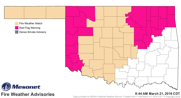
we're going to be left with a really nasty fire weather situation. We already
see Red Flag warnings as well as fire weather watches for the NW 2/3rds of the
state, and we might see that Red Flag warning replace some of those watches as
the days go by.
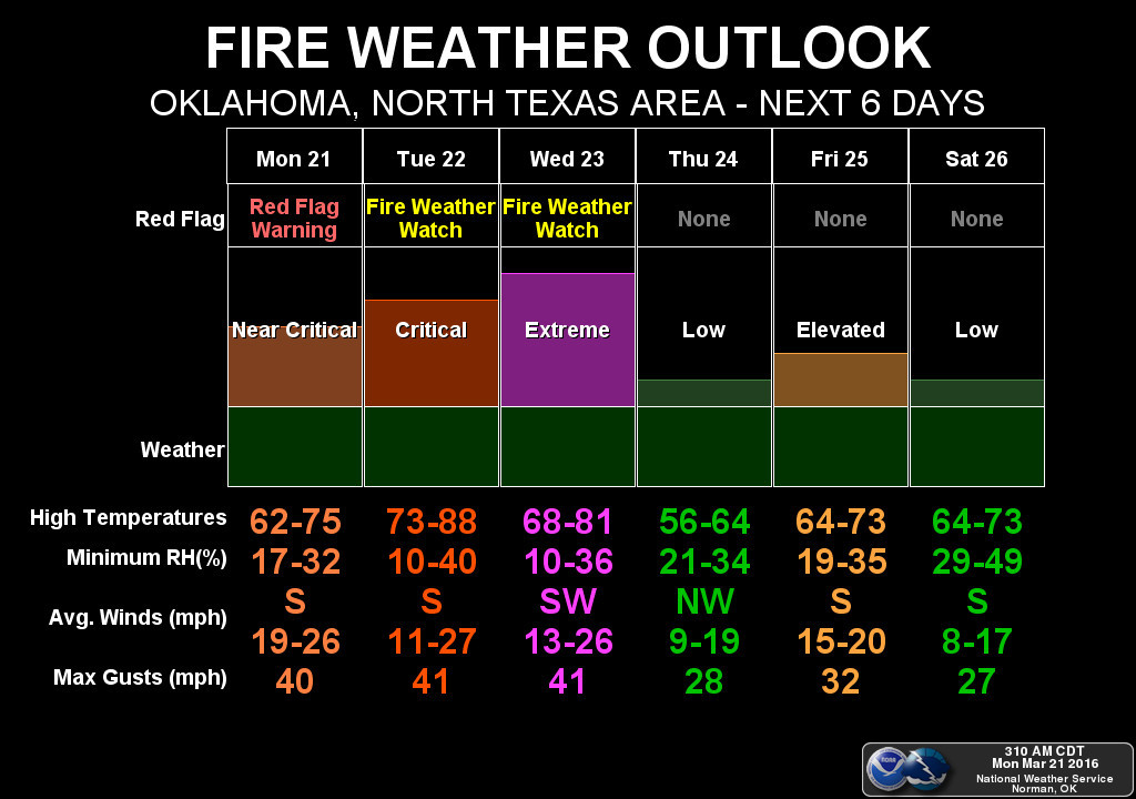
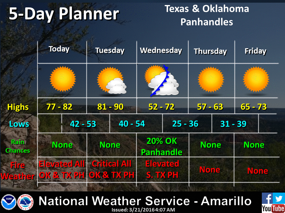
Here are the NWS offices' take on the fire situation over the next several
days.

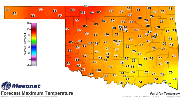
The winds will be howling, the RH will plummet, we'll see summer-like temps,
and things are still just brown/yeller enough -- especially up in the droughty
NW quarter of the state -- that any fires that start will get quickly out of
control.

It does appear that we're in for a roller coaster again on the temperatures with
several mostly dry cold fronts blasting through the state every few days. That
means cool downs during that time, but also lots of wind and high fire danger
at times (hence the most critical day this week being Wednesday following that
day's cold front).
The advice remains the same during this period that it has for 2 months now...
don't burn outdoors (indoors ain't good either for other reasons) and stay
weather aware!
Gary McManus
State Climatologist
Oklahoma Mesonet
Oklahoma Climatological Survey
(405) 325-2253
gmcmanus@mesonet.org
March 21 in Mesonet History
| Record | Value | Station | Year |
|---|---|---|---|
| Maximum Temperature | 97°F | ALTU | 1997 |
| Minimum Temperature | 10°F | KENT | 2006 |
| Maximum Rainfall | 2.92 inches | LANE | 2022 |
Mesonet records begin in 1994.
Search by Date
If you're a bit off, don't worry, because just like horseshoes, “almost” counts on the Ticker website!