Ticker for March 17, 2016
MESONET TICKER ... MESONET TICKER ... MESONET TICKER ... MESONET TICKER ...
March 17, 2016 March 17, 2016 March 17, 2016 March 17, 2016
It's WHAT in the Panhandle?

Yes, you're reading that correctly, the wind chill is 11 degrees in the Panhandle,
with an air temperature of 20.


By the way, what does it have to be "the Panhandle" while the rest of the state
is "Oklahoma?" Why not call that strip of land while the rest of the state is
known as "the Oklahoma Pan?"
The revolution starts here!
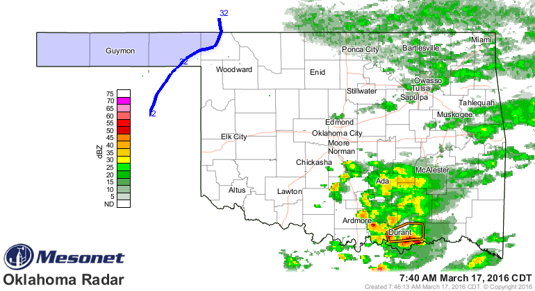
Anyway, the craziness goes even further as we have rain falling in the southern
parts of the state, a severe storm warning for Durant, and drought spreading in
Oklahoma...I mean the Panhandle!

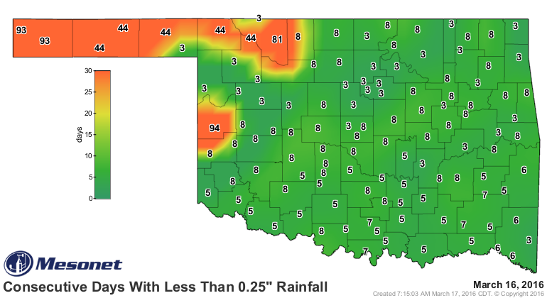
That's right, we're now up to 8% of the state in moderate drought, and 34% in
at least abnormally dry (D0) conditions. And the divide between the NW and SE is
fairly stark, and I'm not just talking about accents. We'll just go with the last
30 days for dramatic effect.
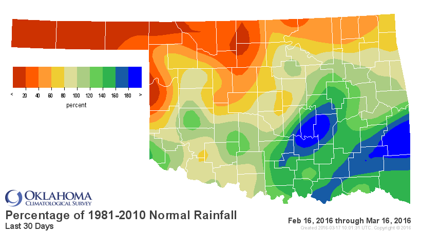
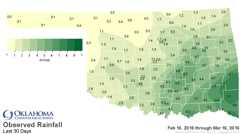
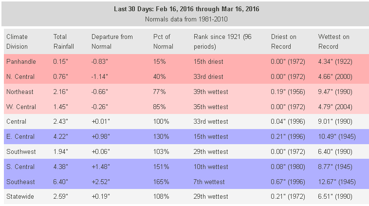
And remember, those stats were through midnight last night, so the starkness
will get even, uhhh, starkerer with the rain this morning. We've already seen
the 7th wettest Feb. 16-March 16 vs. the 15th driest Panhandle region since at
least 1921. And it has been more than 90 days since parts of NW OK have seen at
least a quarter-inch in a single day.
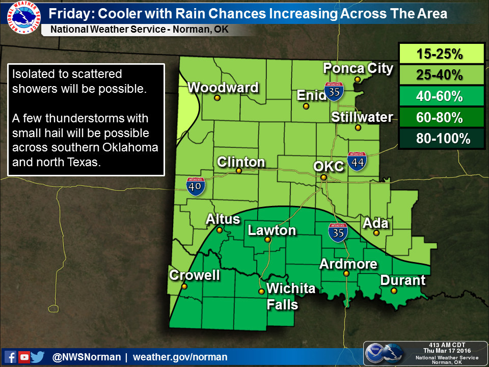
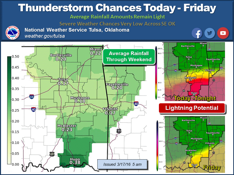
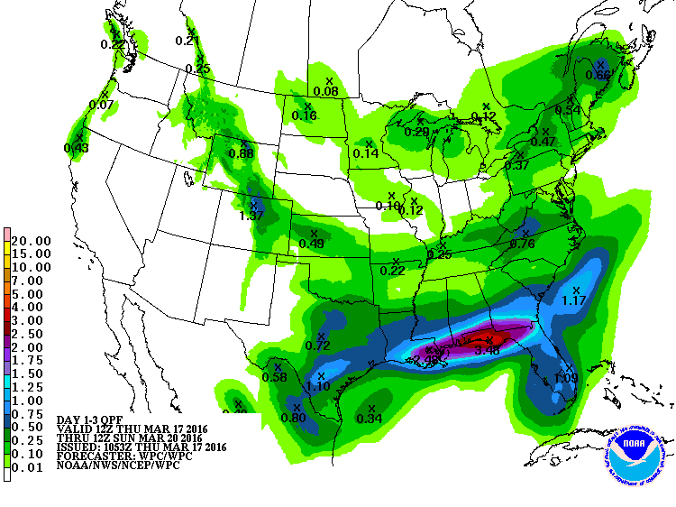
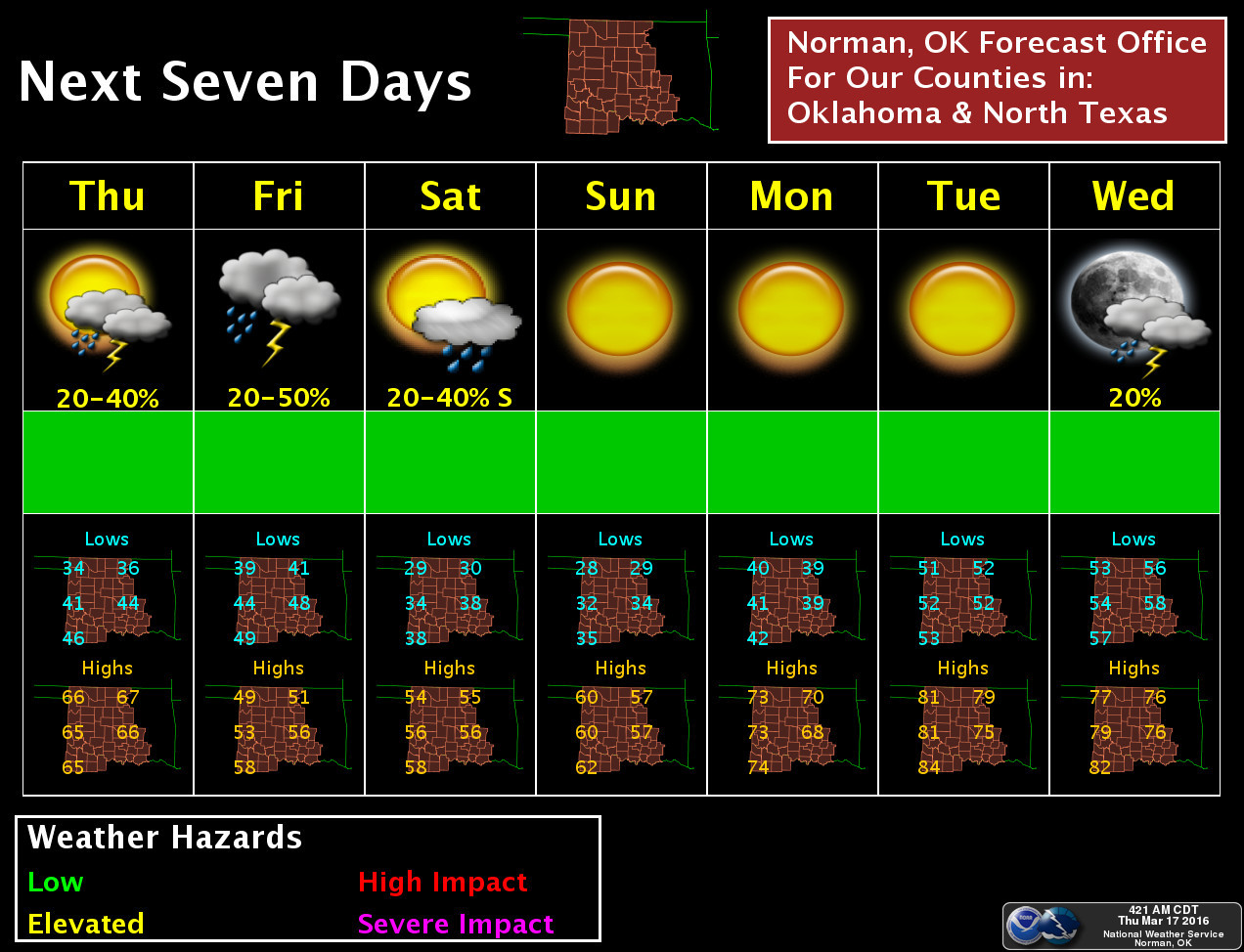
It'll get worse before it gets better. We will see rain chances off and on
across most of the state for the next two days, especially in southern Oklahoma
and especially tomorrow.
And even MORE craziness, after several weeks without seeing a below freezing
reading on the thermometer, winter is making a brief comeback for the NW
third of the state (if not a larger area) for Saturday and Sunday mornings.


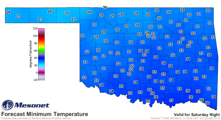
And let's face it, it's been a wonderfully freeze-free March thus far for most
of the state, at least through last night.
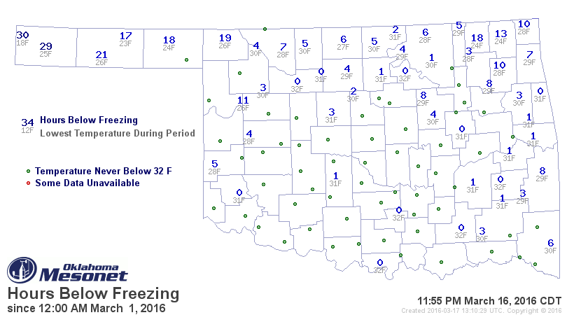
Regardless, with lows dropping into the low- to mid-20s, vegetation is going to
take it on the chin in some areas.
Rainfall amounts are going to be fairly light for the most part.
After that, a nice warm up is in store for the state.
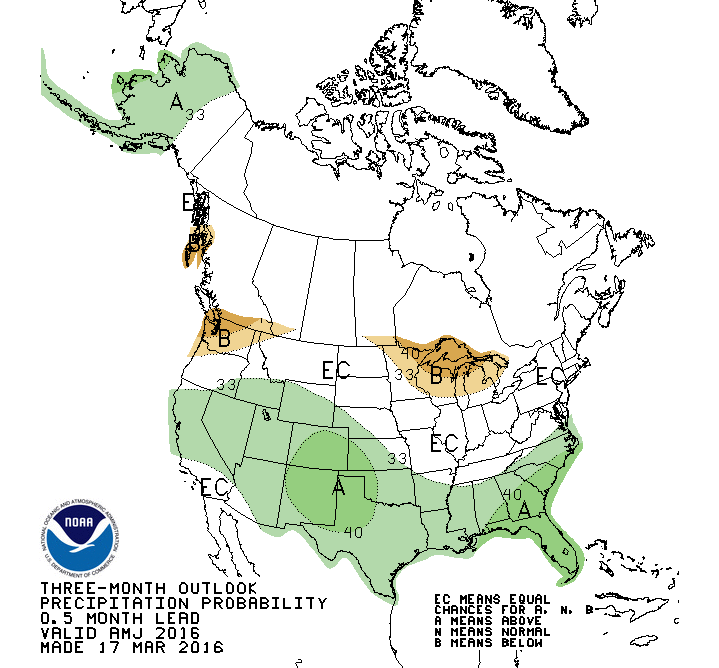
Following that, as we look ahead to April and also April-June, the Climate
Prediction Center precipitation outlooks show slightly increased odds of above
normal precip for OK, especially across the western quarter of the state as
we get farther into spring. The basis for these outlooks continues to be the
general precipitation patterns observed during strong El Nino events (even
though it continues to fade).
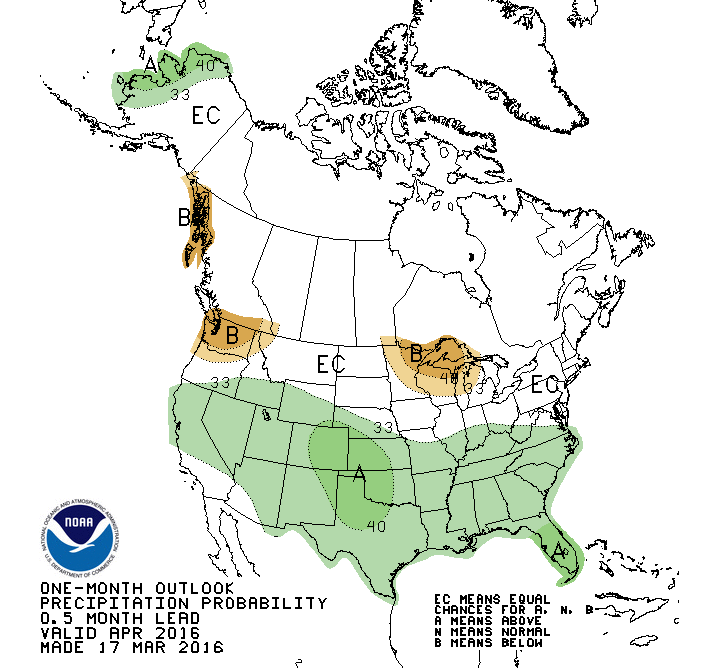
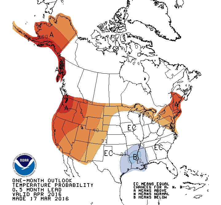
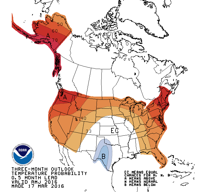
The temperature outlooks for the same period are rather inconclusive for most
of the state, save for slightly enhanced odds of below normal temperatures across
parts of southern Oklahoma. Now you're going to see some folks show these maps
(maybe) where they label that white "EC" area as "normal" or something like that.
Please remember that is INCORRECT! The EC (Equal Chances) area is where the
forecaster sees EQUAL odds of below-, near- or above-normal temperatures for
each time frame. NOT NORMAL! In those cases, each category has about a 33%
chance of occurring.
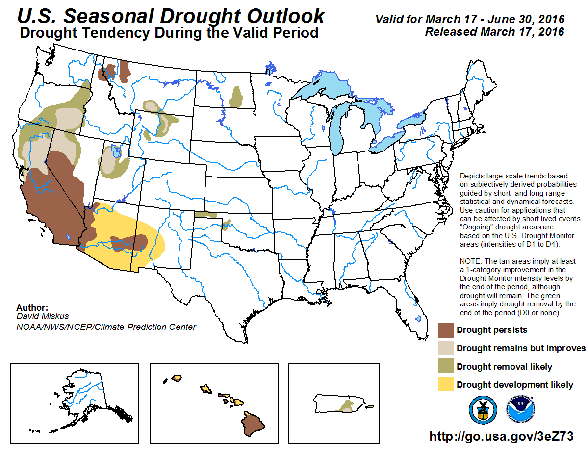
With those outlooks, the drought across NW OK is expected to improve by the end
June with the wettest part of the year (climatologically speaking) approaching.
Gary McManus
State Climatologist
Oklahoma Mesonet
Oklahoma Climatological Survey
(405) 325-2253
gmcmanus@mesonet.org
March 17 in Mesonet History
| Record | Value | Station | Year |
|---|---|---|---|
| Maximum Temperature | 95°F | ALTU | 2011 |
| Minimum Temperature | 13°F | BOIS | 2000 |
| Maximum Rainfall | 3.03 inches | BESS | 2008 |
Mesonet records begin in 1994.
Search by Date
If you're a bit off, don't worry, because just like horseshoes, “almost” counts on the Ticker website!