Ticker for March 9, 2016
MESONET TICKER ... MESONET TICKER ... MESONET TICKER ... MESONET TICKER ...
March 9, 2016 March 9, 2016 March 9, 2016 March 9, 2016
Do you feel lucky, punk!
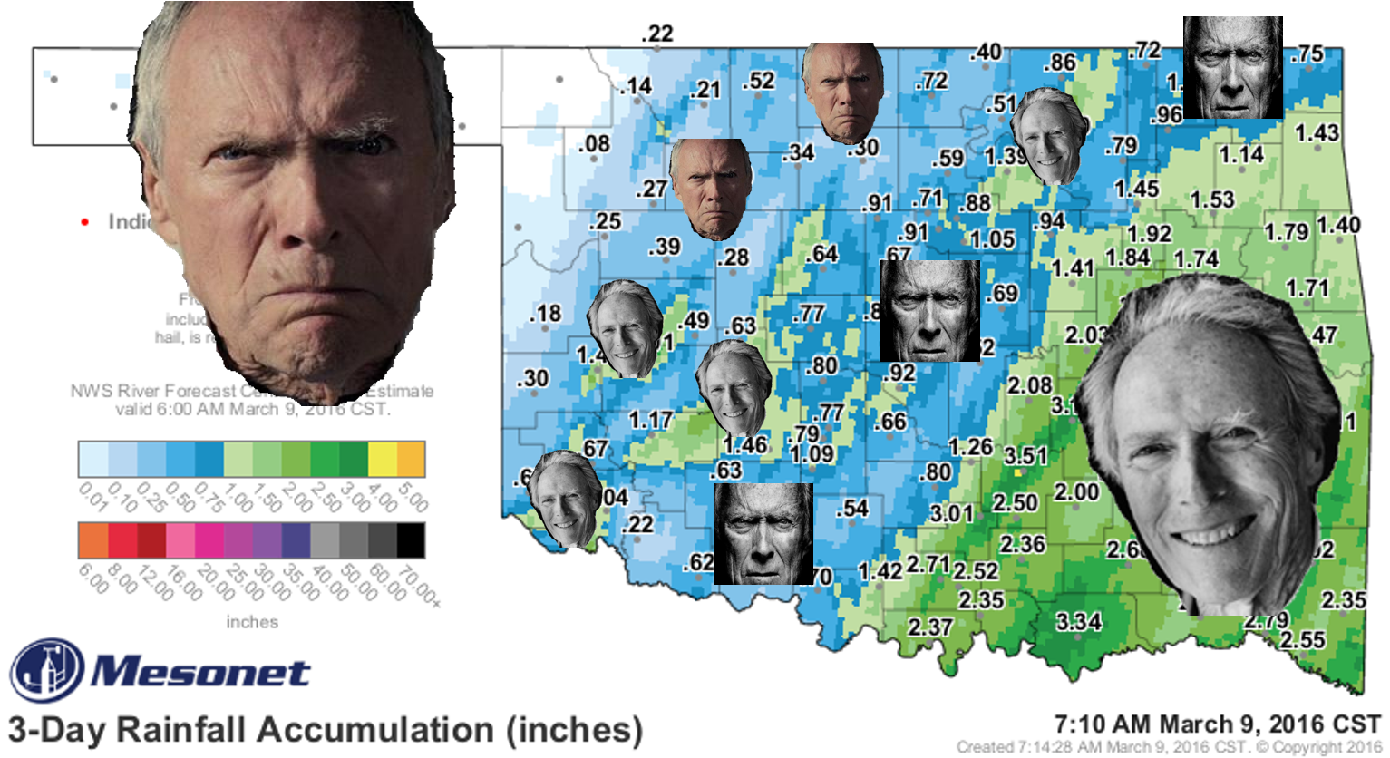
Before judging today's Ticker, let me just say that googling "angry Clint Eastwood"
brings up quite a few more results than "happy Clint Eastwood." In fact, "happy
Clint Eastwood" is mostly pictures of angry Clint Eastwood. But, here's the same
map without Clint's grizzled expressions.
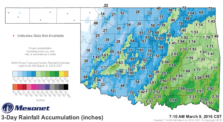
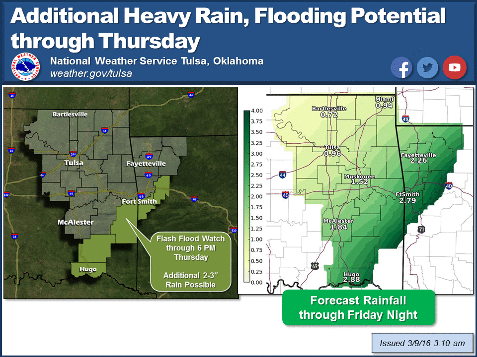
Obviously, some folks are happy (if not soggy), whilst others are breaking out
the chap-stick for their desiccated lips. It's easy to see the places that
got the training thunderstorms and others that got a good storm here or there,
and those that were left out. Totals ranged from 3.46 inches over the last 3 days
in Ada to ZILCH across the far northwest where drought was trying to gain a
foothold. Translation: the far NW needed it the most but got the least.
Some good news, it's still raining.
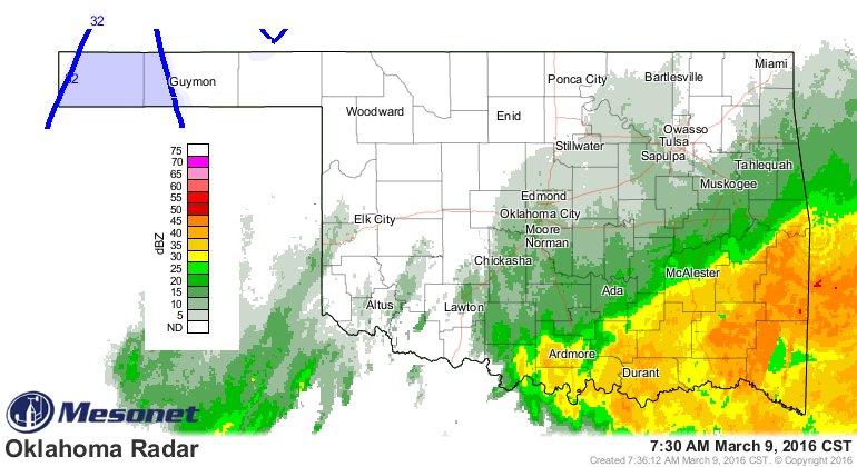
The bad news...not where it's needed the most (again!).

We did shrink the orange on that map considerably, but 85-86 days without a
quarter-inch of rain is pushing it. The return of drought is imminent in those
areas without a good rain. More bad news...the rain will not fall in the plains
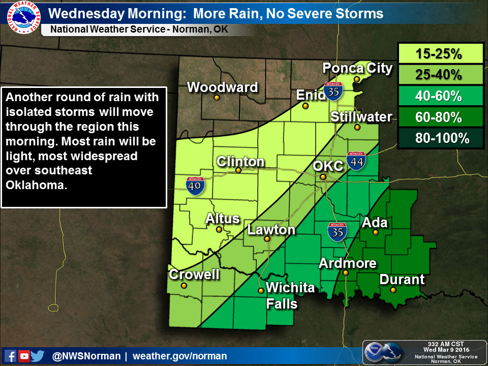
of far NW OK mainly in...okay, that didn't work. Here's the forecast for clarity.
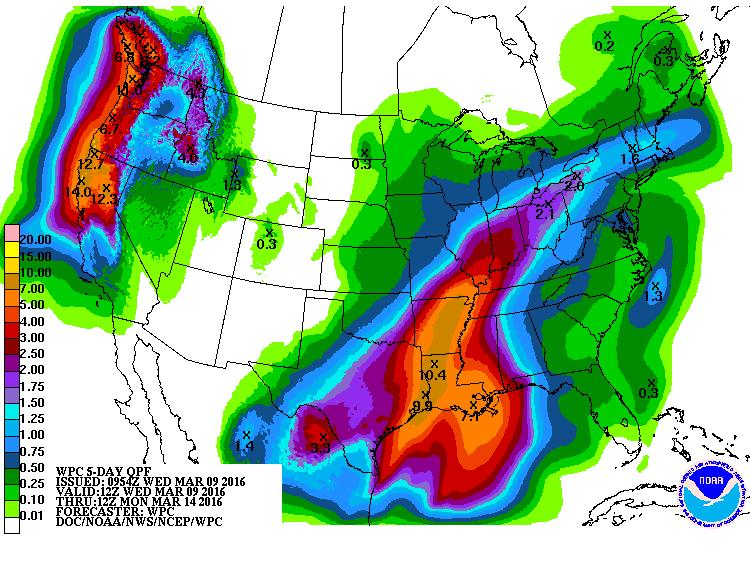
Ugh. Here's a news flash...the SE doesn't need 5-10 inches of rain, and the
NW third needs more than 0.25-0.50. Nevertheless, here are some graphics to give
us a taste of the next few days.
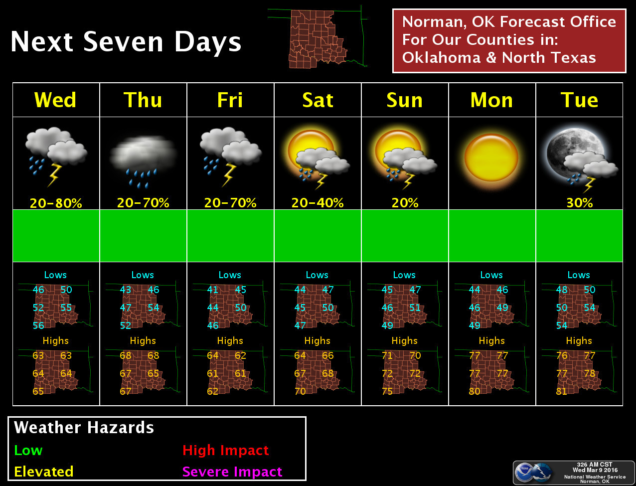
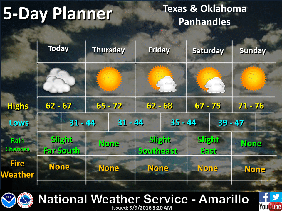
And while we can't seem to get the NWS offices on the same time scale, their
graphics tell the story...a chance of rain downstate for the next few days, then
a return to dry, springy weather, while the Panhandle gets a big fat nuthin.
Don't give up hope yet...the CPC outlook for spring break around these parts
does show increased odds of above normal precip, at least for the March 16-22
time frame. And above normal precip gets more and more significant the deeper
we get into spring.
I fear by that time drought will have begun to blossom on the Drought Monitor
map in the NW, but there's lots of spring to come, and El Nino is still strong
(but fading) in the equatorial pacific. So here's a bit of advice to Mother
Nature for the next few weeks...
Right turn, Clyde.
Gary McManus
State Climatologist
Oklahoma Mesonet
Oklahoma Climatological Survey
(405) 325-2253
gmcmanus@mesonet.org
March 9 in Mesonet History
| Record | Value | Station | Year |
|---|---|---|---|
| Maximum Temperature | 87°F | CAMA | 2017 |
| Minimum Temperature | 9°F | EVAX | 2022 |
| Maximum Rainfall | 3.32 inches | CLOU | 2023 |
Mesonet records begin in 1994.
Search by Date
If you're a bit off, don't worry, because just like horseshoes, “almost” counts on the Ticker website!