Ticker for March 10, 2016
MESONET TICKER ... MESONET TICKER ... MESONET TICKER ... MESONET TICKER ...
March 10, 2016 March 10, 2016 March 10, 2016 March 10, 2016
And so it begins...the drought of 2016

"Ay, ay, a scratch, a scratch. Marry, ?tis enough."
Okay, I could have gone two ways there with my all-too-clever quote...Mercutio or
Monty Python. Hey, I figured I'd class up the joint for once and go with ol' Bill
Shakespeare. And ay, ay, just a bit of moderate drought. Marry, 'tis enough.
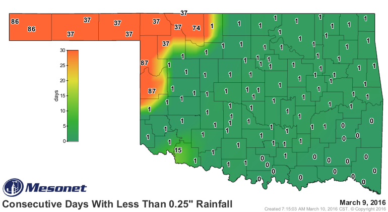
Against all odds (YOU HAD ONE JOB, EL NINO!), moderate drought (D1) once again
rears its ugly head in the state with a blog from Roger Mill/Ellis counties up
through Woodward County. This despite a everlasting gobstopper amount of rain
across the SE over the last several days.
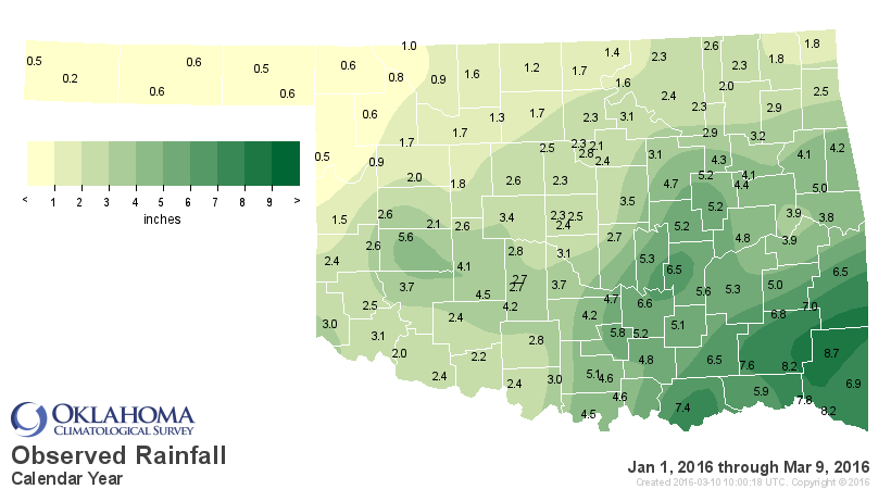
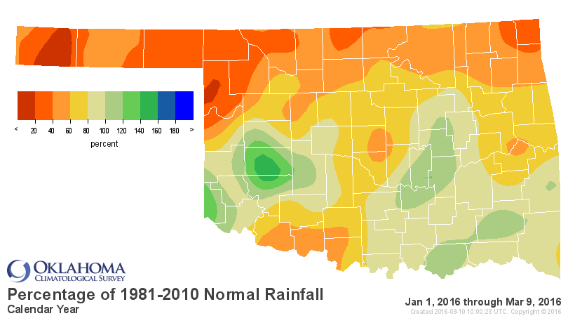
Up to 4 inches has fallen in some parts of the state, with a wide area of 2-4
inches across the SE third. If you look even farther southeast, you can see where
places in Louisiana and the ArkLaTex received over 2 feet of rain associated with
the same large upper-level low pressure system that dug itself in over Old Mexico.
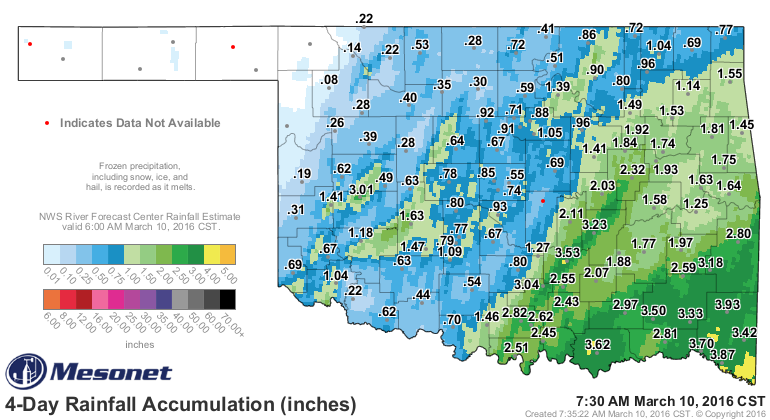
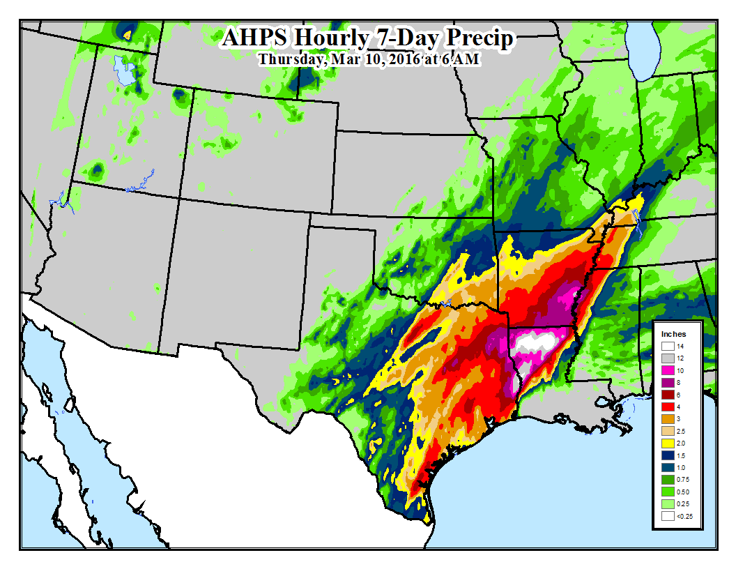
But both of those maps show the same sad story for the NW 1/4-1/3 of the state.
That area missed the moisture entirely and that deficit now compounds previous
dry weather to force the introduction of that area of D1.


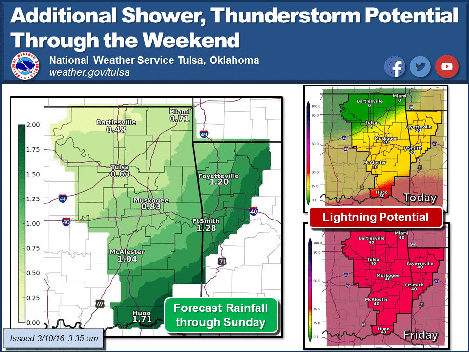
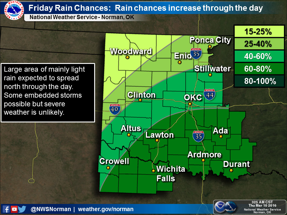
The tougher pill to swallow is that more rain is expected over the next few
days...just not much of it up to the NW. Here are what the local NWS offices
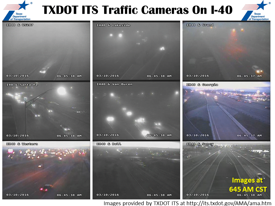
are expecting in the way of rainfall. Amarillo has just gone to showing pics
of fog, which for the Panhandle areas is pretty darned exciting (HEY, I'M FROM
THERE, I CAN SAY IT!).

After that, it does appear the southern track of the jet stream will go a bit
dormant for awhile, at least through spring break and beyond. The good news is
it will be cooler than normal (you have NO idea how tough it was for me to
write that) so that should help slow the expansion of drought down just a bit,
and perhaps wildfire danger as well.
In realistic terms, however, nothing to worry about here. So we have our first
drought in the state since Nov. 24, 2015, and it is only 3% of the state. But
abnormally dry weather does cover 31% of the state so there is room for that
drought to stretch its legs if rain doesn't pick up across the NW third of the
state.
A scratch for now. Let's now have a flesh wound, thank you.
Gary McManus
State Climatologist
Oklahoma Mesonet
Oklahoma Climatological Survey
(405) 325-2253
gmcmanus@mesonet.org
March 10 in Mesonet History
| Record | Value | Station | Year |
|---|---|---|---|
| Maximum Temperature | 87°F | MANG | 2021 |
| Minimum Temperature | 6°F | BEAV | 1998 |
| Maximum Rainfall | 1.93 inches | RING | 2012 |
Mesonet records begin in 1994.
Search by Date
If you're a bit off, don't worry, because just like horseshoes, “almost” counts on the Ticker website!