Ticker for March 7, 2016
MESONET TICKER ... MESONET TICKER ... MESONET TICKER ... MESONET TICKER ...
March 7, 2016 March 7, 2016 March 7, 2016 March 7, 2016
Tornado risk is

The tornado risk has been deemed "low, but not zero" for today across parts of
the Southern Plains and Oklahoma.

Yes, "low but not zero." The proverbial "like kissing your sister" taunt when it
comes to tornado risk in Oklahoma. What do you do when you're planning events or
trying to prepare you and your family in what the NWS folks have called "a messy
forecast" in which the threat of all modes of severe weather are possible but
not necessarily high?
My answer is stay weather aware and avoid any UNNECESSARY risks. Let me give you
a personal example. My kids were to travel to Camp Classen near Davis this morning
and stay the week. Given the language and the possible threat of severe weather,
what was the call? Well, in looking at the experts language in their discussions,
one word tends to stand out when making that call..."supercells."
Here's what the SPC has to say about today (their screaming, not mine):
"OVERALL SETUP SUGGESTS CONDITIONAL RISK FOR ISOLD LATE-DAY STORMS
ALONG LEE TROUGH/DRY LINE SEGMENTS IN WRN OK AND SW KS...WHERE AMPLE
SHEAR WILL EXIST FOR SUPERCELLS. THE MAIN THREAT POSED BY SUCH
ACTIVITY WOULD BE LARGE HAIL. FARTHER SE...GRADUALLY WARMING/MOISTENING
OF CONFLUENT LOW-LEVEL FLOW MAY SUPPORT THE DEVELOPMENT OF AN AREA OF
LATE DAY/EARLY EVE STORMS FROM N CNTRL TX NNEWD INTO SRN AND ERN OK.
PRESENCE OF CONSIDERABLE SPEED/DIRECTIONAL SHEAR AMIDST THE WEAKLY
FORCED ENVIRONMENT SUGGESTS AT LEAST SOME RISK FOR TORNADOES/LOCALLY
DAMAGING WIND INTO TONIGHT."
So that says "conditional risk" out along the dryline in W OK, meaning some
things have to come together to get storms, which if they did go up with
rapidly go severe with large hail being the main concern. Then the threat to
the S and E around the I35 corridor across C and S OK then the east would be
for supercells with a bit of tornado threat with them. Again, all predicated
on the current data, lots of "if this happens then that COULD happen." In
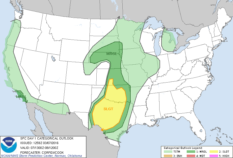
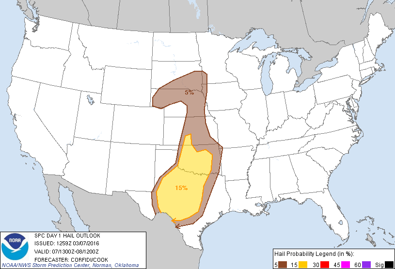
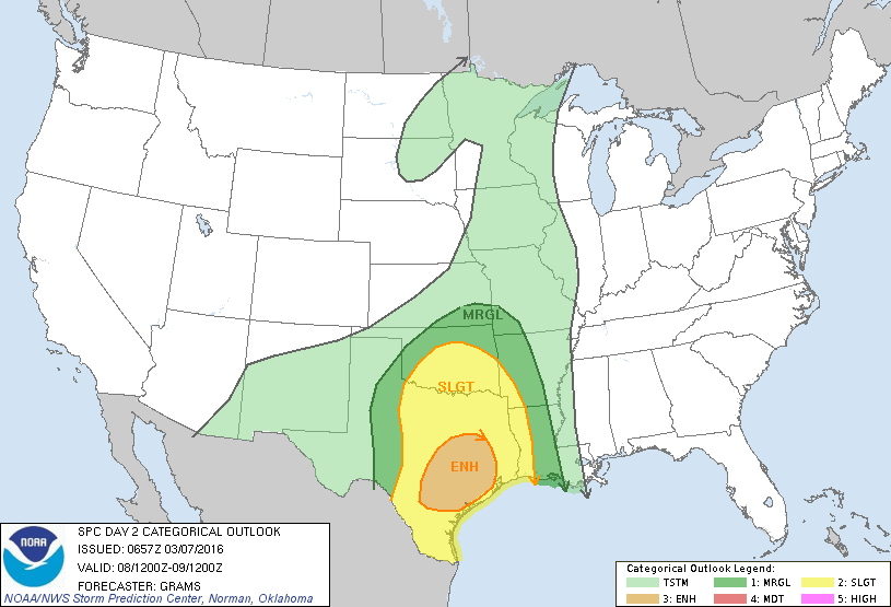
other words, a messy forecast. Here's what the SPC put out in graphics from
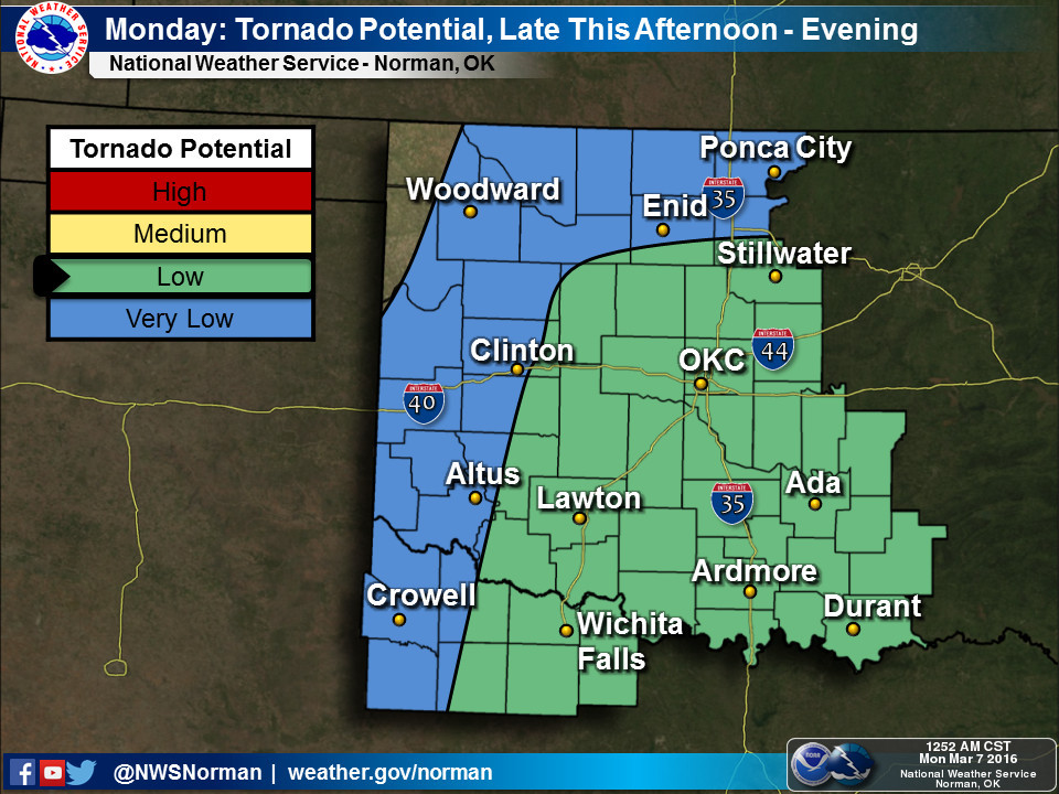
this morning (tornado probability map is up top).

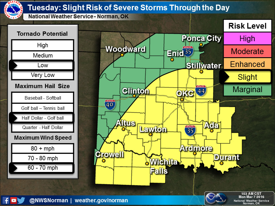
How about the NWS offices? Well, much the same concerns on their end. Here's
what the NWS Norman office had to say (ENOUGH WITH THE SCREAMING!):
"HOWEVER BY LATE TODAY INTO THIS EVENING... MODELS SHOW A
DISTURBANCE LIFTING NORTHEAST OUT OF THE BIG BEND AREA. THIS
ALONG WITH DEVELOPING LOW LEVEL JET SHOULD BE SUFFICIENT FOR STORMS TO
DEVELOP ACROSS THE WARM SECTOR... BOTH NEAR THE DRYLINE AND
FARTHER EAST IN THE MOIST AIRMASS. MODELS HAVE BEEN PERSISTENT IN
SHOWING A FAVORED AREA OF CONVECTION ACROSS NORTH CENTRAL TEXAS
NORTHWARD TOWARD SOUTH CENTRAL AND PERHAPS CENTRAL OKLAHOMA. ALL
OF THIS ACTIVITY WILL BE DEVELOPING IN A AIRMASS FAVORABLE FOR
SEVERE STORMS."
Same thing. "Warm sector" in this case means to the east of the dryline, both
near the dryline and farther east, as noted above. In particular, across NC Texas
into SC and C Oklahoma. In graphics (tornado potential map up top):

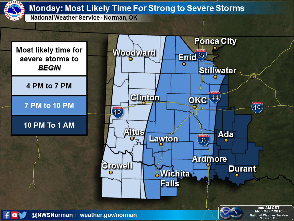
So what do you do when given the above information, even though you know that it
will be adjusted and probably change a bit throughout the day? What call do you
make? In this case, you stay out of harms way for a day, try again tomorrow. And
by all means, regardless of where you're at, you stay weather aware.
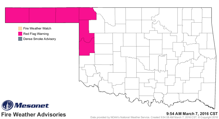
That's not all, unfortunately. For those folks out west stuck behind the dryline
mentioned above, you're going to see that high fire danger continue. We have a
Red Flag Warning out already for NW OK and the Panhandle, and that could shift
to the east a bit depending on what happens later today.

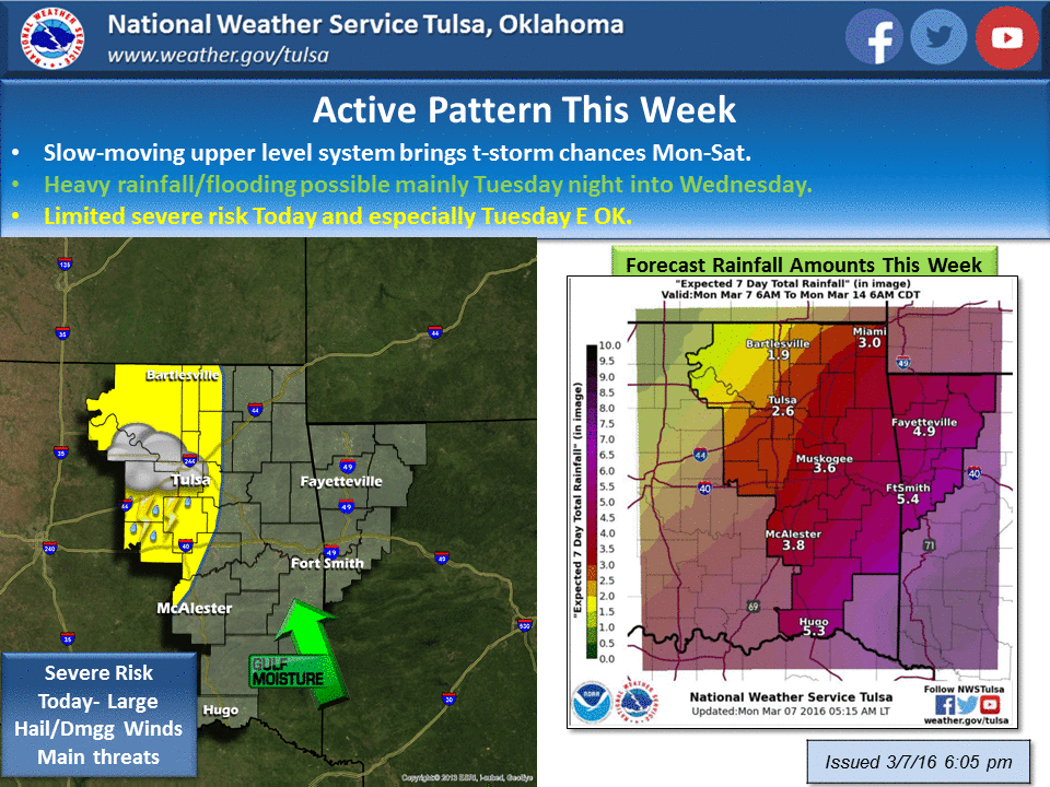
Now here's the kicker...we may have to do this all over again tomorrow.
Regardless of the tornado risk, there is a chance for all modes of severe
weather, including large hail, severe winds and lightning. Oh, and don't forget
flooding tomorrow.
Gary McManus
State Climatologist
Oklahoma Mesonet
Oklahoma Climatological Survey
(405) 325-2253
gmcmanus@mesonet.org
March 7 in Mesonet History
| Record | Value | Station | Year |
|---|---|---|---|
| Maximum Temperature | 87°F | HOLL | 2006 |
| Minimum Temperature | 8°F | SEIL | 2008 |
| Maximum Rainfall | 3.76 inches | PRYO | 1998 |
Mesonet records begin in 1994.
Search by Date
If you're a bit off, don't worry, because just like horseshoes, “almost” counts on the Ticker website!