Ticker for March 4, 2016
MESONET TICKER ... MESONET TICKER ... MESONET TICKER ... MESONET TICKER ...
March 4, 2016 March 4, 2016 March 4, 2016 March 4, 2016
All eyes on next week

We've had hail, we've had winds, we've had heavy rain...heck, we've had severe
storms at times I didn't even know it was supposed to rain, and I look at this
stuff everyday! But come Sunday and Monday (maybe into Tuesday), it looks like the
big boys are coming out to play as a very large upper-level trough will dive to
out SW and then move over us, giving us a chance for severe weather. We always have
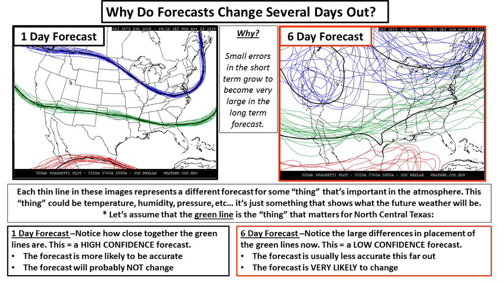
to remember the chaos that can occur with the forecast models, especially with
storm systems off the coast that haven't been given a chance to be sampled by our
land-based instruments (here's a reminder of what can go wrong with the forecast
model output):
But when the Storm Prediction Center and NWS offices start making mention of it
to raise awareness, well, then that's the time to, uhhhhhh, start being aware.
Odd how that works.
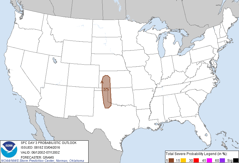
We start off with some graphics from SPC, beginning with Sunday where they show
a Marginal risk across far western Oklahoma, associated with a dryline that is
expected to form with a surface low pressure system.
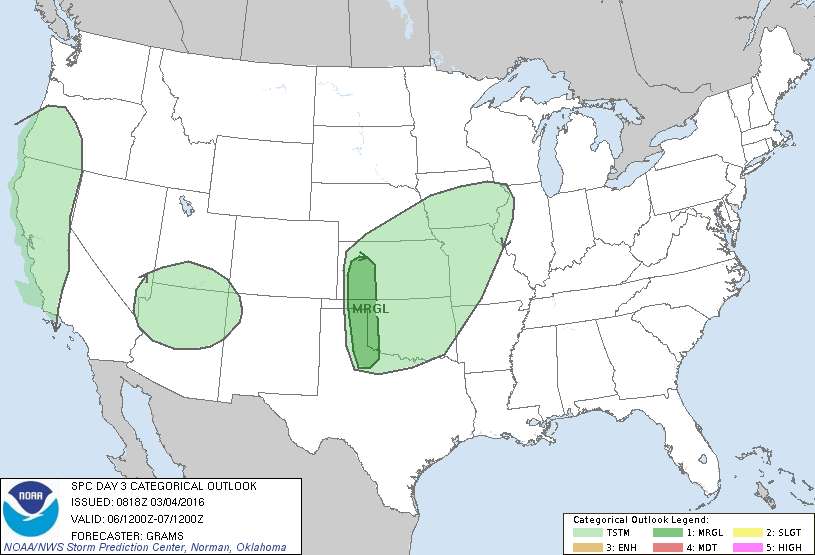
Now as we go through these, remember that they can and probably will change as
the forecast models start to coalesce into a common solution. Might take right
up until the day of the event and then some, so that's the reason to stay weather
aware. SPC's analysis for Sunday:
"POTENTIAL FOR SURFACE-BASED DEEP CONVECTION SHOULD BE CONFINED TO A
NARROW CORRIDOR ALONG THE DRYLINE IN THE LATE AFTERNOON/EARLY
EVENING. WHILE BUOYANCY SHOULD REMAIN MODEST...ROBUST HEATING INTO
THE 70S TO LOWER 80S W OF THE DRYLINE SHOULD SUPPORT UNCAPPED
PARCELS ALONG IT. WHETHER LOW-LEVEL CONVERGENCE WILL BE SUFFICIENT
TO SUSTAIN DEEP CONVECTION IS UNCLEAR WITH WEAK LARGE-SCALE ASCENT.
BUT IT IS PLAUSIBLE THAT A CONDITIONAL SUPERCELL RISK MAY DEVELOP
WITH LARGE HAIL AS THE MAIN HAZARD."
There's a bit of scientific-ese in there, so let me translate: "There will be a
dryline, and it might storm, and some of those storms might be severe."
Hope that helps.
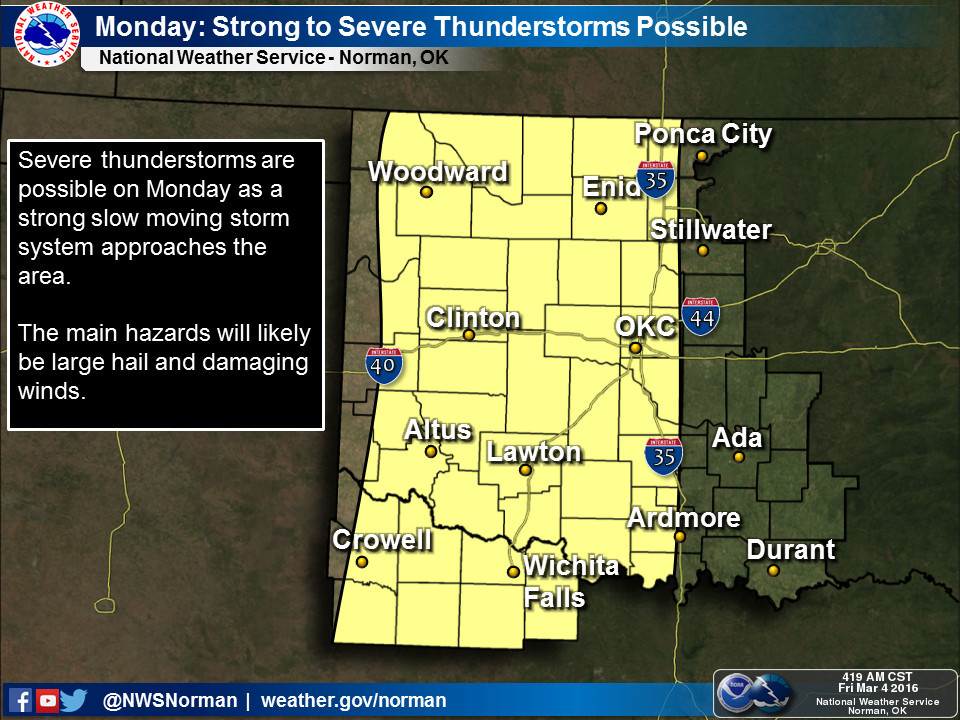
Here's NWS Norman's take on the day.
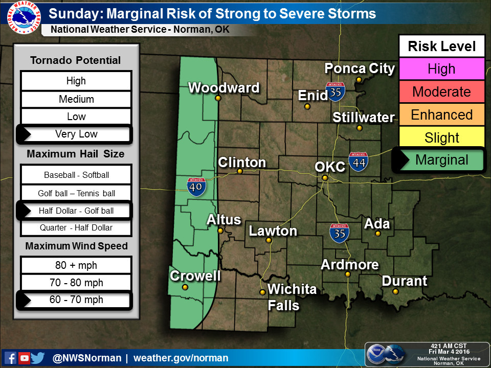
Looks like a typical stormy spring day to me. Now to Monday, where things appear
to come together a bit better to produce severe weather.
Again, SPC puts a bit of color across western into central Oklahoma. In this
case,a bit of 15%, which indicates a 15% probability for severe thunderstorms
within 25 miles of a point within that yellow area. Here's NWS Norman's take:
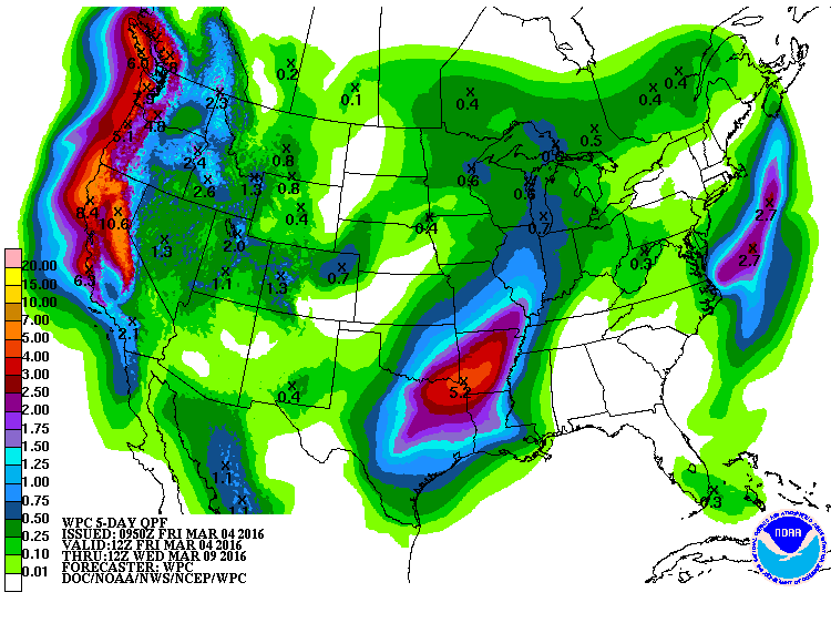
Now the severe weather threat should shift to our SE as we go through Monday
night into Tuesday, but that doesn't mean we can't have some severe storms
and a bunch of rainfall. As per usual, there will be a sharp gradient from very
heavy rains to the SE to lesser amounts in the NW (where they need it the most).
There are way too many unknowns at this point to pin down exactly what we're going
to see Sunday-Tuesday. How much moisture return from the Gulf of Mexico will
there be (forget about that moisture from the Pacific...it gets leeched out by
the mountains to our west)? How much daytime heating? How far west will the
dryline mix on either day?
Lots of unknowns, but one know...it's springtime in Oklahoma. When any storm
system approaches, it's time to be weather aware. Mother Nature doesn't care
if you're ready, but you should.
Gary McManus
State Climatologist
Oklahoma Mesonet
Oklahoma Climatological Survey
(405) 325-2253
gmcmanus@mesonet.org
March 4 in Mesonet History
| Record | Value | Station | Year |
|---|---|---|---|
| Maximum Temperature | 91°F | HOLL | 2009 |
| Minimum Temperature | -5°F | VINI | 2002 |
| Maximum Rainfall | 5.31 inches | KING | 2004 |
Mesonet records begin in 1994.
Search by Date
If you're a bit off, don't worry, because just like horseshoes, “almost” counts on the Ticker website!