Ticker for March 3, 2016
MESONET TICKER ... MESONET TICKER ... MESONET TICKER ... MESONET TICKER ...
March 3, 2016 March 3, 2016 March 3, 2016 March 3, 2016
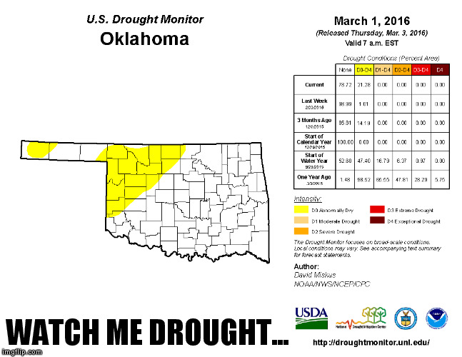
Watch me drought...
Watch me drought...
Now watch me rain rain!

Okay, let's get a couple of things straight from the get-go:
1) That first graphic, this morning's Drought Monitor map, doesn't actually
contain any drought for Oklahoma, but it does show a big expansion of D0
"Abnormally Dry" across NW OK and the far western Panhandle.
B) The only reason I know about this "Now Watch Me Nae Nae" song is because I
have kids. My hipness stopped at Def Leppard. Go ahead, crack wise.
What we have though is a situation that has been brewing for a couple of months
now, to go from no problems in the state to now 21% covered by that D0. I think
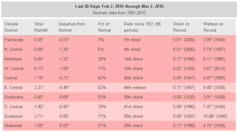
the "days without rainfall" maps from the Mesonet show the story pretty clearly.
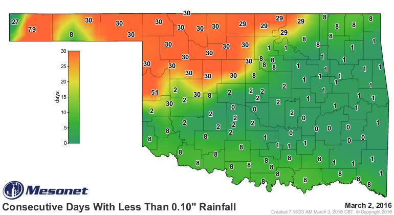

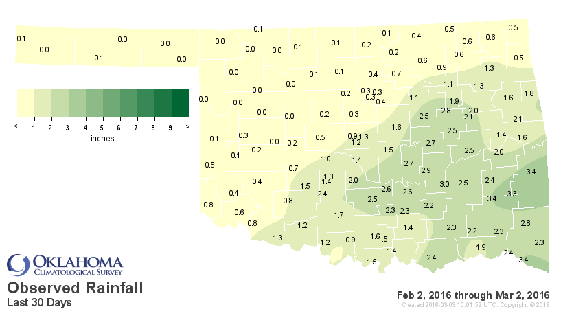
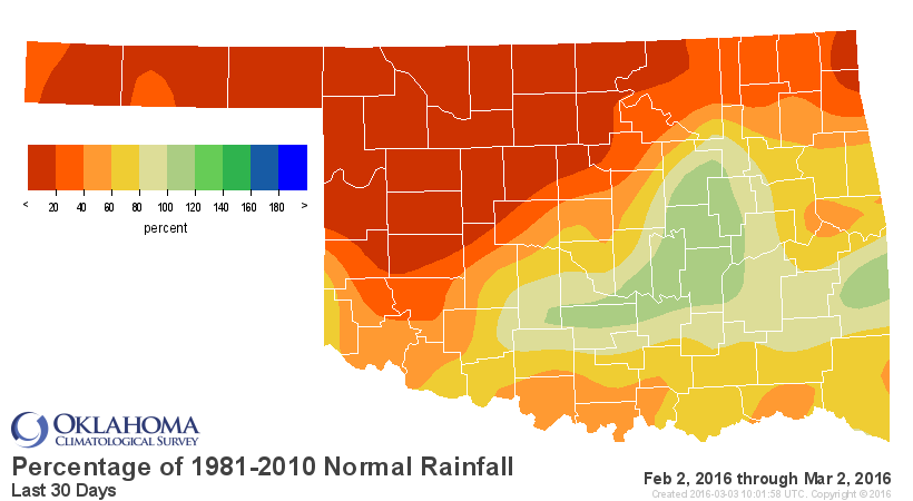
Yikes indeed! And the 30- and YTD-maps are equally ugly for NW OK.
Last 30 days:
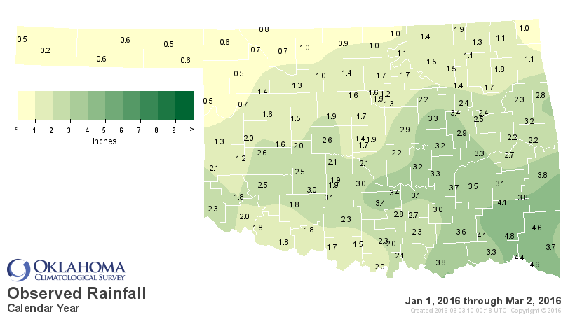
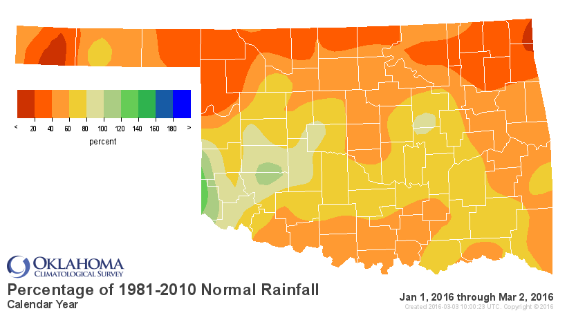
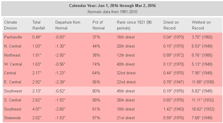
Year to date:
We actually held off on the D0 as long as we thought prudent, relying on the
moisture received during November and December (which shows up in the longer
period rainfall maps).
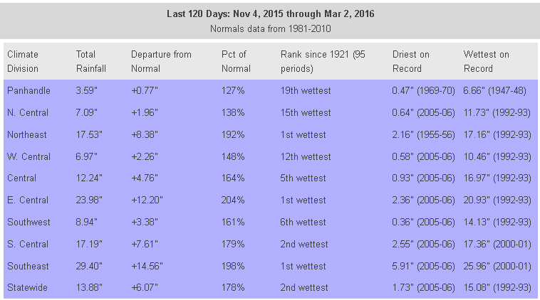
Last 120 days:


With February being so warm, however (highs reaching into the 70s-90s at times),
and windy, and news of winter wheat coming out of dormancy even out in the far
western Panhandle....we felt it was time to pull the trigger. That wheat is
awake and kicking in places, needing a drink and only getting hot, dry winds
in return. Soil moisture is starting to be sapped from the topsoil. That was
our reasoning for the escalation for now, at least.
Okay, now on to the good news. It does appear that the southern branch will
start to become active again, possibly thanks to a resurgence in tropical
convection due to El Nino, and we might get some rain in here late in the weekend
and then early next week. And beyond?
Here is the 7-day forecast precipitation map from this morning where you can
see next week's rain starting to show up mighty bright (without the meme
nonsense).
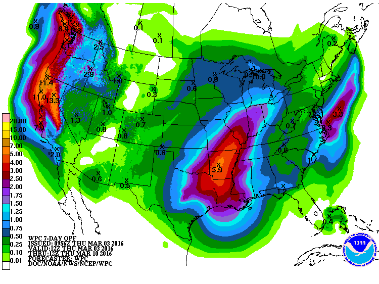
It does look like eastern Oklahoma will be receiving a good portion of these
rains, but there are hopes for NW OK as well. A decent rain will be enough to
wipe out D0 before it becomes D1 (and then D2, and D3, etc.). And if you take
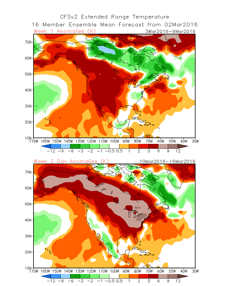
a look at the precipitation anomaly forecast maps for the three weeks after
next week, it does appear that southern jet stream will remain somewhat active.
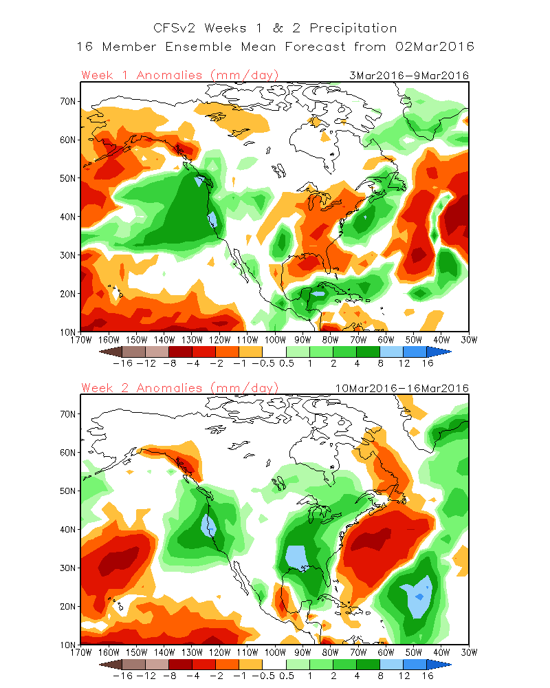
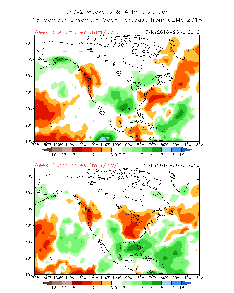
There is absolutely no indication of any sort of arctic air intrusions down
this way on those same period maps. With the wheat maturing early, that needs
to stay that way to avoid any sort of freeze damage.
Some caveats...the storm for early next week is still way out in the pacific,
so we should expect some of the particulars to change, small changes or large
changes still possible. The longer range forecasts are even more uncertain, but
the best we have to go by right now. And there will be the possibility of severe
weather next week with that first storm system.
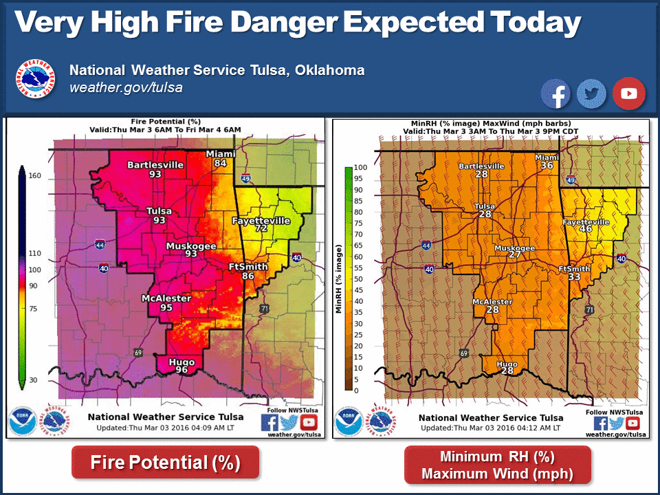
Finally, the rain will be crucial in helping us end all this fire danger we've
been seeing over the last month or so. It's warm enough that precipitation
will start to give us a nice green up, removing that fuel for wildfires as it
comes out of dormancy or comes alive. Until that occurs, the wildfire danger
will continue.

Rain, you say? Well how about I "rain" down some hip lyrics on ya!
Ooh RAIN
Hysteria when you're near
Come on!
Gary McManus
State Climatologist
Oklahoma Mesonet
Oklahoma Climatological Survey
(405) 325-2253
gmcmanus@mesonet.org
March 3 in Mesonet History
| Record | Value | Station | Year |
|---|---|---|---|
| Maximum Temperature | 86°F | WAUR | 2024 |
| Minimum Temperature | -7°F | BUFF | 2014 |
| Maximum Rainfall | 3.93 inches | PORT | 2004 |
Mesonet records begin in 1994.
Search by Date
If you're a bit off, don't worry, because just like horseshoes, “almost” counts on the Ticker website!