Ticker for March 2, 2016
MESONET TICKER ... MESONET TICKER ... MESONET TICKER ... MESONET TICKER ...
March 2, 2016 March 2, 2016 March 2, 2016 March 2, 2016
Fire'll be back

Plagued by alien bounty hunters? Afraid your spine is going to be ripped from
your body by a Predator? Well don't think about lighting any torches outside
to attract the big ugly. Feel free to smear yourself with mud if you want, but
with RED FLAG FIRE WARNINGS in place across most of the state, I'm afraid the
torch is out of the question.
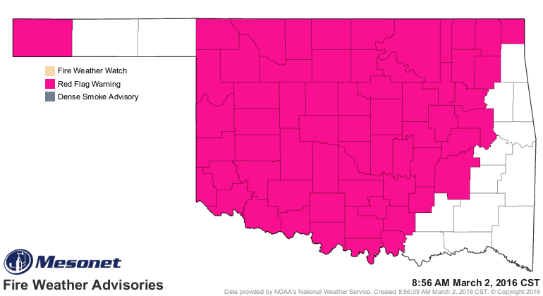
Notice how the Red Flag warning extends into areas that just saw rains a few days
ago?
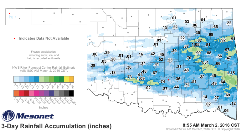
As we've mentioned time and time again, at this time of year, rain plays a much
less important role in fire danger (or the lack thereof) since all that vegetation
remains dead and/or dormant. So the fire danger therefore is much more dependent
upon the day-to-day weather conditions. It will become more important as we
travel deeper into spring and expect that vegetation to green up and become less
of a fuel source for wildfires. To emphasize this point, check out the special
note to firefighters from the Oklahoma Forestry Service this morning:
"With recent rains, soil moisture is high in some areas. Getting an
engine stuck not only takes that piece of equipment out of the
firefight, but may result in a safety hazard if making access to a
fire in unburned fuels. Scout the area on foot prior to committing
engines and adjust tactics to take advantage of natural or man-made
fuel breaks such as roads, creeks and heavily grazed pastures.
Okay, with all that out of the way, here's the setup according to the NWS and the
Oklahoma Forestry Service.
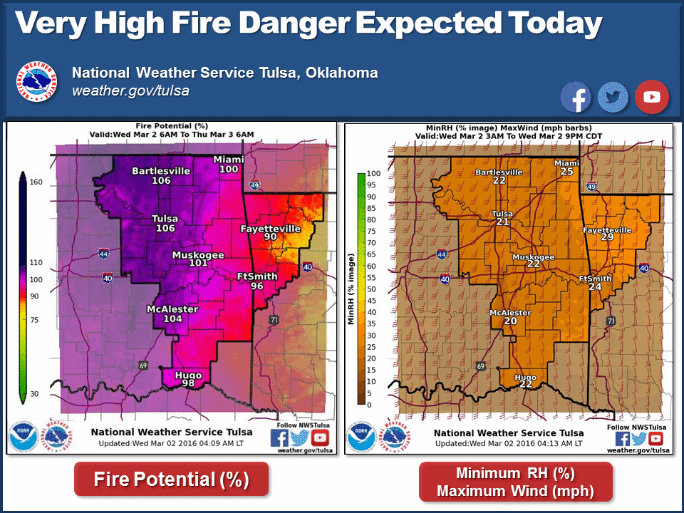
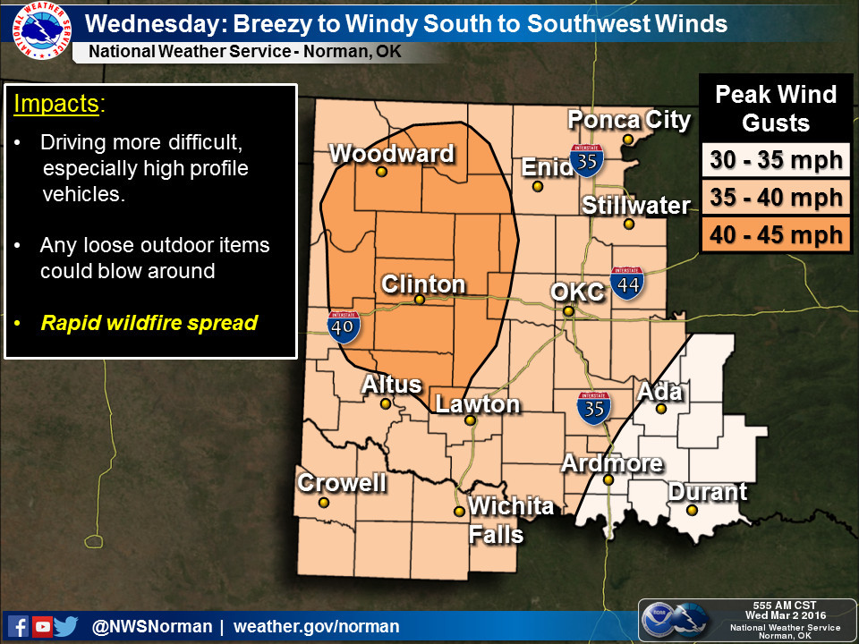
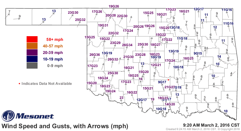
Winds are already kicking up to 30 mph and above out west.
From the OFS:
"Very High to Extreme fire danger indices will be present across most
of Oklahoma today with the greatest intensity centered in western
Oklahoma. Temperatures this afternoon from the upper 60??s to 80?
and ample solar exposure will raise fuel temperature supporting rapid
combustion. Relative humidity values during the peak of the burning
period will register around 20% with some areas in western counties
dipping to 15%. Significant winds are expected through the day
with a south to southwest flow sustained 18-30 mph with gusts near
45 mph in areas from Woodward to Altus. Significant rates of fire
spread in grass dominated fuel models should be expected with potential
for some fires to exhibit nearly 400 ft/min. in horizontally continuous
fuels."
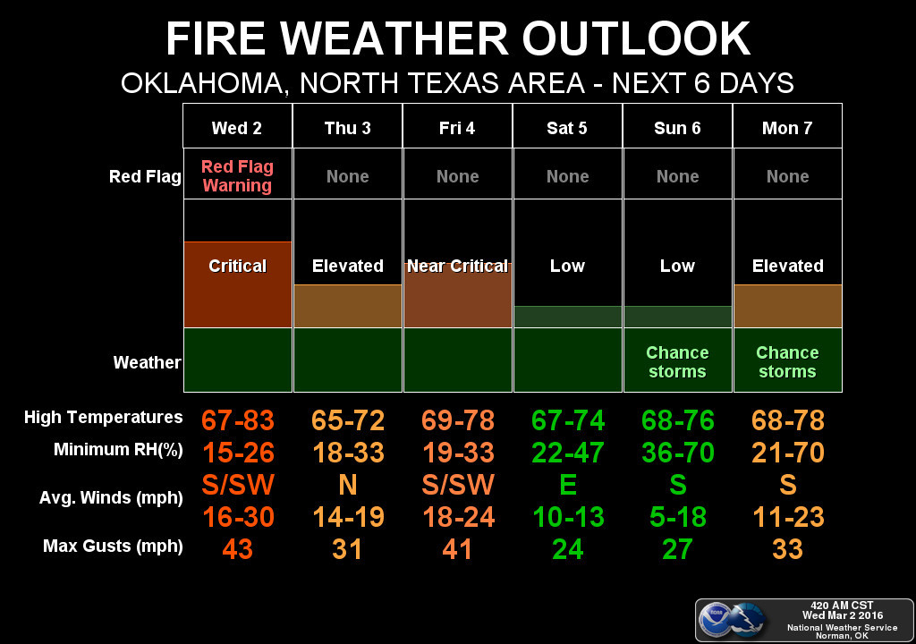
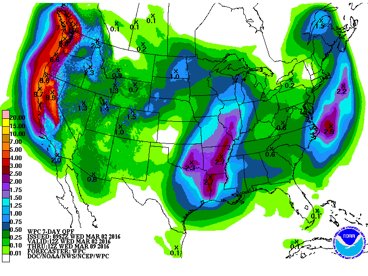
The good news is there will be a chance of rain over the weekend (I know,
I know, but we need the rain) which should aid in that green up we need, since
temperatures show no sign of plummeting anytime soon.
In fact, as we get into early next week, that system has the chance to give us
our second round of somewhat widespread severe weather this year, quickly after
the severe weather of earlier this week. And rainfall amounts will depend on
where any of those heaviest storms hit. And it's always good to remember that
this storm system is still way wayyyyy out in the pacific, so things can and
probably will change as we get closer. And I'm just going to go ahead and say
it, western Oklahoma needs more rainfall than this.
Pretty simple case here. Don't burn outdoors. My advice?
GET TO THE CHOPPAH!
Gary McManus
State Climatologist
Oklahoma Mesonet
Oklahoma Climatological Survey
(405) 325-2253
gmcmanus@mesonet.org
March 2 in Mesonet History
| Record | Value | Station | Year |
|---|---|---|---|
| Maximum Temperature | 85°F | WOOD | 2024 |
| Minimum Temperature | -2°F | BOIS | 2014 |
| Maximum Rainfall | 3.21 inches | HUGO | 2023 |
Mesonet records begin in 1994.
Search by Date
If you're a bit off, don't worry, because just like horseshoes, “almost” counts on the Ticker website!