Ticker for March 1, 2016
MESONET TICKER ... MESONET TICKER ... MESONET TICKER ... MESONET TICKER ...
March 1, 2016 March 1, 2016 March 1, 2016 March 1, 2016
The Winter That Never Was
Last night's storms were greatly appreciated, despite the bouts with occasional
hail and strong winds, because we greatly need the moisture. Pretty spotty in
a fan shaped footprint, expanding from west central Oklahoma through eastern
Oklahoma, amounts generally ranged from about a half-inch to more than 1.25 inches
in some areas.

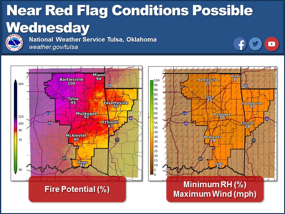
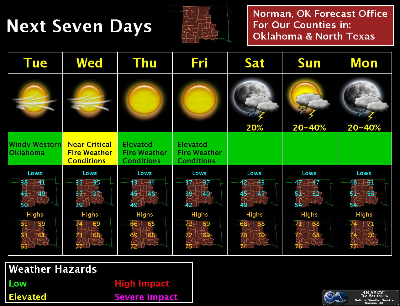
Despite that moisture, too many folks didn't get any, and high fire danger remains
all the rage (and despite all that rage, I'm still just a rat in a cage...
Smashing Pumpkins fans...anybody??), especially for tomorrow.
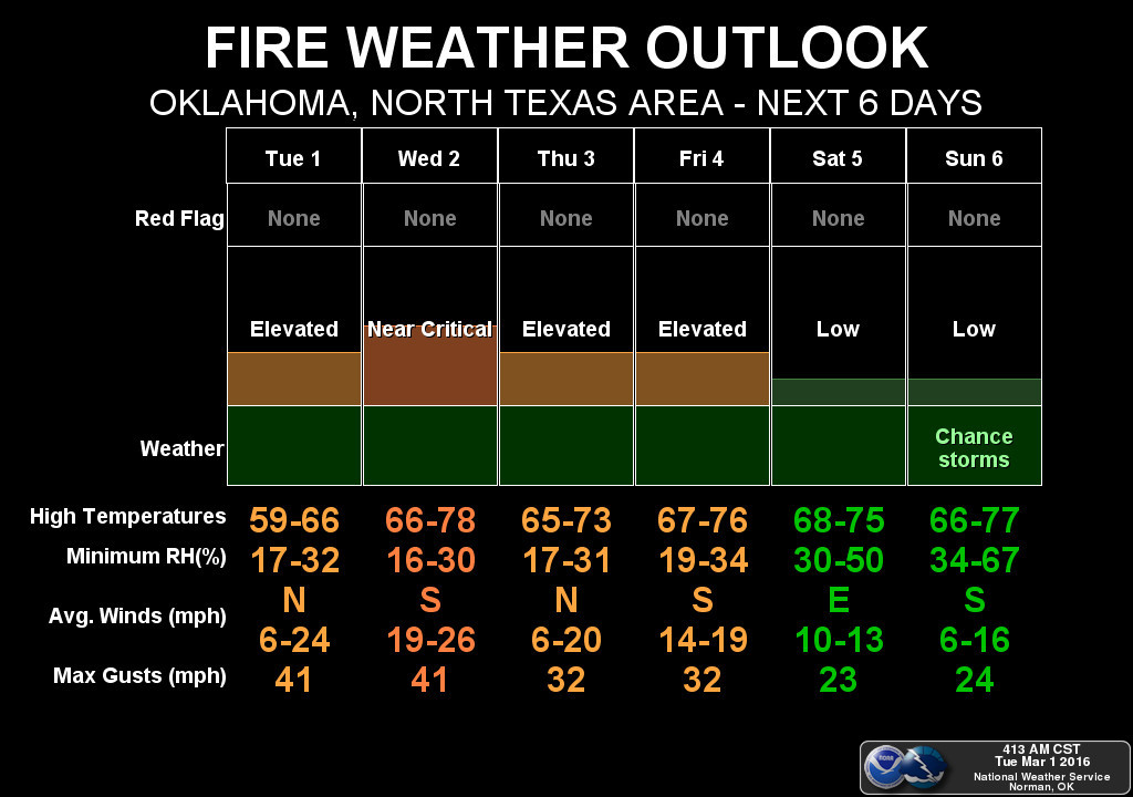
There will be an enhanced chance for some moisture starting this weekend it
appears, and even beyond that point.
With all that to look forward to, now let's take a look back at February and the
climatological winter...or the Winter That Never Was (other than those two ice
storms).
-------------------------------------------------------------------------------
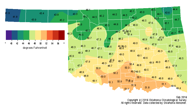
A warm, windy and dry February, plagued by wildfires, served as a fitting
epitaph for a winter that largely failed to materialize. According to
preliminary data from the Oklahoma Mesonet, the month ended more than 5 degrees
above normal to rank as the ninth warmest February since records began in 1895.
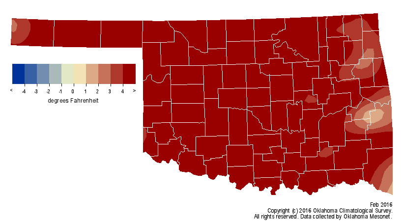
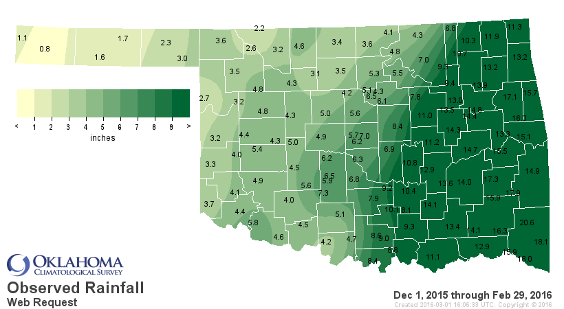
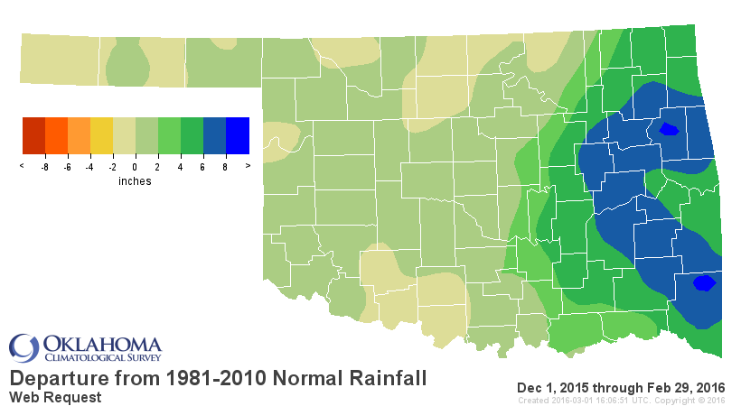
That propelled the climatological winter, December through February, to the
fourth warmest on record at nearly 4 degrees above normal.


February high temperatures rose consistently into the 70s and 80s according to
the Mesonet, with Buffalo reaching the month?s highest reading of 91 degrees on
the 18th. The lowest temperature of 2 degrees was recorded at Kenton on the
third. Only three single-digit low temperatures were reported by the 120 Mesonet
stations during February. The 91 degrees at Buffalo was also the winter?s
highest reported temperature. Somewhat more unusual was the lack of any
temperatures that fell below zero during the winter. Kenton fell to zero
degrees on Dec. 17th for the Mesonet?s lowest winter temperature, and the
National Weather Service (NWS) cooperative observers at Okay and Ralston
matched that mark.
Giving February an extra day this leap year helped improve the rainfall
statistics with a burst of spring weather to end the month. Storms, severe at
times, fired early in the evening across western Oklahoma before progressing
east overnight. The rainfall amounts were spotty, but added enough moisture to
bump the statewide average for the month to 1.13 inches, 0.7 inches below normal.
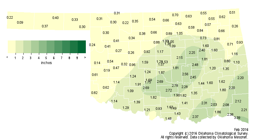
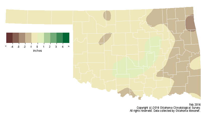
The Mesonet site at Idabel led the state with 3.39 inches during February. The
Boise City Mesonet site brought up the rear with 0.09 inches. The wettest
December on record helped boost the winter to rank as the 15th wettest for the
state at 1.5 inches above normal, despite the 19th driest January-February
period.
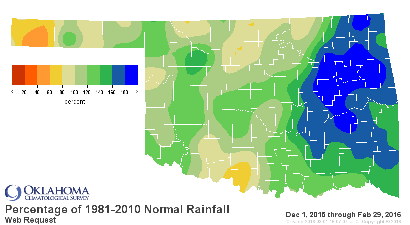
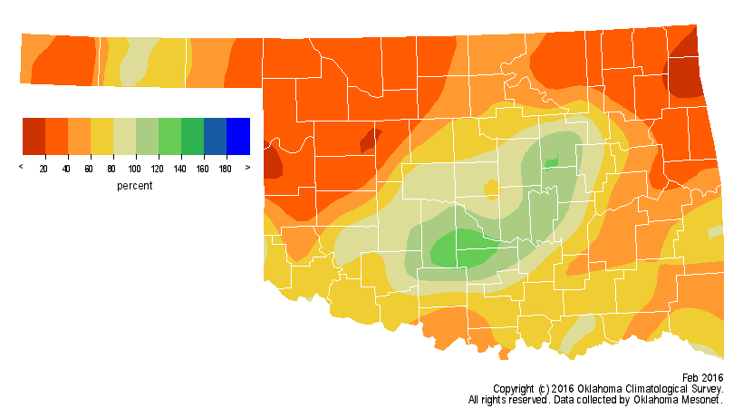
The first two months of the year saw a statewide average of 1.64 inches, nearly
2 inches below normal.
The spate of dry weather since the beginning of 2016 left the state with
something it had not seen since late last fall ? a splotch of color on the U.S.
Drought Monitor map.
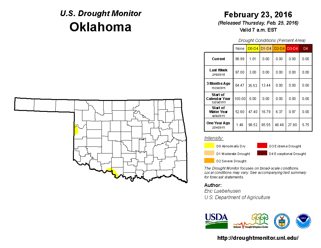
Granted, there was no drought indicated on that map, but small patches of
abnormally dry (D0) conditions were noted across south central and west central
Oklahoma. Although not a drought designation, the abnormally dry label can
indicate areas that are either entering or exiting drought; the former in this
case. The dry start to the year combined with the warm and windy weather during
February to create numerous days with high fire danger. The worst of those days
came on Feb. 18 when highs in the 80s and 90s combined with winds gusting up to
60 mph and relative humidity readings in the teens to spark several large fires
across the state. Tens of thousands of acres were burned, including a 22,000
acre fire in Okmulgee and Okfuskee counties and a 17,000 acre fire in Harper
County. The fire danger remained high through the month?s final day.
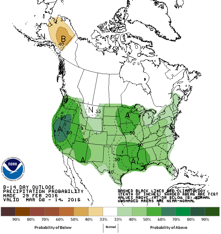
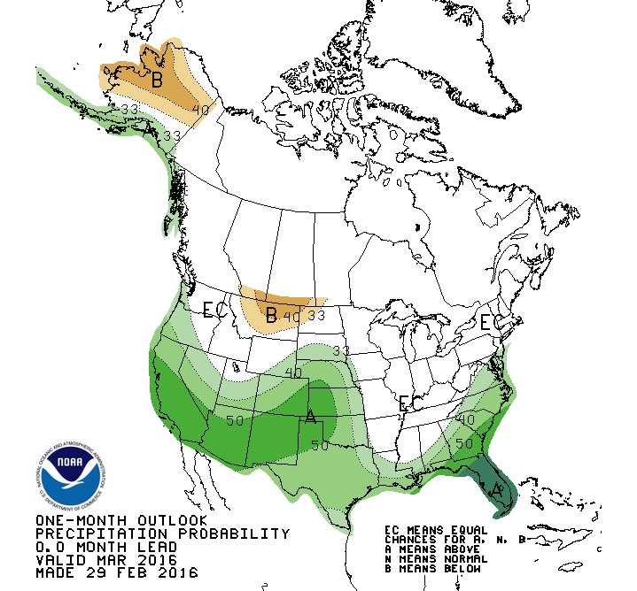
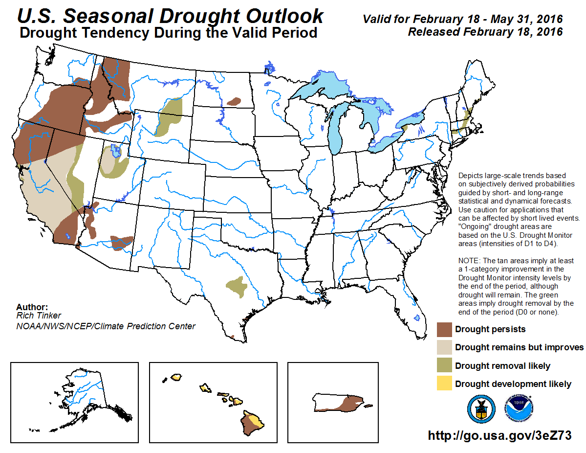
The Climate Prediction Center (CPC) continues to hint at an influence from El
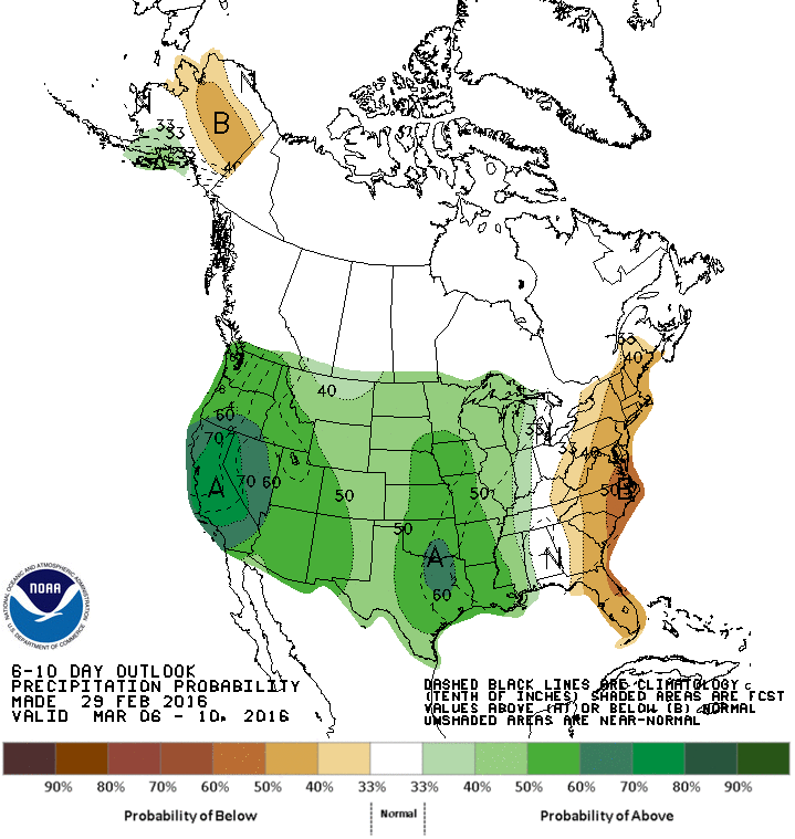
Ni?o through at least mid-spring. The March precipitation outlook shows
increased odds of above normal precipitation across the entire state, but
especially across the western third including the Panhandle.
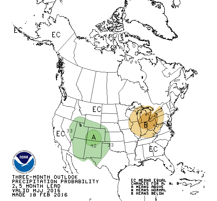
As El Ni?o is expected to fade, so are the odds of wetter than normal
conditions. Those odds weaken and shrink westward through spring before
dissipating in the summer. The outlook for May-July sees the last remnants of
El Ni?o?s influence, albeit weakly, across the Panhandle.
The odds of below normal precipitation then begin to take hold and expand
across the Southern Plains next fall and winter with the expected development
of La Ni?a conditions in the equatorial pacific. Given the bullish precipitation
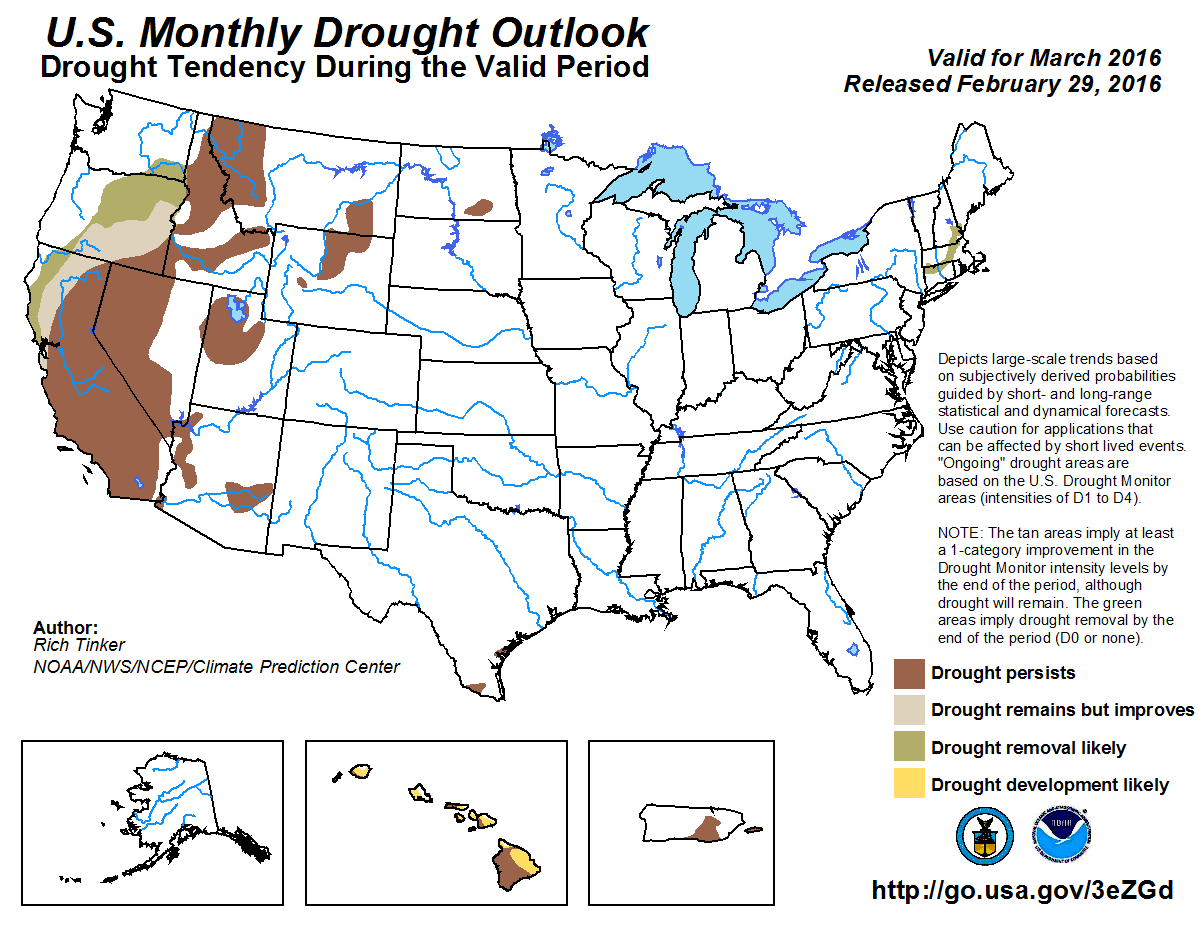
outlook for the next several months, CPC?s March and Seasonal U.S. Drought
Outlooks do not depict any drought developing within the state of Oklahoma
through the end of May.
Gary McManus
State Climatologist
Oklahoma Mesonet
Oklahoma Climatological Survey
(405) 325-2253
gmcmanus@mesonet.org
March 1 in Mesonet History
| Record | Value | Station | Year |
|---|---|---|---|
| Maximum Temperature | 95°F | NEWP | 2006 |
| Minimum Temperature | 7°F | GOOD | 2001 |
| Maximum Rainfall | 1.86 inches | HUGO | 1997 |
Mesonet records begin in 1994.
Search by Date
If you're a bit off, don't worry, because just like horseshoes, “almost” counts on the Ticker website!