Ticker for February 29, 2016
MESONET TICKER ... MESONET TICKER ... MESONET TICKER ... MESONET TICKER ...
February 29, 2016 February 29, 2016 February 29, 2016 February 29, 2016
All HAIL leap day!
Give Mother Nature an extra day in Oklahoma and you're just asking for trouble.
The state will finally see a cold front with some decent moisture to work with.
Add heat and a bit of a strong jet stream and poof!, you have a springtime severe
weather setup. Luckily most of the action will occur later into the evening so
not a ton of heating, but enough to bring a risk of severe storms with the
possibility of large hail and strong winds being the highest risk according to
the Storm Prediction Center. As of now, west central through northeast Oklahoma
stands the highest risk, although SPC terms it "slight" with a big of marginal
risk surrounding that area.

As you can see from SPC's categorical risks, the tornado threat is negligible with
wind being a bit higher and hail the highest (but not THAT high) threat.

Also remember that this is the early morning update from SPC, and these outlooks
can often change throughout the day. AND ANYTIME THERE IS A THREAT OF SEVERE
WEATHER IN OKLAHOMA, THE MOST PRUDENT COURSE OF ACTION IS TO STAY WEATHER AWARE!
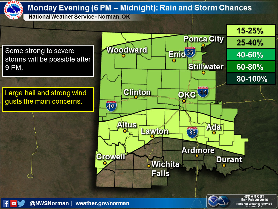
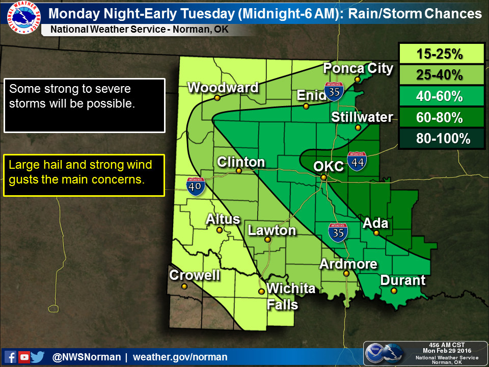
The timing is delineated pretty well by our local NWS offices. Expect an late
afternoon/early evening start with increasing chances the deeper into the night
that you go.
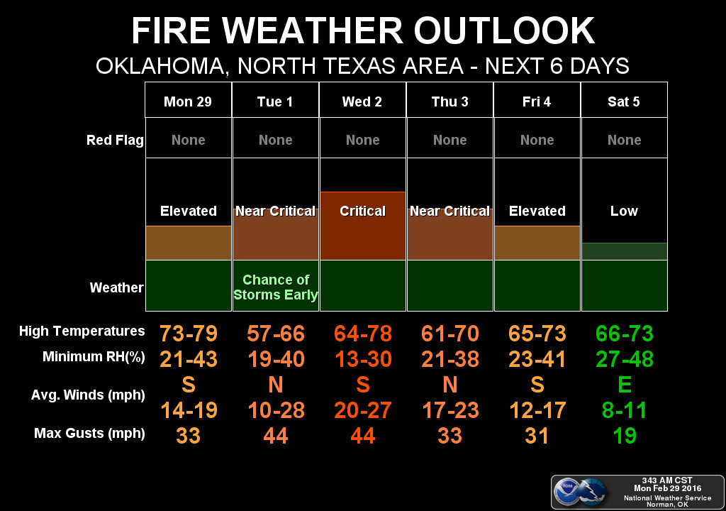
Plus it's going to be just windy and dry enough (with all that dormant vegetation
sticking around) that fire danger will continue to be a problem, even today
when storms are expected. And given that the cold front associated with this
system is more like a "mild front," that fire danger will remain somewhat
elevated, reaching critical levels on Wednesday. Don't be shocked to see Red
Flag warnings on Wednesday.
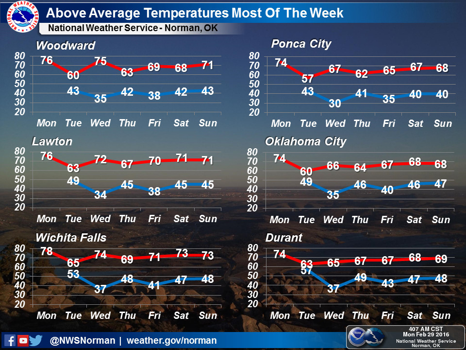
Other than all that unpleasantness (except the rain), we can now focus on the
fact that spring has apparently sprung for the time being. No hint of any sort
of arctic air coming our way for the near future, and other than a bit of a cool
down after tonight's front, it looks like clear sailing into March. The 60s and
70s are here for awhile.
OH YES, the rain. This looks to be a bit of a narrow heavy banding event, but
if it's wet, we'll take it!
Gary McManus
State Climatologist
Oklahoma Mesonet
Oklahoma Climatological Survey
(405) 325-2253
gmcmanus@mesonet.org
March 1 in Mesonet History
| Record | Value | Station | Year |
|---|---|---|---|
| Maximum Temperature | 80°F | WAUR | 2016 |
| Minimum Temperature | 19°F | KENT | 2012 |
| Maximum Rainfall | 1.11 inches | ACME | 2016 |
Mesonet records begin in 1994.
Search by Date
If you're a bit off, don't worry, because just like horseshoes, “almost” counts on the Ticker website!