Ticker for February 25, 2016
MESONET TICKER ... MESONET TICKER ... MESONET TICKER ... MESONET TICKER ...
February 25, 2016 February 25, 2016 February 25, 2016 February 25, 2016
We lost some yeller
Lost in last week's fire madness was the reintroduction of some unwanted colors
on the U.S. Drought Monitor map for Oklahoma. Remember this?
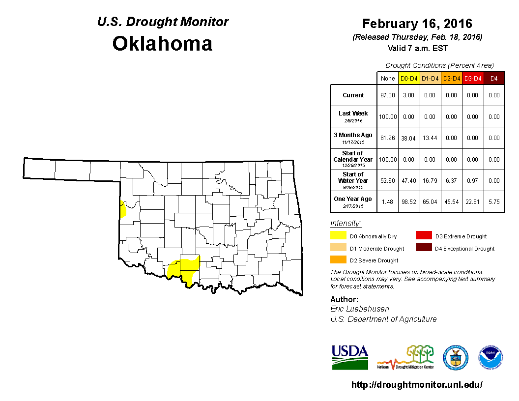
Well, that was last week. Then, we FINALLY managed to get a burst of rain across
the SE half of the state, which eradicated at least a tiny bit of that yellow
"Abnormally Dry" color to give us this week's less yeller map.

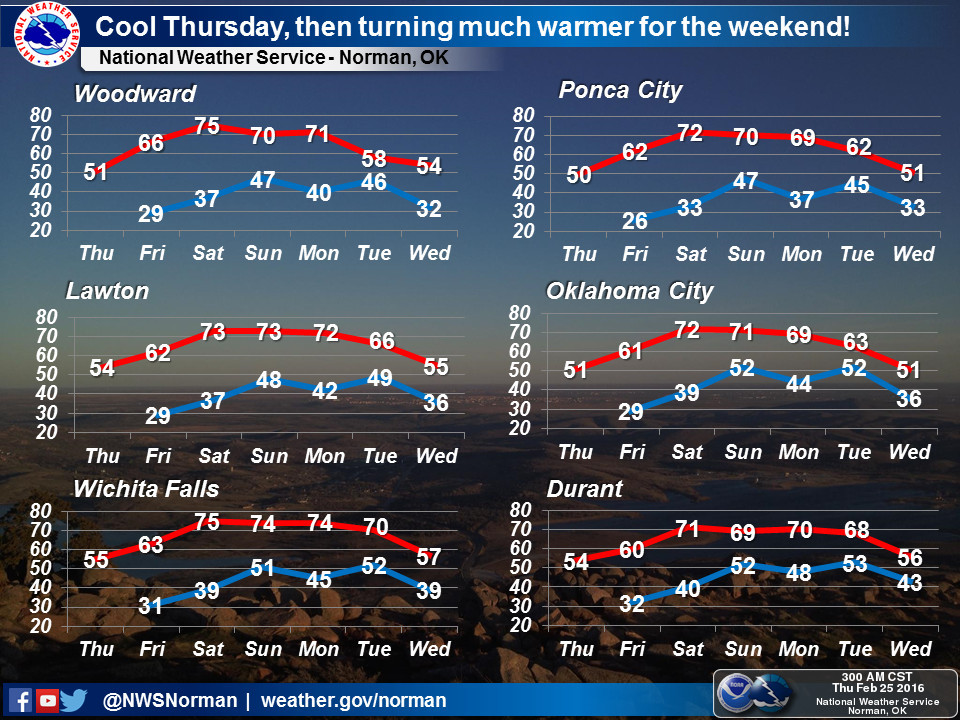
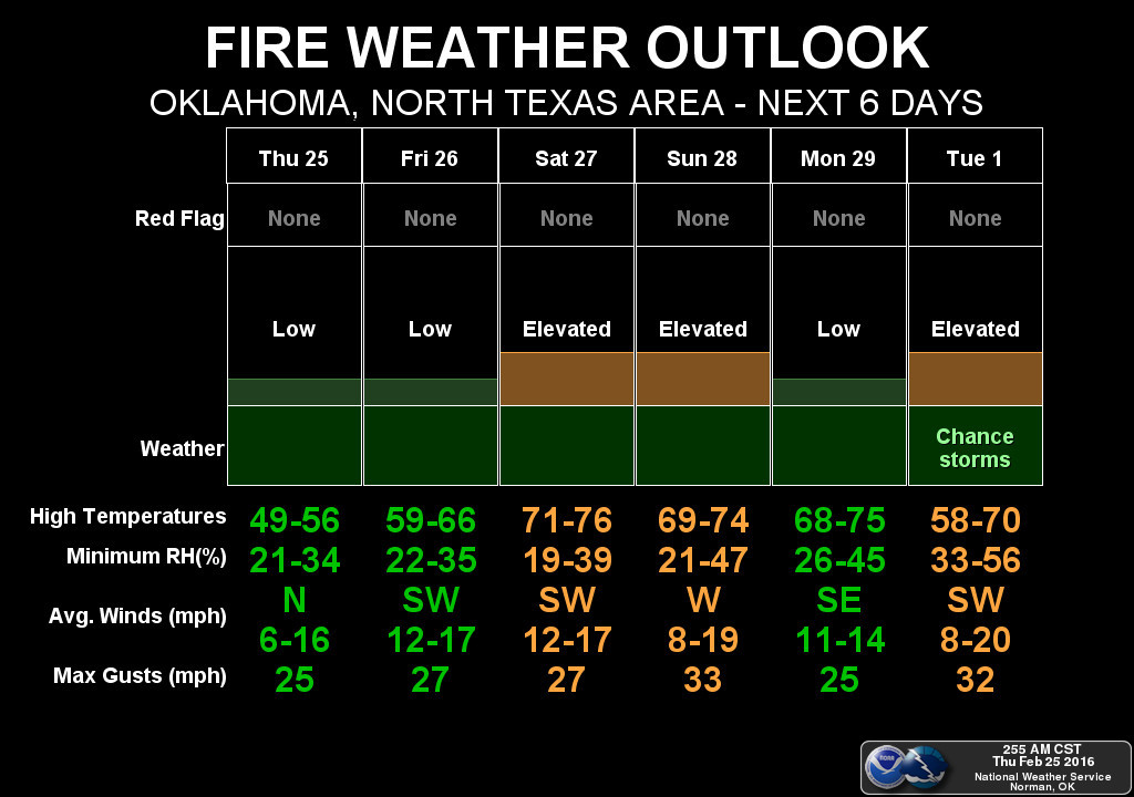
With our next rain chances 4 or 5 days out, we now look towards the weekend and
some nice weather. Highs should return to the 70s with lots of sunshine in the
offing. There will be elevated fire danger once again, but we should start
to green up pretty rapidly if we stay warm and continue to get these bursts of
rain.


Also lost was the mention of the spring outlooks from CPC. With El Nino still
chugging along (but fading), the classic impacts of that phenomenon are still
showing up in those long range outlooks. We see increased odds of below normal
temperatures across the western half of the state, and increased odds of above
normal precipitation (especially across western Oklahoma once again).
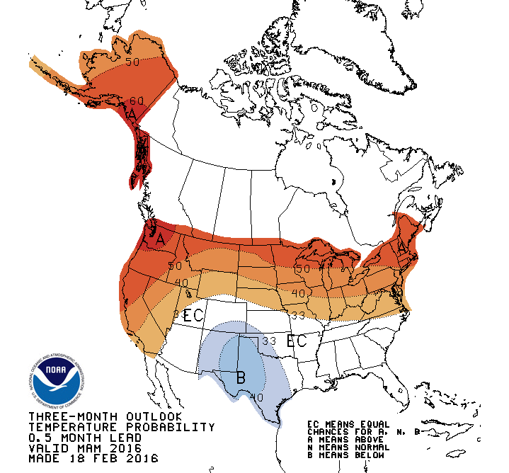
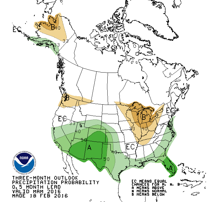
Let me strongly caution you once again to not mistake that white "EC" (Equal
Chances) area on the map to mean "normal." The EC areas are where the
forecasters couldn't really make a call in favor of below-, above- or near-normal
conditions being favored, so all have an equal possibility in their eyes.
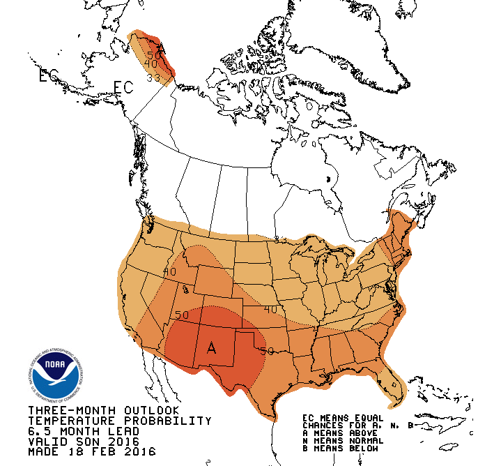
La Nina is still a moderately significant possibility come next fall and winter,
and the outlooks start to reflect those impacts as early as the Sept-Nov period.
Those impacts being increased odds of above normal temps and below normal
precip for our neck of the woods.

By the Dec-Feb winter period, the outlooks take on the classic La Nina look with
warm and dry weather favored across the southern tier of the U.S. and cool and
wet weather more likely across the northern tier.
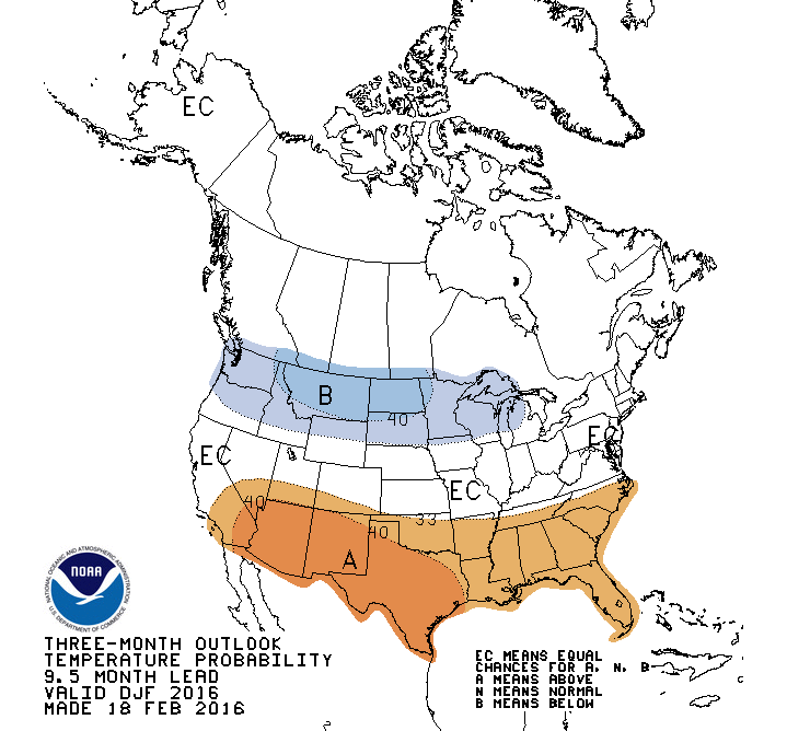
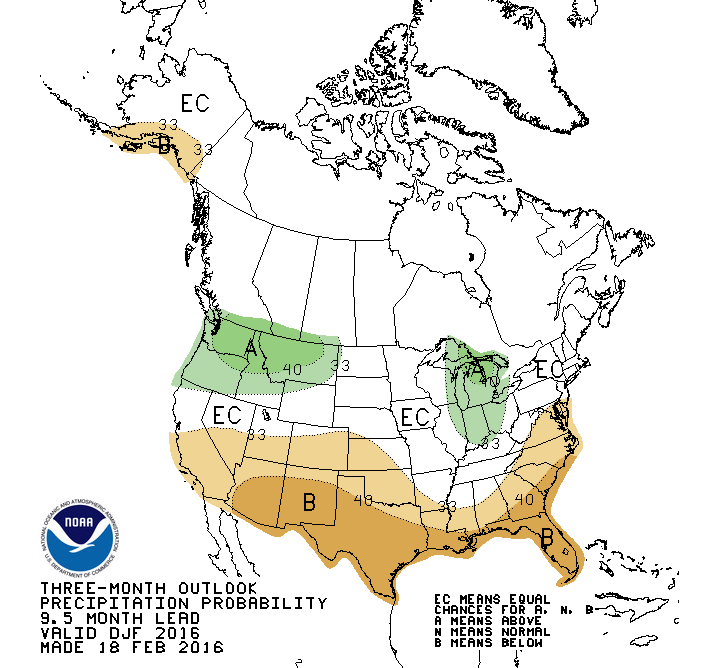
The precautions are obvious...La Nina actually has to develop, and even then
the impacts are only a possibility for our area, not a certainty.
The storm system for early next week will need to be watched for the possibility
of either severe weather, winter weather, or even both.
It'll be early March. The fickleness of Mother Nature is expected.
Gary McManus
State Climatologist
Oklahoma Mesonet
Oklahoma Climatological Survey
(405) 325-2253
gmcmanus@mesonet.org
February 25 in Mesonet History
| Record | Value | Station | Year |
|---|---|---|---|
| Maximum Temperature | 85°F | HOLL | 1999 |
| Minimum Temperature | -2°F | CHER | 2003 |
| Maximum Rainfall | 1.79 inches | KIN2 | 2013 |
Mesonet records begin in 1994.
Search by Date
If you're a bit off, don't worry, because just like horseshoes, “almost” counts on the Ticker website!