Ticker for February 24, 2016
MESONET TICKER ... MESONET TICKER ... MESONET TICKER ... MESONET TICKER ...
February 24, 2016 February 24, 2016 February 24, 2016 February 24, 2016
Dumb and Wetter

Yeah, it does kind of make you want to throw up, much like our dumb friend Lloyd
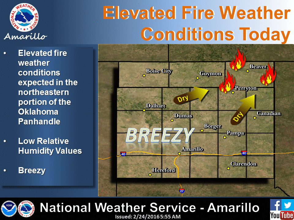
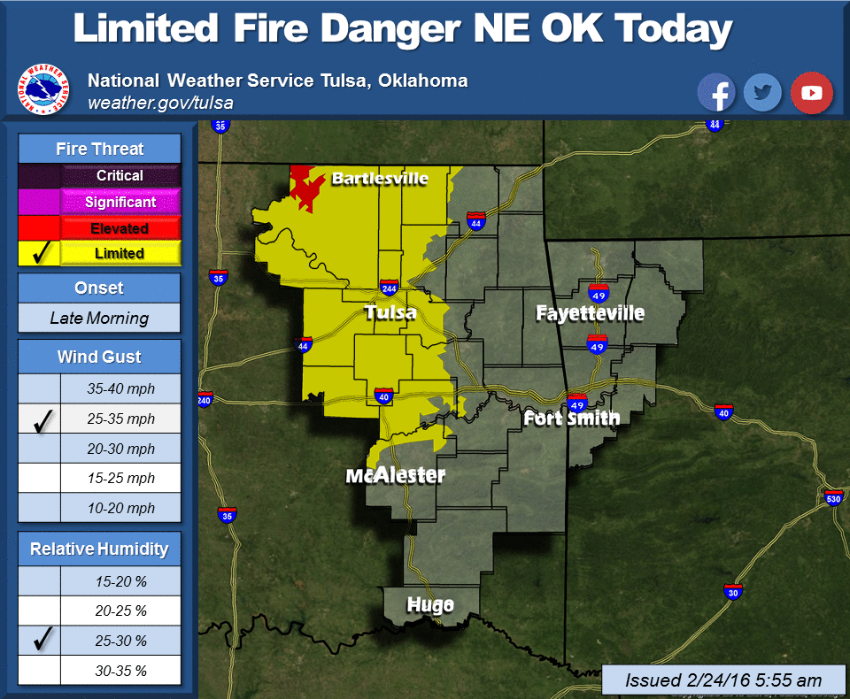
there across the NW half of the state, especially across those areas that suffered
from the fires up in the NW. A closer look (sans nauseated Lloyd and happy Harry)
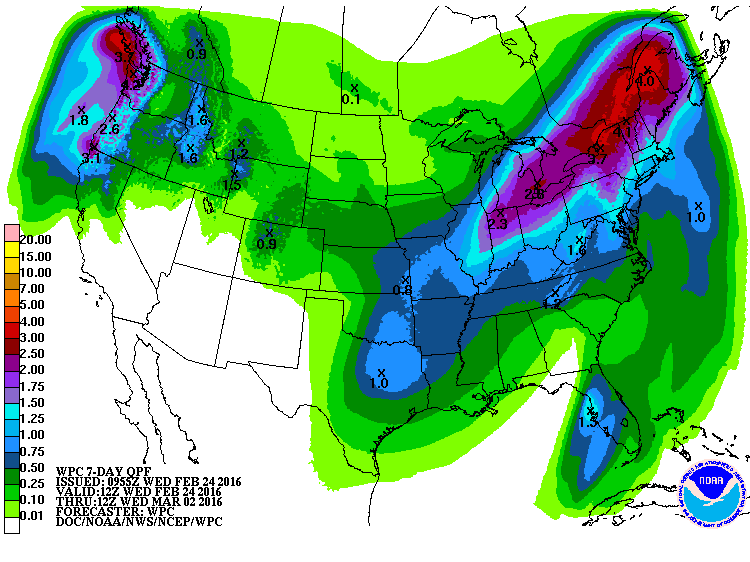
shows that the buildup to drought across the SE half (or so) of the state took
another bullet with a good 1-2 inches of rainfall.
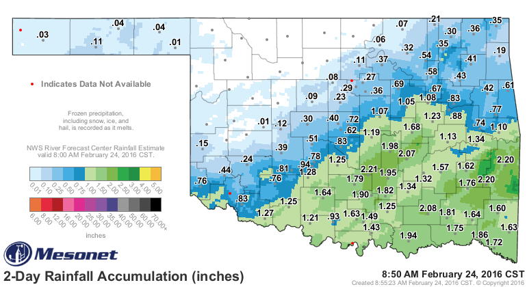
That pares all those nasty orange colors on the "days without at least" Mesonet
rainfall maps, and highlights the areas that will now need moisture to avoid
sinking into dangerous drought territory as we head to warmer weather (heck, as
we remain in the midst of warmer weather!).
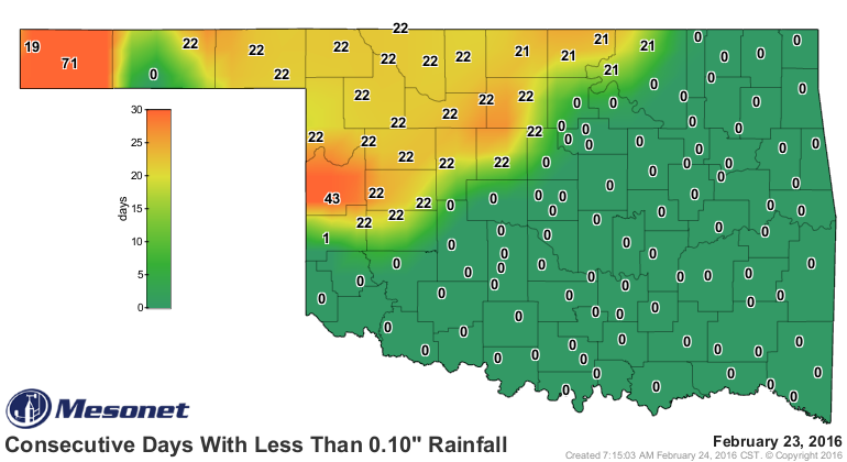
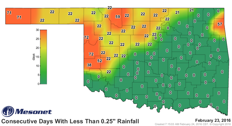
Up to 72 days without a day with at least 0.25" of rain in some areas. Yikes!
57 days over in Delaware County. That ain't good either. I'm afraid we're in for
another week-long dry spell, with maybe the hint of some precip as we get a bit
to the end of that 7-day forecast. That moisture is starting to show up on the
7-day moisture forecast. PLEASE keep in mind though that the storm system we're
talking about here is still way out in the pacific, and it's track and impacts
are still a bit uncertain at this time.
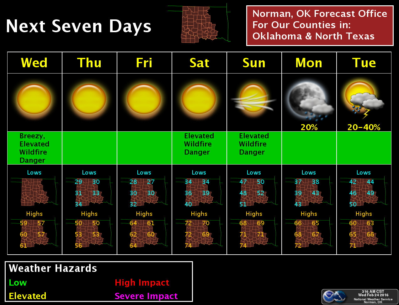
As we promised in the last Ticker, however, here comes the fire danger again!

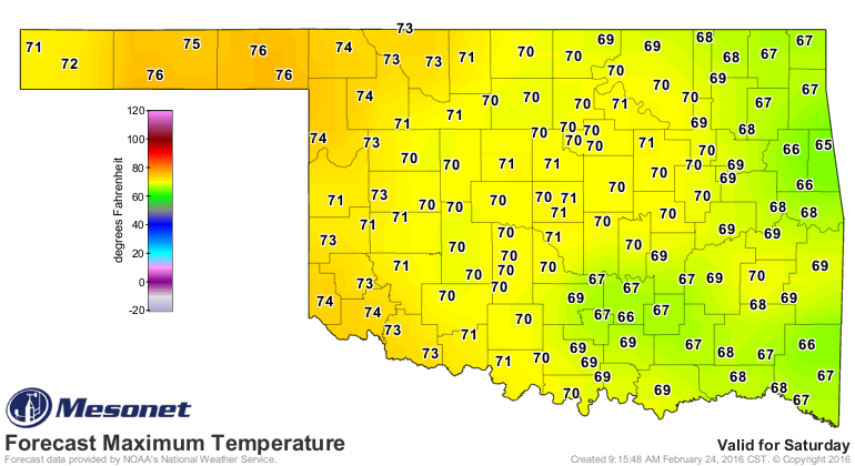
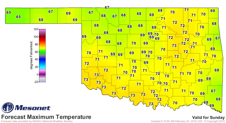
At the least, Mother Nature owes us a nice weekend, no?
Done!
Harry, Lloyd, your thoughts?

Gary McManus
State Climatologist
Oklahoma Mesonet
Oklahoma Climatological Survey
(405) 325-2253
gmcmanus@mesonet.org
February 24 in Mesonet History
| Record | Value | Station | Year |
|---|---|---|---|
| Maximum Temperature | 82°F | HOLL | 2002 |
| Minimum Temperature | -3°F | EVAX | 2022 |
| Maximum Rainfall | 2.61 inches | MTHE | 2018 |
Mesonet records begin in 1994.
Search by Date
If you're a bit off, don't worry, because just like horseshoes, “almost” counts on the Ticker website!