Ticker for February 22, 2016
MESONET TICKER ... MESONET TICKER ... MESONET TICKER ... MESONET TICKER ...
February 22, 2016 February 22, 2016 February 22, 2016 February 22, 2016
Gimme Moisture
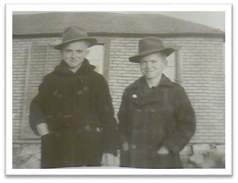
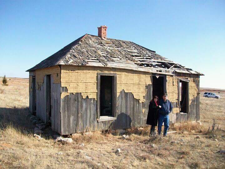
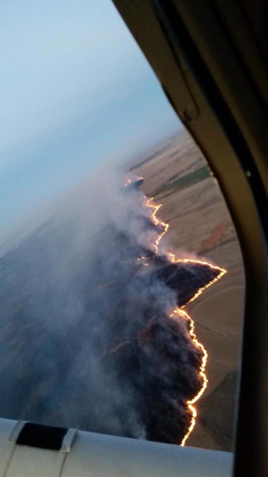
Yes, last week's fires were nasty, so we won't dwell on that. Even the Ticker was
impacted when our family's old homestead, built in 1905 by our great-great
grandparents (and where our grandparents raised their 8 kids until they moved to
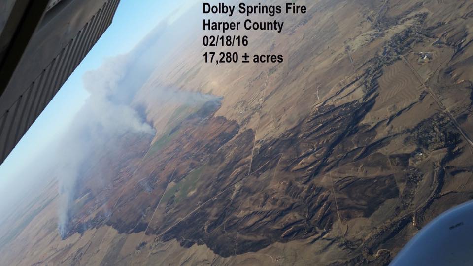
town in 1950 for a bit of running water and electricity), burned in the 17,000
acre fire north of Buffalo in Harper County.
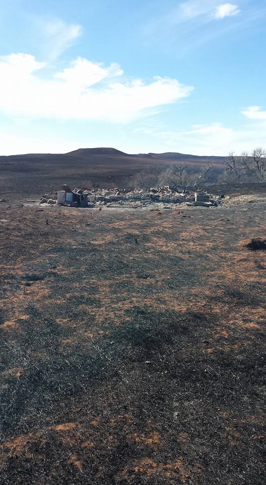
The aerial view of that fire gives you a good idea of what it was like.
So everybody is obviously thankful for the moist air that has moved in AND the
moisture we are slated to receive today and tomorrow. It even looks fairly
substantial for a decent part of the state (you indecent folks will have to do
without...wait, I think I used that word incorrectly!).
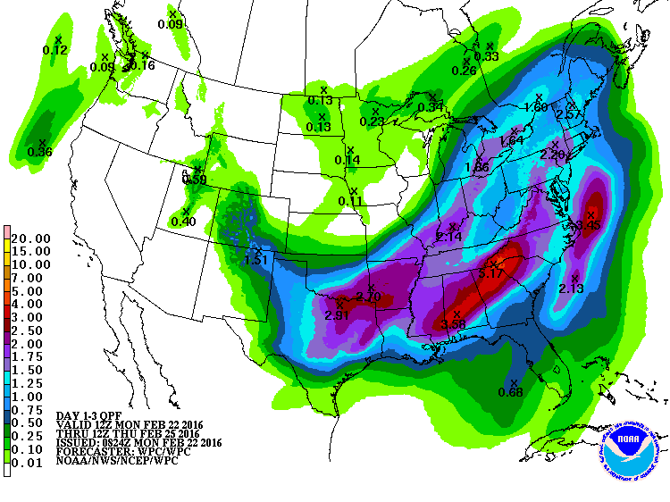
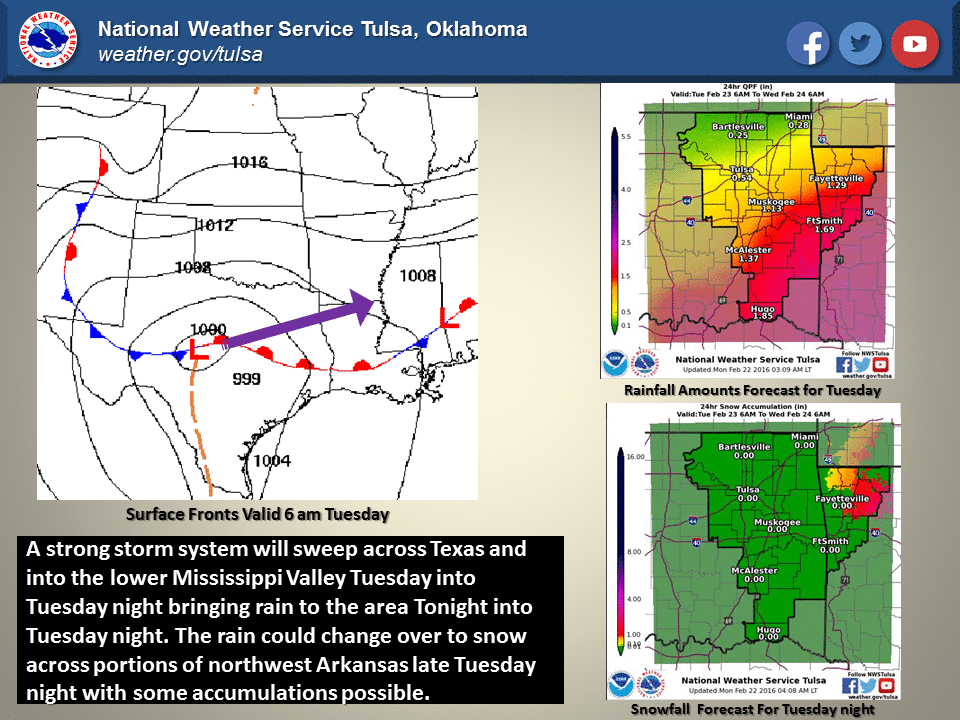
According to the local NWS offices, we can expect some decent rains, maybe some
storms...and snow?
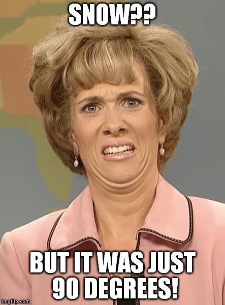
NO, SAY IT AIN'T SNOW, JOE!
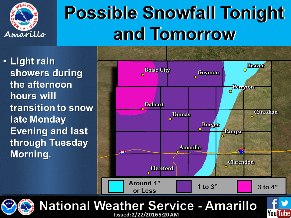
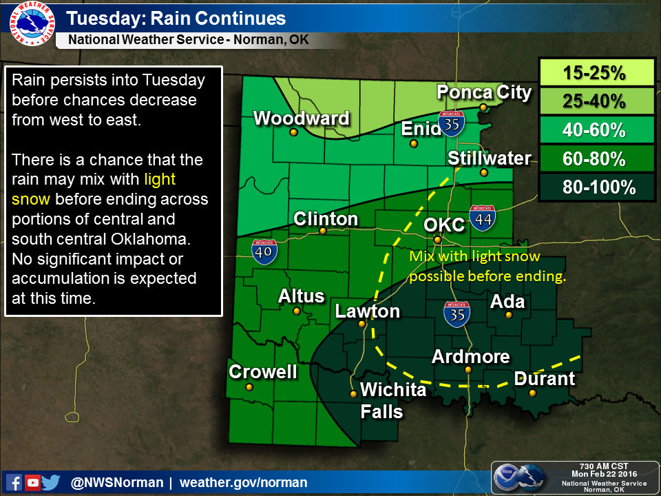
So obviously the Panhandle is expecting some good snows. Hey, it's the
Panhandle, it's what they do. Plus it was in the 80s and 90s last week, so I'm
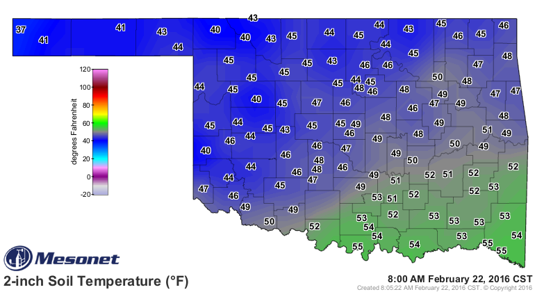
doubting it lasts long. Same goes for other parts of the state...ground
temps are extremely warm for this time of year.
That will rise a bit today before the main show tomorrow anyway. The Norman
NWS office mentions...well, I'll just quote them:
"THERE IS ALSO A CHANCE FOR A RAIN/SNOW
MIX OR ALL SNOW TRANSITION ACROSS FAR WESTERN OKLAHOMA LATE
TONIGHT AND EARLY TUESDAY MORNING BUT CONFIDENCE NOT AS HIGH...SO
HAVE NOT MENTIONED SNOW POSSIBILITIES WEST. IF WE DO GET A
TRANSITION TO SNOW ON NORTH/NORTHWEST SIDE OF INTENSE MID- LEVEL
LOW...PRIMARILY IMPACTS WILL BE RAPID ACCUMULATIONS ON ELEVATED
OBJECTS/TREES/GRASS... PERHAPS TWO OR THREE INCHES. IF THERE ARE
HEAVY ENOUGH BANDS OF SNOW...BRIEF SLUSHY ROADWAYS AND REDUCTIONS
IN VISIBILITY WILL ALSO BE HAZARDS. WITH TEMPERATURES EXPECTED TO
STAY NEAR OR ABOVE FREEZING IN AREA OF CONCERN...AND THE FACT THAT
GROUND TEMPS ARE QUITE WARM...ANY SNOW THAT ACCUMULATES WILL NOT
LAST VERY LONG."
Sounds fairly innocuous to me, but so did my barber's comment 10 years ago that
I was getting a bit thin on top!
And don't think the fire danger is going to disappear just because we're gonna
see rain. Fire danger will be elevated once again as early as Wednesday as we
see dry air and strong winds return. That's the way it works in the cool season
with the dead/dormant vegetation out there. All we need are the proper day-to-day
weather ingredients to dry out that fuel and poof, you have fire danger. But we
are going to see a general calming down of the fire weather it appears.
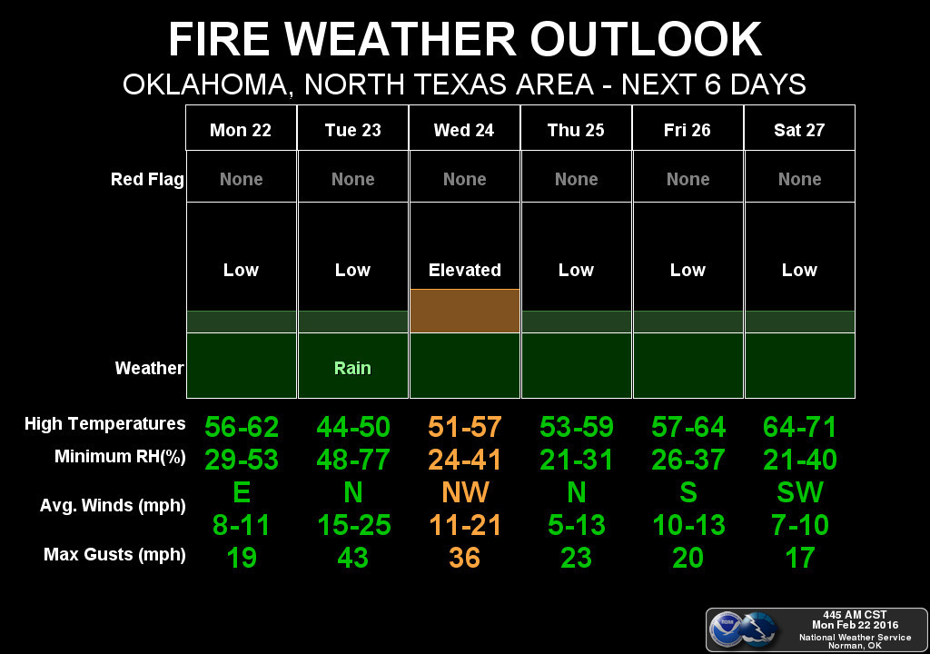
Notice that the winds will be similar on Tuesday and Wednesday, but the moisture
will make all the difference.
Gary McManus
State Climatologist
Oklahoma Mesonet
Oklahoma Climatological Survey
(405) 325-2253
gmcmanus@mesonet.org
February 22 in Mesonet History
| Record | Value | Station | Year |
|---|---|---|---|
| Maximum Temperature | 86°F | HOLL | 2017 |
| Minimum Temperature | -2°F | HOOK | 2013 |
| Maximum Rainfall | 2.74 inches | BROK | 2018 |
Mesonet records begin in 1994.
Search by Date
If you're a bit off, don't worry, because just like horseshoes, “almost” counts on the Ticker website!