Ticker for February 18, 2016
MESONET TICKER ... MESONET TICKER ... MESONET TICKER ... MESONET TICKER ...
February 18, 2016 February 18, 2016 February 18, 2016 February 18, 2016
Just don't do it.
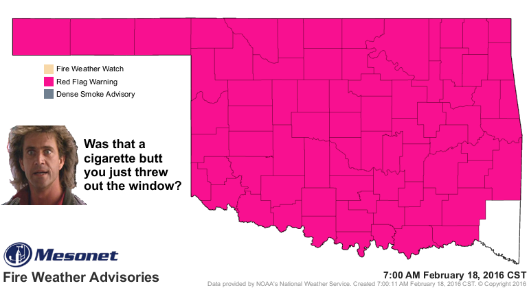
I agree with Mel. This just ain't the day to do it. Whether you're thinking about
welding, grilling, starting up that old lawn mower that throws sparks out its
muffler, throwing your butt out the window (wouldn't that be odd!), etc.
Just don't do it.
Don't take it from me, take it from Governor Fallin:
"We know from past experience that everyone doing their part can have
an effect. This is a short duration event with potentially dire
consequences. But vigilant residents can reduce the potential impacts.
Simple, everyday activities like welding, charcoal grilling or campfires
should be postponed until conditions improve. Furthermore, residents
should call their nearest fire department immediately if they see smoke
or fire. Time is of the essence, because under extreme conditions any
fire that starts will spread rapidly.?
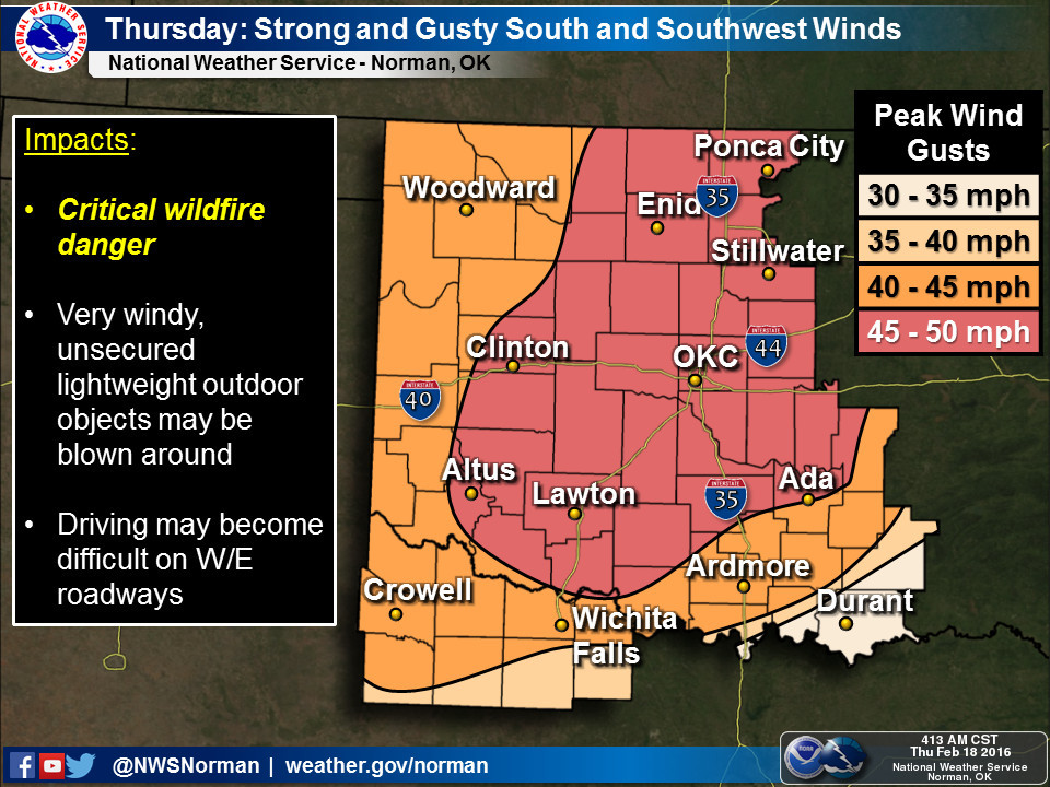
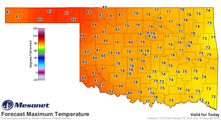
76 of 77 Oklahoma counties are under a Red Flag Fire warning, meaning any fires
that ignite will quickly get out of control and risk lives and property. The
main time of concern will be from noon thru 7pm, but special care should be
taken outside of those time frames as well. Any fires that start before noon
will become monsters if they're not discovered or brought under control before
the worst of the conditions settle in. And those conditions will consist of
winds gusting to over 50 mph, humidity levels below 20% and record threatening
high temperatures.
We've talked about this all week, so there's no reason to belabor this point,
but when has that ever stopped me? The big culprit here is the enhanced
vegetative growth thanks to our wet 2015, growth that then became dormant or
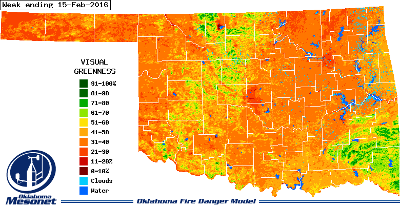
dead during the cool season. As you can see from our OK-FIRE greenness maps,
there just ain't much green out there to inhibit fire.

For more information on the Mesonet's OK-FIRE greenness maps and its products
in general, go here:
http://okfire.mesonet.org/sub_info/?cat=product_info
I urge you to go read Oklahoma Forestry Services' Fire Situation Report for
today. They describe rates of fire spread up to 400 ft/min. I'm thinking my
hundred yard dash time at this point in my life is about a minute. So doing the
math there...100 yards = 300 feet < 400 feet = one burned up State Climatologist.
Gulp.
http://www.forestry.ok.gov/Websites/forestry/images/Fire_Situation_Report_02-18-16.pdf
Okay, enough on the fire situation. We know what to do, and that's JUST DON'T
DO IT!
-------------------------------------------------------------------------------
Another emerging problem in Oklahoma's climate scene is the extreme dryness
we've experienced since the beginning of the year, and especially since about
the 2nd week in January. Just look at the Mesonet maps and stats from the last
30 days.

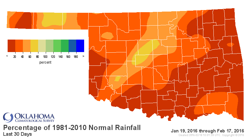
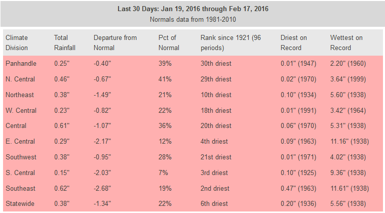
And remember, this is during a time when it's been windy...a lot (SHOCKER!).
And we've also seen high temperatures running about 3 degrees above normal
(normal statewide avg. high = 51.6F, observed = 54.7). Well, all that together
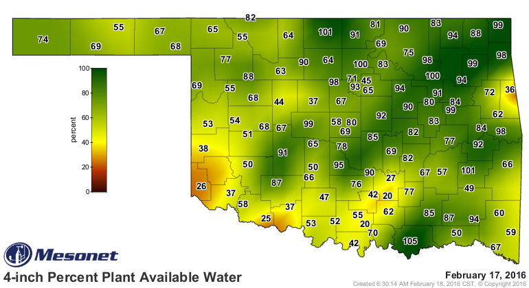
has brought about a quick drop in topsoil moisture, especially across far
western and southern Oklahoma.

That's enough to give us a few splotches of yellow on the new U.S. Drought
Monitor map. And remember, it's only the "abnormally dry D0" category, so it's
not drought. Yet.

The handwriting is in the dirt, however, as we are starting to see those dry
conditions spread north from Texas where drought is becoming more and more
established as we travel without rain deeper into winter and early spring.

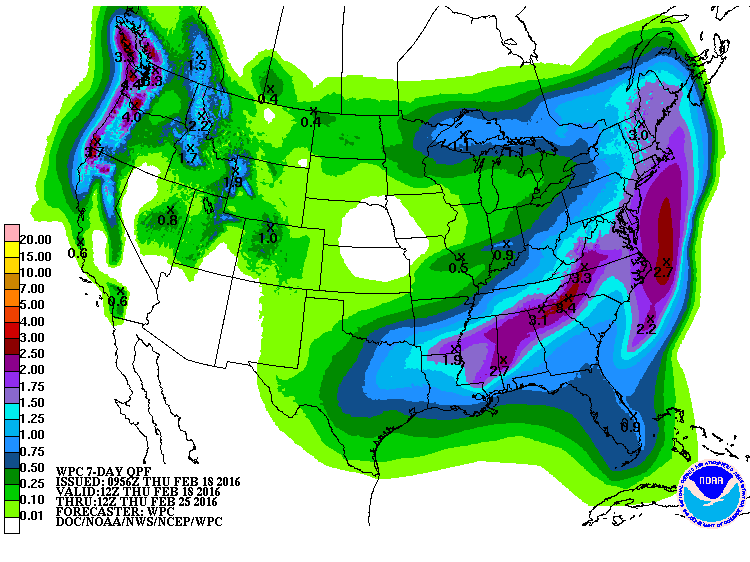
The rain from this system will barely touch those emerging dry areas.
Here's our saving grace(s): the March and March-May precip outlooks still show
a possible wet signal from El Nino, with increased odds of above normal precip
for both periods. The odds are greater in the west vs. the east.


Based on those outlooks, the CPC Seasonal Drought Outlook DOES NOT see this
dry spell to continue much longer. Even with normal spring rains, the drought
should not be able to gain a foothold.
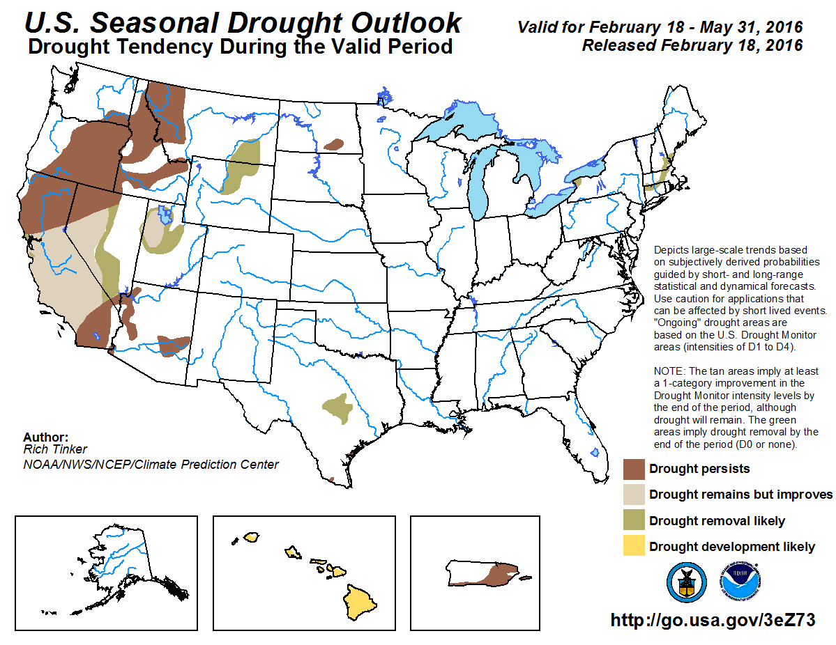
La Nina and enhanced odds for dry weather remain in the crosshairs for next fall
and winter, but that's something we will have to wait a few months on before we
can say it's more of a certainty.
Ugh and double-ugh!
Gary McManus
State Climatologist
Oklahoma Mesonet
Oklahoma Climatological Survey
(405) 325-2253
gmcmanus@mesonet.org
February 18 in Mesonet History
| Record | Value | Station | Year |
|---|---|---|---|
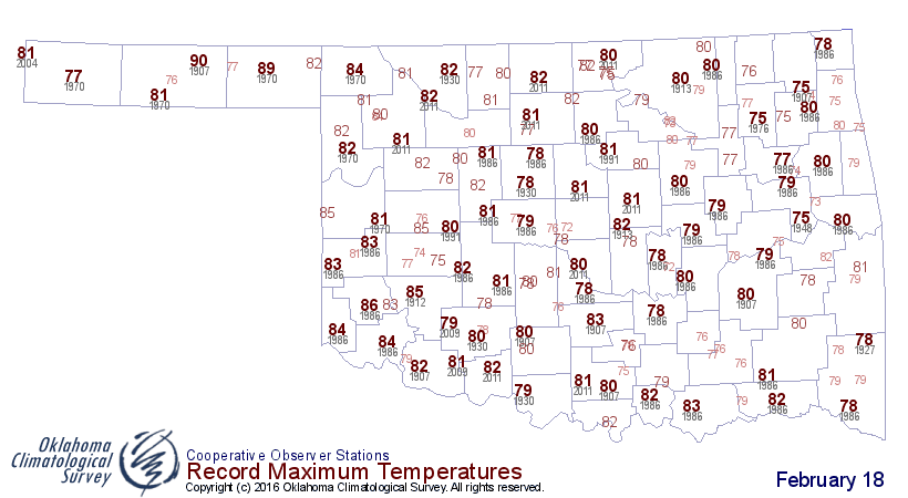
| Maximum Temperature | 91°F | BUFF | 2016 |
| Minimum Temperature | -8°F | TIPT | 2021 |
| Maximum Rainfall | 0.78 inches | TIPT | 1998 |
Mesonet records begin in 1994.
Search by Date
If you're a bit off, don't worry, because just like horseshoes, “almost” counts on the Ticker website!