Ticker for February 17, 2016
MESONET TICKER ... MESONET TICKER ... MESONET TICKER ... MESONET TICKER ...
February 17, 2016 February 17, 2016 February 17, 2016 February 17, 2016
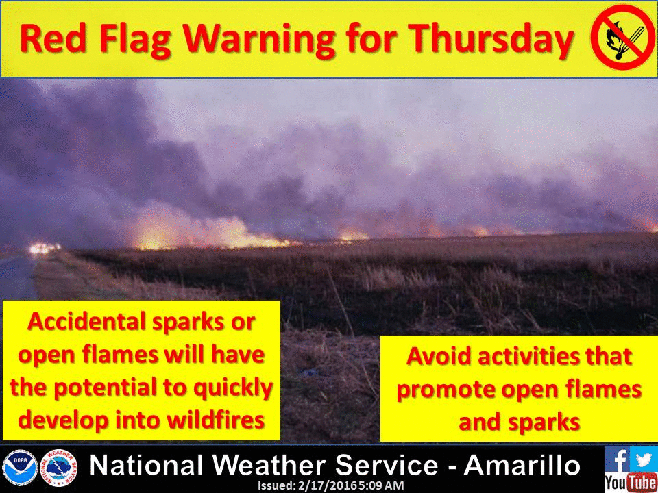
Fire...FIRE!!!
Yes, the Ticker has gone highbrow to get its point across. I'm sure many of you
that signed up for the Ticker thought you were going to get lots of salient,
important info about Oklahoma's weather and climate from an intelligent
source (HEY, I HEARD THAT!). So in order to fulfill that wish, we give
you...Beavis?
But to be serious for a moment, we're rapidly approaching one of those days later
into February with all the characteristics of a classic fire danger setup. Winds
of 30-50 mph, relative humidity down into the teens and near-record temperatures
are going to combine on Thursday to leave the state a tinderbox. And let's not
forget all that rain we had last spring, summer and even late into a very warm
November-December period that has left the state with a massive overgrowth of
fuel for those fires, all sitting dormant or dead waiting for a spark.
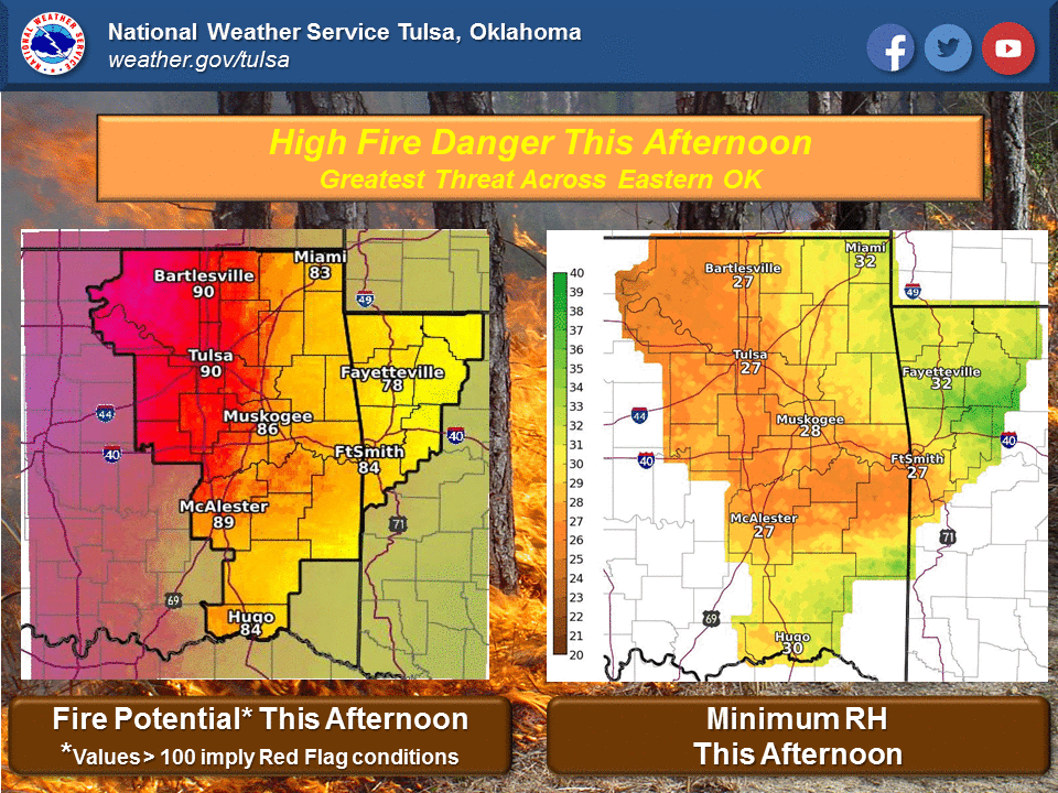
Here is the synopsis from the Oklahoma Forestry Services' Fire Situation Report
for today:
"Very High fire danger will reside across Oklahoma today. Temperature
67?-73? will contribute to pushing relative humidity value to 23-30%
(lower in the Panhandle). The threat will be greatest today along
a broad swath following I-44 as south-southwest winds around 15 mph
gusting in excess of 20 mph at times develop this afternoon. Winds are e
xpected to be lighter and much less gusty than yesterday in southeast
Oklahoma with south winds around 10 mph.
Some fires have exhibited extreme fire behavior and resistance to
suppression efforts. This trend is expected to last through the week.
Timber litter and other sheltered fuel models have transitioned to
supporting active fie behavior. Thursday will present very warm
temperatures, strong winds and low humidity with dry/receptive fuels
in place. A warning indicates that critical fire weather is imminent
while a watch indicates that critical fire weather is likely/possible
and can be upgraded to a warning as conditions merit."
And here is the gist of above in graphical form:


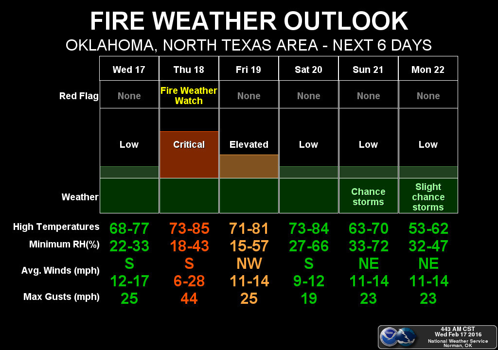

This is all due to a low pressure system approaching from the west that should
eventually drag a cold front through on Friday, but it will have a dryline with
it that will really kick up the fire danger out west. How far east that dryline
moves will determine where the really bad fire danger is (Red Flag Warnings) to
just bad fire danger (Fire Weather Watch, perhaps).
And let's not forget that the fire danger will also be elevated today and also
on Friday, but Thursday is the real kicker.
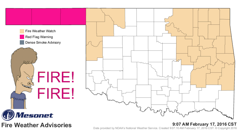
Right now, we do see those Red Flag warnings for the High Plains, and a Fire
Weather Watch for the far NW and also much of eastern OK, extending into the
surrounding states.
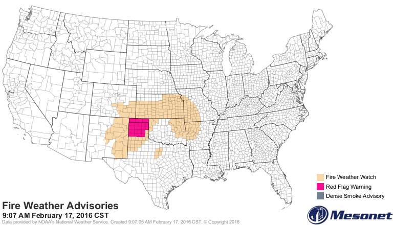
Don't be shocked if we see those watches and warnings cover more of the state
later today and tomorrow, so just as with any severe weather type, stay tuned
to your favorite trusted weather source in order to stay weather aware.
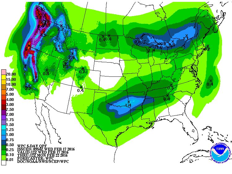
The good news is there will be some moisture available to eek out of the
atmosphere with this system, especially across SE Oklahoma.
Let me leave you (waits for applause to die down) with this thought. This is
sorta normal for mid- to late-February during our primary fire season. It has
been exacerbated a bit by both the extended dry weather over the last 45 days
AND the wet weather of 2015. But anytime we have dead/dormant vegetation in
place, all it takes to get a big fire danger day is the proper conditions of
heat, low RH and strong winds. But much like flash flooding deaths, this is
an almost entirely preventable weather hazard that can pose a risk to property
and even life.
JUST DON'T BURN, AND DON'T THROW OUT YOUR LIT CIGARETTE BUTTS! Or unlit ones
for that matter.
We will now patiently await a good green up as we get farther into March and
April. We will need it to rain a bit eventually to help that along. We have the
warmth and the days growing longer. Just add water and POOF!
POOF!
Gary McManus
State Climatologist
Oklahoma Mesonet
Oklahoma Climatological Survey
(405) 325-2253
gmcmanus@mesonet.org
February 17 in Mesonet History
| Record | Value | Station | Year |
|---|---|---|---|
| Maximum Temperature | 85°F | ALTU | 2011 |
| Minimum Temperature | -2°F | HOLL | 2021 |
| Maximum Rainfall | 1.56 inches | TULN | 2022 |
Mesonet records begin in 1994.
Search by Date
If you're a bit off, don't worry, because just like horseshoes, “almost” counts on the Ticker website!